Directions to พาหุรัด (พระนคร) with public transportation
The following transit lines have routes that pass near พาหุรัด
How to get to พาหุรัด by bus?
Click on the bus route to see step by step directions with maps, line arrival times and updated time schedules.
How to get to พาหุรัด by train?
Click on the train route to see step by step directions with maps, line arrival times and updated time schedules.
How to get to พาหุรัด by metro?
Click on the metro route to see step by step directions with maps, line arrival times and updated time schedules.
How to get to พาหุรัด by SkyTrain?
Click on the SkyTrain route to see step by step directions with maps, line arrival times and updated time schedules.
How to get to พาหุรัด by ferry?
Click on the ferry route to see step by step directions with maps, line arrival times and updated time schedules.
Bus stations near พาหุรัด in พระนคร
- บ้านหม้อ;Ban Mo, 2 min walk,
- บ้านหม้อ Ban Mo, 2 min walk,
- พาหุรัด(ไชน่าเวิลด์) Phahurat (China World), 3 min walk,
- ไชน่าเวิลด์ พาหุรัด;China World Phahurat, 3 min walk,
- พาหุรัด(เพาะช่าง-สวนกุหลาบ), 3 min walk,
- ตรงข้ามโรงเรียนสวนกุหลาบวิทยาลัย;Opposite Suankularb Wittayalai School, 3 min walk,
- ก่อนสี่กั๊กพระยาศรี;Before Si Kak Phraya Sri, 5 min walk,
- เฉลิมกรุง Chaloem Krung, 5 min walk,
- ตรงข้ามเฉลิมกรุง;Chalermkrung (Opposite), 5 min walk,
Metro stations near พาหุรัด in พระนคร
- Mrt สามยอด;Mrt Sam Yot, 8 min walk,
Ferry stations near พาหุรัด in พระนคร
- ท่าเรือสะพานพุทธ;Memorial Bridge Pier, 9 min walk,
- ท่าเรืออัษฎางค์ (ปากคลองตลาด) (ข้ามฟาก);Asdand Pier (Ferry), 11 min walk,
Bus lines to พาหุรัด in พระนคร
- 12, ห้วยขวาง;Huai Khwang,
- 42, เสาชิงช้า;Giant Swing,
- 4-1 (6), พระประแดง;Phra Pradaeng,
- 3-37 (12)(TSB), ห้วยขวาง;Huai Kwang,
- 4-10 (42), เสาชิงช้า;Sao Ching Cha,
- 4-11 (43), รร.ศึกษานารีวิทยา;Suksanareewittaya School,
- 3, Btsกรุงธนบุรี(ทางออก3) Bts Krungthonburi (Exit 3),
- 3 (ปอ.) (AC), อู่หมอชิต 2 Mochit 2 Bus Depot,
- 6, โรงละครแห่งชาติ National Theater,
- 6 (ปอ.) (AC), ตลาดพระประแดง Pak Lat Fa MA Si,
- 12, สถานีดับเพลิงห้วยขวาง,สาธารณสุข 52,
- 12, ตรงข้ามตลาดสดห้วยขวาง,
- 12 (ปอ.) (AC), โรงเรียนวัดราชบพิธ(ท่าปลายทางปากคลองตลาด),
- 42, ตรงข้ามวัดสุทัศน์,ร้านวิจิตรพานิช,
- 53, [เปลี่ยนรถ] ท่าปล่อยรถ เทเวศร์,
- 2-9 (53), สนามหลวง;Sanamluang,
- 7ก, อู่่บรมราชชนนี - พาหุรัด Borommaratchachonnani - Phahurat,
- 82, ท่าน้ำพระประแดง - พาหุรัด Phra Pradaeng - Phahurat,
- 82, ท่าน้ำพระประแดง - ปากคลองตลาด Phra Pradaeng - Pak Klong Talad,
- 3-2E, ปู่เจ้าสมิงพราย - ท่าเรือสะพานพุทธ (ทางด่วน);Pu Chao Samingphrai - Memorial Bridge,
What are the closest stations to พาหุรัด?
The closest stations to พาหุรัด are:
- บ้านหม้อ;Ban Mo is 141 meters away, 2 min walk.
- บ้านหม้อ Ban Mo is 141 meters away, 2 min walk.
- พาหุรัด(ไชน่าเวิลด์) Phahurat (China World) is 209 meters away, 3 min walk.
- ไชน่าเวิลด์ พาหุรัด;China World Phahurat is 209 meters away, 3 min walk.
- พาหุรัด(เพาะช่าง-สวนกุหลาบ) is 210 meters away, 3 min walk.
- ตรงข้ามโรงเรียนสวนกุหลาบวิทยาลัย;Opposite Suankularb Wittayalai School is 210 meters away, 3 min walk.
- ก่อนสี่กั๊กพระยาศรี;Before Si Kak Phraya Sri is 344 meters away, 5 min walk.
- เฉลิมกรุง Chaloem Krung is 344 meters away, 5 min walk.
- ตรงข้ามเฉลิมกรุง;Chalermkrung (Opposite) is 345 meters away, 5 min walk.
- Mrt สามยอด;Mrt Sam Yot is 565 meters away, 8 min walk.
- ท่าเรือสะพานพุทธ;Memorial Bridge Pier is 628 meters away, 9 min walk.
- ท่าเรืออัษฎางค์ (ปากคลองตลาด) (ข้ามฟาก);Asdand Pier (Ferry) is 809 meters away, 11 min walk.
Which SkyTrain line stops near พาหุรัด?
SILOM
Which metro line stops near พาหุรัด?
BLUE
Which bus lines stop near พาหุรัด?
These bus lines stop near พาหุรัด: 3, 4-10 (42), 508 (ปอ.) (AC), 60 (ปอ.) (AC).
Which ferry lines stop near พาหุรัด?
These ferry lines stop near พาหุรัด: เรือคลองแสนแสบ, เรือด่วนธงส้ม.
Which train lines stop near พาหุรัด?
These train lines stop near พาหุรัด: 208, 278, 388.
What’s the nearest metro station to พาหุรัด in พระนคร?
The nearest metro station to พาหุรัด in พระนคร is Mrt สามยอด;Mrt Sam Yot. It’s a 8 min walk away.
What’s the nearest bus stop to พาหุรัด in พระนคร?
The nearest bus stops to พาหุรัด in พระนคร are บ้านหม้อ;Ban Mo and บ้านหม้อ Ban Mo. The closest one is a 2 min walk away.
What’s the nearest ferry station to พาหุรัด in พระนคร?
The nearest ferry station to พาหุรัด in พระนคร is ท่าเรือสะพานพุทธ;Memorial Bridge Pier. It’s a 9 min walk away.
What time is the first metro to พาหุรัด in พระนคร?
The BLUE is the first metro that goes to พาหุรัด in พระนคร. It stops nearby at 6:19 AM.
What time is the last metro to พาหุรัด in พระนคร?
The BLUE is the last metro that goes to พาหุรัด in พระนคร. It stops nearby at 12:33 AM.
What time is the first bus to พาหุรัด in พระนคร?
The 25 is the first bus that goes to พาหุรัด in พระนคร. It stops nearby at 3:00 AM.
What time is the last bus to พาหุรัด in พระนคร?
The 3-1 (2) (TSB) is the last bus that goes to พาหุรัด in พระนคร. It stops nearby at 4:42 AM.
What time is the first ferry to พาหุรัด in พระนคร?
The เรือข้ามฟาก is the first ferry that goes to พาหุรัด in พระนคร. It stops nearby at 6:00 AM.
What time is the last ferry to พาหุรัด in พระนคร?
The เรือด่วนธงส้ม is the last ferry that goes to พาหุรัด in พระนคร. It stops nearby at 9:04 PM.
See พาหุรัด, พระนคร, on the map
Public Transit to พาหุรัด in พระนคร
Wondering how to get to พาหุรัด in พระนคร, Thailand? Moovit helps you find the best way to get to พาหุรัด with step-by-step directions from the nearest public transit station.
Moovit provides free maps and live directions to help you navigate through your city. View schedules, routes, timetables, and find out how long does it take to get to พาหุรัด in real time.
Looking for the nearest stop or station to พาหุรัด? Check out this list of stops closest to your destination: บ้านหม้อ;Ban Mo; บ้านหม้อ Ban Mo; พาหุรัด(ไชน่าเวิลด์) Phahurat (China World); ไชน่าเวิลด์ พาหุรัด;China World Phahurat; พาหุรัด(เพาะช่าง-สวนกุหลาบ); ตรงข้ามโรงเรียนสวนกุหลาบวิทยาลัย;Opposite Suankularb Wittayalai School; ก่อนสี่กั๊กพระยาศรี;Before Si Kak Phraya Sri; เฉลิมกรุง Chaloem Krung; ตรงข้ามเฉลิมกรุง;Chalermkrung (Opposite); Mrt สามยอด;Mrt Sam Yot; ท่าเรือสะพานพุทธ;Memorial Bridge Pier; ท่าเรืออัษฎางค์ (ปากคลองตลาด) (ข้ามฟาก);Asdand Pier (Ferry).
SkyTrain: SILOM.Metro: BLUE.Bus: 3, 4-10 (42), 508 (ปอ.) (AC), 60 (ปอ.) (AC), 12, 42, 4-1 (6), 3-37 (12)(TSB), 3 (ปอ.) (AC), 6, 6 (ปอ.) (AC), 12, 2-9 (53), 53.Ferry: เรือคลองแสนแสบ, เรือด่วนธงส้ม, เรือประจำทาง (ไม่มีธง).Train: 208, 278, 388.
Want to see if there’s another route that gets you there at an earlier time? Moovit helps you find alternative routes or times. Get directions from and directions to พาหุรัด easily from the Moovit App or Website.
We make riding to พาหุรัด easy, which is why over 1.5 million users, including users in พระนคร, trust Moovit as the best app for public transit. You don’t need to download an individual bus app or train app, Moovit is your all-in-one transit app that helps you find the best bus time or train time available.
For information on prices of bus, metro, SkyTrain, train and ferry, costs and ride fares to พาหุรัด, please check the Moovit app.
Use the app to navigate to popular places including to the airport, hospital, stadium, grocery store, mall, coffee shop, school, college, and university.
พาหุรัด Address: ถนนพาหุรัด street in พระนคร
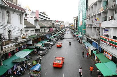
Attractions near พาหุรัด
จารุเพชรรังสรรค์,Phahurat Intersection (แยกพาหุรัด),ห้างไนติงเกล โอลิมปิค,Phahurat Market (Little India),ร้านไอรัก การ์ดแต่งงานและของชำร่วย@พาหุรัด,ศ. มณีภัณฑ์ นพรัตน์,ร้านสวีท,ส.แสงรุ่งเพ็ชร์,The Grand Palace Hostel,เดอะ แกรนด์ พาเลส โฮสเทล,ห้างทองวิทเฮงหลี,หอศิลป์เพาะช่าง,สาขาวิชาออกแบบภายใน วิทยาลัยเพาะช่าง,นิวชูรสโภชนา ก๋วยเตี๋ยวหมูเจ๊กเล็ก 100 ปี,ร้านเพชรเจ้าพระยา,The Grand Palace Hostel Bangkok,Liang Seng Heng Phanich (เลี่ยงเส็งเฮงพาณิชย์),เย็นตาโฟตรอกแขก พาหุรัด,เพชรเจ้าพระยา ดิโอลด์สยามพลาซ่า,โยเทเลคอมHow to get to popular attractions in พระนคร with public transit
EmQuartier (เอ็มควอเทียร์), คลองเตย,วัดหูช้าง, บางกรวย,คิวรถตู้ ต.85 อนุเสาวรีย์-ม.กรุงเทพ-ธรรมศาสตร์ รังสิต, ราชเทวี,ท่ารถตู้ แปดริ้ว พนมสารคาม คลองรั้ง 304, ราชเทวี,มูลนิธิพุทธจักษุวิชชาลัย วัดพระกษิติครรภ์มหาโพธิสัตว์,วัดบัวขวัญ, เมืองนนทบุรี,โรงพยาบาลแพทย์ปัญญา, สวนหลวง,ร้านอินเตอร์เน็ตคาเฟ่. เปิดตลอด24 ชม ร้านเก้าอี้สีชมพูนะคะ, ภาษีเจริญ,บิ๊กซี่พระราม4, คลองเตย,สนามหลวง 2, บางแค,วินรถตู้ฉะเชิงเทรา-มีนบุรี, เขตมีนบุรี,วัดชลประทานรังสฤษฎ์, ปากเกร็ด,รถตู้-มีนบุรี-คู้ขวา ตลาดมีนบุรี, เขตมีนบุรี,ซอย จรัญสนิทวงศ์ 46, พระนคร,ตลาดนางเลิ้ง, ป้อมปราบศัตรูพ่าย,บางกรวย นนทบุรี, บางกรวย,คิวรถตู้ บางใหญ่-อนุสาวรีย์, บางบัวทอง,วัดนวลจันทร์, บึงกุ่ม,หมอชิต (คิวรถตู้ราชบุรี), จตุจักร,โรงพยาบาล นวมินทร์ 9, เขตมีนบุรีGet around Bangkok by public transit!
Traveling around Bangkok has never been so easy. See step by step directions as you travel to any attraction, street or major public transit station. View bus and train schedules, arrival times, service alerts and detailed routes on a map, so you know exactly how to get to anywhere in Bangkok.
When traveling to any destination around Bangkok use Moovit's Live Directions with Get Off Notifications to know exactly where and how far to walk, how long to wait for your line, and how many stops are left. Moovit will alert you when it's time to get off — no need to constantly re-check whether yours is the next stop.
Wondering how to use public transit in Bangkok or how to pay for public transit in Bangkok? Moovit public transit app can help you navigate your way with public transit easily, and at minimum cost. It includes public transit fees, ticket prices, and costs. Looking for a map of Bangkok public transit lines? Moovit public transit app shows all public transit maps in Bangkok with all Bus, Train, Metro, SkyTrain and Ferry routes and stops on an interactive map.
Bangkok has 5 transit type(s), including: Bus, Train, Metro, SkyTrain and Ferry, operated by several transit agencies, including บีทีเอส BTS, MRT, บริษัท ไทย สมายล์ บัส จำกัด;thaismilebus company limited, ขสมก. BMTA, รถไฟฟ้ารฟท. SRTET, รถประจำทาง Transport Bus, บีอาร์ที BRT, เรือคลองโดยสาร Canal Ferry, เรือข้ามฟาก River Ferry, รถสองแถว Songthaew, จุฬาป๊อบบัส Chula Pop Bus, ขสมก BMTA, ขสมก. (BMTA), รถมินิบัส Minibus, รฟท. SRT