
How to get to วัดชนะสงครามฯ in พระนคร by Bus, Metro, Train or Ferry?

See วัดชนะสงครามฯ, พระนคร, on the map

Directions to วัดชนะสงครามฯ (พระนคร) with public transportation

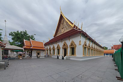
The following transit lines have routes that pass near วัดชนะสงครามฯ

  • MetroMetro:
  • BusBus:
  • FerryFerry:
  • TrainTrain:

How to get to วัดชนะสงครามฯ by Bus?

Click on the Bus route to see step by step directions with maps, line arrival times and updated time schedules.

How to get to วัดชนะสงครามฯ by Train?

Click on the Train route to see step by step directions with maps, line arrival times and updated time schedules.

How to get to วัดชนะสงครามฯ by Metro?

Click on the Metro route to see step by step directions with maps, line arrival times and updated time schedules.

How to get to วัดชนะสงครามฯ by Ferry?

Click on the Ferry route to see step by step directions with maps, line arrival times and updated time schedules.

Bus stations near วัดชนะสงครามฯ in พระนคร

  • ถนนข้าวสาร;Khaosan Road,3 min walk,
  • วัดชนะสงคราม WAT Chanasongkram,3 min walk,
  • กองสลาก Kong Salak,4 min walk,
  • กองสลาก;The Government Lottery Office,4 min walk,
  • จุดขึ้นลง;Visual Stop,5 min walk,
  • ตรงข้ามกองสลาก;The Government Lottery Office (Opposite),7 min walk,
  • แยกบางลำพู Banglumphu Intersection,7 min walk,
  • หลังแยกบางลำพู;Behind Bang Lamphu Intersection,7 min walk,
  • หอศิลป์เจ้าฟ้า;National Gallery,7 min walk,

Ferry stations near วัดชนะสงครามฯ in พระนคร

  • ท่าเรือสะพานพระราม 8;Rama 8 Bridge Pier,12 min walk,
  • ท่าเรือพระอาทิตย์;Phra Arthit Pier,14 min walk,
  • ท่าเรือพระจันทร์ (ข้ามฟาก);Tha Phra Chan Pier (Ferry),18 min walk,
  • ท่าเรือพระปิ่นเกล้า;Phra Pin Klao Bridge Pier,18 min walk,

Bus lines to วัดชนะสงครามฯ in พระนคร

  • S1,สนามบินสุวรรณภูมิ - สนามหลวง;suvarnabhumiairport - sanamliang,
  • 3,คลองสาน - อู่กำแพงเพชร;Klongsan - Kamphaeng Phet Bus Depot,
  • A4,สนามบินดอนเมือง - สนามหลวง;Donmueng Airport - Sanamluang,
  • 15,BRT ราชพฤกษ์ - บางลำพู;BRT Ratchaphruek - Bang Lamphu,
  • 32,ปากเกร็ด - วัดโพธิ์;Pak Kret - Wat Pho,
  • 4-1,ท่าเรือพระประแดง - บางลำพู; Phra Pradaeng Pier - Banglamphu,
  • 43,รร.ศึกษานารีวิทยา2 - เทเวศร์;Suksanareewittaya School - Thewet,
  • 59,รังสิต - สนามหลวง (ทางด่วน);Rangsit - Sanamluang (Expressway),
  • 65,วัดปากน้ำนนทบุรี - สนามหลวง;Wat Paknam Nonthaburi - Sanamluang,
  • 82,ท่าน้ำพระประแดง - สนามหลวง;Phra Pradaeng - Sanam Luang,
  • 2-37,คลองสาน - อู่กำแพงเพชร;Klongsan - Kamphaeng Phet Bus Depot,
  • 4-8 (35),เคหะธนบุรี - บางลำพู;Thonburi Housing - Bang Lamphu,
  • 4-11 (43),รร.ศึกษานารีวิทยา - เทเวศร์;Suksanareewittaya School - Thewet,
  • 2-4 (30,65),วัดปากน้ำนนทบุรี - สถานีขนส่งผู้โดยสารกรุงเทพฯ (ปิ่นเกล้า);Wat Paknam Nonthaburi - Southern Bus (Pinklao),
  • S1 (ปอ.) (AC),ท่าอากาศยานสุวรรณภูมิ (อาคารผู้โดยสารชั้น1 ประตู7),
  • 2,วัดไตร WAT Trai,
  • 3,Btsกรุงธนบุรี(ทางออก3) Bts Krungthonburi (Exit 3),
  • 3 (ปอ.) (AC),อู่หมอชิต 2 Mochit 2 Bus Depot,
  • A4 (ปอ.) (AC),ท่าปล่อยรถ สนามหลวง (53l 59 503),
  • 6,ตลาดพระประแดง Pak Lat Fa MA Si,
Questions & Answers
  • What are the closest stations to วัดชนะสงครามฯ?

    The closest stations to วัดชนะสงครามฯ are:

    • ถนนข้าวสาร;Khaosan Road is 146 meters away, 3 min walk.
    • วัดชนะสงคราม WAT Chanasongkram is 166 meters away, 3 min walk.
    • กองสลาก Kong Salak is 206 meters away, 4 min walk.
    • กองสลาก;The Government Lottery Office is 206 meters away, 4 min walk.
    • จุดขึ้นลง;Visual Stop is 372 meters away, 5 min walk.
    • ตรงข้ามกองสลาก;The Government Lottery Office (Opposite) is 461 meters away, 7 min walk.
    • แยกบางลำพู Banglumphu Intersection is 483 meters away, 7 min walk.
    • หลังแยกบางลำพู;Behind Bang Lamphu Intersection is 483 meters away, 7 min walk.
    • หอศิลป์เจ้าฟ้า;National Gallery is 501 meters away, 7 min walk.
    • ท่าเรือสะพานพระราม 8;Rama 8 Bridge Pier is 900 meters away, 12 min walk.
    • ท่าเรือพระอาทิตย์;Phra Arthit Pier is 1059 meters away, 14 min walk.
    • ท่าเรือพระจันทร์ (ข้ามฟาก);Tha Phra Chan Pier (Ferry) is 1338 meters away, 18 min walk.
    • ท่าเรือพระปิ่นเกล้า;Phra Pin Klao Bridge Pier is 1362 meters away, 18 min walk.
  • Which Metro lines stop near วัดชนะสงครามฯ?

    These Metro lines stop near วัดชนะสงครามฯ: BLUE

  • Which Bus lines stop near วัดชนะสงครามฯ?

    These Bus lines stop near วัดชนะสงครามฯ: 2, 3-1 (2), 32, 4-11 (43), 42, 68, ต.125, ต.4

  • Which Ferry lines stop near วัดชนะสงครามฯ?

    These Ferry lines stop near วัดชนะสงครามฯ: เรือคลองแสนแสบ, เรือด่วนธงส้ม

  • Which Train lines stop near วัดชนะสงครามฯ?

    These Train lines stop near วัดชนะสงครามฯ: 258, 317

  • What’s the nearest bus stop to วัดชนะสงครามฯ in พระนคร?

    The nearest bus stops to วัดชนะสงครามฯ in พระนคร are ถนนข้าวสาร;Khaosan Road and วัดชนะสงคราม WAT Chanasongkram. The closest one is a 3 min walk away.

  • What’s the nearest ferry station to วัดชนะสงครามฯ in พระนคร?

    The nearest ferry station to วัดชนะสงครามฯ in พระนคร is ท่าเรือสะพานพระราม 8;Rama 8 Bridge Pier. It’s a 12 min walk away.

  • What time is the first Bus to วัดชนะสงครามฯ in พระนคร?

    The 80 is the first Bus that goes to วัดชนะสงครามฯ in พระนคร. It stops nearby at 3:00 AM.

  • What time is the last Bus to วัดชนะสงครามฯ in พระนคร?

    The 59 is the last Bus that goes to วัดชนะสงครามฯ in พระนคร. It stops nearby at 3:53 AM.

  • What time is the first Ferry to วัดชนะสงครามฯ in พระนคร?

    The เรือข้ามฟาก is the first Ferry that goes to วัดชนะสงครามฯ in พระนคร. It stops nearby at 5:00 AM.

  • What time is the last Ferry to วัดชนะสงครามฯ in พระนคร?

    The เรือด่วนธงส้ม is the last Ferry that goes to วัดชนะสงครามฯ in พระนคร. It stops nearby at 8:24 PM.

See วัดชนะสงครามฯ, พระนคร, on the map

The Most Popular Urban Mobility App in พระนคร.
All local mobility options in one app

Public Transit to วัดชนะสงครามฯ in พระนคร

Wondering how to get to วัดชนะสงครามฯ in พระนคร, Thailand? Moovit helps you find the best way to get to วัดชนะสงครามฯ with step-by-step directions from the nearest public transit station.

Moovit provides free maps and live directions to help you navigate through your city. View schedules, routes, timetables, and find out how long does it take to get to วัดชนะสงครามฯ in real time.

Looking for the nearest stop or station to วัดชนะสงครามฯ? Check out this list of stops closest to your destination: ถนนข้าวสาร;Khaosan Road; วัดชนะสงคราม WAT Chanasongkram; กองสลาก Kong Salak; กองสลาก;The Government Lottery Office; จุดขึ้นลง;Visual Stop; ตรงข้ามกองสลาก;The Government Lottery Office (Opposite); แยกบางลำพู Banglumphu Intersection; หลังแยกบางลำพู;Behind Bang Lamphu Intersection; หอศิลป์เจ้าฟ้า;National Gallery; ท่าเรือสะพานพระราม 8;Rama 8 Bridge Pier; ท่าเรือพระอาทิตย์;Phra Arthit Pier; ท่าเรือพระจันทร์ (ข้ามฟาก);Tha Phra Chan Pier (Ferry); ท่าเรือพระปิ่นเกล้า;Phra Pin Klao Bridge Pier.

Metro:Bus:Ferry:Train:

Want to see if there’s another route that gets you there at an earlier time? Moovit helps you find alternative routes or times. Get directions from and directions to วัดชนะสงครามฯ easily from the Moovit App or Website.

We make riding to วัดชนะสงครามฯ easy, which is why over 1.5 million users, including users in พระนคร, trust Moovit as the best app for public transit. You don’t need to download an individual bus app or train app, Moovit is your all-in-one transit app that helps you find the best bus time or train time available.

For information on prices of Bus, Metro, Train and Ferry, costs and ride fares to วัดชนะสงครามฯ, please check the Moovit app.

Use the app to navigate to popular places including to the airport, hospital, stadium, grocery store, mall, coffee shop, school, college, and university.

วัดชนะสงครามฯ Address: Chakrabongse Rd. street in พระนคร

วัดชนะสงครามฯ, พระนคร
วัดชนะสงครามฯ, พระนครWat Chanasongkhram Ratchaworamahawiharn (Thai: วัดชนะสงครามราชวรมหาวิหาร), usually shortened to Wat Chana Songkhram (Thai: วัดชนะสงคราม, pronounced [wát t͡ɕʰā.náʔ sǒŋ.kʰrāːm]), is a second-class royal monastery in Chana Songkram Sub-district, Phra Nakhon District, Bangkok, within area of Bang Lamphu opposite to Khaosan Road and next to Rambuttri Road. The temple is located at 77 Chakrabongse Road, it is an old monastery which was built before the first Rattanakosin period (before 1782). The former name is "Wat Klang Na" (วัดกลางนา; lit: temple in the middle of paddy field), later the reign of King Phutthayotfa Chulalok (Rama I), Prince Maha Sura Singhanat (the king younger brother) granted Mon people and monks to lived in the area, renovated the temple to be resident of Mon monks. Later, King Phutthayotfa Chulalok gave the new name "Wat Thong Pu" (วัดตองปุ), refers to name of a town in Myanmar after the name of Mon temple in Ayutthaya and Lopburi in the reign King Phutthayotfa Chulalok. The temple became a center of Mon sect of Buddhism as he awarded to Mon soldiers who formed major troop in war with Burmese. After the war, the temple was restored and made the royal monastery, and then renamed again to be "Wat Chana Songkhram" which means victory of war temple as Thai gained victory over Burmese for three times between 1785–87 (Nine Armies' Wars, Tha Din Daeng campaign and Sam Sop, battle at Nakorn Lampang Pasang).Wat Chana Songkram is open for visitors or travelers every day, with no admission fee. And it has been promoted as one of the nine temples under the campaign "Respect to the Nine Temples" (ไหว้พระ 9 วัด) by Tourism Authority of Thailand (TAT) along with other temples (Wat Phra Kaew, Wat Pho, Wat Suthat, City Pillar Shrine, San Chao Pho Suea (Phra Nakhon side), Wat Arun, Wat Rakhangkhositraram and Wat Kalayanamitr (Thonburi side)) for the auspicious of life.
How to get to วัดชนะสงครามฯ with public transit - About the place

Public transit lines with stations closest to วัดชนะสงครามฯ in พระนคร

Bus lines with stations closest to วัดชนะสงครามฯ in พระนคร

Ferry lines with stations closest to วัดชนะสงครามฯ in พระนคร

Easier to get to วัดชนะสงครามฯ in…