Directions to วัดสุทัศนเทพวรารามราชวรมหาวิหาร (พระนคร) with public transportation
The following transit lines have routes that pass near วัดสุทัศนเทพวรารามราชวรมหาวิหาร
How to get to วัดสุทัศนเทพวรารามราชวรมหาวิหาร by bus?
Click on the bus route to see step by step directions with maps, line arrival times and updated time schedules.
How to get to วัดสุทัศนเทพวรารามราชวรมหาวิหาร by metro?
Click on the metro route to see step by step directions with maps, line arrival times and updated time schedules.
How to get to วัดสุทัศนเทพวรารามราชวรมหาวิหาร by SkyTrain?
Click on the SkyTrain route to see step by step directions with maps, line arrival times and updated time schedules.
How to get to วัดสุทัศนเทพวรารามราชวรมหาวิหาร by ferry?
Click on the ferry route to see step by step directions with maps, line arrival times and updated time schedules.
Bus stops near วัดสุทัศนเทพวรารามราชวรมหาวิหาร in พระนคร
- ตรงข้ามโรงเรียนเบญจมราชาลัย;Opposite Benjamarachalai School, 2 min walk,
- วัดสุทัศน์;Wat Suthat Thepwararam, 2 min walk,
- วัดสุทัศน์ WAT Suthat, 2 min walk,
- โรงเรียนเบญจมราชาลัย;Benjama Rachalai School, 3 min walk,
- ตรงข้ามวัดสุทัศน์,ร้านวิจิตรพานิช, 3 min walk,
- ตรงข้ามวัดสุทัศน์ฯ;Wat Suthat Thepwararam (Opposite), 3 min walk,
- ตรงข้ามเฉลิมกรุง;Chalermkrung (Opposite), 6 min walk,
- ตรงข้ามเฉลิมกรุง Opposite Chalermkrung, 6 min walk,
- สินดำรงค์ Sin Dam Rong, 7 min walk,
Ferry stations near วัดสุทัศนเทพวรารามราชวรมหาวิหาร in พระนคร
- ท่าเรือผ่านฟ้าลีลาศ;Panfa Leelard Pier, 2 min walk,
- ท่าเรือสะพานพุทธ;Memorial Bridge Pier, 9 min walk,
Metro stations near วัดสุทัศนเทพวรารามราชวรมหาวิหาร in พระนคร
- Mrt สามยอด;Mrt Sam Yot, 6 min walk,
Bus lines to วัดสุทัศนเทพวรารามราชวรมหาวิหาร in พระนคร
- 4-10 (42), เสาชิงช้า;Sao Ching Cha,
- 12, สนง.ที่ดินกรุงเทพฯ;Bangkok Metropolitan Land Office,
- 35, พระประแดง;Phra Pradaeng,
- 3-37 (12)(TSB), ห้วยขวาง;Huai Kwang,
- 12, สถานีดับเพลิงห้วยขวาง,สาธารณสุข 52,
- 12, โรงเรียนวัดราชบพิธ(ท่าปลายทางปากคลองตลาด),
- 12 (ปอ.) (AC), โรงเรียนวัดราชบพิธ(ท่าปลายทางปากคลองตลาด),
- 42, เสาชิงช้า;Giant Swing,
- 3-53, เสาชิงช้า;The Giant Swing,
- 3, อู่หมอชิต 2 Mochit 2 Bus Depot,
- 3 (ปอ.) (AC), อู่หมอชิต 2 Mochit 2 Bus Depot,
- 42, ตรงข้ามวัดสุทัศน์,ร้านวิจิตรพานิช,
- 12, ห้วยขวาง;Huai Khwang,
- 508, ปากน้ำ (ตลาดปากน้ำ);Paknam (Pak Nam Market),
- 3-11 (48), ม.รามคำแหง 2;Ramkhamhaeng 2,
- 3-13 (507), สำโรง;Samrong,
- 1, โรงพยาบาลเจริญกรุง(ตรงข้ามซอยเจริญกรุง 86),
- 1, ตลาดบางคอแหลม Talat Bangkholaem,
- 25, อู่บ่อดิน Bodin Bus Depot,
- 73ก (ปอ.) (AC), อู่สวนสยาม Siam Park Bus Depot,
What are the closest stations to วัดสุทัศนเทพวรารามราชวรมหาวิหาร?
The closest stations to วัดสุทัศนเทพวรารามราชวรมหาวิหาร are:
- ตรงข้ามโรงเรียนเบญจมราชาลัย;Opposite Benjamarachalai School is 114 meters away, 2 min walk.
- วัดสุทัศน์;Wat Suthat Thepwararam is 129 meters away, 2 min walk.
- วัดสุทัศน์ WAT Suthat is 130 meters away, 2 min walk.
- ท่าเรือผ่านฟ้าลีลาศ;Panfa Leelard Pier is 144 meters away, 2 min walk.
- โรงเรียนเบญจมราชาลัย;Benjama Rachalai School is 176 meters away, 3 min walk.
- ตรงข้ามวัดสุทัศน์,ร้านวิจิตรพานิช is 191 meters away, 3 min walk.
- ตรงข้ามวัดสุทัศน์ฯ;Wat Suthat Thepwararam (Opposite) is 191 meters away, 3 min walk.
- Mrt สามยอด;Mrt Sam Yot is 436 meters away, 6 min walk.
- ตรงข้ามเฉลิมกรุง;Chalermkrung (Opposite) is 444 meters away, 6 min walk.
- ตรงข้ามเฉลิมกรุง Opposite Chalermkrung is 444 meters away, 6 min walk.
- สินดำรงค์ Sin Dam Rong is 466 meters away, 7 min walk.
- ท่าเรือสะพานพุทธ;Memorial Bridge Pier is 607 meters away, 9 min walk.
Which SkyTrain line stops near วัดสุทัศนเทพวรารามราชวรมหาวิหาร?
SILOM
Which metro line stops near วัดสุทัศนเทพวรารามราชวรมหาวิหาร?
BLUE
Which bus lines stop near วัดสุทัศนเทพวรารามราชวรมหาวิหาร?
These bus lines stop near วัดสุทัศนเทพวรารามราชวรมหาวิหาร: 12 (ปอ.) (AC), 35, 4-10 (42), 85.
Which ferry line stops near วัดสุทัศนเทพวรารามราชวรมหาวิหาร?
เรือด่วนธงส้ม
What’s the nearest metro station to วัดสุทัศนเทพวรารามราชวรมหาวิหาร in พระนคร?
The nearest metro station to วัดสุทัศนเทพวรารามราชวรมหาวิหาร in พระนคร is Mrt สามยอด;Mrt Sam Yot. It’s a 6 min walk away.
What’s the nearest bus stop to วัดสุทัศนเทพวรารามราชวรมหาวิหาร in พระนคร?
The nearest bus stops to วัดสุทัศนเทพวรารามราชวรมหาวิหาร in พระนคร are ตรงข้ามโรงเรียนเบญจมราชาลัย;Opposite Benjamarachalai School, วัดสุทัศน์;Wat Suthat Thepwararam and วัดสุทัศน์ WAT Suthat. The closest one is a 2 min walk away.
What’s the nearest ferry station to วัดสุทัศนเทพวรารามราชวรมหาวิหาร in พระนคร?
The nearest ferry station to วัดสุทัศนเทพวรารามราชวรมหาวิหาร in พระนคร is ท่าเรือผ่านฟ้าลีลาศ;Panfa Leelard Pier. It’s a 2 min walk away.
What time is the first metro to วัดสุทัศนเทพวรารามราชวรมหาวิหาร in พระนคร?
The BLUE is the first metro that goes to วัดสุทัศนเทพวรารามราชวรมหาวิหาร in พระนคร. It stops nearby at 6:19 AM.
What time is the last metro to วัดสุทัศนเทพวรารามราชวรมหาวิหาร in พระนคร?
The BLUE is the last metro that goes to วัดสุทัศนเทพวรารามราชวรมหาวิหาร in พระนคร. It stops nearby at 12:45 AM.
What time is the first bus to วัดสุทัศนเทพวรารามราชวรมหาวิหาร in พระนคร?
The 25 is the first bus that goes to วัดสุทัศนเทพวรารามราชวรมหาวิหาร in พระนคร. It stops nearby at 3:01 AM.
What time is the last bus to วัดสุทัศนเทพวรารามราชวรมหาวิหาร in พระนคร?
The 3 is the last bus that goes to วัดสุทัศนเทพวรารามราชวรมหาวิหาร in พระนคร. It stops nearby at 2:54 AM.
What time is the first ferry to วัดสุทัศนเทพวรารามราชวรมหาวิหาร in พระนคร?
The เรือคลองแสนแสบ is the first ferry that goes to วัดสุทัศนเทพวรารามราชวรมหาวิหาร in พระนคร. It stops nearby at 6:00 AM.
What time is the last ferry to วัดสุทัศนเทพวรารามราชวรมหาวิหาร in พระนคร?
The เรือคลองแสนแสบ is the last ferry that goes to วัดสุทัศนเทพวรารามราชวรมหาวิหาร in พระนคร. It stops nearby at 8:52 PM.
See วัดสุทัศนเทพวรารามราชวรมหาวิหาร, พระนคร, on the map
Public Transit to วัดสุทัศนเทพวรารามราชวรมหาวิหาร in พระนคร
Wondering how to get to วัดสุทัศนเทพวรารามราชวรมหาวิหาร in พระนคร, Thailand? Moovit helps you find the best way to get to วัดสุทัศนเทพวรารามราชวรมหาวิหาร with step-by-step directions from the nearest public transit station.
Moovit provides free maps and live directions to help you navigate through your city. View schedules, routes, timetables, and find out how long does it take to get to วัดสุทัศนเทพวรารามราชวรมหาวิหาร in real time.
Looking for the nearest stop or station to วัดสุทัศนเทพวรารามราชวรมหาวิหาร? Check out this list of stops closest to your destination: ตรงข้ามโรงเรียนเบญจมราชาลัย;Opposite Benjamarachalai School; วัดสุทัศน์;Wat Suthat Thepwararam; วัดสุทัศน์ WAT Suthat; ท่าเรือผ่านฟ้าลีลาศ;Panfa Leelard Pier; โรงเรียนเบญจมราชาลัย;Benjama Rachalai School; ตรงข้ามวัดสุทัศน์,ร้านวิจิตรพานิช; ตรงข้ามวัดสุทัศน์ฯ;Wat Suthat Thepwararam (Opposite); Mrt สามยอด;Mrt Sam Yot; ตรงข้ามเฉลิมกรุง;Chalermkrung (Opposite); ตรงข้ามเฉลิมกรุง Opposite Chalermkrung; สินดำรงค์ Sin Dam Rong; ท่าเรือสะพานพุทธ;Memorial Bridge Pier.
SkyTrain: SILOM.Metro: BLUE.Bus: 12 (ปอ.) (AC), 35, 4-10 (42), 85, 12, 3-37 (12)(TSB), 12, 12, 42, 3-53.Ferry: เรือด่วนธงส้ม, เรือคลองแสนแสบ.
Want to see if there’s another route that gets you there at an earlier time? Moovit helps you find alternative routes or times. Get directions from and directions to วัดสุทัศนเทพวรารามราชวรมหาวิหาร easily from the Moovit App or Website.
We make riding to วัดสุทัศนเทพวรารามราชวรมหาวิหาร easy, which is why over 1.5 million users, including users in พระนคร, trust Moovit as the best app for public transit. You don’t need to download an individual bus app or train app, Moovit is your all-in-one transit app that helps you find the best bus time or train time available.
For information on prices of bus, metro, ferry and SkyTrain, costs and ride fares to วัดสุทัศนเทพวรารามราชวรมหาวิหาร, please check the Moovit app.
Use the app to navigate to popular places including to the airport, hospital, stadium, grocery store, mall, coffee shop, school, college, and university.
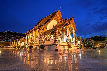
วัดสุทัศนเทพวรารามราชวรมหาวิหาร Address: ถนนอุณากรรณ street in พระนคร
Attractions near วัดสุทัศนเทพวรารามราชวรมหาวิหาร
พระอุโบสถ,รร.กวดวิชาครูละเมียด@วัดสุทัศน์,ปืนสองพี่น้อง,โตฟาอีซี่ ร้านอาหารอิสลาม,จงดีทันตแพทย์คลินิก,กรุงเทพโรคผิวหนังคลินิก,7-11@หน้าตลาดตรอกหม้อ,อ. เทพนคร,2 ถนน อุณากรรณ (Unakan Road),นิวไพโรจน์ประดิษฐ์,สตรองแมน โปลิศ,เกาะรัตนโกสินทร์,6 Unakan Road (ถนน อุณากรรณ),ภารตวิทยาลัย,ประจักษ์การแพทย์,สมาคมฮินดูสมาช,นิว ชลิตา ถ้วยรางวัล,ธนาคารกสิกรไทย.เสาชิงช้า.,Wat Suthat Thepwararam (วัดสุทัศน์เทพวรารามฯ),ทรงมาลาHow to get to popular attractions in พระนคร with public transit
สนามหลวง, พระนคร,รถตู้ฟิวเจอร์-คลอง8, ธัญบุรี,คิวรถตู้ เดอะมอลล์ บางกะปิ - ฟิวเจออร์ รังสิต (ทางด่วน), บางกะปิ,คิวรถตู้ลาดกระบัง-รังสิต, ลาดกระบัง,วัดเบญจมบพิตรดุสิตวนารามราชวรวิหาร, ดุสิต,สถานีขนส่งหมอชิต2, จตุจักร,โรงเรียนหอวัง, จตุจักร,วัดราชโอรส, จอมทอง,สนามศุภชลาศัย, ปทุมวัน,สวนลุมพินี, บางรัก,ถนน ทรงวาด, คลองสาน,SHOW DC (โชว์ ดีซี), ห้วยขวาง,ไอทีสแควร์, หลักสี่,ดิโอลด์สยามพลาซ่า, สัมพันธวงศ์,แยกเทพารักษ์-สําโรง, เมืองสมุทรปราการ,มหาวิทยาลัยราชภัฏสวนสุนันทา, ดุสิต,Rattana Bundit University (RBAC) (มหาวิทยาลัยรัตนบัณฑิต), บางกะปิ,วัดเจ้าอาม, บางกอกน้อย,ราชมังคลากีฬาสถาน, บางกะปิ,ท่ารถตู้มหาชัย-ฟิวเจอร์พาร์ครังสิต, เมืองสมุทรสาครGet around Bangkok by public transit!
Traveling around Bangkok has never been so easy. See step by step directions as you travel to any attraction, street or major public transit station. View bus and train schedules, arrival times, service alerts and detailed routes on a map, so you know exactly how to get to anywhere in Bangkok.
When traveling to any destination around Bangkok use Moovit's Live Directions with Get Off Notifications to know exactly where and how far to walk, how long to wait for your line, and how many stops are left. Moovit will alert you when it's time to get off — no need to constantly re-check whether yours is the next stop.
Wondering how to use public transit in Bangkok or how to pay for public transit in Bangkok? Moovit public transit app can help you navigate your way with public transit easily, and at minimum cost. It includes public transit fees, ticket prices, and costs. Looking for a map of Bangkok public transit lines? Moovit public transit app shows all public transit maps in Bangkok with all Bus, Train, Metro, SkyTrain and Ferry routes and stops on an interactive map.
Bangkok has 5 transit type(s), including: Bus, Train, Metro, SkyTrain and Ferry, operated by several transit agencies, including บีทีเอส BTS, MRT, บริษัท ไทย สมายล์ บัส จำกัด;thaismilebus company limited, ขสมก. BMTA, รถไฟฟ้ารฟท. SRTET, รถประจำทาง Transport Bus, บีอาร์ที BRT, เรือคลองโดยสาร Canal Ferry, เรือข้ามฟาก River Ferry, รถสองแถว Songthaew, จุฬาป๊อบบัส Chula Pop Bus, ขสมก BMTA, ขสมก. (BMTA), รถมินิบัส Minibus, รฟท. SRT