
How to get to เกาะรัตนโกสินทร์ in พระนคร by Bus, Metro, Train, SkyTrain or Ferry?

See เกาะรัตนโกสินทร์, พระนคร, on the map

Directions to เกาะรัตนโกสินทร์ (พระนคร) with public transportation

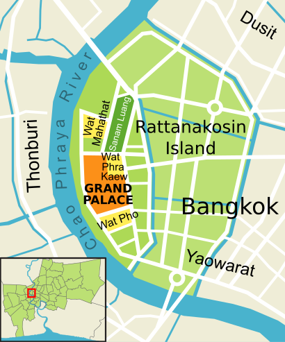
The following transit lines have routes that pass near เกาะรัตนโกสินทร์

  • SkyTrainSkyTrain:
  • MetroMetro:
  • BusBus:
  • FerryFerry:
  • TrainTrain:

How to get to เกาะรัตนโกสินทร์ by Bus?

Click on the Bus route to see step by step directions with maps, line arrival times and updated time schedules.

How to get to เกาะรัตนโกสินทร์ by Train?

Click on the Train route to see step by step directions with maps, line arrival times and updated time schedules.

How to get to เกาะรัตนโกสินทร์ by Metro?

Click on the Metro route to see step by step directions with maps, line arrival times and updated time schedules.

How to get to เกาะรัตนโกสินทร์ by SkyTrain?

Click on the SkyTrain route to see step by step directions with maps, line arrival times and updated time schedules.

How to get to เกาะรัตนโกสินทร์ by Ferry?

Click on the Ferry route to see step by step directions with maps, line arrival times and updated time schedules.

Bus stations near เกาะรัตนโกสินทร์ in พระนคร

  • วัดสุทัศน์;Wat Suthat Thepwararam,1 min walk,
  • วัดสุทัศน์ WAT Suthat,2 min walk,
  • ถนนราชบพิธ;Ratchabophit Road,2 min walk,
  • เสาชิงช้า;Sao Chingcha,3 min walk,
  • ตรงข้ามวัดสุทัศน์ฯ;Wat Suthat Thepwararam (Opposite),3 min walk,
  • ตรงข้ามวัดสุทัศน์,ร้านวิจิตรพานิช,3 min walk,
  • ตรงข้ามเฉลิมกรุง;Chalermkrung (Opposite),6 min walk,
  • ตรงข้ามเฉลิมกรุง Opposite Chalermkrung,6 min walk,
  • หลังสี่กั๊กพระยาศรี;Behind the Si Kak Phraya Si,7 min walk,
  • เฉลิมกรุง Chaloem Krung,7 min walk,
  • สินดำรงค์ Sin Dam Rong,7 min walk,

Ferry stations near เกาะรัตนโกสินทร์ in พระนคร

  • ท่าเรือผ่านฟ้าลีลาศ;Panfa Leelard Pier,11 min walk,
  • ท่าเรืออัษฎางค์ (ปากคลองตลาด) (ข้ามฟาก);Asdand Pier (Ferry),18 min walk,
  • ท่าเรือราชินี;Rajinee Pier,19 min walk,

Metro stations near เกาะรัตนโกสินทร์ in พระนคร

  • Mrt สามยอด;Mrt Sam Yot,13 min walk,

Bus lines to เกาะรัตนโกสินทร์ in พระนคร

  • 12,สนง.ที่ดินกรุงเทพฯ;Bangkok Metropolitan Land Office,
  • 35,พระประแดง;Phra Pradaeng,
  • 3-37 (12),ห้วยขวาง;Huai Kwang,
  • 12,สถานีดับเพลิงห้วยขวาง,สาธารณสุข 52,
  • 12,ตรงข้ามตลาดสดห้วยขวาง,
  • 12 (ปอ.) (AC),โรงเรียนวัดราชบพิธ(ท่าปลายทางปากคลองตลาด),
  • 12,ห้วยขวาง;Huai Khwang,
  • 508,สนามหลวง;Sanam Luang,
  • 42,เสาชิงช้า;Giant Swing,
  • 3-53,เสาชิงช้า;The Giant Swing,
  • 4-10 (42),เสาชิงช้า;Sao Ching Cha,
  • 2-37,อู่หมอชิต 2;Mochit 2,
  • 3,อู่หมอชิต 2 Mochit 2 Bus Depot,
  • 3 (ปอ.) (AC),อู่หมอชิต 2 Mochit 2 Bus Depot,
  • 42,ตรงข้ามวัดสุทัศน์,ร้านวิจิตรพานิช,
  • 3-35 (1),ท่าเตียน;Tha Tien,
  • 3-11 (48),วัดโพธิ์;Wat Pho,
  • 3-13 (507),ปากน้ำ;Paknam,
  • 1,หน่วยบัญชาการรักษาดินแดน,
  • 1,วัดโพธิ์ท่าเตียน Tha Tian,
Questions & Answers
  • What are the closest stations to เกาะรัตนโกสินทร์?

    The closest stations to เกาะรัตนโกสินทร์ are:

    • วัดสุทัศน์;Wat Suthat Thepwararam is 39 meters away, 1 min walk.
    • วัดสุทัศน์ WAT Suthat is 118 meters away, 2 min walk.
    • ถนนราชบพิธ;Ratchabophit Road is 137 meters away, 2 min walk.
    • เสาชิงช้า;Sao Chingcha is 163 meters away, 3 min walk.
    • ตรงข้ามวัดสุทัศน์ฯ;Wat Suthat Thepwararam (Opposite) is 170 meters away, 3 min walk.
    • ตรงข้ามวัดสุทัศน์,ร้านวิจิตรพานิช is 170 meters away, 3 min walk.
    • ตรงข้ามเฉลิมกรุง;Chalermkrung (Opposite) is 421 meters away, 6 min walk.
    • ตรงข้ามเฉลิมกรุง Opposite Chalermkrung is 421 meters away, 6 min walk.
    • หลังสี่กั๊กพระยาศรี;Behind the Si Kak Phraya Si is 460 meters away, 7 min walk.
    • เฉลิมกรุง Chaloem Krung is 460 meters away, 7 min walk.
    • สินดำรงค์ Sin Dam Rong is 531 meters away, 7 min walk.
    • ท่าเรือผ่านฟ้าลีลาศ;Panfa Leelard Pier is 775 meters away, 11 min walk.
    • Mrt สามยอด;Mrt Sam Yot is 946 meters away, 13 min walk.
    • ท่าเรือราชินี;Rajinee Pier is 1389 meters away, 19 min walk.
    • ท่าเรืออัษฎางค์ (ปากคลองตลาด) (ข้ามฟาก);Asdand Pier (Ferry) is 1392 meters away, 18 min walk.
  • Which SkyTrain lines stop near เกาะรัตนโกสินทร์?

    These SkyTrain lines stop near เกาะรัตนโกสินทร์: SILOM

  • Which Metro lines stop near เกาะรัตนโกสินทร์?

    These Metro lines stop near เกาะรัตนโกสินทร์: BLUE

  • Which Bus lines stop near เกาะรัตนโกสินทร์?

    These Bus lines stop near เกาะรัตนโกสินทร์: 12, 25, 3 (ปอ.) (AC), 35, 4-10 (42)

  • Which Ferry lines stop near เกาะรัตนโกสินทร์?

    These Ferry lines stop near เกาะรัตนโกสินทร์: เรือคลองแสนแสบ, เรือด่วนธงส้ม

  • Which Train lines stop near เกาะรัตนโกสินทร์?

    These Train lines stop near เกาะรัตนโกสินทร์: 262, 282

  • What’s the nearest metro station to เกาะรัตนโกสินทร์ in พระนคร?

    The nearest metro station to เกาะรัตนโกสินทร์ in พระนคร is Mrt สามยอด;Mrt Sam Yot. It’s a 13 min walk away.

  • What’s the nearest bus stop to เกาะรัตนโกสินทร์ in พระนคร?

    The nearest bus stop to เกาะรัตนโกสินทร์ in พระนคร is วัดสุทัศน์;Wat Suthat Thepwararam. It’s a 1 min walk away.

  • What’s the nearest ferry station to เกาะรัตนโกสินทร์ in พระนคร?

    The nearest ferry station to เกาะรัตนโกสินทร์ in พระนคร is ท่าเรือผ่านฟ้าลีลาศ;Panfa Leelard Pier. It’s a 11 min walk away.

  • What time is the first Metro to เกาะรัตนโกสินทร์ in พระนคร?

    The BLUE is the first Metro that goes to เกาะรัตนโกสินทร์ in พระนคร. It stops nearby at 6:19 AM.

  • What time is the last Metro to เกาะรัตนโกสินทร์ in พระนคร?

    The BLUE is the last Metro that goes to เกาะรัตนโกสินทร์ in พระนคร. It stops nearby at 12:45 AM.

  • What time is the first Bus to เกาะรัตนโกสินทร์ in พระนคร?

    The 25 is the first Bus that goes to เกาะรัตนโกสินทร์ in พระนคร. It stops nearby at 3:00 AM.

  • What time is the last Bus to เกาะรัตนโกสินทร์ in พระนคร?

    The 25 is the last Bus that goes to เกาะรัตนโกสินทร์ in พระนคร. It stops nearby at 3:54 AM.

  • What time is the first Ferry to เกาะรัตนโกสินทร์ in พระนคร?

    The เรือข้ามฟาก is the first Ferry that goes to เกาะรัตนโกสินทร์ in พระนคร. It stops nearby at 5:00 AM.

  • What time is the last Ferry to เกาะรัตนโกสินทร์ in พระนคร?

    The เรือคลองแสนแสบ is the last Ferry that goes to เกาะรัตนโกสินทร์ in พระนคร. It stops nearby at 8:52 PM.

See เกาะรัตนโกสินทร์, พระนคร, on the map

The Most Popular Urban Mobility App in พระนคร.
All local mobility options in one app

Public Transit to เกาะรัตนโกสินทร์ in พระนคร

Wondering how to get to เกาะรัตนโกสินทร์ in พระนคร, Thailand? Moovit helps you find the best way to get to เกาะรัตนโกสินทร์ with step-by-step directions from the nearest public transit station.

Moovit provides free maps and live directions to help you navigate through your city. View schedules, routes, timetables, and find out how long does it take to get to เกาะรัตนโกสินทร์ in real time.

Looking for the nearest stop or station to เกาะรัตนโกสินทร์? Check out this list of stops closest to your destination: วัดสุทัศน์;Wat Suthat Thepwararam; วัดสุทัศน์ WAT Suthat; ถนนราชบพิธ;Ratchabophit Road; เสาชิงช้า;Sao Chingcha; ตรงข้ามวัดสุทัศน์ฯ;Wat Suthat Thepwararam (Opposite); ตรงข้ามวัดสุทัศน์,ร้านวิจิตรพานิช; ตรงข้ามเฉลิมกรุง;Chalermkrung (Opposite); ตรงข้ามเฉลิมกรุง Opposite Chalermkrung; หลังสี่กั๊กพระยาศรี;Behind the Si Kak Phraya Si; เฉลิมกรุง Chaloem Krung; สินดำรงค์ Sin Dam Rong; ท่าเรือผ่านฟ้าลีลาศ;Panfa Leelard Pier; Mrt สามยอด;Mrt Sam Yot; ท่าเรือราชินี;Rajinee Pier; ท่าเรืออัษฎางค์ (ปากคลองตลาด) (ข้ามฟาก);Asdand Pier (Ferry).

SkyTrain:Metro:Bus:Ferry:Train:

Want to see if there’s another route that gets you there at an earlier time? Moovit helps you find alternative routes or times. Get directions from and directions to เกาะรัตนโกสินทร์ easily from the Moovit App or Website.

We make riding to เกาะรัตนโกสินทร์ easy, which is why over 1.5 million users, including users in พระนคร, trust Moovit as the best app for public transit. You don’t need to download an individual bus app or train app, Moovit is your all-in-one transit app that helps you find the best bus time or train time available.

For information on prices of Bus, Metro, Train, SkyTrain and Ferry, costs and ride fares to เกาะรัตนโกสินทร์, please check the Moovit app.

Use the app to navigate to popular places including to the airport, hospital, stadium, grocery store, mall, coffee shop, school, college, and university.

เกาะรัตนโกสินทร์ Address: เกาะรัตนโกสินทร์ แขวง วัดราชบพิตร เขต พระนคร กรุงเทพมหานคร 10200 ประเทศไทย street in พระนคร

เกาะรัตนโกสินทร์, พระนคร
เกาะรัตนโกสินทร์, พระนครRattanakosin Island (Thai: เกาะรัตนโกสินทร์, RTGS: Ko Rattanakosin, pronounced [kɔ̀ʔ rát.tā.ná(ʔ).kōː.sǐn]) is a historic area in the Phra Nakhon District in the city of Bangkok, Thailand. It is bordered by the Chao Phraya River to the west and various canals to the east that were dug to serve as moats for what was originally the fortified city center. Situated on the eastern convex bank of a meander in the Chao Phraya River, the island is the site of the Grand Palace and Bangkok's City Pillar Shrine, among other places of historical significance.
How to get to เกาะรัตนโกสินทร์ with public transit - About the place

Public transit lines with stations closest to เกาะรัตนโกสินทร์ in พระนคร

Metro lines with stations closest to เกาะรัตนโกสินทร์ in พระนคร

Bus lines with stations closest to เกาะรัตนโกสินทร์ in พระนคร

Ferry lines with stations closest to เกาะรัตนโกสินทร์ in พระนคร

Easier to get to เกาะรัตนโกสินทร์ in…