See วัดหงษ์รัตนารามราชวรวิหาร, ธนบุรี, on the map
Directions to วัดหงษ์รัตนารามราชวรวิหาร (ธนบุรี) with public transportation
The following transit lines have routes that pass near วัดหงษ์รัตนารามราชวรวิหาร
 SkyTrain:
 - Metro:
- Bus:
- Ferry:
- Train:
How to get to วัดหงษ์รัตนารามราชวรวิหาร by bus?
Click on the bus route to see step by step directions with maps, line arrival times and updated time schedules.
How to get to วัดหงษ์รัตนารามราชวรวิหาร by train?
Click on the train route to see step by step directions with maps, line arrival times and updated time schedules.
How to get to วัดหงษ์รัตนารามราชวรวิหาร by metro?
Click on the metro route to see step by step directions with maps, line arrival times and updated time schedules.
How to get to วัดหงษ์รัตนารามราชวรวิหาร by SkyTrain?
Click on the SkyTrain route to see step by step directions with maps, line arrival times and updated time schedules.
How to get to วัดหงษ์รัตนารามราชวรวิหาร by ferry?
Click on the ferry route to see step by step directions with maps, line arrival times and updated time schedules.
Bus stations near วัดหงษ์รัตนารามราชวรวิหาร in ธนบุรี
- ตรงข้าม สน.บางกอกใหญ่;Opposite Bangkok Yai Metropolitan Police Station,5 min walk,
- โรงเรียนพันจ่าทหารเรือ,6 min walk,
- กฎีเจริญพาศน์; Kudi Charoen Phat,7 min walk,
- หน้าร้านสิริภัณฑ์ Naran Siri Phan,7 min walk,
- มัสยิดดิลฟัลลาห์ Matsayit Din Fan La,8 min walk,
Ferry stations near วัดหงษ์รัตนารามราชวรวิหาร in ธนบุรี
- ท่าเรือวัดอรุณราชวราราม (ท่าวัดอรุณฯ) (ข้ามฟาก);Wat Arun Ratchawararam Pier (Ferry),12 min walk,
- ท่าเรือวัดกัลยาณมิตร (ข้ามฟาก);Wat Kalayanamit Pier (Ferry),13 min walk,
- ท่าเรือราชินี;Rajinee Pier,31 min walk,
Metro stations near วัดหงษ์รัตนารามราชวรวิหาร in ธนบุรี
- Mrt อิสรภาพ;Mrt Itsaraphap,29 min walk,
Bus lines to วัดหงษ์รัตนารามราชวรวิหาร in ธนบุรี
- 4-41 (57),ธนบุรี;Thonburi,
- 208,สน.ตลิ่งชัน Talingchan Police Station,
- 4-16 (85),พระประแดง;Phra Pradaeng,
- 4-39 (40),สถานีขนส่งผู้โดยสารกรุงเทพฯ (เอกมัย);Bangkok Bus Terminal (Ekkamai),
- 4-40 (56),บางลำพู;Banglamphu,
- 4-53 (149),เอกมัย;Akkamai,
- 40,สามย่าน Sam Yan Intersection,
- 40 (ปอ.) (AC),Mrt หัวลำโพง(ทางออก 3) Mrt Hua Lamphong (Exit 3),
- 56 (ปอ.) (AC),วิทยาลัยเทคโนโลยีพณิชยการสยาม,
- 56 (ปอ.) (AC),วัดรวกบางบำหรุ,บ้านบรรหารศิลปอาชา,
What are the closest stations to วัดหงษ์รัตนารามราชวรวิหาร?
The closest stations to วัดหงษ์รัตนารามราชวรวิหาร are:
- ตรงข้าม สน.บางกอกใหญ่;Opposite Bangkok Yai Metropolitan Police Station is 350 meters away, 5 min walk.
- โรงเรียนพันจ่าทหารเรือ is 444 meters away, 6 min walk.
- กฎีเจริญพาศน์; Kudi Charoen Phat is 522 meters away, 7 min walk.
- หน้าร้านสิริภัณฑ์ Naran Siri Phan is 522 meters away, 7 min walk.
- มัสยิดดิลฟัลลาห์ Matsayit Din Fan La is 565 meters away, 8 min walk.
- ท่าเรือวัดอรุณราชวราราม (ท่าวัดอรุณฯ) (ข้ามฟาก);Wat Arun Ratchawararam Pier (Ferry) is 842 meters away, 12 min walk.
- ท่าเรือวัดกัลยาณมิตร (ข้ามฟาก);Wat Kalayanamit Pier (Ferry) is 937 meters away, 13 min walk.
- Mrt อิสรภาพ;Mrt Itsaraphap is 2212 meters away, 29 min walk.
- ท่าเรือราชินี;Rajinee Pier is 2409 meters away, 31 min walk.
Which SkyTrain line stops near วัดหงษ์รัตนารามราชวรวิหาร?
SILOM
Which metro line stops near วัดหงษ์รัตนารามราชวรวิหาร?
BLUE
Which bus lines stop near วัดหงษ์รัตนารามราชวรวิหาร?
These bus lines stop near วัดหงษ์รัตนารามราชวรวิหาร: 208, 4-16 (85), 4-41 (57), 40, 40 (ปอ.) (AC).
Which ferry line stops near วัดหงษ์รัตนารามราชวรวิหาร?
เรือด่วนธงส้ม
Which train lines stop near วัดหงษ์รัตนารามราชวรวิหาร?
These train lines stop near วัดหงษ์รัตนารามราชวรวิหาร: 4312, 476.
What’s the nearest metro station to วัดหงษ์รัตนารามราชวรวิหาร in ธนบุรี?
The nearest metro station to วัดหงษ์รัตนารามราชวรวิหาร in ธนบุรี is Mrt อิสรภาพ;Mrt Itsaraphap. It’s a 29 min walk away.
What’s the nearest bus stop to วัดหงษ์รัตนารามราชวรวิหาร in ธนบุรี?
The nearest bus stop to วัดหงษ์รัตนารามราชวรวิหาร in ธนบุรี is ตรงข้าม สน.บางกอกใหญ่;Opposite Bangkok Yai Metropolitan Police Station. It’s a 5 min walk away.
What’s the nearest ferry station to วัดหงษ์รัตนารามราชวรวิหาร in ธนบุรี?
The nearest ferry station to วัดหงษ์รัตนารามราชวรวิหาร in ธนบุรี is ท่าเรือวัดอรุณราชวราราม (ท่าวัดอรุณฯ) (ข้ามฟาก);Wat Arun Ratchawararam Pier (Ferry). It’s a 12 min walk away.
What time is the first metro to วัดหงษ์รัตนารามราชวรวิหาร in ธนบุรี?
The BLUE is the first metro that goes to วัดหงษ์รัตนารามราชวรวิหาร in ธนบุรี. It stops nearby at 6:17 AM.
What time is the last metro to วัดหงษ์รัตนารามราชวรวิหาร in ธนบุรี?
The BLUE is the last metro that goes to วัดหงษ์รัตนารามราชวรวิหาร in ธนบุรี. It stops nearby at 12:35 AM.
What time is the first bus to วัดหงษ์รัตนารามราชวรวิหาร in ธนบุรี?
The 4-16 (85) is the first bus that goes to วัดหงษ์รัตนารามราชวรวิหาร in ธนบุรี. It stops nearby at 5:08 AM.
What time is the last bus to วัดหงษ์รัตนารามราชวรวิหาร in ธนบุรี?
The 4-41 (57) is the last bus that goes to วัดหงษ์รัตนารามราชวรวิหาร in ธนบุรี. It stops nearby at 11:30 PM.
What time is the first ferry to วัดหงษ์รัตนารามราชวรวิหาร in ธนบุรี?
The เรือข้ามฟาก is the first ferry that goes to วัดหงษ์รัตนารามราชวรวิหาร in ธนบุรี. It stops nearby at 5:00 AM.
What time is the last ferry to วัดหงษ์รัตนารามราชวรวิหาร in ธนบุรี?
The เรือด่วนธงส้ม is the last ferry that goes to วัดหงษ์รัตนารามราชวรวิหาร in ธนบุรี. It stops nearby at 8:55 PM.
See วัดหงษ์รัตนารามราชวรวิหาร, ธนบุรี, on the map
Public Transit to วัดหงษ์รัตนารามราชวรวิหาร in ธนบุรี
Wondering how to get to วัดหงษ์รัตนารามราชวรวิหาร in ธนบุรี, Thailand? Moovit helps you find the best way to get to วัดหงษ์รัตนารามราชวรวิหาร with step-by-step directions from the nearest public transit station.
Moovit provides free maps and live directions to help you navigate through your city. View schedules, routes, timetables, and find out how long does it take to get to วัดหงษ์รัตนารามราชวรวิหาร in real time.
Looking for the nearest stop or station to วัดหงษ์รัตนารามราชวรวิหาร? Check out this list of stops closest to your destination: ตรงข้าม สน.บางกอกใหญ่;Opposite Bangkok Yai Metropolitan Police Station; โรงเรียนพันจ่าทหารเรือ; กฎีเจริญพาศน์; Kudi Charoen Phat; หน้าร้านสิริภัณฑ์ Naran Siri Phan; มัสยิดดิลฟัลลาห์ Matsayit Din Fan La; ท่าเรือวัดอรุณราชวราราม (ท่าวัดอรุณฯ) (ข้ามฟาก);Wat Arun Ratchawararam Pier (Ferry); ท่าเรือวัดกัลยาณมิตร (ข้ามฟาก);Wat Kalayanamit Pier (Ferry); Mrt อิสรภาพ;Mrt Itsaraphap; ท่าเรือราชินี;Rajinee Pier.
SkyTrain:Metro:Bus:Ferry:Train:
Want to see if there’s another route that gets you there at an earlier time? Moovit helps you find alternative routes or times. Get directions from and directions to วัดหงษ์รัตนารามราชวรวิหาร easily from the Moovit App or Website.
We make riding to วัดหงษ์รัตนารามราชวรวิหาร easy, which is why over 1.5 million users, including users in ธนบุรี, trust Moovit as the best app for public transit. You don’t need to download an individual bus app or train app, Moovit is your all-in-one transit app that helps you find the best bus time or train time available.
For information on prices of bus, metro, train, SkyTrain and ferry, costs and ride fares to วัดหงษ์รัตนารามราชวรวิหาร, please check the Moovit app.
Use the app to navigate to popular places including to the airport, hospital, stadium, grocery store, mall, coffee shop, school, college, and university.
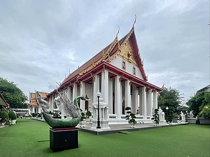
วัดหงษ์รัตนารามราชวรวิหาร Address: 72 Wang Doem Rd. street in ธนบุรี
Attractions near วัดหงษ์รัตนารามราชวรวิหาร
Wat Hong Rattanaram Ratchaworawihan (วัดหงส์รัตนารามราชวรวิหาร),ศูนย์บริการสาธารณสุข 33 เขตบางกอกใหญ่,แฟลตตำรวจสน. บางกอกใหญ่,มัสยิดต้นสน,Tonson Mosque (มัสยิดต้นสน),Ton Son Mosque,ยิ้มแย้มแมนชั่น,โรงเรียนวัดหงส์รัตนาราม,Wat Hong Rattanaram School (โรงเรียนวัดหงส์รัตนาราม),ก๋วยเตี๋ยวเป็ด ตรงข้ามปั๊มแก๊สอิสระภาพ,ซอยอิสรภาพ 28,ซอย วัดหงษ์รัตนาราม,ศูนย์สุขภาพชุมชน ชุมชนวัดโมลีโลกยาราม,สะพานอนุทินสวัสดิ์ 2541,เซ็นทรัลปิ่นเกล้า@Laura Mercier,อาคาร แย้มยิ้มแมนชั่น,ร้าน รวมแว่น ถนนอิสรภาพ,24/49 ซอยอิสรภาพ 30 ถนนอิสรภาพ,ซอย อิสรภาพ 32 อิสรภาพ 30,60/2 อิสรภาพ 34How to get to popular attractions in ธนบุรี with public transit
CADET-TUTOR, ปากเกร็ด,พิศมัย สาย 2, บางแค,สนามหลวง, พระนคร,หมู่บ้านทิพย์พิมาน การ์เด้น, บางบัวทอง,ดอนเมือง, ดอนเมือง,บ้านดาวล้อมเดือน, ตลิ่งชัน,อิสลามวิทยาลัยแห่งประเทศไทย, ทุ่งครุ,V2GAS LPG Station (วีทูแก๊ส), บางขุนเทียน,เตี๋ยวหมูชานเมือง (เตี๋ยวโอ่งมังกร), จอมทอง,วัดชมภูเวก, เมืองนนทบุรี,A4 | Bangkok University, Rangsit campus, คลองหลวง,Experteam Co.,Ltd., บางขุนเทียน,เดอะ ฮับ, ลำลูกกา,โรงเรียนเซนต์ราฟาแอล, เมืองสมุทรปราการ,วัดตลิ่งชัน, บางกอกน้อย,สะพานกลับรถหน้าฐานทัพอากาศ, ดอนเมือง,หอพักเปี่ยมศิริ, บางกอกน้อย,เทสโก้ โลตัส เอ็กซ์เพรส, บางกอกน้อย,วิทยาลัยการปกครอง,ฝ่ายปฏิบัติการภาคกลาง (อปก.) EGAT, บางกรวยGet around ธนบุรี by public transit!
Traveling around ธนบุรี has never been so easy. See step by step directions as you travel to any attraction, street or major public transit station. View bus and train schedules, arrival times, service alerts and detailed routes on a map, so you know exactly how to get to anywhere in ธนบุรี.
When traveling to any destination around ธนบุรี use Moovit's Live Directions with Get Off Notifications to know exactly where and how far to walk, how long to wait for your line, and how many stops are left. Moovit will alert you when it's time to get off — no need to constantly re-check whether yours is the next stop.
Wondering how to use public transit in ธนบุรี or how to pay for public transit in ธนบุรี? Moovit public transit app can help you navigate your way with public transit easily, and at minimum cost. It includes public transit fees, ticket prices, and costs. Looking for a map of ธนบุรี public transit lines? Moovit public transit app shows all public transit maps in ธนบุรี with all bus, metro, train, SkyTrain or ferry routes and stops on an interactive map.
ธนบุรี has 5 transit type(s), including: bus, metro, train, SkyTrain or ferry, operated by several transit agencies, including บีทีเอส BTS, MRT, ขสมก. BMTA, รถไฟฟ้ารฟท. SRTET, รถไฟฟ้ารฟท. SRTET, รถประจำทาง Transport Bus, บีอาร์ที BRT, เรือคลองโดยสาร Canal Ferry, เรือข้ามฟาก River Ferry, รถสองแถว Songthaew, จุฬาป๊อบบัส Chula Pop Bus, ขสมก BMTA, ขสมก. (BMTA), รถมินิบัส Minibus and รฟท. SRT