Directions to สะพานชวา (บางซื่อ) with public transportation
The following transit lines have routes that pass near สะพานชวา
How to get to สะพานชวา by bus?
Click on the bus route to see step by step directions with maps, line arrival times and updated time schedules.
How to get to สะพานชวา by train?
Click on the train route to see step by step directions with maps, line arrival times and updated time schedules.
How to get to สะพานชวา by metro?
Click on the metro route to see step by step directions with maps, line arrival times and updated time schedules.
How to get to สะพานชวา by SkyTrain?
Click on the SkyTrain route to see step by step directions with maps, line arrival times and updated time schedules.
How to get to สะพานชวา by ferry?
Click on the ferry route to see step by step directions with maps, line arrival times and updated time schedules.
Bus stops near สะพานชวา in บางซื่อ
- ซอยสะพานขวา;Soi Saphan Khwang, 4 min walk,
- ซอยเยาวพา Soi Yaowapha, 5 min walk,
- ข้างตลาดเตาปูน,แยกเตาปูน, 8 min walk,
- ตลาดเตาปูน;Tao Poon Market, 8 min walk,
- เทสโก้โลตัสเตาปูน, 12 min walk,
- โลตัสประชาชื่น;Tesco Lotus Prachachuen, 12 min walk,
- จุดขึ้นลง;Visual Stop, 12 min walk,
Metro stations near สะพานชวา in บางซื่อ
- Mrt บางโพ;Mrt Bang Pho, 6 min walk,
- Mrt เตาปูน;Mrt Tao Poon, 18 min walk,
Ferry stations near สะพานชวา in บางซื่อ
- ท่าเรือบางโพ;Bang Pho Pier, 14 min walk,
- ท่าเรือเกียกกาย;Kaik Kai Pier, 27 min walk,
Bus lines to สะพานชวา in บางซื่อ
- 5, สะพานพุทธ;Saphan Phut Bus Station,
- 2-2, ท่าเรือปากเกร็ด; Pak Kret Pier,
- 2-17R, สถานีรถไฟบางซื่อ (วนขวา);Bang Sue Railway Station,
- 2-12 (66), สถานีขนส่งผู้โดยสารกรุงเทพฯ(สายใต้เก่า);Bangkok Bus Terminal (Southern) Pinklao,
- 16, อู่หมอชิต 2 Mochit 2 Bus Depot,
- 16 (ปอ.) (AC), สภากาชาดไทย the Thai Red Cross Society,
- 66, ท่าปล่อยรถ สายใต้ใหม่ (ตลิ่งชัน),
- 66 (ปอ.) (AC), ท่าปล่อยรถ ศูนย์ราชการแจ้งวัฒนะ,
- 505 (ปอ.) (AC), สวนลุมพินีป้ายแรก (เข้าเมือง),
- 2-17L, สถานีรถไฟบางซื่อ (วนซ้าย);Bang Sue Railway Station,
- 50, สวนลุมพินีป้ายแรก (เข้าเมือง),
- 50 (ปอ.) (AC), สวนลุมพินีป้ายแรก (เข้าเมือง),
- 65, ตรงข้ามโรงเรียนสตรีนนทบุรี-วัดปากน้ำ,
- 97, โรงพยาบาลสงฆ์ Priest Hospital,
- 97 (ปอ.) (AC), ท่าน้ำนนทบุรี Nonthaburi Pier,
- 2-33, สถานีรถไฟบางซื่อ;Bang Sue Railway Station,
- 2-4 (30), สายใต้ (ปิ่นเกล้า);Southern Bus (Pinklao),
- 2-7 (50), สวนลุมพินี;Lumphini Park,
- 2-15 (97), กระทรวงสาธารณสุข ;Ministry Of Public Health,
- 67, ใต้ทางด่วนสาธุประดิษฐ์ Sathu Pradit Expressway,
What are the closest stations to สะพานชวา?
The closest stations to สะพานชวา are:
- ซอยสะพานขวา;Soi Saphan Khwang is 272 meters away, 4 min walk.
- ซอยเยาวพา Soi Yaowapha is 346 meters away, 5 min walk.
- Mrt บางโพ;Mrt Bang Pho is 435 meters away, 6 min walk.
- ข้างตลาดเตาปูน,แยกเตาปูน is 573 meters away, 8 min walk.
- ตลาดเตาปูน;Tao Poon Market is 573 meters away, 8 min walk.
- เทสโก้โลตัสเตาปูน is 874 meters away, 12 min walk.
- โลตัสประชาชื่น;Tesco Lotus Prachachuen is 874 meters away, 12 min walk.
- ท่าเรือบางโพ;Bang Pho Pier is 883 meters away, 14 min walk.
- จุดขึ้นลง;Visual Stop is 937 meters away, 12 min walk.
- Mrt เตาปูน;Mrt Tao Poon is 1340 meters away, 18 min walk.
- ท่าเรือเกียกกาย;Kaik Kai Pier is 2116 meters away, 27 min walk.
Which bus lines stop near สะพานชวา?
These bus lines stop near สะพานชวา: 16, 16 (ปอ.) (AC), 505 (ปอ.) (AC), 66 (ปอ.) (AC).
Which train line stops near สะพานชวา?
318 (กรุงเทพ;Bangkok)
Which metro lines stop near สะพานชวา?
These metro lines stop near สะพานชวา: BLUE, PURPLE.
Which SkyTrain lines stop near สะพานชวา?
These SkyTrain lines stop near สะพานชวา: RED, SUKHUMVIT.
Which ferry line stops near สะพานชวา?
URBAN LINE (พระปิ่นเกล้า;Phra Pinklao)
What’s the nearest metro station to สะพานชวา in บางซื่อ?
The nearest metro station to สะพานชวา in บางซื่อ is Mrt บางโพ;Mrt Bang Pho. It’s a 6 min walk away.
What’s the nearest bus station to สะพานชวา in บางซื่อ?
The nearest bus station to สะพานชวา in บางซื่อ is ซอยสะพานขวา;Soi Saphan Khwang. It’s a 4 min walk away.
What’s the nearest ferry station to สะพานชวา in บางซื่อ?
The nearest ferry station to สะพานชวา in บางซื่อ is ท่าเรือบางโพ;Bang Pho Pier. It’s a 14 min walk away.
What time is the first metro to สะพานชวา in บางซื่อ?
The BLUE is the first metro that goes to สะพานชวา in บางซื่อ. It stops nearby at 6:00 AM.
What time is the last metro to สะพานชวา in บางซื่อ?
The BLUE is the last metro that goes to สะพานชวา in บางซื่อ. It stops nearby at 12:59 AM.
What time is the first bus to สะพานชวา in บางซื่อ?
The 97 is the first bus that goes to สะพานชวา in บางซื่อ. It stops nearby at 3:01 AM.
What time is the last bus to สะพานชวา in บางซื่อ?
The 97 is the last bus that goes to สะพานชวา in บางซื่อ. It stops nearby at 3:05 AM.
What time is the first ferry to สะพานชวา in บางซื่อ?
The URBAN LINE is the first ferry that goes to สะพานชวา in บางซื่อ. It stops nearby at 6:19 AM.
What time is the last ferry to สะพานชวา in บางซื่อ?
The เรือด่วนธงส้ม is the last ferry that goes to สะพานชวา in บางซื่อ. It stops nearby at 7:53 PM.
See สะพานชวา, บางซื่อ, on the map
Public Transit to สะพานชวา in บางซื่อ
How to get to สะพานชวา in บางซื่อ, Thailand?
It’s easy with Moovit. Type in your street address and Moovit’s route finder will locate the fastest way to get you there! Not sure where to get off on the street? Download the Moovit App to find live directions (including where to get off on สะพานชวา), see timetables and get the estimated arrival times for your favorite bus, metro, SkyTrain, ferry or train lines.
Looking for the nearest stop or station to สะพานชวา? Check out this list of closest stops available to your destination: ซอยสะพานขวา;Soi Saphan Khwang; ซอยเยาวพา Soi Yaowapha; Mrt บางโพ;Mrt Bang Pho; ข้างตลาดเตาปูน,แยกเตาปูน; ตลาดเตาปูน;Tao Poon Market; เทสโก้โลตัสเตาปูน; โลตัสประชาชื่น;Tesco Lotus Prachachuen; ท่าเรือบางโพ;Bang Pho Pier; จุดขึ้นลง;Visual Stop; Mrt เตาปูน;Mrt Tao Poon; ท่าเรือเกียกกาย;Kaik Kai Pier.
Bus: 16, 16 (ปอ.) (AC), 505 (ปอ.) (AC), 66 (ปอ.) (AC), 5, 2-2, 2-17R, 2-12 (66), 2-17L, 50, 50 (ปอ.) (AC), 65, 97, 97 (ปอ.) (AC).Train: 318.Metro: BLUE, PURPLE.SkyTrain: RED, SUKHUMVIT.Ferry: URBAN LINE, เรือด่วนธงส้ม, เรือด่วนธงเขียวเหลือง, เรือด่วนธงเหลือง, เรือด่วนธงเหลือง (กลางวัน).
Download the Moovit App to see the current schedule and routes available for บางซื่อ. No need to install a special bus app to check the bus time or a train app to get train time. Moovit is the only all-in-one transit app that helps you get where you need to go.
We make riding on public transit to สะพานชวา easy, which is why over 1.5 million users, including users in บางซื่อ trust Moovit as the best app for public transit.
Use the app to navigate to popular places including to the airport, hospital, stadium, grocery store, mall, coffee shop, school, college, and university.
Location: บางซื่อ, Bangkok
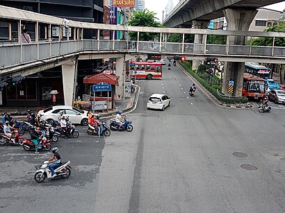
Streets near สะพานชวา, บางซื่อ
Get around บางซื่อ by public transit!
Traveling around บางซื่อ has never been so easy. See step by step directions as you travel to any attraction, street or major public transit station. View bus and train schedules, arrival times, service alerts and detailed routes on a map, so you know exactly how to get to anywhere in บางซื่อ.
When traveling to any destination around บางซื่อ use Moovit's Live Directions with Get Off Notifications to know exactly where and how far to walk, how long to wait for your line, and how many stops are left. Moovit will alert you when it's time to get off — no need to constantly re-check whether yours is the next stop.
Wondering how to use public transit in บางซื่อ or how to pay for public transit in บางซื่อ? Moovit public transit app can help you navigate your way with public transit easily, and at minimum cost. It includes public transit fees, ticket prices, and costs. Looking for a map of บางซื่อ public transit lines? Moovit public transit app shows all public transit maps in บางซื่อ with all Bus, Train, Metro, SkyTrain and Ferry routes and stops on an interactive map.
Bangkok has 5 transit type(s), including: Bus, Train, Metro, SkyTrain and Ferry, operated by several transit agencies, including บีทีเอส BTS, MRT, ไทย สมายล์ บัส;Thai Smile Bus, ขสมก. BMTA, รถไฟฟ้ารฟท. SRTET, รถประจำทาง Transport Bus, บีอาร์ที BRT, เรือคลองโดยสาร Canal Ferry, เรือข้ามฟาก River Ferry, รถสองแถว Songthaew, จุฬาป๊อบบัส Chula Pop Bus, ขสมก BMTA, ขสมก. (BMTA), รถมินิบัส Minibus and รฟท. SRT