Directions to สะพานพระนั่งเกล้า (เมืองนนทบุรี) with public transportation
The following transit lines have routes that pass near สะพานพระนั่งเกล้า
How to get to สะพานพระนั่งเกล้า by bus?
Click on the bus route to see step by step directions with maps, line arrival times and updated time schedules.
How to get to สะพานพระนั่งเกล้า by metro?
Click on the metro route to see step by step directions with maps, line arrival times and updated time schedules.
How to get to สะพานพระนั่งเกล้า by ferry?
Click on the ferry route to see step by step directions with maps, line arrival times and updated time schedules.
Ferry stations near สะพานพระนั่งเกล้า in เมืองนนทบุรี
- ท่าเรือสะพานพระนั่งเกล้า;Phra Nang Klao Brigde, 3 min walk,
Bus stops near สะพานพระนั่งเกล้า in เมืองนนทบุรี
- ท่ารถพระนั่งเกล้า;Phra Nang Klao Bus Depot, 6 min walk,
- Mrt ท่าเรือพระนั่งเกล้า / Mrt Phra Nang Klao Pier, 6 min walk,
- จุดขึ้นลง;Visual Stop, 7 min walk,
- สะพานพระนั่งเกล้า;Phra Nang Klao Bridge, 7 min walk,
- หมู่บ้านนนท์ณิชา;Nonnicha Village, 7 min walk,
- หมู่บ้านชมเพลิน ริเวอร์ลอฟท์;Chomploen River Loft Village, 8 min walk,
- หมู่บ้านชมเพลิน Muban Chomploern, 8 min walk,
- ริชพาร์ค 3;Rich Park 3, 10 min walk,
- ก่อนแยกพระนั่งเกล้า;Before Phra Nang Klao Intersection, 10 min walk,
Metro stations near สะพานพระนั่งเกล้า in เมืองนนทบุรี
- Mrt สะพานพระนั่งเกล้า;Mrt Phra Nang Klao Bridge, 9 min walk,
Bus lines to สะพานพระนั่งเกล้า in เมืองนนทบุรี
- 63, MRT พระนั่งเกล้า - อนุสาวรีย์ชัยสมรภูมิ;MRT Phra Nang Klao - Victory Monument,
- 191, MRT พระนั่งเกล้า - เคหะคลองจั่น;MRT Phra Nang Klao - Klongchan Housing,
- 191, ตรงข้ามกระทรวงพาณิชย์ Ministry Of Commerce,
- 1024, บริเวณอำเภอบางใหญ่;Bang Yai District,
- 337, ช่วงปทุมธานี - ถนนกาญจนาภิเษก - ห้างสรรพสินค้าเดอะมอลล์งามวงศ์วาน;Pathum Thani - Kanchanaphisek Road - The mall Ngamwongwan,
- 337, ตัดช่วงสี่แยกนพวงศ์ - ห้างสรรพสินค้าเดอะมอลล์งามวงศ์วาน;Noppawong Intersection - The mall Ngamwongwan,
- 337, ตัดช่วงสี่แยกนพวงศ์ - นนทบุรี;Noppawong Intersection - Nonthaburi,
- 337, ปทุมธานี - นนทบุรี;Pathum Thani - Nonthaburi,
- 370, ปทุมธานี - บ้านลำโพธิ์ - นนทบุรี;Pathum Thani - Lam Pho Home - Nonthaburi,
- 18, อนุสาวรีย์ชัยสมรภูมิ;Victory Monument,
- 64, กระทรวงพาณิชย์;Ministry Of Commerce,
- 203, สนามหลวง;Sanamluang,
- 2-3 (18), อนุสาวรีย์ชัยสมรภูมิ;Victory Monument,
- 2-18E (69E), รามคำแหง;Ramkhamhaeng,
- 2-20 (134), ม.บัวทองเคหะ;Buathong Keha Village,
- ต.15, ช่วงมีนบุรี - บางบัวทอง;Min Buri - Bang Bua Thong,
- ต.37, ช่วงห้างสรรพสินค้าเซ็นทรัลลาดพร้าว - หมู่บ้านรัตนาธิเบศร์;Central Plaza Lardprao Department Store - Rattanathibate Village,
- ต.37, ช่วงสถานีขนส่งผู้โดยสารกรุงเทพฯ (จตุจักร) - หมู่บ้านรัตนาธิเบศร์;Bangkok Bus Terminal (Chatuchak) - Rattanathibate Village,
- ต.37, สวนจตุจักร - อำเภอบางบัวทอง;Chatuchak Park - Bang Bua Thong District,
- ต.38, ห้างสรรพสินค้าเดอะมอลล์งามวงศ์วาน - หมู่บ้านบัวทอง 4;The mall Ngam wong wan Department Store - Bang Bua Thong 4 Village,
What are the closest stations to สะพานพระนั่งเกล้า?
The closest stations to สะพานพระนั่งเกล้า are:
- ท่าเรือสะพานพระนั่งเกล้า;Phra Nang Klao Brigde is 169 meters away, 3 min walk.
- ท่ารถพระนั่งเกล้า;Phra Nang Klao Bus Depot is 443 meters away, 6 min walk.
- Mrt ท่าเรือพระนั่งเกล้า / Mrt Phra Nang Klao Pier is 460 meters away, 6 min walk.
- จุดขึ้นลง;Visual Stop is 486 meters away, 7 min walk.
- สะพานพระนั่งเกล้า;Phra Nang Klao Bridge is 486 meters away, 7 min walk.
- หมู่บ้านนนท์ณิชา;Nonnicha Village is 486 meters away, 7 min walk.
- หมู่บ้านชมเพลิน ริเวอร์ลอฟท์;Chomploen River Loft Village is 548 meters away, 8 min walk.
- หมู่บ้านชมเพลิน Muban Chomploern is 580 meters away, 8 min walk.
- Mrt สะพานพระนั่งเกล้า;Mrt Phra Nang Klao Bridge is 632 meters away, 9 min walk.
- ริชพาร์ค 3;Rich Park 3 is 754 meters away, 10 min walk.
- ก่อนแยกพระนั่งเกล้า;Before Phra Nang Klao Intersection is 754 meters away, 10 min walk.
Which metro line stops near สะพานพระนั่งเกล้า?
PURPLE
Which bus lines stop near สะพานพระนั่งเกล้า?
These bus lines stop near สะพานพระนั่งเกล้า: 1024, 2-18E (69E), 203, 337, 388, 64.
Which ferry line stops near สะพานพระนั่งเกล้า?
เรือด่วนธงเขียวเหลือง
What’s the nearest metro station to สะพานพระนั่งเกล้า in เมืองนนทบุรี?
The nearest metro station to สะพานพระนั่งเกล้า in เมืองนนทบุรี is Mrt สะพานพระนั่งเกล้า;Mrt Phra Nang Klao Bridge. It’s a 9 min walk away.
What’s the nearest bus stop to สะพานพระนั่งเกล้า in เมืองนนทบุรี?
The nearest bus stops to สะพานพระนั่งเกล้า in เมืองนนทบุรี are ท่ารถพระนั่งเกล้า;Phra Nang Klao Bus Depot and Mrt ท่าเรือพระนั่งเกล้า / Mrt Phra Nang Klao Pier. The closest one is a 6 min walk away.
What’s the nearest ferry station to สะพานพระนั่งเกล้า in เมืองนนทบุรี?
The nearest ferry station to สะพานพระนั่งเกล้า in เมืองนนทบุรี is ท่าเรือสะพานพระนั่งเกล้า;Phra Nang Klao Brigde. It’s a 3 min walk away.
What time is the first metro to สะพานพระนั่งเกล้า in เมืองนนทบุรี?
The PURPLE is the first metro that goes to สะพานพระนั่งเกล้า in เมืองนนทบุรี. It stops nearby at 6:15 AM.
What time is the last metro to สะพานพระนั่งเกล้า in เมืองนนทบุรี?
The PURPLE is the last metro that goes to สะพานพระนั่งเกล้า in เมืองนนทบุรี. It stops nearby at 12:13 AM.
What time is the first bus to สะพานพระนั่งเกล้า in เมืองนนทบุรี?
The 134 is the first bus that goes to สะพานพระนั่งเกล้า in เมืองนนทบุรี. It stops nearby at 3:06 AM.
What time is the last bus to สะพานพระนั่งเกล้า in เมืองนนทบุรี?
The 134 is the last bus that goes to สะพานพระนั่งเกล้า in เมืองนนทบุรี. It stops nearby at 3:16 AM.
See สะพานพระนั่งเกล้า, เมืองนนทบุรี, on the map
Public Transit to สะพานพระนั่งเกล้า in เมืองนนทบุรี
Wondering how to get to สะพานพระนั่งเกล้า in เมืองนนทบุรี, Thailand? Moovit helps you find the best way to get to สะพานพระนั่งเกล้า with step-by-step directions from the nearest public transit station.
Moovit provides free maps and live directions to help you navigate through your city. View schedules, routes, timetables, and find out how long does it take to get to สะพานพระนั่งเกล้า in real time.
Looking for the nearest stop or station to สะพานพระนั่งเกล้า? Check out this list of stops closest to your destination: ท่าเรือสะพานพระนั่งเกล้า;Phra Nang Klao Brigde; ท่ารถพระนั่งเกล้า;Phra Nang Klao Bus Depot; Mrt ท่าเรือพระนั่งเกล้า / Mrt Phra Nang Klao Pier; จุดขึ้นลง;Visual Stop; สะพานพระนั่งเกล้า;Phra Nang Klao Bridge; หมู่บ้านนนท์ณิชา;Nonnicha Village; หมู่บ้านชมเพลิน ริเวอร์ลอฟท์;Chomploen River Loft Village; หมู่บ้านชมเพลิน Muban Chomploern; Mrt สะพานพระนั่งเกล้า;Mrt Phra Nang Klao Bridge; ริชพาร์ค 3;Rich Park 3; ก่อนแยกพระนั่งเกล้า;Before Phra Nang Klao Intersection.
Metro: PURPLE.Bus: 1024, 2-18E (69E), 203, 337, 388, 64, 63, 191, 191, 370.Ferry: เรือด่วนธงเขียวเหลือง.
Want to see if there’s another route that gets you there at an earlier time? Moovit helps you find alternative routes or times. Get directions from and directions to สะพานพระนั่งเกล้า easily from the Moovit App or Website.
We make riding to สะพานพระนั่งเกล้า easy, which is why over 1.5 million users, including users in เมืองนนทบุรี, trust Moovit as the best app for public transit. You don’t need to download an individual bus app or train app, Moovit is your all-in-one transit app that helps you find the best bus time or train time available.
For information on prices of bus, metro and ferry, costs and ride fares to สะพานพระนั่งเกล้า, please check the Moovit app.
Use the app to navigate to popular places including to the airport, hospital, stadium, grocery store, mall, coffee shop, school, college, and university.
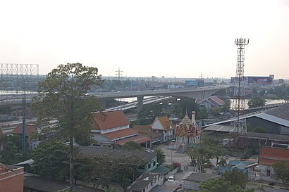
สะพานพระนั่งเกล้า Address: Rattanathibet Rd street in เมืองนนทบุรี
Attractions near สะพานพระนั่งเกล้า
How to get to popular places in Bangkok with public transit
Get around เมืองนนทบุรี by public transit!
Traveling around เมืองนนทบุรี has never been so easy. See step by step directions as you travel to any attraction, street or major public transit station. View bus and train schedules, arrival times, service alerts and detailed routes on a map, so you know exactly how to get to anywhere in เมืองนนทบุรี.
When traveling to any destination around เมืองนนทบุรี use Moovit's Live Directions with Get Off Notifications to know exactly where and how far to walk, how long to wait for your line, and how many stops are left. Moovit will alert you when it's time to get off — no need to constantly re-check whether yours is the next stop.
Wondering how to use public transit in เมืองนนทบุรี or how to pay for public transit in เมืองนนทบุรี? Moovit public transit app can help you navigate your way with public transit easily, and at minimum cost. It includes public transit fees, ticket prices, and costs. Looking for a map of เมืองนนทบุรี public transit lines? Moovit public transit app shows all public transit maps in เมืองนนทบุรี with all bus, metro or ferry routes and stops on an interactive map.
เมืองนนทบุรี has 3 transit type(s), including: bus, metro or ferry, operated by several transit agencies, including บีทีเอส BTS, MRT, บริษัท ไทย สมายล์ บัส จำกัด;thaismilebus company limited, ขสมก. BMTA, รถไฟฟ้ารฟท. SRTET, รถไฟฟ้ารฟท. SRTET, รถประจำทาง Transport Bus, บีอาร์ที BRT, เรือคลองโดยสาร Canal Ferry, เรือข้ามฟาก River Ferry, รถสองแถว Songthaew, จุฬาป๊อบบัส Chula Pop Bus, ขสมก BMTA, ขสมก. (BMTA) and รถมินิบัส Minibus