Directions to สะพานพระปกเกล้า (คลองสาน) with public transportation
The following transit lines have routes that pass near สะพานพระปกเกล้า
Directions to สะพานพระปกเกล้า (คลองสาน) with public transportation
The following transit lines have routes that pass near สะพานพระปกเกล้า
How to get to สะพานพระปกเกล้า by bus?
Click on the bus route to see step by step directions with maps, line arrival times and updated time schedules.
How to get to สะพานพระปกเกล้า by train?
Click on the train route to see step by step directions with maps, line arrival times and updated time schedules.
How to get to สะพานพระปกเกล้า by metro?
Click on the metro route to see step by step directions with maps, line arrival times and updated time schedules.
How to get to สะพานพระปกเกล้า by ferry?
Click on the ferry route to see step by step directions with maps, line arrival times and updated time schedules.
Bus lines to สะพานพระปกเกล้า in คลองสาน
- ต.35,ท่าน้ำพระประแดง;Phra Pradaeng Pier,
- 42,เสาชิงช้า;Giant Swing,
- 82,สนามหลวง;Sanam Luang,
- 82 มินิบัส,พาหุรัด;Phahurat,
- 4-15,ท่าน้ำพระประแดง;Phra Pradaeng,
- 4-48,พาหุรัด;Phahurat,
- 2-37 (3),คลองสาน;Klongsan,
- 4-37 (9),สถานีรถไฟสามเสน;Samsen Station,
- 4-10 (42),เสาชิงช้า;Sao Ching Cha,
- 3,Btsกรุงธนบุรี(ทางออก3) Bts Krungthonburi (Exit 3),
- 3 (ปอ.) (AC),อู่หมอชิต 2 Mochit 2 Bus Depot,
- 6,แยกบางลำพู Banglumphu Intersection,
- 6 (ปอ.) (AC),ตลาดพระประแดง Pak Lat Fa MA Si,
- 7ก,พาหุรัด(เพาะช่าง-สวนกุหลาบ),
- 42,ตรงข้ามวัดสุทัศน์,ร้านวิจิตรพานิช,
- 82,ตลาดท่าเตียน Tha Tien Market,
- 82,ตลาดพระประแดง Pak Lat Fa MA Si,
- 4-11 (43),รร.ศึกษานารีวิทยา;Suksanareewittaya School,
- 8,แฮปปี้แลนด์ - สะพานพุทธ;Happyland - Saphan Phut,
- 3-2E,ปู่เจ้าสมิงพราย - ท่าเรือสะพานพุทธ (ทางด่วน);Pu Chao Samingphrai - Memorial Bridge,
What are the closest stations to สะพานพระปกเกล้า?
The closest stations to สะพานพระปกเกล้า are:
- สะพานพุทธ;Pha Phuttha Yodfa Bridge is 280 meters away, 4 min walk.
- สะพานพุทธ Saphan Phut is 280 meters away, 4 min walk.
- สะพานพุทธ (ฝั่งธนบุรี);Saphan Phut (Thonburi Side) is 389 meters away, 6 min walk.
- ท่าเรือสะพานพุทธ;Memorial Bridge Pier is 402 meters away, 6 min walk.
- ท่ารถสะพานพุทธ;Saphan Phut Bus Station is 426 meters away, 6 min walk.
- ท่าปล่อยรถ สะพานพุทธ Saphan Phut Bus Terminal is 536 meters away, 7 min walk.
- พาหุรัด(อินเดียเอ็มโพเรียม) is 572 meters away, 8 min walk.
- อินเดียเอ็มโพเรียม พาหุรัด;India Emporium Phahurat is 572 meters away, 8 min walk.
- ตรงข้ามโรงเรียนสวนกุหลาบวิทยาลัย;Opposite Suankularb Wittayalai School is 592 meters away, 8 min walk.
- พาหุรัด(เพาะช่าง-สวนกุหลาบ) is 592 meters away, 8 min walk.
- ปากคลองตลาด;Pak Khlong Market is 710 meters away, 10 min walk.
- ท่าเรือราชินี;Rajinee Pier is 888 meters away, 12 min walk.
- ท่าเรืออัษฎางค์ (ปากคลองตลาด) (ข้ามฟาก);Asdand Pier (Ferry) is 890 meters away, 12 min walk.
- ท่าเรือดินแดง (ข้ามฟาก);Dindang Pier (Ferry) is 2360 meters away, 32 min walk.
Which metro line stops near สะพานพระปกเกล้า?
BLUE
Which bus lines stop near สะพานพระปกเกล้า?
These bus lines stop near สะพานพระปกเกล้า: 4-10 (42), 4-28 (529), 4-37 (9), 6 (ปอ.) (AC), 7ก, 82.
Which ferry line stops near สะพานพระปกเกล้า?
เรือด่วนธงแดง
Which train lines stop near สะพานพระปกเกล้า?
These train lines stop near สะพานพระปกเกล้า: 262, 4312.
What’s the nearest bus stop to สะพานพระปกเกล้า in คลองสาน?
The nearest bus stops to สะพานพระปกเกล้า in คลองสาน are สะพานพุทธ;Pha Phuttha Yodfa Bridge and สะพานพุทธ Saphan Phut. The closest one is a 4 min walk away.
What’s the nearest ferry station to สะพานพระปกเกล้า in คลองสาน?
The nearest ferry station to สะพานพระปกเกล้า in คลองสาน is ท่าเรือสะพานพุทธ;Memorial Bridge Pier. It’s a 6 min walk away.
What time is the first bus to สะพานพระปกเกล้า in คลองสาน?
The 3-1 (2) (TSB) is the first bus that goes to สะพานพระปกเกล้า in คลองสาน. It stops nearby at 3:00 AM.
What time is the last bus to สะพานพระปกเกล้า in คลองสาน?
The 4-36 (7) is the last bus that goes to สะพานพระปกเกล้า in คลองสาน. It stops nearby at 5:03 AM.
What time is the first ferry to สะพานพระปกเกล้า in คลองสาน?
The เรือข้ามฟาก is the first ferry that goes to สะพานพระปกเกล้า in คลองสาน. It stops nearby at 5:00 AM.
What time is the last ferry to สะพานพระปกเกล้า in คลองสาน?
The เรือด่วนธงส้ม is the last ferry that goes to สะพานพระปกเกล้า in คลองสาน. It stops nearby at 8:43 PM.
See สะพานพระปกเกล้า, คลองสาน, on the map
Public Transit to สะพานพระปกเกล้า in คลองสาน
Wondering how to get to สะพานพระปกเกล้า in คลองสาน, Thailand? Moovit helps you find the best way to get to สะพานพระปกเกล้า with step-by-step directions from the nearest public transit station.
Moovit provides free maps and live directions to help you navigate through your city. View schedules, routes, timetables, and find out how long does it take to get to สะพานพระปกเกล้า in real time.
Looking for the nearest stop or station to สะพานพระปกเกล้า? Check out this list of stops closest to your destination: สะพานพุทธ;Pha Phuttha Yodfa Bridge; สะพานพุทธ Saphan Phut; สะพานพุทธ (ฝั่งธนบุรี);Saphan Phut (Thonburi Side); ท่าเรือสะพานพุทธ;Memorial Bridge Pier; ท่ารถสะพานพุทธ;Saphan Phut Bus Station; ท่าปล่อยรถ สะพานพุทธ Saphan Phut Bus Terminal; พาหุรัด(อินเดียเอ็มโพเรียม); อินเดียเอ็มโพเรียม พาหุรัด;India Emporium Phahurat; ตรงข้ามโรงเรียนสวนกุหลาบวิทยาลัย;Opposite Suankularb Wittayalai School; พาหุรัด(เพาะช่าง-สวนกุหลาบ); ปากคลองตลาด;Pak Khlong Market; ท่าเรือราชินี;Rajinee Pier; ท่าเรืออัษฎางค์ (ปากคลองตลาด) (ข้ามฟาก);Asdand Pier (Ferry); ท่าเรือดินแดง (ข้ามฟาก);Dindang Pier (Ferry).
Metro: BLUE.Bus: 4-10 (42), 4-28 (529), 4-37 (9), 6 (ปอ.) (AC), 7ก, 82, ต.35, 42, 82 มินิบัส, 4-15, 3, 3 (ปอ.) (AC), 6, 4-11 (43), 8, 3-2E, 3-1 (2) (TSB), 2-38 (8)(TSB), 2-45 (73), 73 (ปอ.) (AC), 73ก (ปอ.) (AC).Ferry: เรือด่วนธงแดง, เรือด่วนธงส้ม, เรือประจำทาง (ไม่มีธง).Train: 262, 4312.
Want to see if there’s another route that gets you there at an earlier time? Moovit helps you find alternative routes or times. Get directions from and directions to สะพานพระปกเกล้า easily from the Moovit App or Website.
We make riding to สะพานพระปกเกล้า easy, which is why over 1.5 million users, including users in คลองสาน, trust Moovit as the best app for public transit. You don’t need to download an individual bus app or train app, Moovit is your all-in-one transit app that helps you find the best bus time or train time available.
For information on prices of bus, train, metro and ferry, costs and ride fares to สะพานพระปกเกล้า, please check the Moovit app.
Use the app to navigate to popular places including to the airport, hospital, stadium, grocery store, mall, coffee shop, school, college, and university.
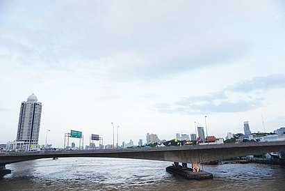
สะพานพระปกเกล้า Address: Chakphet Rd. street in คลองสาน
Attractions near สะพานพระปกเกล้า
Chao Phraya Sky Park (สวนลอยฟ้าเจ้าพระยา),ซอยสะพานยาว สำเพ็ง,สะพานพุทธ,ท่าน้ำท่าดินแดง,ร้านราดหน้านายน้อย เปิดมา 30ปี (เจ้าเดียว),ท่าเรือสะพานพุทธ (Memorial Bridge Pier) N6,Chao Phraya Arena (เจ้าพระยาอารีน่า),ครัวมนตรา@สะพานพุทธ,สนามฟุตซอลใต้สะพานพระปกเกล้าฯ,สะพานพุทธยอดฟ้าจุฬาโลกมหาราช,Memorial Bridge (สะพานพระพุทธยอดฟ้า),อู่สาย 73 สะพานพุทธ,มัสยิดกูวติลอิสลาม -ตึกแดง,Goowatin islam mosque (มัสยิดกูวติลอิสลาม -ตึกแดง),ถนนพญาไม้,มัสยิดกูวติลอิสลาม,ซอยตลาดบ้านสมเด็จ,อู่รถเมล์สาย 8,Saphan Put Night Market,ไปรสนียาคารHow to get to popular attractions in คลองสาน with public transit
ซอยพหลโยธิน48 (ซอยสายหยุด), บางเขน,เซ็นทรัลแจ้งวัฒนะ, หลักสี่,ซาฟารีเวิลด์, คลองสามวา,BTS เอกมัย (E7), คลองเตย,ห้างแพตตินัม ประตูน้ำ, พระนคร,โรงเรียนสุรศักดิ์มนตรี, ดินแดง,โรงแรมอมารี แอร์พอร์ต, ดอนเมือง,ศาลเจ้าพ่อเสือ, พระนคร,บางกรวย นนทบุรี, บางกรวย,ตลาดตรอกหม้อ, พระนคร,สายใต้เก่า ปิ่นเกล้า, บางกอกน้อย,ตลาดน้ำตลิ่งชัน, บางกอกน้อย,Samyan Mitrtown Hall (สามย่าน มิตรทาวน์ ฮอลล์), บางรัก,โรงเรียนสวนกุหลาบวิทยาลัย, พระนคร,ถนน บรรทัดทอง, ปทุมวัน,รถตู้ฟิวเจอร์-คลอง8, ธัญบุรี,สำนักงานขนส่งกรุงเทพมหานครพื้นที่ 1 บางขุนเทียน, บางขุนเทียน,สถานีเดินรถโดยสารขนาดเล็ก (จตุจักร), จตุจักร,โรงเรียนเตรียมอุดมศึกษาพัฒนาการ, สวนหลวง,วัดนาคปรก, จอมทองGet around Bangkok by public transit!
Traveling around Bangkok has never been so easy. See step by step directions as you travel to any attraction, street or major public transit station. View bus and train schedules, arrival times, service alerts and detailed routes on a map, so you know exactly how to get to anywhere in Bangkok.
When traveling to any destination around Bangkok use Moovit's Live Directions with Get Off Notifications to know exactly where and how far to walk, how long to wait for your line, and how many stops are left. Moovit will alert you when it's time to get off — no need to constantly re-check whether yours is the next stop.
Wondering how to use public transit in Bangkok or how to pay for public transit in Bangkok? Moovit public transit app can help you navigate your way with public transit easily, and at minimum cost. It includes public transit fees, ticket prices, and costs. Looking for a map of Bangkok public transit lines? Moovit public transit app shows all public transit maps in Bangkok with all Bus, Train, Metro, SkyTrain and Ferry routes and stops on an interactive map.
Bangkok has 5 transit type(s), including: Bus, Train, Metro, SkyTrain and Ferry, operated by several transit agencies, including บีทีเอส BTS, MRT, บริษัท ไทย สมายล์ บัส จำกัด;thaismilebus company limited, ขสมก. BMTA, รถไฟฟ้ารฟท. SRTET, รถประจำทาง Transport Bus, บีอาร์ที BRT, เรือคลองโดยสาร Canal Ferry, เรือข้ามฟาก River Ferry, รถสองแถว Songthaew, จุฬาป๊อบบัส Chula Pop Bus, ขสมก BMTA, ขสมก. (BMTA), รถมินิบัส Minibus, รฟท. SRT