Directions to สะพานพระราม 6 (บางกรวย) with public transportation
The following transit lines have routes that pass near สะพานพระราม 6
How to get to สะพานพระราม 6 by bus?
Click on the bus route to see step by step directions with maps, line arrival times and updated time schedules.
How to get to สะพานพระราม 6 by metro?
Click on the metro route to see step by step directions with maps, line arrival times and updated time schedules.
How to get to สะพานพระราม 6 by SkyTrain?
Click on the SkyTrain route to see step by step directions with maps, line arrival times and updated time schedules.
How to get to สะพานพระราม 6 by ferry?
Click on the ferry route to see step by step directions with maps, line arrival times and updated time schedules.
Bus stops near สะพานพระราม 6 in บางกรวย
- ตรงข้ามสวนสะพานพระราม 7;Opposite Rama 7 Bridge Park, 5 min walk,
- ใต้สะพานพระราม7(ขาออก) Tai Saphan Phra Ram 7, 5 min walk,
- สวนสะพานพระราม 7;Rama 7 Park, 6 min walk,
- ใต้สะพานพระราม7(ขาเข้า) Tai Saphan Phra Ram 7, 7 min walk,
- ท่าเรือใต้สะพานพระราม7, 18 min walk,
- ตรงข้ามท่าพระราม 7;Opposite Rama 7 Pier, 19 min walk,
Metro stations near สะพานพระราม 6 in บางกรวย
- Mrt บางโพ;Mrt Bang Pho, 16 min walk,
Ferry stations near สะพานพระราม 6 in บางกรวย
- ท่าเรือสะพานพระราม 7;Rama 7 Bridge Pier, 18 min walk,
Bus lines to สะพานพระราม 6 in บางกรวย
- หมอชิต 2, สถานีขนส่่งผู้โดยสารกรุงเทพฯ (จตุจักร) - หัวลำโพง;Bangkok Apiwat - Hua LamphongBangkok Bus Terminal (Chatuchak) - Hua Lamphong,
- ต.12, เซ็นทรัลลาดพร้าว - ท่าน้ำนนทบุรี;Central Plaza Ladprao Department Store - Nonthaburi Pier,
- ต.12, ช่วงสวนจตุจักร - ถนนวงศ์สว่าง - ท่าน้ำนนทบุรี;Chatuchak Park - Wongsawang Road - Nonthaburi Pier,
- ต.80, มหาวิทยาลัยรามคำแหง - ท่าน้ำนนทบุรี;Ramkhamhaeng University - Nonthaburi Pier,
- 117, นนทบุรี - ศาลาว่าการ กทม.2;Nonthaburi - BMA City Hall 2,
- 2-17, วงกลมสถานีรถไฟบางซื่อ - ม.เกษตรศาสตร์;Bang Sue Railway Station - Kasetsart University,
- 1010, สี่แยกบางสีทอง - มหาวิทยาลัยเทคโนโลยีพระจอมเกล้าพระนครเหนือ;Bang Si Thong Intersection - King Mongkut's University of Technology North Bangkok,
- 2-5 (32), ปากเกร็ด - วัดโพธิ์;Pak Kret - Wat Pho,
- 2-6 (33), ปทุมธานี - เทเวศร์;Pathumthani - Thewet,
- 2-15 (97), กระทรวงสาธารณสุข - รพ.สงฆ์;Ministry of Public Health - priest hospital,
- 2-43 (49), กรุงเทพอภิวัฒน์ - หัวลำโพง;Krung Thep Aphiwat - Hua Lamphong,
- 1-34 (543ก), นนทบุรี - บางเขน;Nonthaburi - Bangkhen,
- 2-47 (117), ศูนย์วัฒนธรรมแห่งประเทศไทย - ท่าเรือนนทบุรี;Thailand Cultural Center - Nonthaburi Pier,
- 32, อู่ท่าอิฐ - วัดโพธิ์ Tha It - Wat Pho,
- 49, หมอชิต 2 - หัวลำโพง Mochit 2 - Hua Lamphong,
- 49 (ปอ.) (AC), หมอชิต 2 - หัวลำโพง Mochit 2 - Hua Lamphong,
- 97, กระทรวงสาธารณสุข - รพ.สงฆ์ Ministry of Public Health - priest hospital,
- 97 (ปอ.) (AC), ท่าน้ำนนทบุรี - อนุสาวรีย์ชัยสมรภูมิ Nonthaburi Pier - Victory Monument,
- 117, ท่าน้ำนนทบุรี - กทม.2 Nonthaburi Pier - BMA City Hall 2,
- 543ก (ปอ.) (AC), ท่าน้ำนนทบุรี - อู่บางเขน Nonthaburi Pier - Bangkhen,
What are the closest stations to สะพานพระราม 6?
The closest stations to สะพานพระราม 6 are:
- ตรงข้ามสวนสะพานพระราม 7;Opposite Rama 7 Bridge Park is 207 meters away, 5 min walk.
- ใต้สะพานพระราม7(ขาออก) Tai Saphan Phra Ram 7 is 208 meters away, 5 min walk.
- สวนสะพานพระราม 7;Rama 7 Park is 308 meters away, 6 min walk.
- ใต้สะพานพระราม7(ขาเข้า) Tai Saphan Phra Ram 7 is 330 meters away, 7 min walk.
- Mrt บางโพ;Mrt Bang Pho is 1180 meters away, 16 min walk.
- ท่าเรือใต้สะพานพระราม7 is 1273 meters away, 18 min walk.
- ตรงข้ามท่าพระราม 7;Opposite Rama 7 Pier is 1306 meters away, 19 min walk.
- ท่าเรือสะพานพระราม 7;Rama 7 Bridge Pier is 1359 meters away, 18 min walk.
Which SkyTrain line stops near สะพานพระราม 6?
RED
Which metro lines stop near สะพานพระราม 6?
These metro lines stop near สะพานพระราม 6: BLUE, PURPLE.
Which bus lines stop near สะพานพระราม 6?
These bus lines stop near สะพานพระราม 6: 2-17, 2-22 (175), 203, 3-55, 32.
Which ferry lines stop near สะพานพระราม 6?
These ferry lines stop near สะพานพระราม 6: เรือด่วนธงเขียวเหลือง, เรือด่วนธงส้ม.
What’s the nearest metro station to สะพานพระราม 6 in บางกรวย?
The nearest metro station to สะพานพระราม 6 in บางกรวย is Mrt บางโพ;Mrt Bang Pho. It’s a 16 min walk away.
What’s the nearest bus stop to สะพานพระราม 6 in บางกรวย?
The nearest bus stops to สะพานพระราม 6 in บางกรวย are ตรงข้ามสวนสะพานพระราม 7;Opposite Rama 7 Bridge Park and ใต้สะพานพระราม7(ขาออก) Tai Saphan Phra Ram 7. The closest one is a 5 min walk away.
What’s the nearest ferry station to สะพานพระราม 6 in บางกรวย?
The nearest ferry station to สะพานพระราม 6 in บางกรวย is ท่าเรือสะพานพระราม 7;Rama 7 Bridge Pier. It’s a 18 min walk away.
What time is the first metro to สะพานพระราม 6 in บางกรวย?
The BLUE is the first metro that goes to สะพานพระราม 6 in บางกรวย. It stops nearby at 6:03 AM.
What time is the last metro to สะพานพระราม 6 in บางกรวย?
The BLUE is the last metro that goes to สะพานพระราม 6 in บางกรวย. It stops nearby at 12:19 AM.
What time is the first bus to สะพานพระราม 6 in บางกรวย?
The 97 is the first bus that goes to สะพานพระราม 6 in บางกรวย. It stops nearby at 3:12 AM.
What time is the last bus to สะพานพระราม 6 in บางกรวย?
The 203 is the last bus that goes to สะพานพระราม 6 in บางกรวย. It stops nearby at 3:12 AM.
What time is the first ferry to สะพานพระราม 6 in บางกรวย?
The เรือด่วนธงส้ม is the first ferry that goes to สะพานพระราม 6 in บางกรวย. It stops nearby at 6:19 AM.
What time is the last ferry to สะพานพระราม 6 in บางกรวย?
The เรือด่วนธงส้ม is the last ferry that goes to สะพานพระราม 6 in บางกรวย. It stops nearby at 9:12 PM.
See สะพานพระราม 6, บางกรวย, on the map
Public Transit to สะพานพระราม 6 in บางกรวย
Wondering how to get to สะพานพระราม 6 in บางกรวย, Thailand? Moovit helps you find the best way to get to สะพานพระราม 6 with step-by-step directions from the nearest public transit station.
Moovit provides free maps and live directions to help you navigate through your city. View schedules, routes, timetables, and find out how long does it take to get to สะพานพระราม 6 in real time.
Looking for the nearest stop or station to สะพานพระราม 6? Check out this list of stops closest to your destination: ตรงข้ามสวนสะพานพระราม 7;Opposite Rama 7 Bridge Park; ใต้สะพานพระราม7(ขาออก) Tai Saphan Phra Ram 7; สวนสะพานพระราม 7;Rama 7 Park; ใต้สะพานพระราม7(ขาเข้า) Tai Saphan Phra Ram 7; Mrt บางโพ;Mrt Bang Pho; ท่าเรือใต้สะพานพระราม7; ตรงข้ามท่าพระราม 7;Opposite Rama 7 Pier; ท่าเรือสะพานพระราม 7;Rama 7 Bridge Pier.
SkyTrain: RED.Metro: BLUE, PURPLE.Bus: 2-17, 2-22 (175), 203, 3-55, 32, หมอชิต 2, ต.12, ต.12, ต.80, 117, 49, 49 (ปอ.) (AC), 97, 97 (ปอ.) (AC), ต.46, ต.47, ต.143, ต.143.Ferry: เรือด่วนธงเขียวเหลือง, เรือด่วนธงส้ม, เรือด่วนธงเหลือง, เรือด่วนธงแดง, เรือประจำทาง (ไม่มีธง).
Want to see if there’s another route that gets you there at an earlier time? Moovit helps you find alternative routes or times. Get directions from and directions to สะพานพระราม 6 easily from the Moovit App or Website.
We make riding to สะพานพระราม 6 easy, which is why over 1.5 million users, including users in บางกรวย, trust Moovit as the best app for public transit. You don’t need to download an individual bus app or train app, Moovit is your all-in-one transit app that helps you find the best bus time or train time available.
For information on prices of bus, metro, ferry and SkyTrain, costs and ride fares to สะพานพระราม 6, please check the Moovit app.
Use the app to navigate to popular places including to the airport, hospital, stadium, grocery store, mall, coffee shop, school, college, and university.
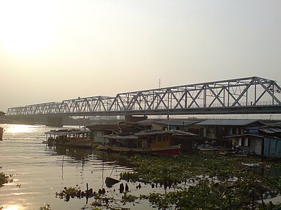
สะพานพระราม 6 Address: สะพานพระราม 7 street in บางกรวย
Attractions near สะพานพระราม 6
How to get to popular places in Bangkok with public transit
Get around บางกรวย by public transit!
Traveling around บางกรวย has never been so easy. See step by step directions as you travel to any attraction, street or major public transit station. View bus and train schedules, arrival times, service alerts and detailed routes on a map, so you know exactly how to get to anywhere in บางกรวย.
When traveling to any destination around บางกรวย use Moovit's Live Directions with Get Off Notifications to know exactly where and how far to walk, how long to wait for your line, and how many stops are left. Moovit will alert you when it's time to get off — no need to constantly re-check whether yours is the next stop.
Wondering how to use public transit in บางกรวย or how to pay for public transit in บางกรวย? Moovit public transit app can help you navigate your way with public transit easily, and at minimum cost. It includes public transit fees, ticket prices, and costs. Looking for a map of บางกรวย public transit lines? Moovit public transit app shows all public transit maps in บางกรวย with all bus, metro, ferry or SkyTrain routes and stops on an interactive map.
บางกรวย has 4 transit type(s), including: bus, metro, ferry or SkyTrain, operated by several transit agencies, including บีทีเอส BTS, MRT, บริษัท ไทย สมายล์ บัส จำกัด;thaismilebus company limited, ขสมก. BMTA, รถไฟฟ้ารฟท. SRTET, รถไฟฟ้ารฟท. SRTET, รถประจำทาง Transport Bus, บีอาร์ที BRT, เรือคลองโดยสาร Canal Ferry, เรือข้ามฟาก River Ferry, รถสองแถว Songthaew, จุฬาป๊อบบัส Chula Pop Bus, ขสมก BMTA, ขสมก. (BMTA) and รถมินิบัส Minibus