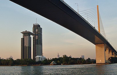
See สะพานพระราม 9, ราษฎร์บูรณะ, on the map
Directions to สะพานพระราม 9 (ราษฎร์บูรณะ) with public transportation
The following transit lines have routes that pass near สะพานพระราม 9
 Bus:
Bus: - Ferry:
How to get to สะพานพระราม 9 by bus?
Click on the bus route to see step by step directions with maps, line arrival times and updated time schedules.
Bus stations near สะพานพระราม 9 in ราษฎร์บูรณะ
- ใต้สะพานแขวน;Suspenion Bridge,8 min walk,
- ใต้สะพานแขวน Tai Saphankhwaen,8 min walk,
- ตรงข้ามโฮมโปรพระราม 3;Opposite Homepro Rama 3,10 min walk,
- ตรงข้ามไอซีซี Trongkham Icc,10 min walk,
- โฮมโปรพรพะราม 3;Homepro Rama 3,11 min walk,
Ferry stations near สะพานพระราม 9 in ราษฎร์บูรณะ
- ท่าเรือพระราม 3 (ข้ามฟาก);Rama 3 Pier (Ferry),41 min walk,
- ท่าเรือสาธุประดิษฐ์ (ข้ามฟาก);Sathupradit Pier (Ferry),55 min walk,
Bus lines to สะพานพระราม 9 in ราษฎร์บูรณะ
- 35,สายใต้ใหม่ (ตลิ่งชัน);Southern Bus (Talingchan),
- ต.71,วัดสน;Son Temple,
- 205 เดิม,เดอะมอลล์ท่าพระ;The Mall Thaphra,
- 4-8 (35),เคหะธนบุรี;Thonburi Housing,
- 3-39 (14),รร.นนทรีวิทยา;Nonsi Wittaya,
- 205,ตรงข้ามเดอะมอลล์ท่าพระ Opp the Mall Thapra,
- 205 (ปอ.) (AC),อู่คลองเตย Klongtoey Bus Depot,
- 3-52,เซ็นทรัลพระราม 3;Central Rama III,
- 4-47 (89),มหาวิทยาลัยเทคโนโลยีราชมงคล กรุงเทพ;Rmutk,
- 205 (ปอ.) (AC),ท่าปล่อยรถ เดอะมอลล์ท่าพระ,
- 3-54,อนุสาวรีย์ชัยสมรภูมิ;Victory Monument,
- 3-35 (1),ท่าเตียน;Tha Tien,
What are the closest stations to สะพานพระราม 9?
The closest stations to สะพานพระราม 9 are:
- ใต้สะพานแขวน;Suspenion Bridge is 352 meters away, 8 min walk.
- ใต้สะพานแขวน Tai Saphankhwaen is 352 meters away, 8 min walk.
- ตรงข้ามโฮมโปรพระราม 3;Opposite Homepro Rama 3 is 511 meters away, 10 min walk.
- ตรงข้ามไอซีซี Trongkham Icc is 511 meters away, 10 min walk.
- โฮมโปรพรพะราม 3;Homepro Rama 3 is 552 meters away, 11 min walk.
- ท่าเรือพระราม 3 (ข้ามฟาก);Rama 3 Pier (Ferry) is 2867 meters away, 41 min walk.
- ท่าเรือสาธุประดิษฐ์ (ข้ามฟาก);Sathupradit Pier (Ferry) is 4251 meters away, 55 min walk.
Which bus lines stop near สะพานพระราม 9?
These bus lines stop near สะพานพระราม 9: 205, 205 (ปอ.) (AC), 3-54, 35, 4-8 (35), ต.71.
What’s the nearest bus stop to สะพานพระราม 9 in ราษฎร์บูรณะ?
The nearest bus stops to สะพานพระราม 9 in ราษฎร์บูรณะ are ใต้สะพานแขวน;Suspenion Bridge and ใต้สะพานแขวน Tai Saphankhwaen. The closest one is a 8 min walk away.
What time is the first bus to สะพานพระราม 9 in ราษฎร์บูรณะ?
The 205 (ปอ.) (AC) is the first bus that goes to สะพานพระราม 9 in ราษฎร์บูรณะ. It stops nearby at 4:42 AM.
What time is the last bus to สะพานพระราม 9 in ราษฎร์บูรณะ?
The 35 is the last bus that goes to สะพานพระราม 9 in ราษฎร์บูรณะ. It stops nearby at 11:28 PM.
What time is the first ferry to สะพานพระราม 9 in ราษฎร์บูรณะ?
The เรือข้ามฟาก is the first ferry that goes to สะพานพระราม 9 in ราษฎร์บูรณะ. It stops nearby at 5:00 AM.
What time is the last ferry to สะพานพระราม 9 in ราษฎร์บูรณะ?
The เรือข้ามฟาก is the last ferry that goes to สะพานพระราม 9 in ราษฎร์บูรณะ. It stops nearby at 7:57 PM.
See สะพานพระราม 9, ราษฎร์บูรณะ, on the map
Public Transit to สะพานพระราม 9 in ราษฎร์บูรณะ
Wondering how to get to สะพานพระราม 9 in ราษฎร์บูรณะ, Thailand? Moovit helps you find the best way to get to สะพานพระราม 9 with step-by-step directions from the nearest public transit station.
Moovit provides free maps and live directions to help you navigate through your city. View schedules, routes, timetables, and find out how long does it take to get to สะพานพระราม 9 in real time.
Looking for the nearest stop or station to สะพานพระราม 9? Check out this list of stops closest to your destination: ใต้สะพานแขวน;Suspenion Bridge; ใต้สะพานแขวน Tai Saphankhwaen; ตรงข้ามโฮมโปรพระราม 3;Opposite Homepro Rama 3; ตรงข้ามไอซีซี Trongkham Icc; โฮมโปรพรพะราม 3;Homepro Rama 3; ท่าเรือพระราม 3 (ข้ามฟาก);Rama 3 Pier (Ferry); ท่าเรือสาธุประดิษฐ์ (ข้ามฟาก);Sathupradit Pier (Ferry).
Bus:Ferry:
Want to see if there’s another route that gets you there at an earlier time? Moovit helps you find alternative routes or times. Get directions from and directions to สะพานพระราม 9 easily from the Moovit App or Website.
We make riding to สะพานพระราม 9 easy, which is why over 1.5 million users, including users in ราษฎร์บูรณะ, trust Moovit as the best app for public transit. You don’t need to download an individual bus app or train app, Moovit is your all-in-one transit app that helps you find the best bus time or train time available.
For information on prices of bus, costs and ride fares to สะพานพระราม 9, please check the Moovit app.
Use the app to navigate to popular places including to the airport, hospital, stadium, grocery store, mall, coffee shop, school, college, and university.
Location: ราษฎร์บูรณะ, Bangkok
Attractions near สะพานพระราม 9
สะพานพระราม 9,Rama IX Bridge (สะพานพระราม 9),รวยรวยริเวอร์ไซด์,วัดภุมรินทร์กุฎีทอง,สะพานพระราม 9,อนุสรณ์ประวัติสะพานพระราม 9,ริมน้ําใต้สะพานแขวน,โรงเรียนวัดบางโคล่นอก,ท่าเรือ ธนาคารกสิกรไทย,Kbank Fl8 พิลาสวาที,K-Canteen (ห้องอาหารดุสิตา),ห้องอาหารดุสิตา ธนาคารกสิกรไทย ราษฎร์บูรณะ,ธนาคารกสิกรไทย จํากัด (มหาชน) ครั้งที่ 25,ธนาคารกสิกรไทย (KBank),ห้องประชุมจินดาธร ชั้น 8, Kasikornbank,ห้องประชุมพิลาศวดี ชั้น 8 ธนาคารกสิกรไทย,ฝ่าย Pf ธนาคารกสิกรไทย ราษฎร์บูรณะ,Fitness Room, 36th Fl. KBank Ratburana,กสิกร@ราษฎร์บูรณะ ชั้น 4,CMB DR site ตึกกสิกรไทย ราษฎร์บูรณะ ชั้น 18How to get to popular attractions in ราษฎร์บูรณะ with public transit
Bts หมอชิต / สวนจตุจักร, จตุจักร,การไฟฟ้าส่วนภูมิภาค อาคาร 4, จตุจักร,หอ10 บ้านลีลาวดี มหิดล ศาลายา, พุทธมณฑล,เซเว่น อีเลฟเว่น, ดอนเมือง,วัดชมภูเวก, เมืองนนทบุรี,เปี่ยมสุข รัตนาธิเบศร์ 17, เมืองนนทบุรี,พรปิยะแมนชั่น, บางซื่อ,Squeeze by Tipco (สควีซ), บางขุนเทียน,โรงเรียนเซนต์ราฟาแอล, เมืองสมุทรปราการ,เจ๊ก้อย ก๋วยเตี๋ยวเรืออยุธยา, พุทธมณฑล,วิทยาลัยการปกครอง,ประตูน้ำ, ปทุมวัน,ร้านปังเย็น เจ๊นก, พุทธมณฑล,เทสโก้ โลตัส เอ็กซ์เพรส, คลองหลวง,ร้านแกงไทย - บางนา, บางพลี,บ้านสวนปาล์ม, คลองหลวง,กลุ่มบริษัท ชัยบูรณ์ บราเดอร์ส, ลำลูกกา,แยกสาครเกษม, กระทุ่มแบน,อุดมทรัพย์ อพาร์ทเมนท์, บางซื่อ,ดอนเมือง, ดอนเมืองGet around ราษฎร์บูรณะ by public transit!
Traveling around ราษฎร์บูรณะ has never been so easy. See step by step directions as you travel to any attraction, street or major public transit station. View bus and train schedules, arrival times, service alerts and detailed routes on a map, so you know exactly how to get to anywhere in ราษฎร์บูรณะ.
When traveling to any destination around ราษฎร์บูรณะ use Moovit's Live Directions with Get Off Notifications to know exactly where and how far to walk, how long to wait for your line, and how many stops are left. Moovit will alert you when it's time to get off — no need to constantly re-check whether yours is the next stop.
Wondering how to use public transit in ราษฎร์บูรณะ or how to pay for public transit in ราษฎร์บูรณะ? Moovit public transit app can help you navigate your way with public transit easily, and at minimum cost. It includes public transit fees, ticket prices, and costs. Looking for a map of ราษฎร์บูรณะ public transit lines? Moovit public transit app shows all public transit maps in ราษฎร์บูรณะ with all bus routes and stops on an interactive map.
ราษฎร์บูรณะ has 1 transit type(s), including: bus, operated by several transit agencies, including บีทีเอส BTS, MRT, ขสมก. BMTA, รถไฟฟ้ารฟท. SRTET, รถไฟฟ้ารฟท. SRTET, รถประจำทาง Transport Bus, บีอาร์ที BRT, เรือคลองโดยสาร Canal Ferry, เรือข้ามฟาก River Ferry, รถสองแถว Songthaew, จุฬาป๊อบบัส Chula Pop Bus, ขสมก BMTA, ขสมก. (BMTA), รถมินิบัส Minibus and รฟท. SRT