
How to get to อนุสาวรีย์หมู in พระนคร by Bus, Metro, Ferry, SkyTrain or Train?

See อนุสาวรีย์หมู, พระนคร, on the map

Directions to อนุสาวรีย์หมู (พระนคร) with public transportation

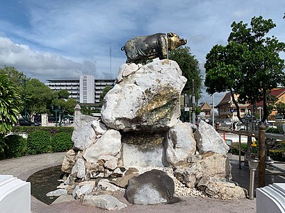
The following transit lines have routes that pass near อนุสาวรีย์หมู

  • SkyTrainSkyTrain:
  • MetroMetro:
  • BusBus:
  • FerryFerry:
  • TrainTrain:

How to get to อนุสาวรีย์หมู by Bus?

Click on the Bus route to see step by step directions with maps, line arrival times and updated time schedules.

How to get to อนุสาวรีย์หมู by Train?

Click on the Train route to see step by step directions with maps, line arrival times and updated time schedules.

How to get to อนุสาวรีย์หมู by Metro?

Click on the Metro route to see step by step directions with maps, line arrival times and updated time schedules.

How to get to อนุสาวรีย์หมู by SkyTrain?

Click on the SkyTrain route to see step by step directions with maps, line arrival times and updated time schedules.

How to get to อนุสาวรีย์หมู by Ferry?

Click on the Ferry route to see step by step directions with maps, line arrival times and updated time schedules.

Bus stations near อนุสาวรีย์หมู in พระนคร

  • อนุสาวรีย์หมู;Pig Monument,1 min walk,
  • ท่ารถคลองคูเมืองเดิม (สาย 2 25 508);Old Khu Mueang Bus Terminal (Line 2,25,508),2 min walk,
  • ท่ารถสาย2(ปากคลองตลาด),2 min walk,
  • กระทรวงมหาดไทย Krasuang Mahatthai,3 min walk,
  • กระทรวงกลาโหม;Ministry Of Defense,4 min walk,
  • กระทรวงกลาโหม Ministry Of Defense,4 min walk,
  • สวนสราญรมย์;Saranrom Park,5 min walk,
  • หน่วยบัญชาการรักษาดินแดน;Territorial Defense Command,5 min walk,
  • หน่วยบัญชาการรักษาดินแดน,5 min walk,
  • พระบรมมหาราชวัง;Grand Palace,8 min walk,

Metro stations near อนุสาวรีย์หมู in พระนคร

  • Mrt สนามไชย;Mrt Sanam Chai,4 min walk,

Ferry stations near อนุสาวรีย์หมู in พระนคร

  • ท่าเรือท่าเตียน (ข้ามฟาก);Tha Tien Pier (Ferry),7 min walk,
  • ท่าเรือท่าช้าง;Tha Chang Pier,64 min walk,
  • ท่าเรือท่าช้าง (ข้ามฟาก);Tha Chang Pier (Ferry),64 min walk,

Bus lines to อนุสาวรีย์หมู in พระนคร

  • 2,สำโรง - สนง.ที่ดินกรุงเทพฯ;Samrong - Bangkok Land Office,
  • 25,แพรกษาบ่อดิน - สนามหลวง;Phraeksa Bo Din - Sanam Luang,
  • 508,ตลาดปากน้ำ - สนามหลวง; Pak Nam Market - Sanam Luang,
  • 3-1 (2),ปากคลองตลาด;Pak Klong Talad,
  • 2,สำโรง - ปากคลองตลาด Samrong - Pak Klong Talad,
  • 2 (ปอ.) (AC),สำโรง - ปากคลองตลาด Samrong - Pak Klong Talad,
  • 25,อู่แพรกษา-บ่อดิน - ท่าช้าง Praksa-Bodin - Tha Chang,
  • 508 (ปอ.) (AC),ปากน้ำ (อู่ฟาร์มจระเข้) - ท่าราชวรดิษฐ์ Paknam (Crocodile Farm) - Ratchaworadit Pier,
  • 60,อู่สวนสยาม Siam Park Bus Depot,
  • 60 (ปอ.) (AC),อู่สวนสยาม Siam Park Bus Depot,
  • 9,กัลปพฤกษ์ - สถานีรถไฟสามเสน;Kallaprapruk - Samsen Station,
  • 32,ปากเกร็ด - วัดโพธิ์;Pak Kret - Wat Pho,
  • 3-2E,ปู่เจ้าสมิงพราย - ท่าเรือสะพานพุทธ (ทางด่วน);Pu Chao Samingphrai - Memorial Bridge,
  • ต.35,สนามหลวง - ท่าน้ำพระประแดง;Sanam Luang - Phra Pradaeng Pier,
  • 4-1,ท่าเรือพระประแดง - บางลำพู; Phra Pradaeng Pier - Banglamphu,
  • 47,ท่าเรือคลองเตย - สนง.ที่ดินกรุงเทพฯ;Khlong Toey - Bangkok Metropolitan Land Office,
  • 60,สวนสยาม - สนง.ที่ดินกรุงเทพฯ;Siam Park - Bangkok Metropolitan Land Office,
  • 82,ท่าน้ำพระประแดง - สนามหลวง;Phra Pradaeng - Sanam Luang,
  • 503,อู่รังสิต - สนามหลวง;Rangsit - Sanamluang,
  • 3-35 (1),พระราม 3 - ท่าเตียน;Rama III Road - Tha Tien,
Questions & Answers
  • What are the closest stations to อนุสาวรีย์หมู?

    The closest stations to อนุสาวรีย์หมู are:

    • อนุสาวรีย์หมู;Pig Monument is 21 meters away, 1 min walk.
    • ท่ารถคลองคูเมืองเดิม (สาย 2 25 508);Old Khu Mueang Bus Terminal (Line 2,25,508) is 98 meters away, 2 min walk.
    • ท่ารถสาย2(ปากคลองตลาด) is 98 meters away, 2 min walk.
    • กระทรวงมหาดไทย Krasuang Mahatthai is 224 meters away, 3 min walk.
    • กระทรวงกลาโหม;Ministry Of Defense is 284 meters away, 4 min walk.
    • กระทรวงกลาโหม Ministry Of Defense is 284 meters away, 4 min walk.
    • Mrt สนามไชย;Mrt Sanam Chai is 293 meters away, 4 min walk.
    • สวนสราญรมย์;Saranrom Park is 320 meters away, 5 min walk.
    • หน่วยบัญชาการรักษาดินแดน;Territorial Defense Command is 350 meters away, 5 min walk.
    • หน่วยบัญชาการรักษาดินแดน is 350 meters away, 5 min walk.
    • ท่าเรือท่าเตียน (ข้ามฟาก);Tha Tien Pier (Ferry) is 491 meters away, 7 min walk.
    • พระบรมมหาราชวัง;Grand Palace is 587 meters away, 8 min walk.
    • ท่าเรือท่าช้าง;Tha Chang Pier is 4995 meters away, 64 min walk.
    • ท่าเรือท่าช้าง (ข้ามฟาก);Tha Chang Pier (Ferry) is 4995 meters away, 64 min walk.
  • Which SkyTrain lines stop near อนุสาวรีย์หมู?

    These SkyTrain lines stop near อนุสาวรีย์หมู: SILOM

  • Which Metro lines stop near อนุสาวรีย์หมู?

    These Metro lines stop near อนุสาวรีย์หมู: BLUE

  • Which Bus lines stop near อนุสาวรีย์หมู?

    These Bus lines stop near อนุสาวรีย์หมู: 1, 12 (ปอ.) (AC), 2, 3-11 (48), 3-13 (507), 4-37 (9), 4-50 (123), 508, 9

  • Which Ferry lines stop near อนุสาวรีย์หมู?

    These Ferry lines stop near อนุสาวรีย์หมู: เรือด่วนธงส้ม

  • Which Train lines stop near อนุสาวรีย์หมู?

    These Train lines stop near อนุสาวรีย์หมู: 258, 4306

  • What’s the nearest metro station to อนุสาวรีย์หมู in พระนคร?

    The nearest metro station to อนุสาวรีย์หมู in พระนคร is Mrt สนามไชย;Mrt Sanam Chai. It’s a 4 min walk away.

  • What’s the nearest bus stop to อนุสาวรีย์หมู in พระนคร?

    The nearest bus stop to อนุสาวรีย์หมู in พระนคร is อนุสาวรีย์หมู;Pig Monument. It’s a 1 min walk away.

  • What’s the nearest ferry station to อนุสาวรีย์หมู in พระนคร?

    The nearest ferry station to อนุสาวรีย์หมู in พระนคร is ท่าเรือท่าเตียน (ข้ามฟาก);Tha Tien Pier (Ferry). It’s a 7 min walk away.

  • What time is the first Metro to อนุสาวรีย์หมู in พระนคร?

    The BLUE is the first Metro that goes to อนุสาวรีย์หมู in พระนคร. It stops nearby at 6:19 AM.

  • What time is the last Metro to อนุสาวรีย์หมู in พระนคร?

    The BLUE is the last Metro that goes to อนุสาวรีย์หมู in พระนคร. It stops nearby at 12:45 AM.

  • What time is the first Bus to อนุสาวรีย์หมู in พระนคร?

    The 25 is the first Bus that goes to อนุสาวรีย์หมู in พระนคร. It stops nearby at 3:00 AM.

  • What time is the last Bus to อนุสาวรีย์หมู in พระนคร?

    The 25 is the last Bus that goes to อนุสาวรีย์หมู in พระนคร. It stops nearby at 4:01 AM.

  • What time is the first Ferry to อนุสาวรีย์หมู in พระนคร?

    The เรือข้ามฟาก is the first Ferry that goes to อนุสาวรีย์หมู in พระนคร. It stops nearby at 5:00 AM.

  • What time is the last Ferry to อนุสาวรีย์หมู in พระนคร?

    The เรือด่วนธงส้ม is the last Ferry that goes to อนุสาวรีย์หมู in พระนคร. It stops nearby at 8:34 PM.

See อนุสาวรีย์หมู, พระนคร, on the map

The Most Popular Urban Mobility App in พระนคร.
All local mobility options in one app

Public Transit to อนุสาวรีย์หมู in พระนคร

Wondering how to get to อนุสาวรีย์หมู in พระนคร, Thailand? Moovit helps you find the best way to get to อนุสาวรีย์หมู with step-by-step directions from the nearest public transit station.

Moovit provides free maps and live directions to help you navigate through your city. View schedules, routes, timetables, and find out how long does it take to get to อนุสาวรีย์หมู in real time.

Looking for the nearest stop or station to อนุสาวรีย์หมู? Check out this list of stops closest to your destination: อนุสาวรีย์หมู;Pig Monument; ท่ารถคลองคูเมืองเดิม (สาย 2 25 508);Old Khu Mueang Bus Terminal (Line 2,25,508); ท่ารถสาย2(ปากคลองตลาด); กระทรวงมหาดไทย Krasuang Mahatthai; กระทรวงกลาโหม;Ministry Of Defense; กระทรวงกลาโหม Ministry Of Defense; Mrt สนามไชย;Mrt Sanam Chai; สวนสราญรมย์;Saranrom Park; หน่วยบัญชาการรักษาดินแดน;Territorial Defense Command; หน่วยบัญชาการรักษาดินแดน; ท่าเรือท่าเตียน (ข้ามฟาก);Tha Tien Pier (Ferry); พระบรมมหาราชวัง;Grand Palace; ท่าเรือท่าช้าง;Tha Chang Pier; ท่าเรือท่าช้าง (ข้ามฟาก);Tha Chang Pier (Ferry).

SkyTrain:Metro:Bus:Ferry:Train:

Want to see if there’s another route that gets you there at an earlier time? Moovit helps you find alternative routes or times. Get directions from and directions to อนุสาวรีย์หมู easily from the Moovit App or Website.

We make riding to อนุสาวรีย์หมู easy, which is why over 1.5 million users, including users in พระนคร, trust Moovit as the best app for public transit. You don’t need to download an individual bus app or train app, Moovit is your all-in-one transit app that helps you find the best bus time or train time available.

For information on prices of Bus, Metro, Ferry, SkyTrain and Train, costs and ride fares to อนุสาวรีย์หมู, please check the Moovit app.

Use the app to navigate to popular places including to the airport, hospital, stadium, grocery store, mall, coffee shop, school, college, and university.

อนุสาวรีย์หมู Address: Thanon Rachini street in พระนคร

อนุสาวรีย์หมู, พระนคร
อนุสาวรีย์หมู, พระนครPig Memorial (Thai: อนุสาวรีย์หมู) is a memorial in Phra Borom Maha Ratchawang sub-district, Phra Nakhon district, Bangkok. It is located in the inner city or Rattanakosin Island which is a historic area of the city. Pig Memorial was built in 1913, the year of Queen Saovabha Phongsri's 50th Birthday Anniversary. Its official name is "Sahachart Memorial" (อนุสาวรีย์สหชาติ), which refers to "The Memorial of Those Who Were Born in The Same Year", which were Prince Narisara Nuvadtivongs, Phraya Phiphat Kosa (Celestino Xavier), and Phraya Ratcha Songkhram (Kon Hongsakul), all of the three had jointly built the memorial as a gesture of gratitude to the queen. The pig sculpture of the memorial is made of gilded cast metal. Initially, the sculpture was resting on large stone pillars, which have since been replaced by a higher, mountain-shaped concrete base. Its purpose is to honor the year of the pig which was the queen's year of birth, as well as the three donors. The memorial was designed by Prince Narisara Nuvadtivongs, who was one of the donors.And Pi Kun Bridge or Thai called "Saphan Pi Kun" (สะพานปีกุน) or commonly "Saphan Mu" (สะพานหมู). The bridge was built on the same occasion. Its name refers to "The Bridge of Year of The Pig". Its structure is cemented adjacent to the memorial, which is located in the west of the bridge. Pi Kun Bridge is a pedestrian overpass across Khlong Khu Mueang Doem (old city moat), better known as Khlong Lot (tube canal) alike other bridges nearby such as Saphan Hok and Saphan Mon. The bridge spans the Rop Krung canal between Atsadang and Rachini roads.At present, they have been registered as ancient monument in Bangkok.
How to get to อนุสาวรีย์หมู with public transit - About the place

Public transit lines with stations closest to อนุสาวรีย์หมู in พระนคร

Metro lines with stations closest to อนุสาวรีย์หมู in พระนคร

Bus lines with stations closest to อนุสาวรีย์หมู in พระนคร

Ferry lines with stations closest to อนุสาวรีย์หมู in พระนคร

Easier to get to อนุสาวรีย์หมู in…