Directions to อนุสาวรีย์หมู (พระนคร) with public transportation
The following transit lines have routes that pass near อนุสาวรีย์หมู
How to get to อนุสาวรีย์หมู by bus?
Click on the bus route to see step by step directions with maps, line arrival times and updated time schedules.
How to get to อนุสาวรีย์หมู by train?
Click on the train route to see step by step directions with maps, line arrival times and updated time schedules.
How to get to อนุสาวรีย์หมู by metro?
Click on the metro route to see step by step directions with maps, line arrival times and updated time schedules.
How to get to อนุสาวรีย์หมู by SkyTrain?
Click on the SkyTrain route to see step by step directions with maps, line arrival times and updated time schedules.
How to get to อนุสาวรีย์หมู by ferry?
Click on the ferry route to see step by step directions with maps, line arrival times and updated time schedules.
Bus stops near อนุสาวรีย์หมู in พระนคร
- อนุสาวรีย์หมู;Pig Monument, 1 min walk,
- ท่ารถสาย2(ปากคลองตลาด), 2 min walk,
- กระทรวงมหาดไทย Krasuang Mahatthai, 3 min walk,
- กระทรวงกลาโหม Ministry Of Defense, 4 min walk,
- กระทรวงกลาโหม;Ministry Of Defense, 4 min walk,
- สวนสราญรมย์;Saranrom Park, 5 min walk,
- หน่วยบัญชาการรักษาดินแดน, 5 min walk,
- หน่วยบัญชาการรักษาดินแดน;Territorial Defense Command, 5 min walk,
- พระบรมมหาราชวัง;Grand Palace, 8 min walk,
Metro stations near อนุสาวรีย์หมู in พระนคร
- Mrt สนามไชย;Mrt Sanam Chai, 11 min walk,
Ferry stations near อนุสาวรีย์หมู in พระนคร
- ท่าเรือท่าเตียน (ข้ามฟาก);Tha Tien Pier (Ferry), 13 min walk,
- ท่าเรือท่าช้าง;Tha Chang Pier, 15 min walk,
- ท่าเรือท่าช้าง (ข้ามฟาก);Tha Chang Pier (Ferry), 15 min walk,
Bus lines to อนุสาวรีย์หมู in พระนคร
- 2, สำโรง - สนง.ที่ดินกรุงเทพฯ;Samrong - Bangkok Land Office,
- 3-1 (2) (TSB), ปากน้ำ - สะพานพุทธ;Paknam - Saphan Phut,
- 508, ปากน้ำ - สนามหลวง; Pak Nam - Sanam Luang,
- 3-7E (25), รร.ปทุมคงคา สมุทรปราการ - สนามหลวง;Pathumkongka Samutprakan - Sanam Luang,
- 3-7E ปอ. (25), แพรกษาบ่อดิน - สนามหลวง;Phraeksa Bo Din - Sanam Luang,
- 2, สำโรง - ปากคลองตลาด Samrong - Pak Klong Talad,
- 2 (ปอ.) (AC), สำโรง - ปากคลองตลาด Samrong - Pak Klong Talad,
- 25, อู่แพรกษา-บ่อดิน - ท่าช้าง Praksa-Bodin - Tha Chang,
- 508 (ปอ.) (AC), ปากน้ำ (อู่ฟาร์มจระเข้) - ท่าราชวรดิษฐ์ Paknam (Crocodile Farm) - Ratchaworadit Pier,
- 60, อู่สวนสยาม Siam Park Bus Depot,
- 60 (ปอ.) (AC), อู่สวนสยาม Siam Park Bus Depot,
- 6, โรงละครแห่งชาติ National Theater,
- 6 (ปอ.) (AC), ตลาดพระประแดง Pak Lat Fa MA Si,
- 3-2E, ปู่เจ้าสมิงพราย - ท่าเรือสะพานพุทธ (ทางด่วน);Pu Chao Samingphrai - Memorial Bridge,
- ต.35, สนามหลวง - ท่าน้ำพระประแดง;Sanam Luang - Phra Pradaeng Pier,
- 82, ท่าน้ำพระประแดง - สนามหลวง;Phra Pradaeng - Sanam Luang,
- 1-80E, สวนสยาม - สถานีรถไฟฟ้าสนามไชย (ทางด่วน);Siam Park - BTS Sanam Chai,
- 4-15, ท่าน้ำพระประแดง - สนามหลวง;Phra Pradaeng - Sanam Luang,
- 4-1 (6), ท่าเรือพระประแดง - บางลำพู; Phra Pradaeng Pier - Banglamphu,
- 503, อู่รังสิต - สนามหลวง;Rangsit - Sanamluang,
What are the closest stations to อนุสาวรีย์หมู?
The closest stations to อนุสาวรีย์หมู are:
- อนุสาวรีย์หมู;Pig Monument is 21 meters away, 1 min walk.
- ท่ารถสาย2(ปากคลองตลาด) is 98 meters away, 2 min walk.
- กระทรวงมหาดไทย Krasuang Mahatthai is 224 meters away, 3 min walk.
- กระทรวงกลาโหม Ministry Of Defense is 282 meters away, 4 min walk.
- กระทรวงกลาโหม;Ministry Of Defense is 282 meters away, 4 min walk.
- สวนสราญรมย์;Saranrom Park is 320 meters away, 5 min walk.
- หน่วยบัญชาการรักษาดินแดน is 350 meters away, 5 min walk.
- หน่วยบัญชาการรักษาดินแดน;Territorial Defense Command is 350 meters away, 5 min walk.
- พระบรมมหาราชวัง;Grand Palace is 587 meters away, 8 min walk.
- Mrt สนามไชย;Mrt Sanam Chai is 834 meters away, 11 min walk.
- ท่าเรือท่าเตียน (ข้ามฟาก);Tha Tien Pier (Ferry) is 938 meters away, 13 min walk.
- ท่าเรือท่าช้าง;Tha Chang Pier is 1080 meters away, 15 min walk.
- ท่าเรือท่าช้าง (ข้ามฟาก);Tha Chang Pier (Ferry) is 1080 meters away, 15 min walk.
Which SkyTrain line stops near อนุสาวรีย์หมู?
SILOM
Which metro line stops near อนุสาวรีย์หมู?
BLUE
Which bus lines stop near อนุสาวรีย์หมู?
These bus lines stop near อนุสาวรีย์หมู: 2, 25, 3-1 (2) (TSB), 3-13 (507), 4-37 (9), 508, 6, ต.35.
Which ferry line stops near อนุสาวรีย์หมู?
เรือด่วนธงส้ม
Which train lines stop near อนุสาวรีย์หมู?
These train lines stop near อนุสาวรีย์หมู: 4312, 476.
What’s the nearest metro station to อนุสาวรีย์หมู in พระนคร?
The nearest metro station to อนุสาวรีย์หมู in พระนคร is Mrt สนามไชย;Mrt Sanam Chai. It’s a 11 min walk away.
What’s the nearest bus stop to อนุสาวรีย์หมู in พระนคร?
The nearest bus stop to อนุสาวรีย์หมู in พระนคร is อนุสาวรีย์หมู;Pig Monument. It’s a 1 min walk away.
What’s the nearest ferry station to อนุสาวรีย์หมู in พระนคร?
The nearest ferry station to อนุสาวรีย์หมู in พระนคร is ท่าเรือท่าเตียน (ข้ามฟาก);Tha Tien Pier (Ferry). It’s a 13 min walk away.
What time is the first metro to อนุสาวรีย์หมู in พระนคร?
The BLUE is the first metro that goes to อนุสาวรีย์หมู in พระนคร. It stops nearby at 6:19 AM.
What time is the last metro to อนุสาวรีย์หมู in พระนคร?
The BLUE is the last metro that goes to อนุสาวรีย์หมู in พระนคร. It stops nearby at 12:45 AM.
What time is the first bus to อนุสาวรีย์หมู in พระนคร?
The 25 is the first bus that goes to อนุสาวรีย์หมู in พระนคร. It stops nearby at 3:00 AM.
What time is the last bus to อนุสาวรีย์หมู in พระนคร?
The 3-1 (2) (TSB) is the last bus that goes to อนุสาวรีย์หมู in พระนคร. It stops nearby at 4:38 AM.
What time is the first ferry to อนุสาวรีย์หมู in พระนคร?
The เรือข้ามฟาก is the first ferry that goes to อนุสาวรีย์หมู in พระนคร. It stops nearby at 5:00 AM.
What time is the last ferry to อนุสาวรีย์หมู in พระนคร?
The เรือด่วนธงส้ม is the last ferry that goes to อนุสาวรีย์หมู in พระนคร. It stops nearby at 8:34 PM.
See อนุสาวรีย์หมู, พระนคร, on the map
Public Transit to อนุสาวรีย์หมู in พระนคร
Wondering how to get to อนุสาวรีย์หมู in พระนคร, Thailand? Moovit helps you find the best way to get to อนุสาวรีย์หมู with step-by-step directions from the nearest public transit station.
Moovit provides free maps and live directions to help you navigate through your city. View schedules, routes, timetables, and find out how long does it take to get to อนุสาวรีย์หมู in real time.
Looking for the nearest stop or station to อนุสาวรีย์หมู? Check out this list of stops closest to your destination: อนุสาวรีย์หมู;Pig Monument; ท่ารถสาย2(ปากคลองตลาด); กระทรวงมหาดไทย Krasuang Mahatthai; กระทรวงกลาโหม Ministry Of Defense; กระทรวงกลาโหม;Ministry Of Defense; สวนสราญรมย์;Saranrom Park; หน่วยบัญชาการรักษาดินแดน; หน่วยบัญชาการรักษาดินแดน;Territorial Defense Command; พระบรมมหาราชวัง;Grand Palace; Mrt สนามไชย;Mrt Sanam Chai; ท่าเรือท่าเตียน (ข้ามฟาก);Tha Tien Pier (Ferry); ท่าเรือท่าช้าง;Tha Chang Pier; ท่าเรือท่าช้าง (ข้ามฟาก);Tha Chang Pier (Ferry).
SkyTrain: SILOM.Metro: BLUE.Bus: 2, 25, 3-1 (2) (TSB), 3-13 (507), 4-37 (9), 508, 6, ต.35, 3-7E (25), 3-7E ปอ. (25), 2 (ปอ.) (AC), 508 (ปอ.) (AC), 60, 60 (ปอ.) (AC), 6 (ปอ.) (AC).Ferry: เรือด่วนธงส้ม, เรือข้ามฟาก.Train: 4312, 476.
Want to see if there’s another route that gets you there at an earlier time? Moovit helps you find alternative routes or times. Get directions from and directions to อนุสาวรีย์หมู easily from the Moovit App or Website.
We make riding to อนุสาวรีย์หมู easy, which is why over 1.5 million users, including users in พระนคร, trust Moovit as the best app for public transit. You don’t need to download an individual bus app or train app, Moovit is your all-in-one transit app that helps you find the best bus time or train time available.
For information on prices of bus, metro, SkyTrain, train and ferry, costs and ride fares to อนุสาวรีย์หมู, please check the Moovit app.
Use the app to navigate to popular places including to the airport, hospital, stadium, grocery store, mall, coffee shop, school, college, and university.
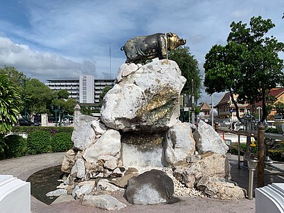
อนุสาวรีย์หมู Address: Thanon Rachini street in พระนคร
Attractions near อนุสาวรีย์หมู
Khlong Khu Mueang Doem (Old City Moat),สะพานปีกุน,131/7 ซอยธีระปัตย์ ถนนอัษฎางค์,Atsadang Road,หอการค้าไทย และสภาหอการค้าแห่งประเทศไทย,วัดราชประดิษฐสถิตมหาสีมาราม,กรมการปกครอง ถนน อัษฎางค์,สุสานหลวง วัดราชบพิธสถิตมหาสีมาราม,สำนักงานประกันสังคมกรุงเทพมหานครพื้นที่ 1,Wat Ratchabophit Sathitmahasimaram,กระทรวงมหาดไทย,กรมการปกครอง,โรงสีข้าวขนาดเล็ก - ลุงคลองบ้านถนนงาม,กองการเจ้าหน้าที่ กรมการปกครอง กระทรวงมหาดไทย,วัดราชบพิธ,Phuchong Pratan Witthayasith Building (อาคารภุชงค์ประทานวิทยาสิทธิ์),ซอย ราชินี,บ้านเครื่องกระเทยไทย,Wat Ratchabophit ,กองภูมิศาสตร์ กรมแผนที่ทหารHow to get to popular attractions in พระนคร with public transit
Chocolate Ville, บึงกุ่ม,ซอย เพชรเกษม 81, หนองแขม,วินรถตู้กรุงเทพ-ฉะเชิงเทราสาย 907 และ 54, เขตมีนบุรี,กระทรวงศึกษาธิการ อาคาร 1 ถนนราชดำเนินนอก, ราชเทวี,วัชรพล รามอินทรา, บางเขน,ฮอลล์ 4 อิมแพค เมืองทองธานี, ดอนเมือง,โรงเรียนรักษาดินแดน, ดินแดง,โรงพยาบาลหัวเฉียว, ป้อมปราบศัตรูพ่าย,สถาบันบำราศนราดูร, เมืองนนทบุรี,วัดพระศรีมหาอุมาเทวี (วัดแขก), บางรัก,โรงแรมริชมอนด์, เมืองนนทบุรี,วชิรพยาบาล, ดุสิต,ศาลหลักเมืองกรุงเทพมหานคร, พระนคร,แอมเวย์ สำนักงานใหญ่, บางกะปิ,อู่รถสมบัติทัวร์ วิภาวดี, จตุจักร,The Bazaar Hotel, จตุจักร,โรงเรียนพิบูลประชาสรรค์, ดินแดง,เมืองไทยรัชดาลัย เธียเตอร์, ห้วยขวาง,นครชัยแอร์, จตุจักร,รัชดาซอย7, ห้วยขวางGet around Bangkok by public transit!
Traveling around Bangkok has never been so easy. See step by step directions as you travel to any attraction, street or major public transit station. View bus and train schedules, arrival times, service alerts and detailed routes on a map, so you know exactly how to get to anywhere in Bangkok.
When traveling to any destination around Bangkok use Moovit's Live Directions with Get Off Notifications to know exactly where and how far to walk, how long to wait for your line, and how many stops are left. Moovit will alert you when it's time to get off — no need to constantly re-check whether yours is the next stop.
Wondering how to use public transit in Bangkok or how to pay for public transit in Bangkok? Moovit public transit app can help you navigate your way with public transit easily, and at minimum cost. It includes public transit fees, ticket prices, and costs. Looking for a map of Bangkok public transit lines? Moovit public transit app shows all public transit maps in Bangkok with all Bus, Train, Metro, SkyTrain and Ferry routes and stops on an interactive map.
Bangkok has 5 transit type(s), including: Bus, Train, Metro, SkyTrain and Ferry, operated by several transit agencies, including บีทีเอส BTS, MRT, บริษัท ไทย สมายล์ บัส จำกัด;thaismilebus company limited, ขสมก. BMTA, รถไฟฟ้ารฟท. SRTET, รถประจำทาง Transport Bus, บีอาร์ที BRT, เรือคลองโดยสาร Canal Ferry, เรือข้ามฟาก River Ferry, รถสองแถว Songthaew, จุฬาป๊อบบัส Chula Pop Bus, ขสมก BMTA, ขสมก. (BMTA), รถมินิบัส Minibus, รฟท. SRT