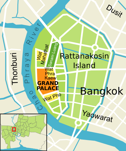
See เกาะรัตนโกสินทร์, พระนคร, on the map
Directions to เกาะรัตนโกสินทร์ (พระนคร) with public transportation
The following transit lines have routes that pass near เกาะรัตนโกสินทร์
 SkyTrain:
 - Metro:
- Bus:
- Ferry:
How to get to เกาะรัตนโกสินทร์ by bus?
Click on the bus route to see step by step directions with maps, line arrival times and updated time schedules.
How to get to เกาะรัตนโกสินทร์ by metro?
Click on the metro route to see step by step directions with maps, line arrival times and updated time schedules.
How to get to เกาะรัตนโกสินทร์ by SkyTrain?
Click on the SkyTrain route to see step by step directions with maps, line arrival times and updated time schedules.
How to get to เกาะรัตนโกสินทร์ by ferry?
Click on the ferry route to see step by step directions with maps, line arrival times and updated time schedules.
Bus stations near เกาะรัตนโกสินทร์ in พระนคร
- ตรงข้ามกระทรวงมหาดไทย Trongkham Krasuang Mahatthai,3 min walk,
- อนุสาวรีย์หมู;Pig Monument,4 min walk,
- ท่ารถสาย2(ปากคลองตลาด),6 min walk,
- ตรงข้ามวัดสุทัศน์,ร้านวิจิตรพานิช,6 min walk,
- ตรงข้ามวัดสุทัศน์ฯ;Wat Suthat Thepwararam (Opposite),6 min walk,
- กระทรวงกลาโหม Ministry Of Defense,6 min walk,
- กระทรวงกลาโหม;Ministry Of Defense,6 min walk,
- วัดสุทัศน์;Wat Suthat Thepwararam,6 min walk,
- กระทรวงมหาดไทย Krasuang Mahatthai,6 min walk,
Ferry stations near เกาะรัตนโกสินทร์ in พระนคร
- ท่าเรือท่าช้าง (ข้ามฟาก);Tha Chang Pier (Ferry),6 min walk,
- ท่าเรือท่าช้าง;Tha Chang Pier,6 min walk,
- ท่าเรือท่าเตียน (ข้ามฟาก);Tha Tien Pier (Ferry),11 min walk,
Metro stations near เกาะรัตนโกสินทร์ in พระนคร
- Mrt สามยอด;Mrt Sam Yot,15 min walk,
Bus lines to เกาะรัตนโกสินทร์ in พระนคร
- 2 (ปอ.) (AC),ท่าปล่อยรถ ช้างเอราวัณ Erawan Bus Terminal,
- 2,สำโรง - สนง.ที่ดินกรุงเทพฯ;Samrong - Bangkok Land Office,
- 25,แพรกษาบ่อดิน - สนามหลวง;Phraeksa Bo Din - Sanam Luang,
- 3-1 (2) (TSB),ปากน้ำ - สะพานพุทธ;Paknam - Saphan Phut,
- 508,ตลาดปากน้ำ - สนามหลวง; Pak Nam Market - Sanam Luang,
- 2,สำโรง - ปากคลองตลาด Samrong - Pak Klong Talad,
- 25,อู่แพรกษา-บ่อดิน - ท่าช้าง Praksa-Bodin - Tha Chang,
- 508 (ปอ.) (AC),ปากน้ำ (อู่ฟาร์มจระเข้) - ท่าราชวรดิษฐ์ Paknam (Crocodile Farm) - Ratchaworadit Pier,
- 3,อู่หมอชิต 2 Mochit 2 Bus Depot,
- 3 (ปอ.) (AC),อู่หมอชิต 2 Mochit 2 Bus Depot,
- 12,สถานีดับเพลิงห้วยขวาง,สาธารณสุข 52,
- 12,ตรงข้ามตลาดสดห้วยขวาง,
- 12 (ปอ.) (AC),โรงเรียนวัดราชบพิธ(ท่าปลายทางปากคลองตลาด),
- 42,ตรงข้ามวัดสุทัศน์,ร้านวิจิตรพานิช,
- 12,ห้วยขวาง;Huai Khwang,
- 42,ท่าพระ;Thaphra,
- 2-37 (3),อู่หมอชิต 2;Mochit 2,
- 3-37 (12)(TSB),ห้วยขวาง;Huai Kwang,
- 4-10 (42),เสาชิงช้า;Sao Ching Cha,
- 6,ตลาดพระประแดง Pak Lat Fa MA Si,
What are the closest stations to เกาะรัตนโกสินทร์?
The closest stations to เกาะรัตนโกสินทร์ are:
- ตรงข้ามกระทรวงมหาดไทย Trongkham Krasuang Mahatthai is 153 meters away, 3 min walk.
- อนุสาวรีย์หมู;Pig Monument is 276 meters away, 4 min walk.
- ท่าเรือท่าช้าง (ข้ามฟาก);Tha Chang Pier (Ferry) is 321 meters away, 6 min walk.
- ท่าเรือท่าช้าง;Tha Chang Pier is 321 meters away, 6 min walk.
- ท่ารถสาย2(ปากคลองตลาด) is 396 meters away, 6 min walk.
- ตรงข้ามวัดสุทัศน์,ร้านวิจิตรพานิช is 437 meters away, 6 min walk.
- ตรงข้ามวัดสุทัศน์ฯ;Wat Suthat Thepwararam (Opposite) is 437 meters away, 6 min walk.
- กระทรวงกลาโหม Ministry Of Defense is 443 meters away, 6 min walk.
- กระทรวงกลาโหม;Ministry Of Defense is 443 meters away, 6 min walk.
- วัดสุทัศน์;Wat Suthat Thepwararam is 446 meters away, 6 min walk.
- กระทรวงมหาดไทย Krasuang Mahatthai is 458 meters away, 6 min walk.
- ท่าเรือท่าเตียน (ข้ามฟาก);Tha Tien Pier (Ferry) is 816 meters away, 11 min walk.
- Mrt สามยอด;Mrt Sam Yot is 1084 meters away, 15 min walk.
Which SkyTrain line stops near เกาะรัตนโกสินทร์?
SILOM
Which metro line stops near เกาะรัตนโกสินทร์?
BLUE
Which bus lines stop near เกาะรัตนโกสินทร์?
These bus lines stop near เกาะรัตนโกสินทร์: 2 (ปอ.) (AC), 25, 3-13 (507), 508, ต.125.
Which ferry lines stop near เกาะรัตนโกสินทร์?
These ferry lines stop near เกาะรัตนโกสินทร์: เรือด่วนธงเขียวเหลือง, เรือด่วนธงเหลือง, เรือประจำทาง (ไม่มีธง).
What’s the nearest metro station to เกาะรัตนโกสินทร์ in พระนคร?
The nearest metro station to เกาะรัตนโกสินทร์ in พระนคร is Mrt สามยอด;Mrt Sam Yot. It’s a 15 min walk away.
What’s the nearest bus stop to เกาะรัตนโกสินทร์ in พระนคร?
The nearest bus stop to เกาะรัตนโกสินทร์ in พระนคร is ตรงข้ามกระทรวงมหาดไทย Trongkham Krasuang Mahatthai. It’s a 3 min walk away.
What’s the nearest ferry station to เกาะรัตนโกสินทร์ in พระนคร?
The nearest ferry stations to เกาะรัตนโกสินทร์ in พระนคร are ท่าเรือท่าช้าง (ข้ามฟาก);Tha Chang Pier (Ferry) and ท่าเรือท่าช้าง;Tha Chang Pier. The closest one is a 6 min walk away.
What time is the first metro to เกาะรัตนโกสินทร์ in พระนคร?
The BLUE is the first metro that goes to เกาะรัตนโกสินทร์ in พระนคร. It stops nearby at 6:19 AM.
What time is the last metro to เกาะรัตนโกสินทร์ in พระนคร?
The BLUE is the last metro that goes to เกาะรัตนโกสินทร์ in พระนคร. It stops nearby at 12:33 AM.
What time is the first bus to เกาะรัตนโกสินทร์ in พระนคร?
The 25 is the first bus that goes to เกาะรัตนโกสินทร์ in พระนคร. It stops nearby at 3:00 AM.
What time is the last bus to เกาะรัตนโกสินทร์ in พระนคร?
The 25 is the last bus that goes to เกาะรัตนโกสินทร์ in พระนคร. It stops nearby at 4:01 AM.
What time is the first ferry to เกาะรัตนโกสินทร์ in พระนคร?
The เรือข้ามฟาก is the first ferry that goes to เกาะรัตนโกสินทร์ in พระนคร. It stops nearby at 5:00 AM.
What time is the last ferry to เกาะรัตนโกสินทร์ in พระนคร?
The เรือด่วนธงส้ม is the last ferry that goes to เกาะรัตนโกสินทร์ in พระนคร. It stops nearby at 8:36 PM.
See เกาะรัตนโกสินทร์, พระนคร, on the map
Public Transit to เกาะรัตนโกสินทร์ in พระนคร
Wondering how to get to เกาะรัตนโกสินทร์ in พระนคร, Thailand? Moovit helps you find the best way to get to เกาะรัตนโกสินทร์ with step-by-step directions from the nearest public transit station.
Moovit provides free maps and live directions to help you navigate through your city. View schedules, routes, timetables, and find out how long does it take to get to เกาะรัตนโกสินทร์ in real time.
Looking for the nearest stop or station to เกาะรัตนโกสินทร์? Check out this list of stops closest to your destination: ตรงข้ามกระทรวงมหาดไทย Trongkham Krasuang Mahatthai; อนุสาวรีย์หมู;Pig Monument; ท่าเรือท่าช้าง (ข้ามฟาก);Tha Chang Pier (Ferry); ท่าเรือท่าช้าง;Tha Chang Pier; ท่ารถสาย2(ปากคลองตลาด); ตรงข้ามวัดสุทัศน์,ร้านวิจิตรพานิช; ตรงข้ามวัดสุทัศน์ฯ;Wat Suthat Thepwararam (Opposite); กระทรวงกลาโหม Ministry Of Defense; กระทรวงกลาโหม;Ministry Of Defense; วัดสุทัศน์;Wat Suthat Thepwararam; กระทรวงมหาดไทย Krasuang Mahatthai; ท่าเรือท่าเตียน (ข้ามฟาก);Tha Tien Pier (Ferry); Mrt สามยอด;Mrt Sam Yot.
SkyTrain:Metro:Bus:Ferry:
Want to see if there’s another route that gets you there at an earlier time? Moovit helps you find alternative routes or times. Get directions from and directions to เกาะรัตนโกสินทร์ easily from the Moovit App or Website.
We make riding to เกาะรัตนโกสินทร์ easy, which is why over 1.5 million users, including users in พระนคร, trust Moovit as the best app for public transit. You don’t need to download an individual bus app or train app, Moovit is your all-in-one transit app that helps you find the best bus time or train time available.
For information on prices of bus, ferry, SkyTrain and metro, costs and ride fares to เกาะรัตนโกสินทร์, please check the Moovit app.
Use the app to navigate to popular places including to the airport, hospital, stadium, grocery store, mall, coffee shop, school, college, and university.
เกาะรัตนโกสินทร์ Address: ถนนบำรุงเมือง street in พระนคร
Attractions near เกาะรัตนโกสินทร์
บุญทอน อาหารไทย-อีสาน,อุดมโภชนา ร้านเก่าแก่ 70 ปี @ แพร่งภูธร,ยี่เหลา ตั้งจั้วหลี,นัฐพร ไอศครีมกะทิสดแท้,สภากาชาด2 แพร่งภูธร,ปังเฉื่อย (ภูธร บาร์),ถนนแพร่งภูธร,ดำรงการแว่น,สถานีกาชาดที่2 (สุขุมาลอนามัย),เพชรบุรี ซอย8,เกาเหลาสมองหมู.ร้านไทยทำ,Neighbor Phuthon,Phuthon Bar (ภูธร บาร์),ร้านแสงประดิษฐ์,ศาลาว่าการกระทรวงกลาโหม,ศรีเมือง (1988),แขวง ศาลเจ้าพ่อเสือ,กาแฟซอย 1,นีก๋วยเตี๋ยวคั่วไก่ แพร่งภูธร,ครัวส้มหอมHow to get to popular attractions in พระนคร with public transit
บางปะกง, ตลิ่งชัน,มหาวิทยาลัยสวนดุสิต, ดุสิต,fullfill ฟูลฟิล (อาหารตามสั่ง), คลองหลวง,สเต็ก รอยยิ้ม แฟมิลี่ สาขาเอกชัย, บางบอน,เดอะมอลล์ บางกะปิ, บางกะปิ,A4 | Bangkok University, Rangsit campus, คลองหลวง,วัดตลิ่งชัน, บางกอกน้อย,โค้งโรงเจ, บางกรวย,หมู่บ้านชมเดือน 1, บางแค,ไปรษณีย์คลองหก,ร้านสหกรณ์มหาวิทยาลัยกรุงเทพ จำกัด, คลองหลวง,Future Dental Clinic, ธัญบุรี,Cafe' Amazon @ PTT ตลาดพูนทรัพย์, เมืองปทุมธานี,ช่อผกา, ธัญบุรี,พรปิยะแมนชั่น, บางซื่อ,SIIT Library (ห้องสมุด สถาบันเทคโนโลยีนานาชาติสิรินธร), เมืองปทุมธานี,เซเว่น อีเลฟเว่น, ดอนเมือง,ร้านปังเย็น เจ๊นก, พุทธมณฑล,แมคโดนัลด์, ตลิ่งชัน,ดอนเมือง, ดอนเมืองGet around พระนคร by public transit!
Traveling around พระนคร has never been so easy. See step by step directions as you travel to any attraction, street or major public transit station. View bus and train schedules, arrival times, service alerts and detailed routes on a map, so you know exactly how to get to anywhere in พระนคร.
When traveling to any destination around พระนคร use Moovit's Live Directions with Get Off Notifications to know exactly where and how far to walk, how long to wait for your line, and how many stops are left. Moovit will alert you when it's time to get off — no need to constantly re-check whether yours is the next stop.
Wondering how to use public transit in พระนคร or how to pay for public transit in พระนคร? Moovit public transit app can help you navigate your way with public transit easily, and at minimum cost. It includes public transit fees, ticket prices, and costs. Looking for a map of พระนคร public transit lines? Moovit public transit app shows all public transit maps in พระนคร with all bus, ferry, SkyTrain or metro routes and stops on an interactive map.
พระนคร has 4 transit type(s), including: bus, ferry, SkyTrain or metro, operated by several transit agencies, including บีทีเอส BTS, MRT, ขสมก. BMTA, รถไฟฟ้ารฟท. SRTET, รถไฟฟ้ารฟท. SRTET, รถประจำทาง Transport Bus, บีอาร์ที BRT, เรือคลองโดยสาร Canal Ferry, เรือข้ามฟาก River Ferry, รถสองแถว Songthaew, จุฬาป๊อบบัส Chula Pop Bus, ขสมก BMTA, ขสมก. (BMTA), รถมินิบัส Minibus and รฟท. SRT