Directions to เขต ป้อมปราบศัตรูพ่าย (Pom Pram Sattru) with public transportation
The following transit lines have routes that pass near เขต ป้อมปราบศัตรูพ่าย
How to get to เขต ป้อมปราบศัตรูพ่าย by bus?
Click on the bus route to see step by step directions with maps, line arrival times and updated time schedules.
How to get to เขต ป้อมปราบศัตรูพ่าย by metro?
Click on the metro route to see step by step directions with maps, line arrival times and updated time schedules.
Bus stops near เขต ป้อมปราบศัตรูพ่าย in Pom Pram Sattru
- บ้านบาตร Pai Ban Bat, 5 min walk,
- ตลาดวรจักร Talat Wolachak, 5 min walk,
- โรงแรม Miramar Miramar Hotel, 6 min walk,
- วรจักร Worachak, 7 min walk,
- ประปาแม้นศรี Prapa Maen Si, 7 min walk,
- สินดำรงค์ Sin Dam Rong, 9 min walk,
- เสาชิงช้า Sao Chingcha, 10 min walk,
Bus lines to เขต ป้อมปราบศัตรูพ่าย in Pom Pram Sattru
- 508 (ปอ.) (AC), อู่ฟาร์มจระเข้สมุทรปราการ,
- 15, โรงละครแห่งชาติ National Theater,
- 37 (ปอ.) (AC), ท่าแจงร้อน(ราษฎร์บูรณะ37) Tha Chaeng Ron,
- 49, สถานีรถไฟหัวลำโพง Hua Lamphong,
- 49 (ปอ.) (AC), อู่หมอชิต 2 Mochit 2 Bus Depot,
- 21, วัดคู่สร้าง(ถนนประชาอุทิศ) WAT Koosrang,
- 56 (ปอ.) (AC), วัดรวกบางบำหรุ,บ้านบรรหารศิลปอาชา,
- 56 (ปอ.) (AC), วิทยาลัยเทคโนโลยีพณิชยการสยาม,
- 21 (ปอ.) (AC), วัดคู่สร้าง(ถนนประชาอุทิศ) WAT Koosrang,
- 47, สถานีตำรวจพระราชวัง Phrarachawang Police Station,
- 1, โรงพยาบาลเจริญกรุง(ตรงข้ามซอยเจริญกรุง 86),
- 1, ตลาดบางคอแหลม Talat Bangkholaem,
- 73 (ปอ.) (AC), โรงแรมดิเอมเมอรัล Rongraem Di Em Moe Ran,
- 73ก (ปอ.) (AC), อู่สวนสยาม Siam Park Bus Depot,
- 12, ห้วยขวาง - ปากคลองตลาด Huai Kwang - Pak Klong Talad,
- 12, ห้วยขวาง - ปากคลองตลาด Huai Khwang - Pak Klong Talad,
- 12 (ปอ.) (AC), ห้วยขวาง - ปากคลองตลาด Huai Kwang - Pak Klong Talad,
- 42, เสาชิงช้า - ท่าพระ Giant Swing - Thaphra,
What are the closest stations to เขต ป้อมปราบศัตรูพ่าย?
The closest stations to เขต ป้อมปราบศัตรูพ่าย are:
- บ้านบาตร Pai Ban Bat is 301 meters away, 5 min walk.
- ตลาดวรจักร Talat Wolachak is 334 meters away, 5 min walk.
- โรงแรม Miramar Miramar Hotel is 428 meters away, 6 min walk.
- วรจักร Worachak is 450 meters away, 7 min walk.
- ประปาแม้นศรี Prapa Maen Si is 484 meters away, 7 min walk.
- สินดำรงค์ Sin Dam Rong is 644 meters away, 9 min walk.
- เสาชิงช้า Sao Chingcha is 742 meters away, 10 min walk.
Which metro line stops near เขต ป้อมปราบศัตรูพ่าย?
สายเฉลิมรัชมงคล MRT BLUE LINE
Which bus lines stop near เขต ป้อมปราบศัตรูพ่าย?
These bus lines stop near เขต ป้อมปราบศัตรูพ่าย: 21, 35 (ปอ.) (AC), 49 (ปอ.) (AC), 508 (ปอ.) (AC), 56, 56 (ปอ.) (AC), 6 (ปอ.) (AC), 7, 85.
What’s the nearest bus stop to เขต ป้อมปราบศัตรูพ่าย in Pom Pram Sattru?
The nearest bus stops to เขต ป้อมปราบศัตรูพ่าย in Pom Pram Sattru are บ้านบาตร Pai Ban Bat and ตลาดวรจักร Talat Wolachak. The closest one is a 5 min walk away.
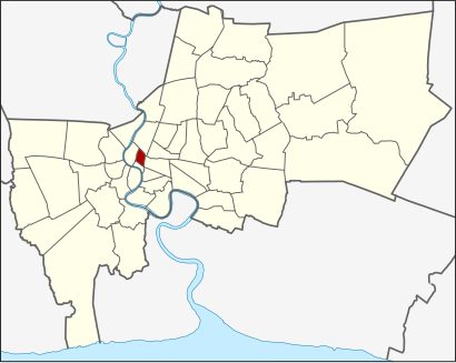
See เขต ป้อมปราบศัตรูพ่าย, Pom Pram Sattru, on the map
Public Transit to เขต ป้อมปราบศัตรูพ่าย in Pom Pram Sattru
Wondering how to get to เขต ป้อมปราบศัตรูพ่าย in Pom Pram Sattru, Thailand? Moovit helps you find the best way to get to เขต ป้อมปราบศัตรูพ่าย with step-by-step directions from the nearest public transit station.
Moovit provides free maps and live directions to help you navigate through your city. View schedules, routes, timetables, and find out how long does it take to get to เขต ป้อมปราบศัตรูพ่าย in real time.
Looking for the nearest stop or station to เขต ป้อมปราบศัตรูพ่าย? Check out this list of stops closest to your destination: บ้านบาตร Pai Ban Bat; ตลาดวรจักร Talat Wolachak; โรงแรม Miramar Miramar Hotel; วรจักร Worachak; ประปาแม้นศรี Prapa Maen Si; สินดำรงค์ Sin Dam Rong; เสาชิงช้า Sao Chingcha.
Metro: สายเฉลิมรัชมงคล MRT BLUE LINE.Bus: 21, 35 (ปอ.) (AC), 49 (ปอ.) (AC), 508 (ปอ.) (AC), 56, 56 (ปอ.) (AC), 6 (ปอ.) (AC), 7, 85, 15, 37 (ปอ.) (AC), 49, 21 (ปอ.) (AC), 47, 1, 1, 73 (ปอ.) (AC), 73ก (ปอ.) (AC).
Want to see if there’s another route that gets you there at an earlier time? Moovit helps you find alternative routes or times. Get directions from and directions to เขต ป้อมปราบศัตรูพ่าย easily from the Moovit App or Website.
We make riding to เขต ป้อมปราบศัตรูพ่าย easy, which is why over 1.5 million users, including users in Pom Pram Sattru, trust Moovit as the best app for public transit. You don’t need to download an individual bus app or train app, Moovit is your all-in-one transit app that helps you find the best bus time or train time available.
For information on prices of bus and metro, costs and ride fares to เขต ป้อมปราบศัตรูพ่าย, please check the Moovit app.
Use the app to navigate to popular places including to the airport, hospital, stadium, grocery store, mall, coffee shop, school, college, and university.
เขต ป้อมปราบศัตรูพ่าย Address: เขต ป้อมปราบศัตรูพ่าย กรุงเทพมหานคร จังหวัด กรุงเทพมหานคร 10100 ประเทศไทย street in Pom Pram Sattru
Attractions near เขต ป้อมปราบศัตรูพ่าย
นิวแบงกอกเทรดดิ้งพานิชย์,อะไหล่พาณิชย์,T. Saha Kit Yarnyont,Alai Pha Nit,New Bangkok Trading Phanit,Boripat Road,ไทยแมคคานิกส์ อินดัสตรี้,Suriya Yon,ทวีชัยก้ามเบรค,ต. กิจยานยนต์,ต. สหชัยอะไหล่,ลิตรชัยยนต์การช่าง,ส.นพรัตน์แทรกเตอร์,สหการช่างโกวิทย์,ก กระจกรถยนต์ (วรจักร),ไพศาลกิจ,ศรีสัมพันธ์ฮาร์ดแวร์,ที.เอส.เค. อินเตอร์เทรด,อิศราชัยพานิช,Khongkha Yon (คงคายนต์)How to get to popular attractions in Pom Pram Sattru with public transit
คิวรถตู้กรุงเทพ-ราชบุรี, จตุจักร,ปากซอยรามอินทรา 109, เขตมีนบุรี,BTS ห้าแยกลาดพร้าว (N9), จตุจักร,โรงพยาบาลตำรวจ, ปทุมวัน,เขต สาทร, สาทร,สถาบันโรคผิวหนัง, ราชเทวี,ป้ายรถเมล์ ฟิวเจอร์ รังสิต, คลองหลวง,วัดมกุฏกษัตริยารามราชวรวิหาร, พระนคร,ตลาดโบ๊เบ๊ - สะพานผ่านฟ้า, ป้อมปราบศัตรูพ่าย,ศูนย์กลางตลาดดอกไม้ ปากคลองตลาดใหม่, ตลิ่งชัน,ร้านน้องรีจ๊อย ส้มตำรสเด็ด เผ็ดสะเด็ดสะด่วง, จตุจักร,วัดบางเพ็งใต้, เขตมีนบุรี,ป้ายรถเมล์ Central พระราม 9, ห้วยขวาง,รถตู้ เซ็นทรัลพระรามสอง-บางแสน, บางขุนเทียน,โรงพยาบาลรามาธิบดี, ราชเทวี,คิวรถตู้[หมอชิต-พระราม2], จตุจักร,ท่าเรือวังหลัง (ศิริราช) N10, พระนคร,โรงพยาบาลกล้วยน้ำไท, คลองเตย,เซ็นทรัลเฟสติวัล อีสต์วิลล์, บางกะปิ,ICONSIAM, คลองสานGet around Bangkok by public transit!
Traveling around Bangkok has never been so easy. See step by step directions as you travel to any attraction, street or major public transit station. View bus and train schedules, arrival times, service alerts and detailed routes on a map, so you know exactly how to get to anywhere in Bangkok.
When traveling to any destination around Bangkok use Moovit's Live Directions with Get Off Notifications to know exactly where and how far to walk, how long to wait for your line, and how many stops are left. Moovit will alert you when it's time to get off — no need to constantly re-check whether yours is the next stop.
Wondering how to use public transit in Bangkok or how to pay for public transit in Bangkok? Moovit public transit app can help you navigate your way with public transit easily, and at minimum cost. It includes public transit fees, ticket prices, and costs. Looking for a map of Bangkok public transit lines? Moovit public transit app shows all public transit maps in Bangkok with all Bus, Train, Metro, SkyTrain and Ferry routes and stops on an interactive map.
Bangkok has 5 transit type(s), including: Bus, Train, Metro, SkyTrain and Ferry, operated by several transit agencies, including บีทีเอส BTS, MRT, บริษัท ไทย สมายล์ บัส จำกัด;thaismilebus company limited, ขสมก. BMTA, รถไฟฟ้ารฟท. SRTET, รถประจำทาง Transport Bus, บีอาร์ที BRT, เรือคลองโดยสาร Canal Ferry, เรือข้ามฟาก River Ferry, รถสองแถว Songthaew, จุฬาป๊อบบัส Chula Pop Bus, ขสมก BMTA, ขสมก. (BMTA), รถมินิบัส Minibus, รฟท. SRT