
How to get to เขต ป้อมปราบศัตรูพ่าย by Bus, Metro, Ferry or Train?

See เขต ป้อมปราบศัตรูพ่าย on the map

Directions to เขต ป้อมปราบศัตรูพ่าย with public transportation

The following transit lines have routes that pass near เขต ป้อมปราบศัตรูพ่าย

  • MetroMetro:
  • BusBus:
  • FerryFerry:
  • TrainTrain:

How to get to เขต ป้อมปราบศัตรูพ่าย by Bus?

Click on the Bus route to see step by step directions with maps, line arrival times and updated time schedules.

How to get to เขต ป้อมปราบศัตรูพ่าย by Train?

Click on the Train route to see step by step directions with maps, line arrival times and updated time schedules.

How to get to เขต ป้อมปราบศัตรูพ่าย by Metro?

Click on the Metro route to see step by step directions with maps, line arrival times and updated time schedules.

How to get to เขต ป้อมปราบศัตรูพ่าย by Ferry?

Click on the Ferry route to see step by step directions with maps, line arrival times and updated time schedules.

Bus stations near เขต ป้อมปราบศัตรูพ่าย

  • ตรงข้ามสถานีตำรวจนครบาลสำราญราษฎร์,2 min walk,
  • ตรงข้ามวัดราชนัดดาราม(มหาไชย);Wat Ratchanatda (Opposite),3 min walk,
  • ตรงข้ามวัดราชนัดดาราม(มหาไชย),3 min walk,
  • สถานีตำรวจนครบาลสำราญราษฎร์;Police Station Samranrat,4 min walk,
  • วัดราชนัดดาราม(มหาไชย),4 min walk,
  • บ้านบาตร;Baan Bat,5 min walk,
  • ท่าเรือผ่านฟ้า;Phan Fa Pier,6 min walk,
  • การบินไทยหลานหลวง Thai Airways Larnluang,6 min walk,
  • ตรงข้ามการบินไทยหลานหลวง,6 min walk,
  • นิทรรศน์รัตนโกสินทร์;Nitas Rattanakosin,7 min walk,
  • วัดราชนัดดา,ลานพลับพลามหาเจษฎาบดินทร์,7 min walk,

Ferry stations near เขต ป้อมปราบศัตรูพ่าย

  • ท่าเรือราชดำเนินนอก;Rajadamnoen Nok Pier,5 min walk,
  • ท่าเรือผ่านฟ้าลีลาศ;Panfa Leelard Pier,17 min walk,

Metro stations near เขต ป้อมปราบศัตรูพ่าย

  • Mrt สามยอด;Mrt Sam Yot,9 min walk,

Bus lines to เขต ป้อมปราบศัตรูพ่าย

  • 508 (ปอ.) (AC),อู่ฟาร์มจระเข้สมุทรปราการ,
  • 1-63,สวนหลวงพระราม 8;Suan Luang Rama VIII,
  • 4-40 (56),บางลำพู;Banglamphu,
  • 56 (ปอ.) (AC),วัดรวกบางบำหรุ,บ้านบรรหารศิลปอาชา,
  • 35,สายใต้ใหม่ (ตลิ่งชัน);Southern Bus (Talingchan),
  • 56 (ปอ.) (AC),วิทยาลัยเทคโนโลยีพณิชยการสยาม,
  • 508,ปากน้ำ (ตลาดปากน้ำ);Paknam (Pak Nam Market),
  • S1,สนามบินสุวรรณภูมิ - สนามหลวง;suvarnabhumiairport - sanamliang,
  • 2,สำโรง - สนง.ที่ดินกรุงเทพฯ;Samrong - Bangkok Land Office,
  • A4,สนามบินดอนเมือง - สนามหลวง;Donmueng Airport - Sanamluang,
  • 15,BRT ราชพฤกษ์ - บางลำพู;BRT Ratchaphruek - Bang Lamphu,
  • 1-9E,มหาวิทยาลัยธรรมศาสตร์ (ศูนย์รังสิต) - มหาวิทยาลัยธรรมศาสตร์ท่าพระจันทร์ (ทางด่วน);Thammasat (Rangsit) - Thammasat (Tha Prachan),
  • ต.31,บางนา (ทางด่วน) - สถานีขนส่งผู้โดยสารสายใต้;Bangna (Highway) - Bangkok Southern Bus Terminal,
  • 3-2E,ปู่เจ้าสมิงพราย - ท่าเรือสะพานพุทธ (ทางด่วน);Pu Chao Samingphrai - Memorial Bridge,
  • 47,ท่าเรือคลองเตย - สนง.ที่ดินกรุงเทพฯ;Khlong Toey - Bangkok Metropolitan Land Office,
  • 59,รังสิต - สนามหลวง (ทางด่วน);Rangsit - Sanamluang (Expressway),
  • 60,สวนสยาม - สนง.ที่ดินกรุงเทพฯ;Siam Park - Bangkok Metropolitan Land Office,
  • 79,อู่บรมราชชนนี - ราชประสงค์;Borommaratchachonnani Bus Depot - Ratchaprasong,
  • ต.102,ท่าน้ำปากเกร็ด - สนามหลวง (ทางด่วน);Pak Kret Pier - Sanam Luang (Highway),
  • ต.126,ท่าอากาศยานสุวรรณภูมิ - สถานีขนส่งผู้โดยสารกรุงเทพฯ (ตลิ่งชัน);Suvarnabhumi Airport - Bangkok Southern Bus Terminal (Taling Chan)(Highway),
Questions & Answers
  • What are the closest stations to เขต ป้อมปราบศัตรูพ่าย?

    The closest stations to เขต ป้อมปราบศัตรูพ่าย are:

    • ตรงข้ามสถานีตำรวจนครบาลสำราญราษฎร์ is 144 meters away, 2 min walk.
    • ตรงข้ามวัดราชนัดดาราม(มหาไชย);Wat Ratchanatda (Opposite) is 196 meters away, 3 min walk.
    • ตรงข้ามวัดราชนัดดาราม(มหาไชย) is 205 meters away, 3 min walk.
    • สถานีตำรวจนครบาลสำราญราษฎร์;Police Station Samranrat is 248 meters away, 4 min walk.
    • วัดราชนัดดาราม(มหาไชย) is 258 meters away, 4 min walk.
    • ท่าเรือราชดำเนินนอก;Rajadamnoen Nok Pier is 314 meters away, 5 min walk.
    • บ้านบาตร;Baan Bat is 319 meters away, 5 min walk.
    • ท่าเรือผ่านฟ้า;Phan Fa Pier is 398 meters away, 6 min walk.
    • การบินไทยหลานหลวง Thai Airways Larnluang is 398 meters away, 6 min walk.
    • ตรงข้ามการบินไทยหลานหลวง is 408 meters away, 6 min walk.
    • นิทรรศน์รัตนโกสินทร์;Nitas Rattanakosin is 451 meters away, 7 min walk.
    • วัดราชนัดดา,ลานพลับพลามหาเจษฎาบดินทร์ is 451 meters away, 7 min walk.
    • Mrt สามยอด;Mrt Sam Yot is 683 meters away, 9 min walk.
    • ท่าเรือผ่านฟ้าลีลาศ;Panfa Leelard Pier is 1284 meters away, 17 min walk.
  • Which Metro lines stop near เขต ป้อมปราบศัตรูพ่าย?

    These Metro lines stop near เขต ป้อมปราบศัตรูพ่าย: BLUE

  • Which Bus lines stop near เขต ป้อมปราบศัตรูพ่าย?

    These Bus lines stop near เขต ป้อมปราบศัตรูพ่าย: 1-63, 203, 4-40 (56), 49, 49 (ปอ.) (AC), 56 (ปอ.) (AC)

  • Which Ferry lines stop near เขต ป้อมปราบศัตรูพ่าย?

    These Ferry lines stop near เขต ป้อมปราบศัตรูพ่าย: เรือด่วนธงส้ม

  • Which Train lines stop near เขต ป้อมปราบศัตรูพ่าย?

    These Train lines stop near เขต ป้อมปราบศัตรูพ่าย: 262

  • What’s the nearest metro station to เขต ป้อมปราบศัตรูพ่าย?

    The nearest metro station to เขต ป้อมปราบศัตรูพ่าย is Mrt สามยอด;Mrt Sam Yot. It’s a 9 min walk away.

  • What’s the nearest bus stop to เขต ป้อมปราบศัตรูพ่าย?

    The nearest bus stop to เขต ป้อมปราบศัตรูพ่าย is ตรงข้ามสถานีตำรวจนครบาลสำราญราษฎร์. It’s a 2 min walk away.

  • What’s the nearest ferry station to เขต ป้อมปราบศัตรูพ่าย?

    The nearest ferry station to เขต ป้อมปราบศัตรูพ่าย is ท่าเรือราชดำเนินนอก;Rajadamnoen Nok Pier. It’s a 5 min walk away.

  • What time is the first Metro to เขต ป้อมปราบศัตรูพ่าย?

    The BLUE is the first Metro that goes to เขต ป้อมปราบศัตรูพ่าย. It stops nearby at 6:21 AM.

  • What time is the last Metro to เขต ป้อมปราบศัตรูพ่าย?

    The BLUE is the last Metro that goes to เขต ป้อมปราบศัตรูพ่าย. It stops nearby at 12:43 AM.

  • What time is the first Bus to เขต ป้อมปราบศัตรูพ่าย?

    The 2 is the first Bus that goes to เขต ป้อมปราบศัตรูพ่าย. It stops nearby at 3:05 AM.

  • What time is the last Bus to เขต ป้อมปราบศัตรูพ่าย?

    The 59 is the last Bus that goes to เขต ป้อมปราบศัตรูพ่าย. It stops nearby at 3:51 AM.

  • What time is the first Ferry to เขต ป้อมปราบศัตรูพ่าย?

    The เรือคลองแสนแสบ is the first Ferry that goes to เขต ป้อมปราบศัตรูพ่าย. It stops nearby at 6:00 AM.

  • What time is the last Ferry to เขต ป้อมปราบศัตรูพ่าย?

    The เรือคลองแสนแสบ is the last Ferry that goes to เขต ป้อมปราบศัตรูพ่าย. It stops nearby at 8:52 PM.

See เขต ป้อมปราบศัตรูพ่าย on the map

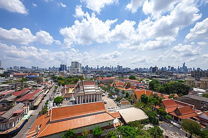
The Most Popular Urban Mobility App in ป้อมปราบศัตรูพ่าย.
All local mobility options in one app

Public Transportation to เขต ป้อมปราบศัตรูพ่าย

Wondering how to get to เขต ป้อมปราบศัตรูพ่าย, Thailand? Moovit helps you find the best way to get to เขต ป้อมปราบศัตรูพ่าย with step-by-step directions from the nearest public transit station.

Moovit provides free maps and live directions to help you navigate through your city. View schedules, routes, timetables, and find out how long does it take to get to เขต ป้อมปราบศัตรูพ่าย in real time.

Looking for the nearest stop or station to เขต ป้อมปราบศัตรูพ่าย? Check out this list of stops closest to your destination: ตรงข้ามสถานีตำรวจนครบาลสำราญราษฎร์; ตรงข้ามวัดราชนัดดาราม(มหาไชย);Wat Ratchanatda (Opposite); ตรงข้ามวัดราชนัดดาราม(มหาไชย); สถานีตำรวจนครบาลสำราญราษฎร์;Police Station Samranrat; วัดราชนัดดาราม(มหาไชย); ท่าเรือราชดำเนินนอก;Rajadamnoen Nok Pier; บ้านบาตร;Baan Bat; ท่าเรือผ่านฟ้า;Phan Fa Pier; การบินไทยหลานหลวง Thai Airways Larnluang; ตรงข้ามการบินไทยหลานหลวง; นิทรรศน์รัตนโกสินทร์;Nitas Rattanakosin; วัดราชนัดดา,ลานพลับพลามหาเจษฎาบดินทร์; Mrt สามยอด;Mrt Sam Yot; ท่าเรือผ่านฟ้าลีลาศ;Panfa Leelard Pier.

Metro:Bus:Ferry:Train:

Want to see if there’s another route that gets you there at an earlier time? Moovit helps you find alternative routes or times. Get directions from and directions to เขต ป้อมปราบศัตรูพ่าย easily from the Moovit App or Website.

We make riding to เขต ป้อมปราบศัตรูพ่าย easy, which is why over 1.5 million users, including users in ป้อมปราบศัตรูพ่าย, trust Moovit as the best app for public transit. You don’t need to download an individual bus app or train app, Moovit is your all-in-one transit app that helps you find the best bus time or train time available.

For information on prices of Bus, Metro, Ferry and Train, costs and ride fares to เขต ป้อมปราบศัตรูพ่าย, please check the Moovit app.

Use the app to navigate to popular places including to the airport, hospital, stadium, grocery store, mall, coffee shop, school, college, and university.

เขต ป้อมปราบศัตรูพ่าย Address: เขต ป้อมปราบศัตรูพ่าย กรุงเทพมหานคร จังหวัด กรุงเทพมหานคร 10100 ประเทศไทย street in ป้อมปราบศัตรูพ่าย

เขต ป้อมปราบศัตรูพ่าย
เขต ป้อมปราบศัตรูพ่ายPom Prap Sattru Phai (Thai: ป้อมปราบศัตรูพ่าย, pronounced [pɔ̂m pràːp sàt.trūː pʰâːj], or popularly just called Pom Prap, pronounced [pɔ̂m pràːp]) is one of the 50 districts (khet) of Bangkok, Thailand. Neighbouring districts are (from north clockwise) Dusit, Pathum Wan, Bang Rak, Samphanthawong, and Phra Nakhon. With more than 24,000 inhabitants per square kilometre (more than 62,000 per square mile) it is the district with the highest population density in Thailand.
How to get to เขต ป้อมปราบศัตรูพ่าย with public transit - About the place

Public transit lines with stations closest to เขต ป้อมปราบศัตรูพ่าย

Metro lines with stations closest to เขต ป้อมปราบศัตรูพ่าย

Bus lines with stations closest to เขต ป้อมปราบศัตรูพ่าย

Ferry lines with stations closest to เขต ป้อมปราบศัตรูพ่าย

Easier to get to เขต ป้อมปราบศัตรูพ่าย in…