Directions to เขต พระโขนง (Bang Na) with public transportation
The following transit lines have routes that pass near เขต พระโขนง
How to get to เขต พระโขนง by bus?
Click on the bus route to see step by step directions with maps, line arrival times and updated time schedules.
How to get to เขต พระโขนง by metro?
Click on the metro route to see step by step directions with maps, line arrival times and updated time schedules.
Bus stops near เขต พระโขนง in Bang Na
- วชิรธรรมสาธิต(สุขุมวิท 101/1), 2 min walk,
Bus lines to เขต พระโขนง in Bang Na
- 2, สำโรง - ปากคลองตลาด Samrong - Pak Klong Talad,
- 2, อู่เมกาบางนา - ศูนย์การประชุมแห่งชาติสิริกิติ์,
- 2 (ปอ.) (AC), สำโรง - ปากคลองตลาด Samrong - Pak Klong Talad,
- 23, อู่เมกาบางนา - ประตูน้ำ Mega Bangna - Pratunam,
- 23, สำโรง - เทเวศร์ Samrong - Thewet,
- 23, เมกา - เทเวศร์ Pak Klong Talad - sovereign,
- 25, รร.ปทุมคงคา สมุทรปราการ - วัดธาตุทอง Pathumkongka Samutprakan - Wat Thad Thong,
- 25, อู่แพรกษา-บ่อดิน - ท่าช้าง Praksa-Bodin - Tha Chang,
- 45, สำโรง - สี่พระยา Samrong - Siphaya,
- 46, ม.รามคำแหง 2 - รองเมือง Ramkhamhaeng University 2 - Rong Muang,
- 180, [ท] ม.รามคำแหง 2 - เซ็นทรัลพระราม 3 [E] Ramkhamhaeng 2 - Central RAMA 3,
- 508 (ปอ.) (AC), ปากน้ำ (อู่ฟาร์มจระเข้) - ท่าราชวรดิษฐ์ Paknam (Crocodile Farm) - Ratchaworadit Pier,
- 511 (ปอ.) (AC), ปากน้ำ (อู่ฟาร์มจระเข้) - สายใต้ใหม่ (ตลิ่งชัน) Paknam (Crocodile Farm) - Southern bus (Talingchan),
What are the closest stations to เขต พระโขนง?
The closest stations to เขต พระโขนง are:
- วชิรธรรมสาธิต(สุขุมวิท 101/1) is 91 meters away, 2 min walk.
Which metro line stops near เขต พระโขนง?
รถไฟฟ้าบีทีเอส สายสุขุมวิท SUKHUMVIT LINE
Which bus lines stop near เขต พระโขนง?
These bus lines stop near เขต พระโขนง: 116, 25, 508 (ปอ.) (AC).
What’s the nearest bus stop to เขต พระโขนง in Bang Na?
The nearest bus stop to เขต พระโขนง in Bang Na is วชิรธรรมสาธิต(สุขุมวิท 101/1). It’s a 2 min walk away.
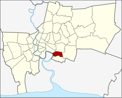
See เขต พระโขนง, Bang Na, on the map
Public Transit to เขต พระโขนง in Bang Na
Wondering how to get to เขต พระโขนง in Bang Na, Thailand? Moovit helps you find the best way to get to เขต พระโขนง with step-by-step directions from the nearest public transit station.
Moovit provides free maps and live directions to help you navigate through your city. View schedules, routes, timetables, and find out how long does it take to get to เขต พระโขนง in real time.
Looking for the nearest stop or station to เขต พระโขนง? Check out this list of stops closest to your destination: วชิรธรรมสาธิต(สุขุมวิท 101/1).
Metro: รถไฟฟ้าบีทีเอส สายสุขุมวิท SUKHUMVIT LINE.Bus: 116, 25, 508 (ปอ.) (AC), 2, 2, 2, 2 (ปอ.) (AC), 23.
Want to see if there’s another route that gets you there at an earlier time? Moovit helps you find alternative routes or times. Get directions from and directions to เขต พระโขนง easily from the Moovit App or Website.
We make riding to เขต พระโขนง easy, which is why over 1.5 million users, including users in Bang Na, trust Moovit as the best app for public transit. You don’t need to download an individual bus app or train app, Moovit is your all-in-one transit app that helps you find the best bus time or train time available.
For information on prices of metro and bus, costs and ride fares to เขต พระโขนง, please check the Moovit app.
Use the app to navigate to popular places including to the airport, hospital, stadium, grocery store, mall, coffee shop, school, college, and university.
เขต พระโขนง Address: เขต พระโขนง กรุงเทพมหานคร จังหวัด กรุงเทพมหานคร 10260 ประเทศไทย street in Bang Na
Attractions near เขต พระโขนง
How to get to popular places in Bangkok with public transit
Get around Bang Na by public transit!
Traveling around Bang Na has never been so easy. See step by step directions as you travel to any attraction, street or major public transit station. View bus and train schedules, arrival times, service alerts and detailed routes on a map, so you know exactly how to get to anywhere in Bang Na.
When traveling to any destination around Bang Na use Moovit's Live Directions with Get Off Notifications to know exactly where and how far to walk, how long to wait for your line, and how many stops are left. Moovit will alert you when it's time to get off — no need to constantly re-check whether yours is the next stop.
Wondering how to use public transit in Bang Na or how to pay for public transit in Bang Na? Moovit public transit app can help you navigate your way with public transit easily, and at minimum cost. It includes public transit fees, ticket prices, and costs. Looking for a map of Bang Na public transit lines? Moovit public transit app shows all public transit maps in Bang Na with all metro or bus routes and stops on an interactive map.
Bang Na has 2 transit type(s), including: metro or bus, operated by several transit agencies, including บีทีเอส BTS, MRT, บริษัท ไทย สมายล์ บัส จำกัด;thaismilebus company limited, ขสมก. BMTA, รถไฟฟ้ารฟท. SRTET, รถไฟฟ้ารฟท. SRTET, รถประจำทาง Transport Bus, บีอาร์ที BRT, เรือคลองโดยสาร Canal Ferry, เรือข้ามฟาก River Ferry, รถสองแถว Songthaew, จุฬาป๊อบบัส Chula Pop Bus, ขสมก BMTA, ขสมก. (BMTA) and รถมินิบัส Minibus