See เขต ราชเทวี on the map
Directions to เขต ราชเทวี with public transportation
The following transit lines have routes that pass near เขต ราชเทวี
 SkyTrain:
 - Metro:
- Bus:
- Ferry:
- Train:
How to get to เขต ราชเทวี by bus?
Click on the bus route to see step by step directions with maps, line arrival times and updated time schedules.
How to get to เขต ราชเทวี by train?
Click on the train route to see step by step directions with maps, line arrival times and updated time schedules.
How to get to เขต ราชเทวี by metro?
Click on the metro route to see step by step directions with maps, line arrival times and updated time schedules.
How to get to เขต ราชเทวี by SkyTrain?
Click on the SkyTrain route to see step by step directions with maps, line arrival times and updated time schedules.
How to get to เขต ราชเทวี by ferry?
Click on the ferry route to see step by step directions with maps, line arrival times and updated time schedules.
Bus stations near เขต ราชเทวี
- โรงเรียนศรีอยุธยา;Sri Ayudhya School,1 min walk,
- โรงเรียนศรีอยุธยา Sri Ayudhya School,1 min walk,
- อาคารศรีอยุธยา Sri Ayutthaya Building,3 min walk,
- โรงพยาบาลพญาไท1 Ropchut Phaya Thai 1,4 min walk,
- ตรงข้ามพันธุ์ทิพย์ประตูน้ำ Opp. Pantip Pratunam,6 min walk,
- ตรงข้ามพันธุ์ทิพย์ประตูน้ำ;Pantip Pratunam (Opposite),6 min walk,
- พันธุ์ทิพย์ประตูน้ำ Pantip Pratunam,7 min walk,
Ferry stations near เขต ราชเทวี
- ท่าเรือประตูน้ำ;Pratunam Pier,9 min walk,
Skytrain stations near เขต ราชเทวี
- Bts ราชเทวี;Bts Ratchathewi,14 min walk,
Train stations near เขต ราชเทวี
- Arl พญาไท;Arl Phaya Thai,15 min walk,
- Srt พญาไท;Srt Phayathai,16 min walk,
Bus lines to เขต ราชเทวี
- 74,คลองเตย;Klong Toey,
- 77,เซ็นทรัลพระราม 3;Central Rama 3,
- 3-44,ท่าเรือคลองเตย;Khlong Toei Pier,
- 536,ฟาร์มจระเข้สมุทรปราการ;Samutprakan Crocodile Farm And Zoo,
- 539,อนุสาวรีย์ชัยสมรภูมิ;Victory Monument,
- 3-39 (14),รร.นนทรีวิทยา;Nonsi Wittaya,
- 3-45 (77) (TSB),เซ็นทรัลพระราม 3;Central Rama 3,
- 3-46 (72),คลองเตย;Klongtoey,
- 14,สวนลุมพินีป้ายแรก (เข้าเมือง),
- 14 (ปอ.) (AC),สวนลุมพินีป้ายแรก (เข้าเมือง),
- 17 (ปอ.) (AC),ท่าจอดรถสาย 37,ซอยราษฎร์บูรณะ 39 Soi Rat Burana 39,
- 72,อู่คลองเตย Klongtoey Bus Depot,
- 74,ซอยคั่วพริกก่อนถึงแยกกรมศุลกากร,
- 77,อู่สาธุประดิษฐ์ Sathu Pradit Bus Depot,
- 77 (ปอ.) (AC),อู่สาธุประดิษฐ์ Sathu Pradit Bus Depot,
- 536 (ปอ.) (AC),อู่ฟาร์มจระเข้สมุทรปราการ,
- 17,ท่าจอดรถสาย 37,ซอยราษฎร์บูรณะ 39 Soi Rat Burana 39,
- 77,เซ็นทรัลพระราม 3 Central Rama 3,
- 204,ท่าราชวงศ์ Tha Ratchawong,
- 204 (ปอ.) (AC),ศูนย์อีซูซุถนนเทียมร่วมมิตร Izuzu Show Room,
What are the closest stations to เขต ราชเทวี?
The closest stations to เขต ราชเทวี are:
- โรงเรียนศรีอยุธยา;Sri Ayudhya School is 33 meters away, 1 min walk.
- โรงเรียนศรีอยุธยา Sri Ayudhya School is 33 meters away, 1 min walk.
- อาคารศรีอยุธยา Sri Ayutthaya Building is 214 meters away, 3 min walk.
- โรงพยาบาลพญาไท1 Ropchut Phaya Thai 1 is 244 meters away, 4 min walk.
- ตรงข้ามพันธุ์ทิพย์ประตูน้ำ Opp. Pantip Pratunam is 398 meters away, 6 min walk.
- ตรงข้ามพันธุ์ทิพย์ประตูน้ำ;Pantip Pratunam (Opposite) is 398 meters away, 6 min walk.
- พันธุ์ทิพย์ประตูน้ำ Pantip Pratunam is 505 meters away, 7 min walk.
- ท่าเรือประตูน้ำ;Pratunam Pier is 649 meters away, 9 min walk.
- Bts ราชเทวี;Bts Ratchathewi is 1074 meters away, 14 min walk.
- Arl พญาไท;Arl Phaya Thai is 1146 meters away, 15 min walk.
- Srt พญาไท;Srt Phayathai is 1148 meters away, 16 min walk.
Which SkyTrain line stops near เขต ราชเทวี?
SUKHUMVIT
Which metro line stops near เขต ราชเทวี?
BLUE
Which bus lines stop near เขต ราชเทวี?
These bus lines stop near เขต ราชเทวี: 140, 140 (ปอ.) (AC), 204 (ปอ.) (AC), 3-2E, 505 (ปอ.) (AC), 511 (ปอ.) (AC), 60, 77.
Which ferry lines stop near เขต ราชเทวี?
These ferry lines stop near เขต ราชเทวี: เรือคลองผดุงกรุงเกษม, เรือคลองแสนแสบ.
Which train line stops near เขต ราชเทวี?
262
What’s the nearest SkyTrain station to เขต ราชเทวี?
The nearest SkyTrain station to เขต ราชเทวี is Bts ราชเทวี;Bts Ratchathewi. It’s a 14 min walk away.
What’s the nearest train station to เขต ราชเทวี?
The nearest train station to เขต ราชเทวี is Arl พญาไท;Arl Phaya Thai. It’s a 15 min walk away.
What’s the nearest bus stop to เขต ราชเทวี?
The nearest bus stops to เขต ราชเทวี are โรงเรียนศรีอยุธยา;Sri Ayudhya School and โรงเรียนศรีอยุธยา Sri Ayudhya School. The closest one is a 1 min walk away.
What’s the nearest ferry station to เขต ราชเทวี?
The nearest ferry station to เขต ราชเทวี is ท่าเรือประตูน้ำ;Pratunam Pier. It’s a 9 min walk away.
What time is the first SkyTrain to เขต ราชเทวี?
The SUKHUMVIT is the first SkyTrain that goes to เขต ราชเทวี. It stops nearby at 6:50 AM.
What time is the last SkyTrain to เขต ราชเทวี?
The SUKHUMVIT is the last SkyTrain that goes to เขต ราชเทวี. It stops nearby at 12:51 AM.
What time is the first train to เขต ราชเทวี?
The ARL is the first train that goes to เขต ราชเทวี. It stops nearby at 5:30 AM.
What time is the last train to เขต ราชเทวี?
The ARL is the last train that goes to เขต ราชเทวี. It stops nearby at 12:21 AM.
What time is the first bus to เขต ราชเทวี?
The 60 is the first bus that goes to เขต ราชเทวี. It stops nearby at 3:02 AM.
What time is the last bus to เขต ราชเทวี?
The 60 is the last bus that goes to เขต ราชเทวี. It stops nearby at 3:42 AM.
What time is the first ferry to เขต ราชเทวี?
The เรือคลองแสนแสบ is the first ferry that goes to เขต ราชเทวี. It stops nearby at 5:48 AM.
What time is the last ferry to เขต ราชเทวี?
The เรือคลองแสนแสบ is the last ferry that goes to เขต ราชเทวี. It stops nearby at 8:51 PM.
See เขต ราชเทวี on the map
Public Transportation to เขต ราชเทวี
Wondering how to get to เขต ราชเทวี, Thailand? Moovit helps you find the best way to get to เขต ราชเทวี with step-by-step directions from the nearest public transit station.
Moovit provides free maps and live directions to help you navigate through your city. View schedules, routes, timetables, and find out how long does it take to get to เขต ราชเทวี in real time.
Looking for the nearest stop or station to เขต ราชเทวี? Check out this list of stops closest to your destination: โรงเรียนศรีอยุธยา;Sri Ayudhya School; โรงเรียนศรีอยุธยา Sri Ayudhya School; อาคารศรีอยุธยา Sri Ayutthaya Building; โรงพยาบาลพญาไท1 Ropchut Phaya Thai 1; ตรงข้ามพันธุ์ทิพย์ประตูน้ำ Opp. Pantip Pratunam; ตรงข้ามพันธุ์ทิพย์ประตูน้ำ;Pantip Pratunam (Opposite); พันธุ์ทิพย์ประตูน้ำ Pantip Pratunam; ท่าเรือประตูน้ำ;Pratunam Pier; Bts ราชเทวี;Bts Ratchathewi; Arl พญาไท;Arl Phaya Thai; Srt พญาไท;Srt Phayathai.
SkyTrain:Metro:Bus:Ferry:Train:
Want to see if there’s another route that gets you there at an earlier time? Moovit helps you find alternative routes or times. Get directions from and directions to เขต ราชเทวี easily from the Moovit App or Website.
We make riding to เขต ราชเทวี easy, which is why over 1.5 million users, including users in ราชเทวี, trust Moovit as the best app for public transit. You don’t need to download an individual bus app or train app, Moovit is your all-in-one transit app that helps you find the best bus time or train time available.
For information on prices of bus, ferry, metro, SkyTrain and train, costs and ride fares to เขต ราชเทวี, please check the Moovit app.
Use the app to navigate to popular places including to the airport, hospital, stadium, grocery store, mall, coffee shop, school, college, and university.
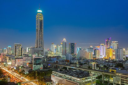
เขต ราชเทวี Address: เขต ราชเทวี กรุงเทพมหานคร ประเทศไทย street in ราชเทวี
Attractions near เขต ราชเทวี
Tiffany Show-Pattaya,ซอยแสงกาญประตูน้ำ,Arunda Oriental Massage,Mon's Pure Vitamin C Serum Thailand,คนน้ำ ทรานสปอร์ต,ทิฟฟานี่ โชว์-พัทยา,The House Pratunam Bangkok,Lemontea Hotel,Harpers Freight Int'L Air Cargo Co.,Ltd.,ซอย หลังโรงแรมอินทรา,First Pride Hotel Bangkok,120 / 114 ซอยหลังโรงแรมอินทรา ถนนราชปรารถ,พริตตี้ ชู,High Cirrus Express,@Alepaint,Fish Spa,My Hotel Pratunam,เซเว่นอีเลฟเว่น เลมอนทรี เพชรบุรี 15,J Two S Pratunam Hotel,สระว่ายน้ำ ชั้น7 วิลล่าราชเทวี (Swimming pool)How to get to popular attractions in ราชเทวี with public transit
โรงพยาบาลธัญบุรี,สุดแซ่บ เมืองยศ, เมืองนนทบุรี,อิสลามวิทยาลัยแห่งประเทศไทย, ทุ่งครุ,ครัวปีกไม้, เมืองสมุทรปราการ,ช่อผกา, ธัญบุรี,หอพักเปี่ยมศิริ, บางกอกน้อย,โรงเรียนเซนต์ราฟาแอล, เมืองสมุทรปราการ,อยู่เจริญ วิภาวดี 37, ดอนเมือง,บ้านสวนปาล์ม, คลองหลวง,สนามหลวง, พระนคร,ตลาดสินทอง, เมืองนนทบุรี,Bts หมอชิต / สวนจตุจักร, จตุจักร,หอ10 บ้านลีลาวดี มหิดล ศาลายา, พุทธมณฑล,อุดมทรัพย์ อพาร์ทเมนท์, บางซื่อ,แมคโดนัลด์, ตลิ่งชัน,BMTA Bus Stop ท่าน้ำนนท์ (Thanam Nonthaburi), เมืองนนทบุรี,วัดชมภูเวก, เมืองนนทบุรี,การไฟฟ้าส่วนภูมิภาค อาคาร 4, จตุจักร,PY Badminton Court, ทุ่งครุ,พิศมัย สาย 2, บางแคGet around ราชเทวี by public transit!
Traveling around ราชเทวี has never been so easy. See step by step directions as you travel to any attraction, street or major public transit station. View bus and train schedules, arrival times, service alerts and detailed routes on a map, so you know exactly how to get to anywhere in ราชเทวี.
When traveling to any destination around ราชเทวี use Moovit's Live Directions with Get Off Notifications to know exactly where and how far to walk, how long to wait for your line, and how many stops are left. Moovit will alert you when it's time to get off — no need to constantly re-check whether yours is the next stop.
Wondering how to use public transit in ราชเทวี or how to pay for public transit in ราชเทวี? Moovit public transit app can help you navigate your way with public transit easily, and at minimum cost. It includes public transit fees, ticket prices, and costs. Looking for a map of ราชเทวี public transit lines? Moovit public transit app shows all public transit maps in ราชเทวี with all bus, ferry, metro, SkyTrain or train routes and stops on an interactive map.
ราชเทวี has 5 transit type(s), including: bus, ferry, metro, SkyTrain or train, operated by several transit agencies, including บีทีเอส BTS, MRT, ขสมก. BMTA, รถไฟฟ้ารฟท. SRTET, รถไฟฟ้ารฟท. SRTET, รถประจำทาง Transport Bus, บีอาร์ที BRT, เรือคลองโดยสาร Canal Ferry, เรือข้ามฟาก River Ferry, รถสองแถว Songthaew, จุฬาป๊อบบัส Chula Pop Bus, ขสมก BMTA, ขสมก. (BMTA), รถมินิบัส Minibus and รฟท. SRT