See แขวง รองเมือง, ปทุมวัน, on the map
Directions to แขวง รองเมือง (ปทุมวัน) with public transportation
The following transit lines have routes that pass near แขวง รองเมือง
 Metro:
 - Bus:
- Ferry:
- Train:
How to get to แขวง รองเมือง by bus?
Click on the bus route to see step by step directions with maps, line arrival times and updated time schedules.
How to get to แขวง รองเมือง by train?
Click on the train route to see step by step directions with maps, line arrival times and updated time schedules.
How to get to แขวง รองเมือง by metro?
Click on the metro route to see step by step directions with maps, line arrival times and updated time schedules.
How to get to แขวง รองเมือง by ferry?
Click on the ferry route to see step by step directions with maps, line arrival times and updated time schedules.
Bus stations near แขวง รองเมือง in ปทุมวัน
- วัดบรมนิวาสราชวรวิหาร;Wat Borom Niwat Ratchaworawihan,3 min walk,
- พระยายัง Phraya Yang,5 min walk,
- วัดพระยายัง;Wat Phraya Young,6 min walk,
- ตรงข้ามวัดชัยมงคล (พระราม 1);Opposite WAT Chai Mongkhon (Rama 1),7 min walk,
- เจริญผล Charoen Phon,7 min walk,
- วัดสามง่าม;Wat Sam Ngam,8 min walk,
- ตรงข้ามซอยอนันตนาค;Opposite Soi Anantanak,11 min walk,
- ตลาดโบ้เบ้(ซอยไพศาลศิลป์) Boe Bae Market,12 min walk,
Ferry stations near แขวง รองเมือง in ปทุมวัน
- ท่าเรือแยกหลานหลวง;Lan Luang Intersection Pier,12 min walk,
- ท่าเรือสะพานเจริญผล;Charoen Phon Bridge Pier,13 min walk,
Bus lines to แขวง รองเมือง in ปทุมวัน
- 3-43 (67),วัดเสมียนนารี;Temple Samiennaree,
- 67,วัดเสมียนนารี WAT Samian Nari,
- ต.65,ห้างสรรพสินค้าบางลำภูงามวงศ์วาน;Banglamphu Ngam Wong Wan Department Store,
- ต.71,การเคหะธนบุรี;Thonburi Housing,
- 15,บางลำพู;Bang Lamphu,
- 1-63,สวนหลวงพระราม 8;Suan Luang Rama VIII,
- 508,สนามหลวง;Sanam Luang,
- 3-11 (48),ม.รามคำแหง 2;Ramkhamhaeng 2,
- 3-41 (47),สนง.ที่ดินกรุงเทพฯ;Bangkok Metropolitan Land Office,
- 1-53 (501),หมู่บ้านนักกีฬาแหลมทอง;Nakkila Laem Thong Village,
- 2-52 (204),ท่าน้ำราชวงศ์;Ratchawong Pier,
- 15,Brt ราชพฤกษ์ Rachapruek Brt Station,
- 47,ท่าปล่อยรถ ท่าเรือคลองเตย,
- 204,ท่าราชวงศ์ Tha Ratchawong,
- 204 (ปอ.) (AC),ท่าราชวงศ์ Tha Ratchawong,
- 508 (ปอ.) (AC),ท่ารถสาย2(ปากคลองตลาด),
- 85,แสมดำ;Samaedam,
- ต.139,มาบุญครอง;Ma Bun Khrong,
- 2-9 (53),เทเวศร์ ;Thewet,
- 53,[เปลี่ยนรถ] ท่าปล่อยรถ สนามหลวง,
What are the closest stations to แขวง รองเมือง?
The closest stations to แขวง รองเมือง are:
- วัดบรมนิวาสราชวรวิหาร;Wat Borom Niwat Ratchaworawihan is 207 meters away, 3 min walk.
- พระยายัง Phraya Yang is 371 meters away, 5 min walk.
- วัดพระยายัง;Wat Phraya Young is 441 meters away, 6 min walk.
- ตรงข้ามวัดชัยมงคล (พระราม 1);Opposite WAT Chai Mongkhon (Rama 1) is 543 meters away, 7 min walk.
- เจริญผล Charoen Phon is 543 meters away, 7 min walk.
- วัดสามง่าม;Wat Sam Ngam is 544 meters away, 8 min walk.
- ตรงข้ามซอยอนันตนาค;Opposite Soi Anantanak is 852 meters away, 11 min walk.
- ท่าเรือแยกหลานหลวง;Lan Luang Intersection Pier is 901 meters away, 12 min walk.
- ตลาดโบ้เบ้(ซอยไพศาลศิลป์) Boe Bae Market is 923 meters away, 12 min walk.
- ท่าเรือสะพานเจริญผล;Charoen Phon Bridge Pier is 998 meters away, 13 min walk.
Which metro line stops near แขวง รองเมือง?
BLUE
Which bus lines stop near แขวง รองเมือง?
These bus lines stop near แขวง รองเมือง: 1-63, 15, 3-43 (67), 47, 50 (ปอ.) (AC), ต.71.
Which ferry line stops near แขวง รองเมือง?
เรือคลองผดุงกรุงเกษม
Which train line stops near แขวง รองเมือง?
262
What’s the nearest bus stop to แขวง รองเมือง in ปทุมวัน?
The nearest bus stop to แขวง รองเมือง in ปทุมวัน is วัดบรมนิวาสราชวรวิหาร;Wat Borom Niwat Ratchaworawihan. It’s a 3 min walk away.
What’s the nearest ferry station to แขวง รองเมือง in ปทุมวัน?
The nearest ferry station to แขวง รองเมือง in ปทุมวัน is ท่าเรือแยกหลานหลวง;Lan Luang Intersection Pier. It’s a 12 min walk away.
What time is the first bus to แขวง รองเมือง in ปทุมวัน?
The 67 is the first bus that goes to แขวง รองเมือง in ปทุมวัน. It stops nearby at 3:48 AM.
What time is the last bus to แขวง รองเมือง in ปทุมวัน?
The 3-11 (48) is the last bus that goes to แขวง รองเมือง in ปทุมวัน. It stops nearby at 11:25 PM.
What time is the first ferry to แขวง รองเมือง in ปทุมวัน?
The เรือคลองแสนแสบ is the first ferry that goes to แขวง รองเมือง in ปทุมวัน. It stops nearby at 5:34 AM.
What time is the last ferry to แขวง รองเมือง in ปทุมวัน?
The เรือคลองแสนแสบ is the last ferry that goes to แขวง รองเมือง in ปทุมวัน. It stops nearby at 9:05 PM.
See แขวง รองเมือง, ปทุมวัน, on the map
Public Transit to แขวง รองเมือง in ปทุมวัน
Wondering how to get to แขวง รองเมือง in ปทุมวัน, Thailand? Moovit helps you find the best way to get to แขวง รองเมือง with step-by-step directions from the nearest public transit station.
Moovit provides free maps and live directions to help you navigate through your city. View schedules, routes, timetables, and find out how long does it take to get to แขวง รองเมือง in real time.
Looking for the nearest stop or station to แขวง รองเมือง? Check out this list of stops closest to your destination: วัดบรมนิวาสราชวรวิหาร;Wat Borom Niwat Ratchaworawihan; พระยายัง Phraya Yang; วัดพระยายัง;Wat Phraya Young; ตรงข้ามวัดชัยมงคล (พระราม 1);Opposite WAT Chai Mongkhon (Rama 1); เจริญผล Charoen Phon; วัดสามง่าม;Wat Sam Ngam; ตรงข้ามซอยอนันตนาค;Opposite Soi Anantanak; ท่าเรือแยกหลานหลวง;Lan Luang Intersection Pier; ตลาดโบ้เบ้(ซอยไพศาลศิลป์) Boe Bae Market; ท่าเรือสะพานเจริญผล;Charoen Phon Bridge Pier.
Metro:Bus:Ferry:Train:
Want to see if there’s another route that gets you there at an earlier time? Moovit helps you find alternative routes or times. Get directions from and directions to แขวง รองเมือง easily from the Moovit App or Website.
We make riding to แขวง รองเมือง easy, which is why over 1.5 million users, including users in ปทุมวัน, trust Moovit as the best app for public transit. You don’t need to download an individual bus app or train app, Moovit is your all-in-one transit app that helps you find the best bus time or train time available.
For information on prices of bus, metro, train and ferry, costs and ride fares to แขวง รองเมือง, please check the Moovit app.
Use the app to navigate to popular places including to the airport, hospital, stadium, grocery store, mall, coffee shop, school, college, and university.
แขวง รองเมือง Address: 29/36-38 ถ.พระราม 6 ซอย 13 แขวง รองเมือง เขต ปทุมวัน กรุงเทพมหานคร 10330 ไทย street in ปทุมวัน
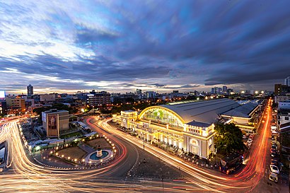
Rong Mueang (Thai: รองเมือง, pronounced [rɔ̄ːŋ mɯ̄a̯ŋ]) is a khwaeng (subdistrict) of Pathum Wan district, downtown Bangkok.Wiki
Attractions near แขวง รองเมือง
The Fifth Residence Bangkok,12 ซอย วัดบรมนิวาส,สำนักชีเนกขัมมาภิรมย์สถาน,พระราม 6 ซอย 15 ซอย วัดบรมนิวาส,เคทีแมนชั่น,ป้ายแรก ถนนอุรุพงษ์,445,สะพานเจริญผล - ตลาดโบ๊เบ๊,โพธิ์ทิพย์นวดแผนไทย,ส. โบตั๋น,ซอย แยกวัดบรมนิวาส,ซอยพระราม 6 ซอย 13,โรงเรียนวัดบรมนิวาส,วัดบรมนิวาสราชวรวิหาร,วัดบรมนิวาสราชวรวิหาร,7 ซอย วัดสามง่าม,88 ซอย โรงปลาทู (Soi Rong Plathu),ก๋วยจั๊บ พระราม6ซอย9,พระราม 6 ซอย 11,วัดบรมนิวาสราชวรวิหารHow to get to popular attractions in ปทุมวัน with public transit
หมู่บ้านชมเดือน 1, บางแค,ดอนเมือง, ดอนเมือง,Wall8 futsal, เมืองนนทบุรี,โรงเรียนฐานปัญญา, บางบอน,7-Eleven (เซเว่น อีเลฟเว่น), เมืองนนทบุรี,สะพานเจ็ดชั่วโคตร, ลำลูกกา,วงแหวนกาญจนาภิเษก-พระราม2, บางขุนเทียน,The Colour Living Hotel, เมืองสมุทรปราการ,หมู่บ้านทิพย์พิมาน การ์เด้น, บางบัวทอง,fullfill ฟูลฟิล (อาหารตามสั่ง), คลองหลวง,หมู่บ้านทองพัฒนา, ภาษีเจริญ,สนามหลวง, พระนคร,ถนนวงแหวนรอบนอก เอกชัย-บางบอน, บางบอน,CC Badminton Court, บางขุนเทียน,ครัวยายเปล่ง, ทวีวัฒนา,เจิน-เจิน ก๋วยเตี๋ยวลูกชิ้นแคะ, บางแค,ชาตรามือ, ดอนเมือง,มหาวิทยาลัยสวนดุสิต, ดุสิต,สเต็กลุงหนวด, ทุ่งครุ,สำนักงานประปา สาขาภาษีเจริญ, บางแคGet around ปทุมวัน by public transit!
Traveling around ปทุมวัน has never been so easy. See step by step directions as you travel to any attraction, street or major public transit station. View bus and train schedules, arrival times, service alerts and detailed routes on a map, so you know exactly how to get to anywhere in ปทุมวัน.
When traveling to any destination around ปทุมวัน use Moovit's Live Directions with Get Off Notifications to know exactly where and how far to walk, how long to wait for your line, and how many stops are left. Moovit will alert you when it's time to get off — no need to constantly re-check whether yours is the next stop.
Wondering how to use public transit in ปทุมวัน or how to pay for public transit in ปทุมวัน? Moovit public transit app can help you navigate your way with public transit easily, and at minimum cost. It includes public transit fees, ticket prices, and costs. Looking for a map of ปทุมวัน public transit lines? Moovit public transit app shows all public transit maps in ปทุมวัน with all bus, metro, train or ferry routes and stops on an interactive map.
ปทุมวัน has 4 transit type(s), including: bus, metro, train or ferry, operated by several transit agencies, including บีทีเอส BTS, MRT, ขสมก. BMTA, รถไฟฟ้ารฟท. SRTET, รถไฟฟ้ารฟท. SRTET, รถประจำทาง Transport Bus, บีอาร์ที BRT, เรือคลองโดยสาร Canal Ferry, เรือข้ามฟาก River Ferry, รถสองแถว Songthaew, จุฬาป๊อบบัส Chula Pop Bus, ขสมก BMTA, ขสมก. (BMTA), รถมินิบัส Minibus and รฟท. SRT