See แยกท่าพระ, บางกอกใหญ่, on the map
Directions to แยกท่าพระ (บางกอกใหญ่) with public transportation
The following transit lines have routes that pass near แยกท่าพระ
 SkyTrain:
 - Metro:
- Bus:
- Ferry:
- Train:
How to get to แยกท่าพระ by bus?
Click on the bus route to see step by step directions with maps, line arrival times and updated time schedules.
How to get to แยกท่าพระ by train?
Click on the train route to see step by step directions with maps, line arrival times and updated time schedules.
How to get to แยกท่าพระ by metro?
Click on the metro route to see step by step directions with maps, line arrival times and updated time schedules.
How to get to แยกท่าพระ by SkyTrain?
Click on the SkyTrain route to see step by step directions with maps, line arrival times and updated time schedules.
How to get to แยกท่าพระ by ferry?
Click on the ferry route to see step by step directions with maps, line arrival times and updated time schedules.
Bus stations near แยกท่าพระ in บางกอกใหญ่
- สถานีตำรวจบางกอกใหญ่(ซอยคริสตจักร) Conifers. Yai,2 min walk,
- สถานีตำรวจบางกอกใหญ่(ซอยคริสตจักร);Police Station Bangkok Yai,2 min walk,
- ซอย จรัญสนิทวงศ์ 1 Soi Charan Sanitwong 1,3 min walk,
- ก่อนแยกท่าพระ (ฝั่งรัชดาภิเษก);Before Tha Phra Intersection (Ratchadapisek Side),4 min walk,
- แยกท่าพระตรงข้ามโรงเรียนประสาทวิทยาอนุชน,4 min walk,
- วัดประดู่ในทรงธรรม;Wat Pradu Nai Songtham,4 min walk,
- วัดประดู่ในทรงธรรม WAT Pradu Nai Songtham,4 min walk,
- หลังแยกท่าพระ (ฝั่งเพชรเกษม);After Tha Phra Intersection (Phetkasem Side),11 min walk,
- ซอยเพชรเกษม 10/2 ตลาดท่าพระรุ่งเรือง,11 min walk,
Metro stations near แยกท่าพระ in บางกอกใหญ่
- Mrt บางไผ่;Mrt Bangphai,14 min walk,
Ferry stations near แยกท่าพระ in บางกอกใหญ่
- ท่าเรือประตูน้ำภาษีเจริญ;Phasi Charoen Dam Pier,17 min walk,
Train stations near แยกท่าพระ in บางกอกใหญ่
- Srt ตลาดพลู;Srt Talat Phlu,21 min walk,
Bus lines to แยกท่าพระ in บางกอกใหญ่
- 42,ตรงข้ามวัดสุทัศน์,ร้านวิจิตรพานิช,
- 68,วัดบวรนิเวศวิหาร,ท่ารถสาย 68 บางลำพู (ตรงข้ามไปรษณีย์บางลำภูบน),
- 42,เสาชิงช้า;Giant Swing,
- 81,สะพานปิ่นเกล้า;-,
- 108,ท่าพระ;Tha Phra,
- 146,บางแค-ศิริราช;Bangkae-Siriraj,
- 157,อู่หมอชิต 2;Mochit 2,
- 4-10 (42),เสาชิงช้า;Sao Ching Cha,
- 4-19 (108),สถานีรถไฟฟ้าตลาดพลู;Bts Talat Phlu,
- 4-52 (146),ตลิ่งชัน (วนขวา);Taling Chan,
- 68,อู่แสมดำ - บางลำพู Samaedam - Bang Lamphu,
- 80 (ปอ.) (AC),วัดศรีนวลธรรมวิมล - สนามหลวง -,
- 189,กระทุ่มแบน - สะพานสมเด็จพระปิ่นเกล้า Kratumban - Somdet Phra Pinklao Bridge,
- 68,บางลำพู;Bang Lamphu,
- 68,แสมดำ ;Samaedam,
- 80ก,หมู่บ้าน วปอ.11;Thai Ndc 11 Village,
- 101,อู่บรมราชชนนี;Borommaratchachonnani Bus Depot,
- 1-32E,บางเขน;Bang Khen,
- 165,พุทธมณฑลสาย 3;-,
- 4-41 (57),ธนบุรี;Thonburi,
What are the closest stations to แยกท่าพระ?
The closest stations to แยกท่าพระ are:
- สถานีตำรวจบางกอกใหญ่(ซอยคริสตจักร) Conifers. Yai is 125 meters away, 2 min walk.
- สถานีตำรวจบางกอกใหญ่(ซอยคริสตจักร);Police Station Bangkok Yai is 125 meters away, 2 min walk.
- ซอย จรัญสนิทวงศ์ 1 Soi Charan Sanitwong 1 is 213 meters away, 3 min walk.
- ก่อนแยกท่าพระ (ฝั่งรัชดาภิเษก);Before Tha Phra Intersection (Ratchadapisek Side) is 229 meters away, 4 min walk.
- แยกท่าพระตรงข้ามโรงเรียนประสาทวิทยาอนุชน is 229 meters away, 4 min walk.
- วัดประดู่ในทรงธรรม;Wat Pradu Nai Songtham is 296 meters away, 4 min walk.
- วัดประดู่ในทรงธรรม WAT Pradu Nai Songtham is 296 meters away, 4 min walk.
- หลังแยกท่าพระ (ฝั่งเพชรเกษม);After Tha Phra Intersection (Phetkasem Side) is 825 meters away, 11 min walk.
- ซอยเพชรเกษม 10/2 ตลาดท่าพระรุ่งเรือง is 825 meters away, 11 min walk.
- Mrt บางไผ่;Mrt Bangphai is 1069 meters away, 14 min walk.
- ท่าเรือประตูน้ำภาษีเจริญ;Phasi Charoen Dam Pier is 1296 meters away, 17 min walk.
- Srt ตลาดพลู;Srt Talat Phlu is 1539 meters away, 21 min walk.
Which SkyTrain line stops near แยกท่าพระ?
SILOM
Which metro line stops near แยกท่าพระ?
BLUE
Which bus lines stop near แยกท่าพระ?
These bus lines stop near แยกท่าพระ: 146, 2-22 (175), 68, 7, 7ก.
Which ferry lines stop near แยกท่าพระ?
These ferry lines stop near แยกท่าพระ: เรือข้ามฟาก, เรือด่วนธงส้ม.
Which train line stops near แยกท่าพระ?
4312
What’s the nearest metro station to แยกท่าพระ in บางกอกใหญ่?
The nearest metro station to แยกท่าพระ in บางกอกใหญ่ is Mrt บางไผ่;Mrt Bangphai. It’s a 14 min walk away.
What’s the nearest train station to แยกท่าพระ in บางกอกใหญ่?
The nearest train station to แยกท่าพระ in บางกอกใหญ่ is Srt ตลาดพลู;Srt Talat Phlu. It’s a 21 min walk away.
What’s the nearest bus stop to แยกท่าพระ in บางกอกใหญ่?
The nearest bus stops to แยกท่าพระ in บางกอกใหญ่ are สถานีตำรวจบางกอกใหญ่(ซอยคริสตจักร) Conifers. Yai and สถานีตำรวจบางกอกใหญ่(ซอยคริสตจักร);Police Station Bangkok Yai. The closest one is a 2 min walk away.
What’s the nearest ferry station to แยกท่าพระ in บางกอกใหญ่?
The nearest ferry station to แยกท่าพระ in บางกอกใหญ่ is ท่าเรือประตูน้ำภาษีเจริญ;Phasi Charoen Dam Pier. It’s a 17 min walk away.
What time is the first metro to แยกท่าพระ in บางกอกใหญ่?
The BLUE is the first metro that goes to แยกท่าพระ in บางกอกใหญ่. It stops nearby at 6:00 AM.
What time is the last metro to แยกท่าพระ in บางกอกใหญ่?
The BLUE is the last metro that goes to แยกท่าพระ in บางกอกใหญ่. It stops nearby at 12:40 AM.
What time is the first train to แยกท่าพระ in บางกอกใหญ่?
The 4302 is the first train that goes to แยกท่าพระ in บางกอกใหญ่. It stops nearby at 5:21 AM.
What time is the last train to แยกท่าพระ in บางกอกใหญ่?
The 4347 is the last train that goes to แยกท่าพระ in บางกอกใหญ่. It stops nearby at 8:14 PM.
What time is the first bus to แยกท่าพระ in บางกอกใหญ่?
The 4-36 (7) is the first bus that goes to แยกท่าพระ in บางกอกใหญ่. It stops nearby at 3:05 AM.
What time is the last bus to แยกท่าพระ in บางกอกใหญ่?
The 4-36 (7) is the last bus that goes to แยกท่าพระ in บางกอกใหญ่. It stops nearby at 4:44 AM.
What time is the first ferry to แยกท่าพระ in บางกอกใหญ่?
The เรือคลองภาษีเจริญ is the first ferry that goes to แยกท่าพระ in บางกอกใหญ่. It stops nearby at 6:00 AM.
What time is the last ferry to แยกท่าพระ in บางกอกใหญ่?
The เรือคลองภาษีเจริญ is the last ferry that goes to แยกท่าพระ in บางกอกใหญ่. It stops nearby at 8:46 PM.
See แยกท่าพระ, บางกอกใหญ่, on the map
Public Transit to แยกท่าพระ in บางกอกใหญ่
Wondering how to get to แยกท่าพระ in บางกอกใหญ่, Thailand? Moovit helps you find the best way to get to แยกท่าพระ with step-by-step directions from the nearest public transit station.
Moovit provides free maps and live directions to help you navigate through your city. View schedules, routes, timetables, and find out how long does it take to get to แยกท่าพระ in real time.
Looking for the nearest stop or station to แยกท่าพระ? Check out this list of stops closest to your destination: สถานีตำรวจบางกอกใหญ่(ซอยคริสตจักร) Conifers. Yai; สถานีตำรวจบางกอกใหญ่(ซอยคริสตจักร);Police Station Bangkok Yai; ซอย จรัญสนิทวงศ์ 1 Soi Charan Sanitwong 1; ก่อนแยกท่าพระ (ฝั่งรัชดาภิเษก);Before Tha Phra Intersection (Ratchadapisek Side); แยกท่าพระตรงข้ามโรงเรียนประสาทวิทยาอนุชน; วัดประดู่ในทรงธรรม;Wat Pradu Nai Songtham; วัดประดู่ในทรงธรรม WAT Pradu Nai Songtham; หลังแยกท่าพระ (ฝั่งเพชรเกษม);After Tha Phra Intersection (Phetkasem Side); ซอยเพชรเกษม 10/2 ตลาดท่าพระรุ่งเรือง; Mrt บางไผ่;Mrt Bangphai; ท่าเรือประตูน้ำภาษีเจริญ;Phasi Charoen Dam Pier; Srt ตลาดพลู;Srt Talat Phlu.
SkyTrain:Metro:Bus:Ferry:Train:
Want to see if there’s another route that gets you there at an earlier time? Moovit helps you find alternative routes or times. Get directions from and directions to แยกท่าพระ easily from the Moovit App or Website.
We make riding to แยกท่าพระ easy, which is why over 1.5 million users, including users in บางกอกใหญ่, trust Moovit as the best app for public transit. You don’t need to download an individual bus app or train app, Moovit is your all-in-one transit app that helps you find the best bus time or train time available.
For information on prices of bus, metro, ferry, train and SkyTrain, costs and ride fares to แยกท่าพระ, please check the Moovit app.
Use the app to navigate to popular places including to the airport, hospital, stadium, grocery store, mall, coffee shop, school, college, and university.
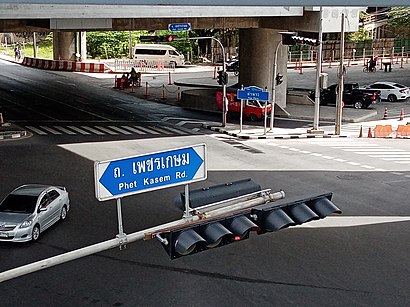
แยกท่าพระ Address: แยกท่าพระ 17/122 ซอย คริสตจักร แขวง วัดท่าพระ เขต บางกอกใหญ่ กรุงเทพมหานคร 10600 ประเทศไทย street in บางกอกใหญ่
Tha Phra (Thai: ท่าพระ, pronounced [tʰâː pʰráʔ]) is a main road intersection in the Wat Tha Phra Subdistrict, Bangkok Yai District in Thon Buri side, Bangkok.Wiki
Attractions near แยกท่าพระ
MRT Tha Phra (BL01) (MRT ท่าพระ),MRT ท่าพระ (BL01),เพชรเกษม 14,Tha Phra MRT Station,Krungthai Bank-MRT Tha Phra,คลองถม(ตลาดมืดตอนสว่าง),ท่าพระสเต็ก,Jaymart Mobile-1095 Ja,บริษัท มีทวีการบัญชีและกฎหมาย จํากัด,สถาบันวิชาไทย,บริษัท เวลมาร์ท จํากัด,สถานีรถไฟฟ้าใต้ดิน-ท่าพระ / ทางออก 4,ห้างหุ้นส่วนจํากัด จันบาติค,ธนบุรีปิโตรเลียม หจก,ห้างหุ้นส่วนจํากัด เจริญวัฒนา เอ็นจิเนียริ่ง,ร้านฅนมีเส้น,บริษัท ดับเบิ้ลยู ที คอมเมอเชียล จํากัด,บริษัท เทคนิคแคล บิสซิเนส ดีเวลลอปเมนท์ จํากัด,ห้างหุ้นส่วนจํากัด ไฮ-คลาส เอ็มโปเรียม,ห้างหุ้นส่วนจํากัด เหลี่ยงเฮงฮวดHow to get to popular attractions in บางกอกใหญ่ with public transit
หมู่บ้านทองพัฒนา, ภาษีเจริญ,แหนมเนือง "คุณน้อย" ปากเกร็ด, ปากเกร็ด,ดอนเมือง, ดอนเมือง,เดอะมอลล์ บางกะปิ, บางกะปิ,หมู่บ้านทิพย์พิมาน การ์เด้น, บางบัวทอง,บ้านส้มตำ, บางแค,โรงเรียนรัตนาธิเบศร์, เมืองนนทบุรี,CC Badminton Court, บางขุนเทียน,BMTA Bus Stop ท่าน้ำนนท์ (Thanam Nonthaburi), เมืองนนทบุรี,The Platinum Fashion Mall, ปทุมวัน,อุดมทรัพย์ อพาร์ทเมนท์, บางซื่อ,หมู่บ้านอมรชัย5, เมืองสมุทรสาคร,พรปิยะแมนชั่น, บางซื่อ,H.S. Aviation Co.,Ltd. Headquarter, ดอนเมือง,เจิน-เจิน ก๋วยเตี๋ยวลูกชิ้นแคะ, บางแค,แพสุวรรณรัตน์,ชาตรามือ, ดอนเมือง,สำนักงานประปาสาขาสมุทรปราการ, เมืองสมุทรปราการ,Red Bull Beverage Co.,Ltd., บางบอน,เดอะ ฮับ, ลำลูกกาGet around บางกอกใหญ่ by public transit!
Traveling around บางกอกใหญ่ has never been so easy. See step by step directions as you travel to any attraction, street or major public transit station. View bus and train schedules, arrival times, service alerts and detailed routes on a map, so you know exactly how to get to anywhere in บางกอกใหญ่.
When traveling to any destination around บางกอกใหญ่ use Moovit's Live Directions with Get Off Notifications to know exactly where and how far to walk, how long to wait for your line, and how many stops are left. Moovit will alert you when it's time to get off — no need to constantly re-check whether yours is the next stop.
Wondering how to use public transit in บางกอกใหญ่ or how to pay for public transit in บางกอกใหญ่? Moovit public transit app can help you navigate your way with public transit easily, and at minimum cost. It includes public transit fees, ticket prices, and costs. Looking for a map of บางกอกใหญ่ public transit lines? Moovit public transit app shows all public transit maps in บางกอกใหญ่ with all bus, metro, ferry, train or SkyTrain routes and stops on an interactive map.
บางกอกใหญ่ has 5 transit type(s), including: bus, metro, ferry, train or SkyTrain, operated by several transit agencies, including บีทีเอส BTS, MRT, ขสมก. BMTA, รถไฟฟ้ารฟท. SRTET, รถไฟฟ้ารฟท. SRTET, รถประจำทาง Transport Bus, บีอาร์ที BRT, เรือคลองโดยสาร Canal Ferry, เรือข้ามฟาก River Ferry, รถสองแถว Songthaew, จุฬาป๊อบบัส Chula Pop Bus, ขสมก BMTA, ขสมก. (BMTA), รถมินิบัส Minibus and รฟท. SRT