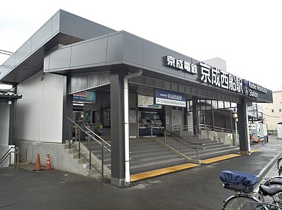
Directions to 京成西船 (船橋市) with public transportation
The following transit lines have routes that pass near 京成西船
How to get to 京成西船 by metro?
Click on the metro route to see step by step directions with maps, line arrival times and updated time schedules.
Metro stations near 京成西船 in 船橋市
- 二俣新町 Futamatashimmachi, 6 min walk,
- 西船橋 Nishi-Funabashi, 31 min walk,
What are the closest stations to 京成西船?
The closest stations to 京成西船 are:
- 二俣新町 Futamatashimmachi is 416 meters away, 6 min walk.
- 西船橋 Nishi-Funabashi is 2397 meters away, 31 min walk.
Which metro line stops near 京成西船?
武蔵野線 MUSASHINO LINE
What’s the nearest metro station to 京成西船 in 船橋市?
The nearest metro station to 京成西船 in 船橋市 is 二俣新町 Futamatashimmachi. It’s a 6 min walk away.
What time is the first metro to 京成西船 in 船橋市?
The 中央・総武各駅停車 CHUO SOBU LOCAL LINE is the first metro that goes to 京成西船 in 船橋市. It stops nearby at 4:35 AM.
What time is the last metro to 京成西船 in 船橋市?
The 中央・総武各駅停車 CHUO SOBU LOCAL LINE is the last metro that goes to 京成西船 in 船橋市. It stops nearby at 12:54 AM.
See 京成西船, 船橋市, on the map
Public Transit to 京成西船 in 船橋市
Wondering how to get to 京成西船 in 船橋市, Japan? Moovit helps you find the best way to get to 京成西船 with step-by-step directions from the nearest public transit station.
Moovit provides free maps and live directions to help you navigate through your city. View schedules, routes, timetables, and find out how long does it take to get to 京成西船 in real time.
Looking for the nearest stop or station to 京成西船? Check out this list of stops closest to your destination: 二俣新町 Futamatashimmachi; 西船橋 Nishi-Funabashi.
Metro: 武蔵野線 MUSASHINO LINE, 京葉線 KEIYO LINE, 中央・総武各駅停車 CHUO SOBU LOCAL LINE, 東西線 TOZAI LINE.
Want to see if there’s another route that gets you there at an earlier time? Moovit helps you find alternative routes or times. Get directions from and directions to 京成西船 easily from the Moovit App or Website.
We make riding to 京成西船 easy, which is why over 1.5 million users, including users in 船橋市, trust Moovit as the best app for public transit. You don’t need to download an individual bus app or train app, Moovit is your all-in-one transit app that helps you find the best bus time or train time available.
For information on prices of metro and bus, costs and ride fares to 京成西船, please check the Moovit app.
Use the app to navigate to popular places including to the airport, hospital, stadium, grocery store, mall, coffee shop, school, college, and university.
Location: 船橋市, Tokyo
Attractions near 京成西船
京成西船,Bakeries Lab.(ベーカリーズラボ),市立葛飾小学校,帰国子女アカデミー,ファミリーマート,三進不動産,吉野家,京葉学園,船橋市西図書館,印内一丁目,鎌倉パーキング,西船三丁目,西船6丁目ふれあい公園,Nishifunabashi,リムジンバス 西船橋駅 羽田空港行乗場,葛羅の井,Nishi-Funabashi Sta. Bus Stop (西船橋駅バス停),東中山駐車場,西船六丁目,ペリエ西船橋How to get to popular attractions in 船橋市 with public transit
横浜天理ビル, 横浜市,杏林大学医学部付属病院, 三鷹市,川崎駅東口バスターミナル 空島 (北のりば), 川崎市,シルクセンター, 横浜市,ネパール大使館, 目黒区,イオン 天王町店, 横浜市,Tucショップ, 和光市,神奈川県立 新城高等学校, 川崎市,象の鼻パーク, 横浜市,NANGA SHOP TOKYO, 目黒区,テレコムセンター駅前喫煙所, 江東区,陣ヶ下渓谷公園, 横浜市,都立 尾久の原公園, 荒川区,Iglesia Ni Cristo local ng Shinagawa, 品川区,江川せせらぎ緑道, 横浜市,道の駅 八王子滝山, 八王子市,陸上自衛隊 朝霞駐屯地, 和光市,神奈川県立生田東高等学校, 川崎市,砂防会館別館A, 千代田区,杉並区立中央図書館, 杉並区Get around Tokyo by public transit!
Traveling around Tokyo has never been so easy. See step by step directions as you travel to any attraction, street or major public transit station. View bus and train schedules, arrival times, service alerts and detailed routes on a map, so you know exactly how to get to anywhere in Tokyo.
When traveling to any destination around Tokyo use Moovit's Live Directions with Get Off Notifications to know exactly where and how far to walk, how long to wait for your line, and how many stops are left. Moovit will alert you when it's time to get off — no need to constantly re-check whether yours is the next stop.
Wondering how to use public transit in Tokyo or how to pay for public transit in Tokyo? Moovit public transit app can help you navigate your way with public transit easily, and at minimum cost. It includes public transit fees, ticket prices, and costs. Looking for a map of Tokyo public transit lines? Moovit public transit app shows all public transit maps in Tokyo with all Bus and Metro routes and stops on an interactive map.
Tokyo has 2 transit type(s), including: Bus and Metro, operated by several transit agencies, including JR East, Tokyo Metro, Toei, Tokyo Waterfront Area Rapid Transit, Transportation Bureau, City of Yokohama, Sagami Railway, 都営バス, Kokusai Kogyo Bus, Tokyu Bus, Keio Bus, Kanto Bus, Nishi Tokyo Bus, Sotetsu Bus