Directions to 双桥路西 (成都市) with public transportation
The following transit lines have routes that pass near 双桥路西
How to get to 双桥路西 by bus?
Click on the bus route to see step by step directions with maps, line arrival times and updated time schedules.
How to get to 双桥路西 by metro?
Click on the metro route to see step by step directions with maps, line arrival times and updated time schedules.
Metro stations near 双桥路西 in 成都市
- 玉双路, 3 min walk,
- 牛王庙, 17 min walk,
Bus stops near 双桥路西 in 成都市
- 玉双路站, 3 min walk,
- 一环路玉双路口北站, 4 min walk,
- 一环路玉双路口南站, 4 min walk,
- 双华路站, 5 min walk,
- 双桥路西站, 5 min walk,
- 双桥北二街口站, 6 min walk,
- 双林路一环路口东站, 9 min walk,
Bus lines to 双桥路西 in 成都市
- 27A路, 牛王庙公交站,
- 27路环线, 火车北公交站,
- 72路, Sm广场,
- 112路, 北湖公交站,
- 106路, 成仁公交站,
- 34A路环线, 百花中心,
- 34路, 火车北公交站,
- 182路, 牛王庙公交站,
- 20路, 北湖公交站,
- 341路, 成洛路公交站,
- 5路, 十陵公交站,
- 8路, 十里店公交站,
- 80路, 大梁村公交站,
- 101路, 成都东客公交,
- 237路, 长融街,
What are the closest stations to 双桥路西?
The closest stations to 双桥路西 are:
- 玉双路 is 167 meters away, 3 min walk.
- 一环路玉双路口北站 is 231 meters away, 4 min walk.
- 玉双路站 is 232 meters away, 3 min walk.
- 一环路玉双路口南站 is 272 meters away, 4 min walk.
- 双华路站 is 333 meters away, 5 min walk.
- 双桥路西站 is 362 meters away, 5 min walk.
- 双桥北二街口站 is 405 meters away, 6 min walk.
- 双林路一环路口东站 is 707 meters away, 9 min walk.
- 牛王庙 is 1308 meters away, 17 min walk.
Which bus lines stop near 双桥路西?
These bus lines stop near 双桥路西: 106路, 27路环线, 72路.
Which metro line stops near 双桥路西?
4号线 (来龙)
What’s the nearest metro station to 双桥路西 in 成都市?
The nearest metro station to 双桥路西 in 成都市 is 玉双路. It’s a 3 min walk away.
What’s the nearest bus station to 双桥路西 in 成都市?
The nearest bus stations to 双桥路西 in 成都市 are 一环路玉双路口北站 and 一环路玉双路口南站. The closest one is a 4 min walk away.
What time is the first metro to 双桥路西 in 成都市?
The 4号线 is the first metro that goes to 双桥路西 in 成都市. It stops nearby at 6:27 AM.
What time is the last metro to 双桥路西 in 成都市?
The 4号线 is the last metro that goes to 双桥路西 in 成都市. It stops nearby at 11:41 PM.
What time is the first bus to 双桥路西 in 成都市?
The 34路 is the first bus that goes to 双桥路西 in 成都市. It stops nearby at 5:57 AM.
What time is the last bus to 双桥路西 in 成都市?
The 27路环线 is the last bus that goes to 双桥路西 in 成都市. It stops nearby at 11:32 PM.
See 双桥路西, 成都市, on the map
Public Transit to 双桥路西 in 成都市
Wondering how to get to 双桥路西 in 成都市? Moovit helps you find the best way to get to 双桥路西 with step-by-step directions from the nearest public transit station.
Moovit provides free maps and live directions to help you navigate through your city. View schedules, routes, timetables, and find out how long does it take to get to 双桥路西 in real time.
Looking for the nearest stop or station to 双桥路西? Check out this list of stops closest to your destination: 玉双路; 一环路玉双路口北站; 玉双路站; 一环路玉双路口南站; 双华路站; 双桥路西站; 双桥北二街口站; 双林路一环路口东站; 牛王庙.
Bus: 106路, 27路环线, 72路, 27A路, 112路, 34A路环线, 34路, 182路.Metro: 4号线, 2号线.
Want to see if there’s another route that gets you there at an earlier time? Moovit helps you find alternative routes or times. Get directions from and directions to 双桥路西 easily from the Moovit App or Website.
We make riding to 双桥路西 easy, which is why over 1.5 million users, including users in 成都市, trust Moovit as the best app for public transit. You don’t need to download an individual bus app or train app, Moovit is your all-in-one transit app that helps you find the best bus time or train time available.
For information on prices of bus and metro, costs and ride fares to 双桥路西, please check the Moovit app.
Use the app to navigate to popular places including to the airport, hospital, stadium, grocery store, mall, coffee shop, school, college, and university.
双桥路西 Address: 20路;106路;341路;1125路 street in 成都市
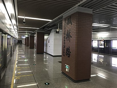
Shuangqiao Road station (Chinese: 双桥路站; pinyin: Shuāngqiáo Lù zhàn) is a station on Line 4 and Line 8 of the Chengdu Metro in China.Wiki
Places Near 双桥路西 (成都市)
How to get to popular places in Chengdu with public transit
Get around 成都市 by public transit!
Traveling around 成都市 has never been so easy. See step by step directions as you travel to any attraction, street or major public transit station. View bus and train schedules, arrival times, service alerts and detailed routes on a map, so you know exactly how to get to anywhere in 成都市.
When traveling to any destination around 成都市 use Moovit's Live Directions with Get Off Notifications to know exactly where and how far to walk, how long to wait for your line, and how many stops are left. Moovit will alert you when it's time to get off — no need to constantly re-check whether yours is the next stop.
Wondering how to use public transit in 成都市 or how to pay for public transit in 成都市? Moovit public transit app can help you navigate your way with public transit easily, and at minimum cost. It includes public transit fees, ticket prices, and costs. Looking for a map of 成都市 public transit lines? Moovit public transit app shows all public transit maps in 成都市 with all Bus and Metro routes and stops on an interactive map.
Chengdu has 2 transit type(s), including: Bus and Metro, operated by several transit agencies, including 成都地铁, 成都公交, 都江堰公交 and 金堂县公交