Directions to 君傲灣 (西貢 Sai Kung) with public transportation
The following transit lines have routes that pass near 君傲灣
How to get to 君傲灣 by bus?
Click on the bus route to see step by step directions with maps, line arrival times and updated time schedules.
How to get to 君傲灣 by subway?
Click on the subway route to see step by step directions with maps, line arrival times and updated time schedules.
Bus stops near 君傲灣 in 西貢 Sai Kung
- 佛教志蓮小學 Chi Lin Buddhist Primary School, 3 min walk,
- 富康花園 Beverly Garden, 6 min walk,
- 尚智樓 Sheung Chi House, 6 min walk,
Subway stations near 君傲灣 in 西貢 Sai Kung
- 將軍澳 Tseung Kwan O, 4 min walk,
- 調景嶺 Tiu Keng Leng, 16 min walk,
Bus lines to 君傲灣 in 西貢 Sai Kung
- 90, 沙田(碩門邨) Sha Tin (Shek Mun Estate),
- N290, 荃灣西站 Tsuen Wan West Station,
- N293, 旺角(柏景灣) Mong Kok (Park Avenue),
- N691, 中環(港澳碼頭) Central (Macau Ferry),
- 694, 小西灣邨 Siu Sai Wan Estate,
- 694S, 小西灣邨 Siu Sai Wan Estate,
- 793, 將軍澳工業邨 Tseung Kwan O Industrial Estate,
- 795X, 蘇屋邨 So Uk Estate,
- N796, 尖沙咀 / 旺角 (循環線) Tsim Sha Tsui / Mong Kok (Circular),
- 796X, 將軍澳站 Tseung Kwan O Station,
- 798P, 大圍站 Tai Wai Station,
- 798X, 火炭(駿洋邨) Fo Tan (Chun Yeung Estate),
- NR212, 火炭 Fo Tan,
- E22A, 將軍澳(康盛花園) Tseung Kwan O (Hong Sing Garden) - 機場(航天城) Airport (SkyCity),
- E22S, 東涌(滿東邨) Tung Chung (Mun Tung Estate) - 將軍澳(寶琳) Tseung Kwan O (Po Lam),
- A28, 將軍澳(日出康城) Tsueng Kwan O (LOHAS Park) - 機場 Airport,
- N29, 將軍澳(康盛花園) Tseung Kwan O (Hong Sing Garden) - 東涌站 Tung Chung Station,
- 93M, 彩明 Choi Ming > 藍田站 Lam Tin Station > 寶林 Po Lam,
- 296M, 康盛花園 Hong Sing Garden - 坑口站 Hang Hau Station,
- 792M, 將軍澳站 Tseung Kwan O Station - 西貢 Sai Kung,
What are the closest stations to 君傲灣?
The closest stations to 君傲灣 are:
- 佛教志蓮小學 Chi Lin Buddhist Primary School is 180 meters away, 3 min walk.
- 將軍澳 Tseung Kwan O is 218 meters away, 4 min walk.
- 富康花園 Beverly Garden is 389 meters away, 6 min walk.
- 尚智樓 Sheung Chi House is 398 meters away, 6 min walk.
- 調景嶺 Tiu Keng Leng is 1125 meters away, 16 min walk.
Which bus lines stop near 君傲灣?
These bus lines stop near 君傲灣: 103M, 296D, 694, 796C.
Which subway line stops near 君傲灣?
將軍澳綫 TSEUNG KWAN O LINE
What’s the nearest subway station to 君傲灣 in 西貢 Sai Kung?
The nearest subway station to 君傲灣 in 西貢 Sai Kung is 將軍澳 Tseung Kwan O. It’s a 4 min walk away.
What’s the nearest bus stop to 君傲灣 in 西貢 Sai Kung?
The nearest bus stop to 君傲灣 in 西貢 Sai Kung is 佛教志蓮小學 Chi Lin Buddhist Primary School. It’s a 3 min walk away.
What time is the first subway to 君傲灣 in 西貢 Sai Kung?
The 將軍澳綫 TSEUNG KWAN O LINE is the first subway that goes to 君傲灣 in 西貢 Sai Kung. It stops nearby at 5:57 AM.
What time is the last subway to 君傲灣 in 西貢 Sai Kung?
The 將軍澳綫 TSEUNG KWAN O LINE is the last subway that goes to 君傲灣 in 西貢 Sai Kung. It stops nearby at 1:30 AM.
What time is the first bus to 君傲灣 in 西貢 Sai Kung?
The N796 is the first bus that goes to 君傲灣 in 西貢 Sai Kung. It stops nearby at 3:00 AM.
What time is the last bus to 君傲灣 in 西貢 Sai Kung?
The N796 is the last bus that goes to 君傲灣 in 西貢 Sai Kung. It stops nearby at 4:14 AM.
How much is the subway fare to 君傲灣?
The subway fare to 君傲灣 costs about $4.40 - $21.90.
How much is the bus fare to 君傲灣?
The bus fare to 君傲灣 costs about $4.50 - $10.40.
See 君傲灣, 西貢 Sai Kung, on the map
Public Transit to 君傲灣 in 西貢 Sai Kung
Wondering how to get to 君傲灣 in 西貢 Sai Kung, Hong Kong? Moovit helps you find the best way to get to 君傲灣 with step-by-step directions from the nearest public transit station.
Moovit provides free maps and live directions to help you navigate through your city. View schedules, routes, timetables, and find out how long does it take to get to 君傲灣 in real time.
Looking for the nearest stop or station to 君傲灣? Check out this list of stops closest to your destination: 佛教志蓮小學 Chi Lin Buddhist Primary School; 將軍澳 Tseung Kwan O; 富康花園 Beverly Garden; 尚智樓 Sheung Chi House; 調景嶺 Tiu Keng Leng.
Bus: 103M, 296D, 694, 796C, 90, N290, N293, N691, NR212, E22A, E22S, A28, N29, 93M, 798B.Subway: 將軍澳綫 TSEUNG KWAN O LINE, 觀塘綫 KWUN TONG LINE.
Want to see if there’s another route that gets you there at an earlier time? Moovit helps you find alternative routes or times. Get directions from and directions to 君傲灣 easily from the Moovit App or Website.
We make riding to 君傲灣 easy, which is why over 1.5 million users, including users in 西貢 Sai Kung, trust Moovit as the best app for public transit. You don’t need to download an individual bus app or train app, Moovit is your all-in-one transit app that helps you find the best bus time or train time available.
For information on prices of subway and bus, costs and ride fares to 君傲灣, please check the Moovit app.
Use the app to navigate to popular places including to the airport, hospital, stadium, grocery store, mall, coffee shop, school, college, and university.
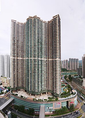
君傲灣 Address: 9 Tong Chun St street in 西貢 Sai Kung
Attractions near 君傲灣
君傲灣 the Grandiose,優衣庫,UNIQLO (優衣庫),Popcorn 2,第2座 Block 2,第3座 Block 3,Popcorn 2,Market Place by Jasons,Best Mart 360,Hoixe Cake Shop 凱施餅店,凱施餅店,KFC 肯德基,Pepper Lunch Express,Ringer Hut,第1座 Block 1,Tseung Kwan O Station Minibus Stop 將軍澳站小巴站,莆田,Book Buddy,君傲灣會所 / PopCorn 2,Xiao Wang Beef Noodle (小王牛肉麵)How to get to popular attractions in 西貢 Sai Kung with public transit
Tuen Mun Marriage Registry 屯門婚姻登記處, 屯門 Tuen Mun,志蓮淨苑, 黃大仙 Wong Tai Sin,綠怡雅苑 Greenhill Villa, 沙田 Sha Tin,沙角村, 沙田 Sha Tin,和記電訊大廈 Hutchison Telecom Tower,Chun Wah Road Sports Centre 振華道體育館, 觀塘 Kwun Tong,天暉路體育館 Tin Fai Road Sports Centre, 元朗 Yuen Long,唯港薈 Hotel Icon, 油尖旺 Yau Tsim Mong,帝京酒店 Royal Plaza Hotel, 九龍 Kowloon City,V Walk, 深水埗 Sham Shui Po,香港中文大學, 沙田 Sha Tin,東區尤德夫人那打素醫院 Pamela Youde Nethersole Eastern Hospital, 東區 Eastern,North Kwai Chung Clinic 北葵涌診所, 葵興 Kwai Tsing,香港殯儀館, 東區 Eastern,石澳,屯門鄧肇堅運動場網球場, 屯門 Tuen Mun,稅務大樓, 灣仔 Wan Chai,聖公會鄧肇堅中學 Skh Tang Shiu Kin Secondary School, 灣仔 Wan Chai,长洲岛,香港嘉里大酒店 Kerry Hotel Hong Kong, 九龍 Kowloon CityGet around Hong Kong by public transit!
Traveling around Hong Kong has never been so easy. See step by step directions as you travel to any attraction, street or major public transit station. View bus and train schedules, arrival times, service alerts and detailed routes on a map, so you know exactly how to get to anywhere in Hong Kong.
When traveling to any destination around Hong Kong use Moovit's Live Directions with Get Off Notifications to know exactly where and how far to walk, how long to wait for your line, and how many stops are left. Moovit will alert you when it's time to get off — no need to constantly re-check whether yours is the next stop.
Wondering how to use public transit in Hong Kong or how to pay for public transit in Hong Kong? Moovit public transit app can help you navigate your way with public transit easily, and at minimum cost. It includes public transit fees, ticket prices, and costs. Looking for a map of Hong Kong public transit lines? Moovit public transit app shows all public transit maps in Hong Kong with all Bus, Subway, Light Rail, Ferry, Cable Car and Funicular routes and stops on an interactive map.
Hong Kong has 6 transit type(s), including: Bus, Subway, Light Rail, Ferry, Cable Car and Funicular, operated by several transit agencies, including 港鐵 MTR, 天星小輪 Star Ferry, 九巴 KMB, 城巴 Citybus, 城巴機場快線 Cityflyer, 龍運巴士 LWB, 九巴 KMB / 城巴 CTB, 龍運巴士 LWB / 城巴 CTB, 新大嶼山巴士 NLB, 愉景灣巴士 DB, 香港電車 Hong Kong Tramways, 香港中文大學 The Chinese University of Hong Kong, 港島區專線小巴 GMB HK Island, 九龍區專線小巴 GMB Kowloon, 新界區專線小巴 GMB New Territories