Directions to 大嶼山 (香港島 Islands) with public transportation
The following transit lines have routes that pass near 大嶼山
How to get to 大嶼山 by bus?
Click on the bus route to see step by step directions with maps, line arrival times and updated time schedules.
Bus stations near 大嶼山 in 香港島 Islands
- 東涌坳管理站 Tung Chung Au Management Office, 37 min walk,
Cable Car stations near 大嶼山 in 香港島 Islands
- 昂坪 Ngong Ping, 50 min walk,
Bus lines to 大嶼山 in 香港島 Islands
- 3M, 東涌站(經北大嶼山醫院) Tung Chung Station (Via N Lantau Hospital),
- 11, 東涌站(沙咀開出,經塘福懲教所) Tung Chung Station (From Sha Tsui, Via Tong Fuk Corr Inst),
- 11A, 東涌站 Tung Chung Station,
- 23, 東涌達東路 Tung Chung Tat Tung Road,
- A35, 梅窩 Mui Wo,
- N35, 機場/港珠澳大橋香港口岸 Airport / Hzmb Hong Kong Port,
What are the closest stations to 大嶼山?
The closest stations to 大嶼山 are:
- 東涌坳管理站 Tung Chung Au Management Office is 2784 meters away, 37 min walk.
- 昂坪 Ngong Ping is 3794 meters away, 50 min walk.
Which bus lines stop near 大嶼山?
These bus lines stop near 大嶼山: 11R, 23, 34, 3M, A35.
What time is the first cable car to 大嶼山 in 香港島 Islands?
The 昂坪360 is the first cable car that goes to 大嶼山 in 香港島 Islands. It stops nearby at 9:00 AM.
What time is the last cable car to 大嶼山 in 香港島 Islands?
The 昂坪360 is the last cable car that goes to 大嶼山 in 香港島 Islands. It stops nearby at 6:39 PM.
What time is the first bus to 大嶼山 in 香港島 Islands?
The N35 is the first bus that goes to 大嶼山 in 香港島 Islands. It stops nearby at 4:26 AM.
What time is the last bus to 大嶼山 in 香港島 Islands?
The N35 is the last bus that goes to 大嶼山 in 香港島 Islands. It stops nearby at 2:11 AM.
How much is the subway fare to 大嶼山?
The subway fare to 大嶼山 costs about $6.60 - $21.90.
How much is the bus fare to 大嶼山?
The bus fare to 大嶼山 costs about $2.60 - $13.90.
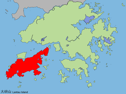
See 大嶼山, 香港島 Islands, on the map
Public Transit to 大嶼山 in 香港島 Islands
Wondering how to get to 大嶼山 in 香港島 Islands, Hong Kong? Moovit helps you find the best way to get to 大嶼山 with step-by-step directions from the nearest public transit station.
Moovit provides free maps and live directions to help you navigate through your city. View schedules, routes, timetables, and find out how long does it take to get to 大嶼山 in real time.
Looking for the nearest stop or station to 大嶼山? Check out this list of stops closest to your destination: 東涌坳管理站 Tung Chung Au Management Office; 昂坪 Ngong Ping.
Bus: 11R, 23, 34, 3M, A35, 11, 11A.Cable Car: 昂坪360.
Want to see if there’s another route that gets you there at an earlier time? Moovit helps you find alternative routes or times. Get directions from and directions to 大嶼山 easily from the Moovit App or Website.
We make riding to 大嶼山 easy, which is why over 1.5 million users, including users in 香港島 Islands, trust Moovit as the best app for public transit. You don’t need to download an individual bus app or train app, Moovit is your all-in-one transit app that helps you find the best bus time or train time available.
For information on prices of bus and subway, costs and ride fares to 大嶼山, please check the Moovit app.
Use the app to navigate to popular places including to the airport, hospital, stadium, grocery store, mall, coffee shop, school, college, and university.
Location: 香港島 Islands, Hong Kong
Attractions near 大嶼山
C1703,C1702,C1704,北峰嶂,東涌坳管理站 Tung Chung Au Management Office,郊野公園管理叁,東林精舍,大東山配水庫,C1701,大屿山,地塘仔 Tei Tong Tsai,東涌道18號塋葬區 Tung Chung Road Burial Ground No.18,南天門,羅漢寺 Lo Hon Buddhist Monastery,Nan-ta-ao,金剛塔 Kam Kwong Pagoda,十方道場,十方道場,客堂,幻亭How to get to popular attractions in 香港島 Islands with public transit
沙田學生健康服務中心, 沙田 Sha Tin,駿業街, 觀塘 Kwun Tong,Riva 爾巒, 元朗 Yuen Long,清水灣第二灣泳灘, 西貢 Sai Kung,蠔涌車公古廟, 西貢 Sai Kung,曾咀靈灰安置所及紀念花園 Tsang Tsui Columbarium And Garden Of Remembrance, 屯門 Tuen Mun,保良局李兆基青年綠洲 Po Leung Kok Lee Shau Kee Youth Oasis, 元朗 Yuen Long,會展站 Exhibition Centre Station, 灣仔 Wan Chai,丽豪酒店, 沙田 Sha Tin,香港麗思卡爾頓酒店 the Ritz-Carlton, Hong Kong, 油尖旺 Yau Tsim Mong,帝苑酒店 the Royal Garden Hotel, 油尖旺 Yau Tsim Mong,Chun Wah Road Sports Centre 振華道體育館, 觀塘 Kwun Tong,駱駝漆大廈3座, 觀塘 Kwun Tong,大連排道, 葵興 Kwai Tsing,慈雲山觀音廟, 黃大仙 Wong Tai Sin,如心廣場2, 荃灣 Tsuen Wan,白石高爾夫球練習場, 沙田 Sha Tin,成業工業大廈 Shing Yip Industrial Building, 觀塘 Kwun Tong,天鑽 the Regent, 大埔 Tai Po,大鴻輝(葵涌)中心第一期, 葵興 Kwai TsingGet around Hong Kong by public transit!
Traveling around Hong Kong has never been so easy. See step by step directions as you travel to any attraction, street or major public transit station. View bus and train schedules, arrival times, service alerts and detailed routes on a map, so you know exactly how to get to anywhere in Hong Kong.
When traveling to any destination around Hong Kong use Moovit's Live Directions with Get Off Notifications to know exactly where and how far to walk, how long to wait for your line, and how many stops are left. Moovit will alert you when it's time to get off — no need to constantly re-check whether yours is the next stop.
Wondering how to use public transit in Hong Kong or how to pay for public transit in Hong Kong? Moovit public transit app can help you navigate your way with public transit easily, and at minimum cost. It includes public transit fees, ticket prices, and costs. Looking for a map of Hong Kong public transit lines? Moovit public transit app shows all public transit maps in Hong Kong with all Bus, Subway, Light Rail, Ferry, Cable Car and Funicular routes and stops on an interactive map.
Hong Kong has 6 transit type(s), including: Bus, Subway, Light Rail, Ferry, Cable Car and Funicular, operated by several transit agencies, including 港鐵 MTR, 天星小輪 Star Ferry, 九巴 KMB, 城巴 Citybus, 城巴機場快線 Cityflyer, 龍運巴士 LWB, 九巴 KMB / 城巴 CTB, 龍運巴士 LWB / 城巴 CTB, 新大嶼山巴士 NLB, 愉景灣巴士 DB, 香港電車 Hong Kong Tramways, 香港中文大學 The Chinese University of Hong Kong, 港島區專線小巴 GMB HK Island, 九龍區專線小巴 GMB Kowloon, 新界區專線小巴 GMB New Territories