Directions to 市川真間 (市川市) with public transportation
The following transit lines have routes that pass near 市川真間
How to get to 市川真間 by bus?
Click on the bus route to see step by step directions with maps, line arrival times and updated time schedules.
How to get to 市川真間 by metro?
Click on the metro route to see step by step directions with maps, line arrival times and updated time schedules.
Metro stations near 市川真間 in 市川市
- 本八幡 Moto-Yawata, 13 min walk,
- 本八幡 Motoyawata, 16 min walk,
- 市川 Ichikawa, 29 min walk,
What are the closest stations to 市川真間?
The closest stations to 市川真間 are:
- 本八幡 Moto-Yawata is 860 meters away, 13 min walk.
- 本八幡 Motoyawata is 1139 meters away, 16 min walk.
- 市川 Ichikawa is 2153 meters away, 29 min walk.
Which bus line stops near 市川真間?
錦27
Which metro lines stop near 市川真間?
These metro lines stop near 市川真間: 中央・総武各駅停車 CHUO SOBU LOCAL LINE, 総武快速線 SOBU RAPID LINE.
What’s the nearest metro station to 市川真間 in 市川市?
The nearest metro station to 市川真間 in 市川市 is 本八幡 Moto-Yawata. It’s a 13 min walk away.
What time is the first metro to 市川真間 in 市川市?
The 中央・総武各駅停車 CHUO SOBU LOCAL LINE is the first metro that goes to 市川真間 in 市川市. It stops nearby at 4:39 AM.
What time is the last metro to 市川真間 in 市川市?
The 中央・総武各駅停車 CHUO SOBU LOCAL LINE is the last metro that goes to 市川真間 in 市川市. It stops nearby at 12:50 AM.
See 市川真間, 市川市, on the map
Public Transit to 市川真間 in 市川市
Wondering how to get to 市川真間 in 市川市, Japan? Moovit helps you find the best way to get to 市川真間 with step-by-step directions from the nearest public transit station.
Moovit provides free maps and live directions to help you navigate through your city. View schedules, routes, timetables, and find out how long does it take to get to 市川真間 in real time.
Looking for the nearest stop or station to 市川真間? Check out this list of stops closest to your destination: 本八幡 Moto-Yawata; 本八幡 Motoyawata; 市川 Ichikawa.
Bus: 錦27.Metro: 中央・総武各駅停車 CHUO SOBU LOCAL LINE, 総武快速線 SOBU RAPID LINE, 新宿線 SHINJUKU LINE.
Want to see if there’s another route that gets you there at an earlier time? Moovit helps you find alternative routes or times. Get directions from and directions to 市川真間 easily from the Moovit App or Website.
We make riding to 市川真間 easy, which is why over 1.5 million users, including users in 市川市, trust Moovit as the best app for public transit. You don’t need to download an individual bus app or train app, Moovit is your all-in-one transit app that helps you find the best bus time or train time available.
For information on prices of metro and bus, costs and ride fares to 市川真間, please check the Moovit app.
Use the app to navigate to popular places including to the airport, hospital, stadium, grocery store, mall, coffee shop, school, college, and university.
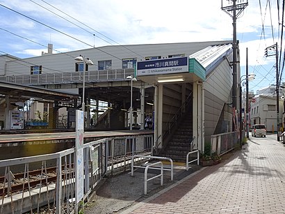
市川真間 Address: 真間銀座通り street in 市川市
Attractions near 市川真間
ファミリーマート,くすりの福太郎,ヘアーサロン 市川理容館,市川三本松郵便局,市川グランドホテル,八幡神社,墨田商事駐車場,ファミリーマート,洋服の青山,はんこ広場,市川,両総医院,北澤薬局,酒房 太郎,Honda,セブン-イレブン,市川歯科医院,タイムズ,市川市市川公民館,パン工房ルチアHow to get to popular attractions in 市川市 with public transit
農林水産省, 千代田区,江戸川北税務署, 江戸川区,信長, 台東区,おふろの王様 花小金井店, 小平市,Tokyo American Club (東京アメリカンクラブ), 港区,駐日パレスチナ常駐総代表部, 千代田区,新宿労働基準監督署, 新宿区,博多長浜らーめん田中商店, 足立区,オフロード印西 デコボコランド, 印西市,旧県立毛呂山高等学校, 毛呂山町,桜美林学園 矢部テニスコート, 町田市,千葉鑑定団, 松戸市,NTTコミュニケーションズ 東京第2データセンター(東京EAST), 江東区,根津美術館, 渋谷区,東京都立 松沢病院, 世田谷区,八潮車両基地, 品川区,亀戸天神, 墨田区,まんだらけ 渋谷店, 渋谷区,特許庁総合庁舎, 千代田区,テアトルアカデミー 東京校, 豊島区Get around Tokyo by public transit!
Traveling around Tokyo has never been so easy. See step by step directions as you travel to any attraction, street or major public transit station. View bus and train schedules, arrival times, service alerts and detailed routes on a map, so you know exactly how to get to anywhere in Tokyo.
When traveling to any destination around Tokyo use Moovit's Live Directions with Get Off Notifications to know exactly where and how far to walk, how long to wait for your line, and how many stops are left. Moovit will alert you when it's time to get off — no need to constantly re-check whether yours is the next stop.
Wondering how to use public transit in Tokyo or how to pay for public transit in Tokyo? Moovit public transit app can help you navigate your way with public transit easily, and at minimum cost. It includes public transit fees, ticket prices, and costs. Looking for a map of Tokyo public transit lines? Moovit public transit app shows all public transit maps in Tokyo with all Bus and Metro routes and stops on an interactive map.
Tokyo has 2 transit type(s), including: Bus and Metro, operated by several transit agencies, including JR East, Tokyo Metro, Toei, Tokyo Waterfront Area Rapid Transit, Transportation Bureau, City of Yokohama, Sagami Railway, 都営バス, Kokusai Kogyo Bus, Tokyu Bus, Keio Bus, Kanto Bus, Nishi Tokyo Bus, Sotetsu Bus