Directions to 平溪區 (New Taipei) with public transportation
The following transit lines have routes that pass near 平溪區
How to get to 平溪區 by bus?
Click on the bus route to see step by step directions with maps, line arrival times and updated time schedules.
Bus stops near 平溪區 in New Taipei
- 東勢格派出所 Dongshige, 13 min walk,
Train stations near 平溪區 in New Taipei
- 嶺腳Lingjiao, 61 min walk,
Bus lines to 平溪區 in New Taipei
- F822平溪, 東勢格派出所 Dongshige Station,
What are the closest stations to 平溪區?
The closest stations to 平溪區 are:
- 東勢格派出所 Dongshige is 980 meters away, 13 min walk.
- 嶺腳Lingjiao is 4716 meters away, 61 min walk.
Which bus lines stop near 平溪區?
These bus lines stop near 平溪區: 795往十分寮, 846舊站.
What’s the nearest bus stop to 平溪區 in New Taipei?
The nearest bus stop to 平溪區 in New Taipei is 東勢格派出所 Dongshige. It’s a 13 min walk away.
What time is the first bus to 平溪區 in New Taipei?
The F822平溪 is the first bus that goes to 平溪區 in New Taipei. It stops nearby at 6:57 AM.
What time is the last bus to 平溪區 in New Taipei?
The F822平溪 is the last bus that goes to 平溪區 in New Taipei. It stops nearby at 4:40 PM.
What time is the first train to 平溪區 in New Taipei?
The 區間 is the first train that goes to 平溪區 in New Taipei. It stops nearby at 5:17 AM.
What time is the last train to 平溪區 in New Taipei?
The 區間 is the last train that goes to 平溪區 in New Taipei. It stops nearby at 9:49 PM.
How much is the bus fare to 平溪區?
The bus fare to 平溪區 costs about $15.00 - $45.00.
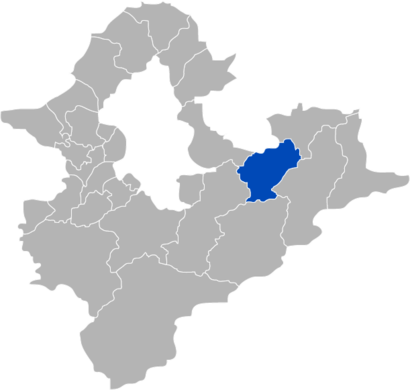
See 平溪區, New Taipei, on the map
Public Transit to 平溪區 in New Taipei
Wondering how to get to 平溪區 in New Taipei, Taiwan? Moovit helps you find the best way to get to 平溪區 with step-by-step directions from the nearest public transit station.
Moovit provides free maps and live directions to help you navigate through your city. View schedules, routes, timetables, and find out how long does it take to get to 平溪區 in real time.
Looking for the nearest stop or station to 平溪區? Check out this list of stops closest to your destination: 東勢格派出所 Dongshige; 嶺腳Lingjiao.
Bus: 795往十分寮, 846舊站, F822平溪.Train: 區間.
Want to see if there’s another route that gets you there at an earlier time? Moovit helps you find alternative routes or times. Get directions from and directions to 平溪區 easily from the Moovit App or Website.
We make riding to 平溪區 easy, which is why over 1.5 million users, including users in New Taipei, trust Moovit as the best app for public transit. You don’t need to download an individual bus app or train app, Moovit is your all-in-one transit app that helps you find the best bus time or train time available.
For information on prices of bus, costs and ride fares to 平溪區, please check the Moovit app.
Use the app to navigate to popular places including to the airport, hospital, stadium, grocery store, mall, coffee shop, school, college, and university.
平溪區 Address: 226台湾新北市平溪區226 street in New Taipei
Attractions near 平溪區
How to get to popular places in Taipei - New Taipei with public transit
Get around New Taipei by public transit!
Traveling around New Taipei has never been so easy. See step by step directions as you travel to any attraction, street or major public transit station. View bus and train schedules, arrival times, service alerts and detailed routes on a map, so you know exactly how to get to anywhere in New Taipei.
When traveling to any destination around New Taipei use Moovit's Live Directions with Get Off Notifications to know exactly where and how far to walk, how long to wait for your line, and how many stops are left. Moovit will alert you when it's time to get off — no need to constantly re-check whether yours is the next stop.
Wondering how to use public transit in New Taipei or how to pay for public transit in New Taipei? Moovit public transit app can help you navigate your way with public transit easily, and at minimum cost. It includes public transit fees, ticket prices, and costs. Looking for a map of New Taipei public transit lines? Moovit public transit app shows all public transit maps in New Taipei with all bus routes and stops on an interactive map.
New Taipei has 1 transit type(s), including: bus, operated by several transit agencies, including 臺北捷運 Taipei Metro, 新北捷運 New Taipei Metro, 桃園捷運Taoyuan Metro, 新北捷運 New Taipei Metro, 臺鐵 Taiwan Railway, 貓空纜車 Maokong Gondola, 首都客運 Capital Bus Co., Ltd., 欣欣客運 Shin-Shin Bus Co., Ltd., 大都會客運 Metropolitan Bus Co., Ltd., 大有巴士 Citiair Bus Co., Ltd., 東南客運 Southeast Bus Co., Ltd., 大南汽車 Danan Bus Co., Ltd., 指南客運 Zhinan Bus Co., Ltd., 光華巴士 Kuang-Hua Bus Co., Ltd. and 中興巴士 Zhongxing Bus