Directions to 明大前南 (世田谷区) with public transportation
The following transit lines have routes that pass near 明大前南
How to get to 明大前南 by bus?
Click on the bus route to see step by step directions with maps, line arrival times and updated time schedules.
Bus stations near 明大前南 in 世田谷区
- 下高井戸駅入口 Shimo-Takaido Sta. Ent., 13 min walk,
- 代田橋 Daitabashi, 18 min walk,
- 新代田駅前 Shin-Daita Sta., 18 min walk,
- 永福町 Eifukucho, 18 min walk,
- 永福町駅 Eifukucho Sta., 19 min walk,
Metro stations near 明大前南 in 世田谷区
- 方南町 Honancho, 30 min walk,
- 代々木上原 Yoyogi-Uehara, 39 min walk,
- 西新宿五丁目 Nishi-Shinjuku-Gochome, 56 min walk,
Bus lines to 明大前南 in 世田谷区
- さくら, 下高井戸駅入口 Shimo-Takaido Sta. Ent.,
- さくら-復, 浜田山駅南 Hamadayama Sta. South,
- 渋66, 杉並車庫前 Suginami Shako Mae(Toei Bus Suginami Office),
- 渋66-方, 方南八幡通り Honan Hachiman-Dori,
- 森91, 大森操車所,
- 新02, 新高円寺駅 Shin-Koenji Station,
- 高45, 高円寺駅南口 Koenji Station Minamiguchi,
- 宿33, 新宿駅西口 Shinjuku Sta. West,
- 新02, 新高円寺駅 Shin-Koenji Sta.,
- 高45, 高円寺駅南口 Koenji Sta. South,
What are the closest stations to 明大前南?
The closest stations to 明大前南 are:
- 下高井戸駅入口 Shimo-Takaido Sta. Ent. is 985 meters away, 13 min walk.
- 代田橋 Daitabashi is 1335 meters away, 18 min walk.
- 新代田駅前 Shin-Daita Sta. is 1381 meters away, 18 min walk.
- 永福町 Eifukucho is 1387 meters away, 18 min walk.
- 永福町駅 Eifukucho Sta. is 1406 meters away, 19 min walk.
- 方南町 Honancho is 2311 meters away, 30 min walk.
- 代々木上原 Yoyogi-Uehara is 2988 meters away, 39 min walk.
- 西新宿五丁目 Nishi-Shinjuku-Gochome is 4361 meters away, 56 min walk.
Which bus lines stop near 明大前南?
These bus lines stop near 明大前南: 宿91, 渋66.
What’s the nearest metro station to 明大前南 in 世田谷区?
The nearest metro station to 明大前南 in 世田谷区 is 方南町 Honancho. It’s a 30 min walk away.
What’s the nearest bus stop to 明大前南 in 世田谷区?
The nearest bus stop to 明大前南 in 世田谷区 is 下高井戸駅入口 Shimo-Takaido Sta. Ent.. It’s a 13 min walk away.
What time is the first bus to 明大前南 in 世田谷区?
The 渋66 is the first bus that goes to 明大前南 in 世田谷区. It stops nearby at 6:06 AM.
What time is the last bus to 明大前南 in 世田谷区?
The 宿91 is the last bus that goes to 明大前南 in 世田谷区. It stops nearby at 10:43 PM.
See 明大前南, 世田谷区, on the map
Public Transit to 明大前南 in 世田谷区
Wondering how to get to 明大前南 in 世田谷区, Japan? Moovit helps you find the best way to get to 明大前南 with step-by-step directions from the nearest public transit station.
Moovit provides free maps and live directions to help you navigate through your city. View schedules, routes, timetables, and find out how long does it take to get to 明大前南 in real time.
Looking for the nearest stop or station to 明大前南? Check out this list of stops closest to your destination: 下高井戸駅入口 Shimo-Takaido Sta. Ent.; 代田橋 Daitabashi; 新代田駅前 Shin-Daita Sta.; 永福町 Eifukucho; 永福町駅 Eifukucho Sta.; 方南町 Honancho; 代々木上原 Yoyogi-Uehara; 西新宿五丁目 Nishi-Shinjuku-Gochome.
Bus: 宿91, 渋66, さくら, さくら-復, 渋66-方, 森91.Metro: 丸ノ内線支線 MARUNOUCHI BRANCH LINE, 千代田線 CHIYODA LINE, 大江戸線 OEDO LINE.
Want to see if there’s another route that gets you there at an earlier time? Moovit helps you find alternative routes or times. Get directions from and directions to 明大前南 easily from the Moovit App or Website.
We make riding to 明大前南 easy, which is why over 1.5 million users, including users in 世田谷区, trust Moovit as the best app for public transit. You don’t need to download an individual bus app or train app, Moovit is your all-in-one transit app that helps you find the best bus time or train time available.
For information on prices of bus, costs and ride fares to 明大前南, please check the Moovit app.
Use the app to navigate to popular places including to the airport, hospital, stadium, grocery store, mall, coffee shop, school, college, and university.
明大前南 Address: すずらん通り street in 世田谷区
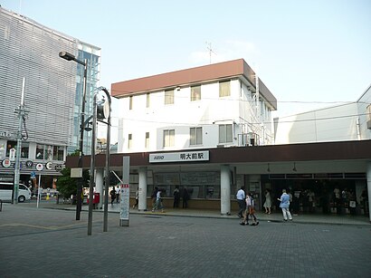
Meidaimae Station (明大前駅, Meidaimae-eki) is a railway station in Setagaya, Tokyo, Japan, operated by the private railway operator Keio Corporation.Wiki
Attractions near 明大前南
セイジョー 明大前店,しらわ整骨院,しらわ はり・きゅう整骨院,ローソン,栄新楼,京王線 明大前駅 (KO06),ファミール明大前,A Lot,中央口,K Shop,松屋,ローソン,Hokuo,まいばすけっと,三井のリパーク 松原一丁目,松屋,WIRED,トーア明大前マンション,春日亭,スワローチェーンHow to get to popular attractions in 世田谷区 with public transit
大宮花の丘農林公苑, さいたま市,カインズホーム 青梅インター店, 青梅市,ヤンマー東京ビル, 千代田区,緑成会横浜総合病院, 川崎市,天沼テニス公園, さいたま市,根津美術館, 渋谷区,鮫洲運転免許試験場前バス停, 品川区,滝が原運動場テニスコート, 八王子市,上川の里特別緑地保全地区, 八王子市,寺田病院, 足立区,特許庁総合庁舎, 千代田区,コストコホールセール川崎倉庫店 タイヤセンター, 川崎市,ラーメン二郎 八王子野猿街道店2, 八王子市,こみの整骨院, 杉並区,Sumitomo Fudosan Iidabashi First Tower (住友不動産飯田橋ファーストタワー), 文京区,大手町駅 C2b出口, 千代田区,舎人公園, 足立区,神奈川朝鮮中高級学校, 横浜市,江東区立砂町文化センター, 江東区,ゆう杉並, 杉並区Get around Tokyo by public transit!
Traveling around Tokyo has never been so easy. See step by step directions as you travel to any attraction, street or major public transit station. View bus and train schedules, arrival times, service alerts and detailed routes on a map, so you know exactly how to get to anywhere in Tokyo.
When traveling to any destination around Tokyo use Moovit's Live Directions with Get Off Notifications to know exactly where and how far to walk, how long to wait for your line, and how many stops are left. Moovit will alert you when it's time to get off — no need to constantly re-check whether yours is the next stop.
Wondering how to use public transit in Tokyo or how to pay for public transit in Tokyo? Moovit public transit app can help you navigate your way with public transit easily, and at minimum cost. It includes public transit fees, ticket prices, and costs. Looking for a map of Tokyo public transit lines? Moovit public transit app shows all public transit maps in Tokyo with all Bus and Metro routes and stops on an interactive map.
Tokyo has 2 transit type(s), including: Bus and Metro, operated by several transit agencies, including JR East, Tokyo Metro, Toei, Tokyo Waterfront Area Rapid Transit, Transportation Bureau, City of Yokohama, Sagami Railway, 都営バス, Kokusai Kogyo Bus, Tokyu Bus, Keio Bus, Kanto Bus, Nishi Tokyo Bus, Sotetsu Bus