The Most Popular Urban Mobility App in 渋谷区.
All local mobility options in one app
The following transit lines have routes that pass near 有栖川宮記念公園
Click on the bus route to see step by step directions with maps, line arrival times and updated time schedules.
Click on the metro route to see step by step directions with maps, line arrival times and updated time schedules.
The closest stations to 有栖川宮記念公園 are:
These bus lines stop near 有栖川宮記念公園: 品97, 橋86, 都06, 黒77
These metro lines stop near 有栖川宮記念公園: 日比谷線 HIBIYA LINE
The nearest metro station to 有栖川宮記念公園 in 渋谷区 is 広尾 Hiro-O. It’s a 6 min walk away.
Wondering how to get to 有栖川宮記念公園 in 渋谷区, Japan? Moovit helps you find the best way to get to 有栖川宮記念公園 with step-by-step directions from the nearest public transit station.
Moovit provides free maps and live directions to help you navigate through your city. View schedules, routes, timetables, and find out how long does it take to get to 有栖川宮記念公園 in real time.
Looking for the nearest stop or station to 有栖川宮記念公園? Check out this list of stops closest to your destination: 広尾 Hiro-O; 麻布十番 Azabu-Juban; 白金高輪 Shirokane-Takanawa; 乃木坂 Nogizaka.
Bus:Metro:
Want to see if there’s another route that gets you there at an earlier time? Moovit helps you find alternative routes or times. Get directions from and directions to 有栖川宮記念公園 easily from the Moovit App or Website.
We make riding to 有栖川宮記念公園 easy, which is why over 1.5 million users, including users in 渋谷区, trust Moovit as the best app for public transit. You don’t need to download an individual bus app or train app, Moovit is your all-in-one transit app that helps you find the best bus time or train time available.
For information on prices of metro and bus, costs and ride fares to 有栖川宮記念公園, please check the Moovit app.
Use the app to navigate to popular places including to the airport, hospital, stadium, grocery store, mall, coffee shop, school, college, and university.
Location: 渋谷区, Tokyo
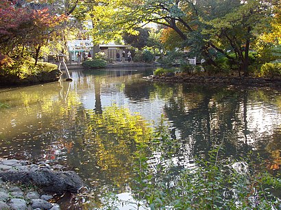
Arisugawa-no-miya Memorial Park (有栖川宮記念公園, Arisugawa Miya Kinen Kōen) is a park located in Minami-Azabu, Minato, Tokyo, Japan. It covers an area of 67,131 square metres.Wiki
Traveling around 渋谷区 has never been so easy. See step by step directions as you travel to any attraction, street or major public transit station. View bus and train schedules, arrival times, service alerts and detailed routes on a map, so you know exactly how to get to anywhere in 渋谷区.
When traveling to any destination around 渋谷区 use Moovit's Live Directions with Get Off Notifications to know exactly where and how far to walk, how long to wait for your line, and how many stops are left. Moovit will alert you when it's time to get off — no need to constantly re-check whether yours is the next stop.
Wondering how to use public transit in 渋谷区 or how to pay for public transit in 渋谷区? Moovit public transit app can help you navigate your way with public transit easily, and at minimum cost. It includes public transit fees, ticket prices, and costs. Looking for a map of 渋谷区 public transit lines? Moovit public transit app shows all public transit maps in 渋谷区 with all metro or bus routes and stops on an interactive map.
渋谷区 has 2 transit type(s), including: metro or bus, operated by several transit agencies, including JR East, Tokyo Metro, Toei, Tokyo Waterfront Area Rapid Transit, Transportation Bureau, City of Yokohama, Sagami Railway, 都営バス, Kokusai Kogyo Bus, Tokyu Bus, Keio Bus, Seibu Bus, Kanto Bus, Nishi Tokyo Bus, Sotetsu Bus and Transportation Bureau, City of Yokohama