Directions to 松山高中 station (信義區) with public transit
The following transit lines have routes that pass near 松山高中
How to get to 松山高中 station by bus?
Click on the bus route to see step by step directions with maps, line arrival times and updated time schedules.
How to get to 松山高中 station by train?
Click on the train route to see step by step directions with maps, line arrival times and updated time schedules.
How to get to 松山高中 station by metro?
Click on the metro route to see step by step directions with maps, line arrival times and updated time schedules.
Bus stops near 松山高中 in 信義區
- 聯合報 United Daily News, 4 min walk,
- 松山高中(基隆路) Songshan High School(Keelung Rd.), 5 min walk,
- 松山高中(基隆路) Songshan High School (Keelung Rd.), 5 min walk,
- 市府轉運站 Taipei City Hall Bus Station, 6 min walk,
Metro stations near 松山高中 in 信義區
- 市政府 Taipei City Hall, 6 min walk,
- 台北101/世貿 Taipei 101/World Trade Center, 16 min walk,
- 南京三民 Nanjing Sanmin, 19 min walk,
Bus lines to 松山高中 station in 信義區
- 202, 捷運國父紀念館站(忠孝) Mrt Sun Yat-Sen Memorial Hall Sta. (Zhongxiao),
- 212, 國興路口 Guoxing Rd. Entrance,
- 212夜, 青年路派出所 Qingnian Rd. Police Substation,
- 212直, 青年路派出所 Qingnian Rd. Police Substation,
- 232快, 蘆洲總站 Luzhou Bus Terminal,
- 240直, 國父紀念館 Dr. Sun Yat-Sen Memorial Hall,
- 270, 捷運西門站 Mrt Ximen Sta.,
- 299(三重), 三重客運新莊站 Xinzhuang Stop,
- 600半(北車發), 臺北車站(忠孝) Taipei Main Sta. (Zhongxiao),
- 仁愛幹線(板橋發車), 五福新村 Wufu New Village,
- 忠孝幹線, 蘆洲總站 Luzhou Bus Terminal,
- 919, 懷生國小 Huaisheng Elementary School,
- 1800, 基隆轉運站 Keelung Transit Station,
- 1814, 臺北車站(東三門) Taipei Station (East Gate),
- 1815, 臺北車站(東三門) Taipei Station (East Gate),
- 1815A, 臺北車站(東三門) Taipei Station (East Gate),
- 1815C, 金青中心 Jinshan Youth Activity Centre,
- 1815D, 萬里區公所 Wanli District Office,
- 2088, 市府轉運站 Taipei City Hall Bus Station,
- 2088A, 海科館 National Museum Of Marine Science And Technology,
What are the closest stations to 松山高中?
The closest stations to 松山高中 are:
- 聯合報 United Daily News is 271 meters away, 4 min walk.
- 松山高中(基隆路) Songshan High School(Keelung Rd.) is 326 meters away, 5 min walk.
- 松山高中(基隆路) Songshan High School (Keelung Rd.) is 326 meters away, 5 min walk.
- 市府轉運站 Taipei City Hall Bus Station is 381 meters away, 6 min walk.
- 市政府 Taipei City Hall is 395 meters away, 6 min walk.
- 台北101/世貿 Taipei 101/World Trade Center is 1181 meters away, 16 min walk.
- 南京三民 Nanjing Sanmin is 1450 meters away, 19 min walk.
Which bus lines stop near 松山高中?
These bus lines stop near 松山高中: 257路, 299(三重), 311路, 912, 919, 基隆路幹線, 棕7.
Which train lines stop near 松山高中?
These train lines stop near 松山高中: 區間, 區間快.
Which metro line stops near 松山高中?
板南線 (南港展覽館 Taipei Nangang Exhibition Center)
What’s the nearest metro station to 松山高中 in 信義區?
The nearest metro station to 松山高中 in 信義區 is 市政府 Taipei City Hall. It’s a 6 min walk away.
What’s the nearest bus stop to 松山高中 in 信義區?
The nearest bus stop to 松山高中 in 信義區 is 聯合報 United Daily News. It’s a 4 min walk away.
What time is the first metro to 松山高中 in 信義區?
The 淡水信義線 is the first metro that goes to 松山高中 in 信義區. It stops nearby at 6:02 AM.
What time is the last metro to 松山高中 in 信義區?
The 淡水信義線 is the last metro that goes to 松山高中 in 信義區. It stops nearby at 12:51 AM.
What time is the first bus to 松山高中 in 信義區?
The 299(三重) is the first bus that goes to 松山高中 in 信義區. It stops nearby at 5:07 AM.
What time is the last bus to 松山高中 in 信義區?
The 212夜 is the last bus that goes to 松山高中 in 信義區. It stops nearby at 12:38 AM.
See 松山高中, 信義區, on the map
Public Transit to 松山高中 in 信義區
Wondering how to get to 松山高中 in 信義區, Taiwan? Moovit helps you find the best way to get to 松山高中 with step-by-step directions from the nearest public transit station.
Moovit provides free maps and live directions to help you navigate through your city. View schedules, routes, timetables, and find out how long does it take to get to 松山高中 in real time.
Looking for the nearest stop or station to 松山高中? Check out this list of stops closest to your destination: 聯合報 United Daily News; 松山高中(基隆路) Songshan High School(Keelung Rd.); 松山高中(基隆路) Songshan High School (Keelung Rd.); 市府轉運站 Taipei City Hall Bus Station; 市政府 Taipei City Hall; 台北101/世貿 Taipei 101/World Trade Center; 南京三民 Nanjing Sanmin.
Bus: 257路, 299(三重), 311路, 912, 919, 基隆路幹線, 棕7, 202, 212, 212夜, 212直, 232快, 1800, 1814, 1815, 1815A, 1815C.Train: 區間, 區間快.Metro: 板南線, 淡水信義線, 松山新店線.
Want to see if there’s another route that gets you there at an earlier time? Moovit helps you find alternative routes or times. Get directions from and directions to 松山高中 easily from the Moovit App or Website.
We make riding to 松山高中 easy, which is why over 1.5 million users, including users in 信義區, trust Moovit as the best app for public transit. You don’t need to download an individual bus app or train app, Moovit is your all-in-one transit app that helps you find the best bus time or train time available.
For information on prices of bus, metro and train, costs and ride fares to 松山高中, please check the Moovit app.
Use the app to navigate to popular places including to the airport, hospital, stadium, grocery store, mall, coffee shop, school, college, and university.
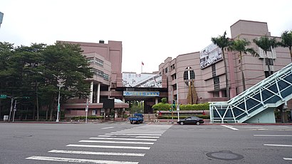
松山高中 Address: 忠孝東路四段559巷 street in 信義區
Directions to 松山高中 station (信義區) with public transit
How to get to popular places in Taipei - New Taipei with public transit
Get around 信義區 by public transit!
Traveling around 信義區 has never been so easy. See step by step directions as you travel to any attraction, street or major public transit station. View bus and train schedules, arrival times, service alerts and detailed routes on a map, so you know exactly how to get to anywhere in 信義區.
When traveling to any destination around 信義區 use Moovit's Live Directions with Get Off Notifications to know exactly where and how far to walk, how long to wait for your line, and how many stops are left. Moovit will alert you when it's time to get off — no need to constantly re-check whether yours is the next stop.
Wondering how to use public transit in 信義區 or how to pay for public transit in 信義區? Moovit public transit app can help you navigate your way with public transit easily, and at minimum cost. It includes public transit fees, ticket prices, and costs. Looking for a map of 信義區 public transit lines? Moovit public transit app shows all public transit maps in 信義區 with all Bus, Train, Metro, Light Rail and Gondola routes and stops on an interactive map.
Taipei - New Taipei has 5 transit type(s), including: Bus, Train, Metro, Light Rail and Gondola, operated by several transit agencies, including 桃園捷運Taoyuan Metro, 臺鐵 Taiwan Railway, 臺北捷運 Taipei Metro, 新北捷運 New Taipei Metro, 臺北客運 Taipei Bus Co., Ltd., 首都客運 Capital Bus Co., Ltd., 新店客運 Sindian Bus Co., Ltd., 三重客運 San Chung Bus Co., Ltd., 欣欣客運 Shin-Shin Bus Co., Ltd., 大都會客運 Metropolitan Bus Co., Ltd., 大有巴士 Citiair Bus Co., Ltd., 東南客運 Southeast Bus Co., Ltd., 大南汽車 Danan Bus Co., Ltd., 指南客運 Zhinan Bus Co., Ltd. and 淡水客運 Tamshui Bus Co., Ltd.