Directions to 沥滘总站 (华洲街道) with public transportation
The following transit lines have routes that pass near 沥滘总站
How to get to 沥滘总站 by bus?
Click on the bus route to see step by step directions with maps, line arrival times and updated time schedules.
How to get to 沥滘总站 by metro?
Click on the metro route to see step by step directions with maps, line arrival times and updated time schedules.
Bus stops near 沥滘总站 in 华洲街道
- 沥滘总站(珠江御景湾), 2 min walk,
- 大沙村东, 6 min walk,
Metro station near 沥滘总站 in 华洲街道
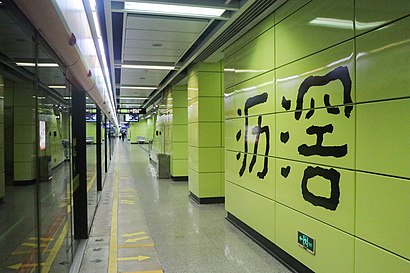
- 沥滘 Lijiao, 34 min walk,
Bus lines to 沥滘总站 in 华洲街道
- 180路, 解放北路(应元路口)总站 Jiefang Beilu (Yingyuan Lu Entrance) Bus Terminal,
- 195路, 广州火车东站总站,
- 夜34路, 沥滘总站(珠江御景湾),
- 35路, 文德路总站,
- 468路, 滨江东路总站,
- 565路, 大学城广工总站,
- 86路, 一德西总站,
- 夜103路, 穗盐路(雍景豪园)总站,
- 夜55路, 广州火车站总站,
- 广565路, 大学城总站(广工),
What are the closest stations to 沥滘总站?
The closest stations to 沥滘总站 are:
- 沥滘总站(珠江御景湾) is 134 meters away, 2 min walk.
- 大沙村东 is 431 meters away, 6 min walk.
- 沥滘 Lijiao is 2644 meters away, 34 min walk.
Which bus lines stop near 沥滘总站?
These bus lines stop near 沥滘总站: 180路, 195路, 468路.
Which metro line stops near 沥滘总站?
3号线 LINE 3 (往番禺广场 To Panyu Square)
What’s the nearest bus station to 沥滘总站 in 华洲街道?
The nearest bus station to 沥滘总站 in 华洲街道 is 沥滘总站(珠江御景湾). It’s a 2 min walk away.
What time is the first metro to 沥滘总站 in 华洲街道?
The 3号线 LINE 3 is the first metro that goes to 沥滘总站 in 华洲街道. It stops nearby at 6:05 AM.
What time is the last metro to 沥滘总站 in 华洲街道?
The 3号线 LINE 3 is the last metro that goes to 沥滘总站 in 华洲街道. It stops nearby at 11:47 PM.
What time is the first bus to 沥滘总站 in 华洲街道?
The 夜34路 is the first bus that goes to 沥滘总站 in 华洲街道. It stops nearby at 4:00 AM.
What time is the last bus to 沥滘总站 in 华洲街道?
The 夜34路 is the last bus that goes to 沥滘总站 in 华洲街道. It stops nearby at 2:59 AM.
See 沥滘总站, 华洲街道, on the map
Public Transit to 沥滘总站 in 华洲街道
Wondering how to get to 沥滘总站 in 华洲街道? Moovit helps you find the best way to get to 沥滘总站 with step-by-step directions from the nearest public transit station.
Moovit provides free maps and live directions to help you navigate through your city. View schedules, routes, timetables, and find out how long does it take to get to 沥滘总站 in real time.
Looking for the nearest stop or station to 沥滘总站? Check out this list of stops closest to your destination: 沥滘总站(珠江御景湾); 大沙村东; 沥滘 Lijiao.
Bus: 180路, 195路, 468路, 夜34路, 35路, 565路, 86路, 夜103路.Metro: 3号线 LINE 3.
Want to see if there’s another route that gets you there at an earlier time? Moovit helps you find alternative routes or times. Get directions from and directions to 沥滘总站 easily from the Moovit App or Website.
We make riding to 沥滘总站 easy, which is why over 1.5 million users, including users in 华洲街道, trust Moovit as the best app for public transit. You don’t need to download an individual bus app or train app, Moovit is your all-in-one transit app that helps you find the best bus time or train time available.
For information on prices of bus and metro, costs and ride fares to 沥滘总站, please check the Moovit app.
Use the app to navigate to popular places including to the airport, hospital, stadium, grocery store, mall, coffee shop, school, college, and university.
沥滘总站 Address: 广东省广州市海珠区南洲路142号 street in 华洲街道
Places Near 沥滘总站 (华洲街道)
How to get to popular places in Guangzhou with public transit
Get around 华洲街道 by public transit!
Traveling around 华洲街道 has never been so easy. See step by step directions as you travel to any attraction, street or major public transit station. View bus and train schedules, arrival times, service alerts and detailed routes on a map, so you know exactly how to get to anywhere in 华洲街道.
When traveling to any destination around 华洲街道 use Moovit's Live Directions with Get Off Notifications to know exactly where and how far to walk, how long to wait for your line, and how many stops are left. Moovit will alert you when it's time to get off — no need to constantly re-check whether yours is the next stop.
Wondering how to use public transit in 华洲街道 or how to pay for public transit in 华洲街道? Moovit public transit app can help you navigate your way with public transit easily, and at minimum cost. It includes public transit fees, ticket prices, and costs. Looking for a map of 华洲街道 public transit lines? Moovit public transit app shows all public transit maps in 华洲街道 with all Bus, Metro, Tram and Ferry routes and stops on an interactive map.
Guangzhou has 4 transit type(s), including: Bus, Metro, Tram and Ferry, operated by several transit agencies, including 广州地铁, BRT, 广州公交, 广州客轮公司, 广州有轨电车有限责任公司 and 佛山公交