Directions to 流山セントラルパーク (Tokyo) with public transportation
The following transit lines have routes that pass near 流山セントラルパーク
How to get to 流山セントラルパーク by metro?
Click on the metro route to see step by step directions with maps, line arrival times and updated time schedules.
Metro stations near 流山セントラルパーク in Tokyo
- 南柏 Minami-Kashiwa, 33 min walk,
- 三郷 Misato, 45 min walk,
What are the closest stations to 流山セントラルパーク?
The closest stations to 流山セントラルパーク are:
- 南柏 Minami-Kashiwa is 2520 meters away, 33 min walk.
- 三郷 Misato is 3515 meters away, 45 min walk.
Which metro line stops near 流山セントラルパーク?
武蔵野線 MUSASHINO LINE
What time is the first metro to 流山セントラルパーク in Tokyo?
The 常磐線各駅停車 JOBAN LOCAL LINE is the first metro that goes to 流山セントラルパーク in Tokyo. It stops nearby at 4:38 AM.
What time is the last metro to 流山セントラルパーク in Tokyo?
The 常磐線各駅停車 JOBAN LOCAL LINE is the last metro that goes to 流山セントラルパーク in Tokyo. It stops nearby at 12:47 AM.
See 流山セントラルパーク, Tokyo, on the map
Public Transit to 流山セントラルパーク in Tokyo
Wondering how to get to 流山セントラルパーク in Tokyo, Japan? Moovit helps you find the best way to get to 流山セントラルパーク with step-by-step directions from the nearest public transit station.
Moovit provides free maps and live directions to help you navigate through your city. View schedules, routes, timetables, and find out how long does it take to get to 流山セントラルパーク in real time.
Looking for the nearest stop or station to 流山セントラルパーク? Check out this list of stops closest to your destination: 南柏 Minami-Kashiwa; 三郷 Misato.
Metro: 武蔵野線 MUSASHINO LINE, 常磐線各駅停車 JOBAN LOCAL LINE.
Want to see if there’s another route that gets you there at an earlier time? Moovit helps you find alternative routes or times. Get directions from and directions to 流山セントラルパーク easily from the Moovit App or Website.
We make riding to 流山セントラルパーク easy, which is why over 1.5 million users, including users in Tokyo, trust Moovit as the best app for public transit. You don’t need to download an individual bus app or train app, Moovit is your all-in-one transit app that helps you find the best bus time or train time available.
For information on prices of metro and bus, costs and ride fares to 流山セントラルパーク, please check the Moovit app.
Use the app to navigate to popular places including to the airport, hospital, stadium, grocery store, mall, coffee shop, school, college, and university.
Location: Tokyo
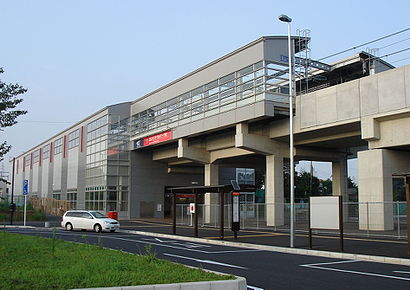
Nagareyama-centralpark Station (流山セントラルパーク駅, Nagareyama-sentorarupāku-eki) is a passenger railway station in the city of Nagareyama, Chiba Prefecture, Japan. Its station number is TX11.Wiki
Attractions near 流山セントラルパーク
流山セントラルパーク,暁星国際流山小学校,ナチュラルベーカリーライフ 流山セントラルパーク店,壁打ち場,後平井,大字加,平和台9号公園,平和台5号公園,平和台8号公園,流山市総合運動公園,宮田モータース,平和台7号公園,平和台1号公園,平和台五丁目,平和台四丁目,加二丁目,西平井4号公園,平和台6号公園,思井,丘の上のサフラン 西平井店How to get to popular attractions in Tokyo with public transit
セント メリーズ インターナショナル スクール, 世田谷区,秩父宮ラグビー場, 渋谷区,そよ風松島荘, 江戸川区,Shibuya Tax Office (渋谷税務署), 渋谷区,埼玉県越谷合同庁舎, 越谷市,Hardy Barracks Heliport, 港区,埼玉県立 狭山工業高等学校, 狭山市,国立新美術館, 港区,ANA InterContinental Tokyo, 港区,UNIQLO CITY TOKYO, 江東区,川崎堀之内No.1ソープClub Ageha~あげは~, 川崎市,日本年金機構 大宮年金事務所, さいたま市,縫いもん屋 かめ蔵, 世田谷区,竹の塚警察署, 足立区,横浜市立横浜サイエンスフロンティア高等学校, 横浜市,サミットストア 横浜岡野, 横浜市,ジョイフル本田 瑞穂店, 瑞穂町,埼玉県立 和光国際高等学校, 和光市,円覚寺, 横浜市,青森大学 東京キャンパス, 江戸川区Get around Tokyo by public transit!
Traveling around Tokyo has never been so easy. See step by step directions as you travel to any attraction, street or major public transit station. View bus and train schedules, arrival times, service alerts and detailed routes on a map, so you know exactly how to get to anywhere in Tokyo.
When traveling to any destination around Tokyo use Moovit's Live Directions with Get Off Notifications to know exactly where and how far to walk, how long to wait for your line, and how many stops are left. Moovit will alert you when it's time to get off — no need to constantly re-check whether yours is the next stop.
Wondering how to use public transit in Tokyo or how to pay for public transit in Tokyo? Moovit public transit app can help you navigate your way with public transit easily, and at minimum cost. It includes public transit fees, ticket prices, and costs. Looking for a map of Tokyo public transit lines? Moovit public transit app shows all public transit maps in Tokyo with all Bus and Metro routes and stops on an interactive map.
Tokyo has 2 transit type(s), including: Bus and Metro, operated by several transit agencies, including JR East, Tokyo Metro, Toei, Tokyo Waterfront Area Rapid Transit, Transportation Bureau, City of Yokohama, Sagami Railway, 都営バス, Kokusai Kogyo Bus, Tokyu Bus, Keio Bus, Kanto Bus, Nishi Tokyo Bus, Sotetsu Bus