Directions to 淘金街 (华乐街道) with public transportation
The following transit lines have routes that pass near 淘金街
How to get to 淘金街 by bus?
Click on the bus route to see step by step directions with maps, line arrival times and updated time schedules.
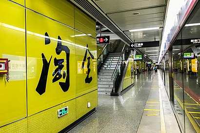
How to get to 淘金街 by metro?
Click on the metro route to see step by step directions with maps, line arrival times and updated time schedules.
Bus stops near 淘金街 in 华乐街道
- 淘金街, 2 min walk,
- 淘金北路, 3 min walk,
- 白云宾馆, 8 min walk,
- 省第二中医院, 9 min walk,
Metro stations near 淘金街 in 华乐街道
- 小北 Xiaobei, 8 min walk,
- 区庄 Ouzhuang, 22 min walk,
- 烈士陵园 Martyrs' Park, 24 min walk,
Bus lines to 淘金街 in 华乐街道
- 482路, 广东电视台,
- 483路环线, 淘金北路,
- 10路, 昌岗路总站,
- 245路, 黄石东总站(白云尚城),
- 247路, 恒福路总站,
- 546路, 柯子岭总站(河田路),
- 夜4路, 海珠客运站总站,
- 夜52路, 外语学院(白云山西门),
- 高峰快线67路, 南洲花园总站,
- 191路, 华景新城总站(华景北路) - 市红会医院北门总站,
- 301A路, 流花车站总站 - 广州南站总站,
- 301路, 番禺市桥汽车站总站 - 流花车站总站,
- 30路, 广州火车站总站 - 龙洞总站(广东金融学院),
- 550路, 东圃珠村总站 - 广州火车站总站,
- 862B路, 沙太路北总站 - 广州火车站总站,
- 862路, 广州火车站总站 - 南湖总站(大河马水上世界),
- B10路, 华观路(岑村火炉山森林公园) - 广州火车站总站,
- B2A路, 汇彩路总站 - 广州火车站总站,
- B2路, 东圃总站 - 广州火车站总站,
- 节假日专线2路, 大夫山公园总站 - 站前路总站,
What are the closest stations to 淘金街?
The closest stations to 淘金街 are:
- 淘金街 is 101 meters away, 2 min walk.
- 淘金北路 is 193 meters away, 3 min walk.
- 小北 Xiaobei is 573 meters away, 8 min walk.
- 白云宾馆 is 626 meters away, 8 min walk.
- 省第二中医院 is 696 meters away, 9 min walk.
- 区庄 Ouzhuang is 1706 meters away, 22 min walk.
- 烈士陵园 Martyrs' Park is 1817 meters away, 24 min walk.
Which bus lines stop near 淘金街?
These bus lines stop near 淘金街: 10路, 245路, 546路, 高峰快线13路, 高峰快线31路.
Which metro line stops near 淘金街?
5号线 LINE 5 (往文冲 To Wenchong)
What’s the nearest metro station to 淘金街 in 华乐街道?
The nearest metro station to 淘金街 in 华乐街道 is 小北 Xiaobei. It’s a 8 min walk away.
What’s the nearest bus station to 淘金街 in 华乐街道?
The nearest bus station to 淘金街 in 华乐街道 is 淘金街. It’s a 2 min walk away.
What time is the first metro to 淘金街 in 华乐街道?
The 5号线 LINE 5 is the first metro that goes to 淘金街 in 华乐街道. It stops nearby at 6:10 AM.
What time is the last metro to 淘金街 in 华乐街道?
The 5号线 LINE 5 is the last metro that goes to 淘金街 in 华乐街道. It stops nearby at 11:48 PM.
What time is the first bus to 淘金街 in 华乐街道?
The 夜5路 is the first bus that goes to 淘金街 in 华乐街道. It stops nearby at 5:22 AM.
What time is the last bus to 淘金街 in 华乐街道?
The 夜25路 is the last bus that goes to 淘金街 in 华乐街道. It stops nearby at 2:24 AM.
See 淘金街, 华乐街道, on the map
Public Transit to 淘金街 in 华乐街道
How to get to 淘金街 in 华乐街道, China?
It’s easy with Moovit. Type in your street address and Moovit’s route finder will locate the fastest way to get you there! Not sure where to get off on the street? Download the Moovit App to find live directions (including where to get off on 淘金街), see timetables and get the estimated arrival times for your favorite bus or metro lines.
Looking for the nearest stop or station to 淘金街? Check out this list of closest stops available to your destination: 淘金街; 淘金北路; 小北 Xiaobei; 白云宾馆; 省第二中医院; 区庄 Ouzhuang; 烈士陵园 Martyrs' Park.
Bus: 10路, 245路, 546路, 高峰快线13路, 高峰快线31路, 482路, 483路环线, 247路, 夜4路.Metro: 5号线 LINE 5, 6号线 LINE 6, 1号线 LINE 1.
Download the Moovit App to see the current schedule and routes available for 华乐街道. No need to install a special bus app to check the bus time or a train app to get train time. Moovit is the only all-in-one transit app that helps you get where you need to go.
We make riding on public transit to 淘金街 easy, which is why over 1.5 million users, including users in 华乐街道 trust Moovit as the best app for public transit.
Use the app to navigate to popular places including to the airport, hospital, stadium, grocery store, mall, coffee shop, school, college, and university.
Location: 华乐街道, Guangzhou
Get around 华乐街道 by public transit!
Traveling around 华乐街道 has never been so easy. See step by step directions as you travel to any attraction, street or major public transit station. View bus and train schedules, arrival times, service alerts and detailed routes on a map, so you know exactly how to get to anywhere in 华乐街道.
When traveling to any destination around 华乐街道 use Moovit's Live Directions with Get Off Notifications to know exactly where and how far to walk, how long to wait for your line, and how many stops are left. Moovit will alert you when it's time to get off — no need to constantly re-check whether yours is the next stop.
Wondering how to use public transit in 华乐街道 or how to pay for public transit in 华乐街道? Moovit public transit app can help you navigate your way with public transit easily, and at minimum cost. It includes public transit fees, ticket prices, and costs. Looking for a map of 华乐街道 public transit lines? Moovit public transit app shows all public transit maps in 华乐街道 with all Bus, Metro, Tram and Ferry routes and stops on an interactive map.
Guangzhou has 4 transit type(s), including: Bus, Metro, Tram and Ferry, operated by several transit agencies, including 广州地铁, BRT, 广州公交, 广州客轮公司, 广州有轨电车有限责任公司 and 佛山公交