See 目黒区 on the map
Directions to 目黒区 with public transportation
The following transit lines have routes that pass near 目黒区
 Bus:
Bus: - Metro:
How to get to 目黒区 by bus?
Click on the bus route to see step by step directions with maps, line arrival times and updated time schedules.
How to get to 目黒区 by metro?
Click on the metro route to see step by step directions with maps, line arrival times and updated time schedules.
Bus stations near 目黒区
- 目黒区総合庁舎前,2 min walk,
- 正覚寺前,5 min walk,
- 田道小学校入口,12 min walk,
Metro stations near 目黒区
- 中目黒 Naka-Meguro,28 min walk,
- 恵比寿 Ebisu,42 min walk,
- 目黒 Meguro,42 min walk,
- 渋谷 Shibuya,51 min walk,
Bus lines to 目黒区
- 恵32,中町五丁目,
- 渋71,渋谷駅東口,
- 渋41,清水,
- 黒09,下馬営業所,
- 渋72,五反田駅,
What are the closest stations to 目黒区?
The closest stations to 目黒区 are:
- 目黒区総合庁舎前 is 114 meters away, 2 min walk.
- 正覚寺前 is 313 meters away, 5 min walk.
- 田道小学校入口 is 864 meters away, 12 min walk.
- 中目黒 Naka-Meguro is 2150 meters away, 28 min walk.
- 恵比寿 Ebisu is 3194 meters away, 42 min walk.
- 目黒 Meguro is 3255 meters away, 42 min walk.
- 渋谷 Shibuya is 3963 meters away, 51 min walk.
Which bus lines stop near 目黒区?
These bus lines stop near 目黒区: 恵32, 渋41, 渋71.
Which metro line stops near 目黒区?
日比谷線 HIBIYA LINE
What’s the nearest metro station to 目黒区?
The nearest metro station to 目黒区 is 中目黒 Naka-Meguro. It’s a 28 min walk away.
What’s the nearest bus stop to 目黒区?
The nearest bus stop to 目黒区 is 目黒区総合庁舎前. It’s a 2 min walk away.
What time is the first metro to 目黒区?
The 山手線 YAMANOTE LINE is the first metro that goes to 目黒区. It stops nearby at 4:32 AM.
What time is the last metro to 目黒区?
The 山手線 YAMANOTE LINE is the last metro that goes to 目黒区. It stops nearby at 12:53 AM.
What time is the first bus to 目黒区?
The 渋41 is the first bus that goes to 目黒区. It stops nearby at 6:14 AM.
What time is the last bus to 目黒区?
The 渋41 is the last bus that goes to 目黒区. It stops nearby at 11:16 PM.
See 目黒区 on the map
Public Transportation to 目黒区
Wondering how to get to 目黒区, Japan? Moovit helps you find the best way to get to 目黒区 with step-by-step directions from the nearest public transit station.
Moovit provides free maps and live directions to help you navigate through your city. View schedules, routes, timetables, and find out how long does it take to get to 目黒区 in real time.
Looking for the nearest stop or station to 目黒区? Check out this list of stops closest to your destination: 目黒区総合庁舎前; 正覚寺前; 田道小学校入口; 中目黒 Naka-Meguro; 恵比寿 Ebisu; 目黒 Meguro; 渋谷 Shibuya.
Bus:Metro:
Want to see if there’s another route that gets you there at an earlier time? Moovit helps you find alternative routes or times. Get directions from and directions to 目黒区 easily from the Moovit App or Website.
We make riding to 目黒区 easy, which is why over 1.5 million users, including users in 目黒区, trust Moovit as the best app for public transit. You don’t need to download an individual bus app or train app, Moovit is your all-in-one transit app that helps you find the best bus time or train time available.
For information on prices of metro and bus, costs and ride fares to 目黒区, please check the Moovit app.
Use the app to navigate to popular places including to the airport, hospital, stadium, grocery store, mall, coffee shop, school, college, and university.
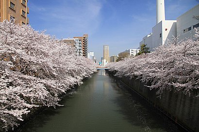
Location: 目黒区, Tokyo
Attractions near 目黒区
目黒区,目黒区役所,ポプラ,J1-01.目黒区総合庁舎 / Meguro City Office Complex,中目黒しぜんとなかよし公園,No Smoking Bar Musicman,Ballon,Ballon,祐天寺変電所,正覚寺,目黒信用金庫 本店,上目黒二丁目,Hao Cha 好茶,目黒区立 中目黒小学校,中目黒駅前郵便局,第二上目黒保育園,niD,NANCY still waiting,うしごろバンビーナ・カルボーネ 中目黒店,恵泉バプテスト教会How to get to popular attractions in 目黒区 with public transit
明治神社の獅子舞, 松戸市,Centurion Hotel Grand Akasakamitsuke Station Tokyo, 新宿区,Hotel Allamanda Aoyama Tokyo, 渋谷区,Kasumigaseki, 千代田区,Shin Kiba Station, 江東区,並木元町公園, 川口市,Jamco, 成田市,一平橋, 松戸市,Kitakoiwa, 葛飾区,相原駅東口バイク駐車場, 町田市,三郷市立彦成小学校,叡知と慈愛の女神像, 新宿区,Haneda Excel Hotel Tokyu Tokyo, 大田区,Nezu Shrine, 文京区,Hikarigaoka Station, 練馬区,Kamata Tokyo, 大田区,蓮華寺 市川道場, 鎌ヶ谷市,ラーメン屋コカトリス, 横浜市,Tokyo International Forum, 千代田区,アイリス整骨院, 葛飾区Get around 目黒区 by public transit!
Traveling around 目黒区 has never been so easy. See step by step directions as you travel to any attraction, street or major public transit station. View bus and train schedules, arrival times, service alerts and detailed routes on a map, so you know exactly how to get to anywhere in 目黒区.
When traveling to any destination around 目黒区 use Moovit's Live Directions with Get Off Notifications to know exactly where and how far to walk, how long to wait for your line, and how many stops are left. Moovit will alert you when it's time to get off — no need to constantly re-check whether yours is the next stop.
Wondering how to use public transit in 目黒区 or how to pay for public transit in 目黒区? Moovit public transit app can help you navigate your way with public transit easily, and at minimum cost. It includes public transit fees, ticket prices, and costs. Looking for a map of 目黒区 public transit lines? Moovit public transit app shows all public transit maps in 目黒区 with all metro or bus routes and stops on an interactive map.
目黒区 has 2 transit type(s), including: metro or bus, operated by several transit agencies, including JR East, Tokyo Metro, Toei, Tokyo Waterfront Area Rapid Transit, Transportation Bureau, City of Yokohama, Sagami Railway, 都営バス, Kokusai Kogyo Bus, Tokyu Bus, Keio Bus, Seibu Bus, Kanto Bus, Nishi Tokyo Bus, Sotetsu Bus and Transportation Bureau, City of Yokohama