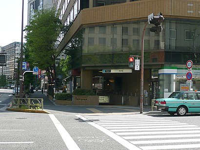
神谷町駅前 stop - Tuesday schedule
| Line | Direction | Time |
|---|---|---|
| 浜95 | 東京タワー | 06:59 |
| 橋86 | 目黒駅前 | 07:08 |
| 渋88 | 渋谷駅前 | 07:11 |
| 橋86 | 目黒駅前 | 07:29 |
| 浜95 | 東京タワー | 07:31 |
| 渋88 | 渋谷駅前 | 07:39 |
| 浜95 | 東京タワー | 07:55 |
| 橋86 | 目黒駅前 | 07:57 |
| 渋88 | 渋谷駅前 | 08:06 |
| 橋86 | 目黒駅前 | 08:19 |
| 渋88 | 渋谷駅前 | 08:34 |
| 橋86 | 目黒駅前 | 08:50 |
| 渋88 | 渋谷駅前 | 08:56 |
| 浜95 | 東京タワー | 09:00 |
| 渋88 | 渋谷駅前 | 09:17 |
| 橋86 | 目黒駅前 | 09:18 |
| 渋88 | 渋谷駅前 | 09:42 |
| 橋86 | 目黒駅前 | 09:47 |
| 渋88 | 渋谷駅前 | 10:08 |
| 浜95 | 東京タワー | 10:12 |
| 橋86 | 目黒駅前 | 10:18 |
| 渋88 | 渋谷駅前 | 10:38 |
| 橋86 | 目黒駅前 | 11:08 |
| 渋88 | 渋谷駅前 | 11:12 |
| 浜95 | 東京タワー | 11:22 |
Directions to 神谷町駅前 (港区) with public transportation
The following transit lines have routes that pass near 神谷町駅前
How to get to 神谷町駅前 by bus?
Click on the bus route to see step by step directions with maps, line arrival times and updated time schedules.
How to get to 神谷町駅前 by metro?
Click on the metro route to see step by step directions with maps, line arrival times and updated time schedules.
Bus stops near 神谷町駅前 in 港区
- 神谷町駅前, 2 min walk,
- 虎ノ門五丁目, 3 min walk,
- 愛宕山下, 4 min walk,
Metro stations near 神谷町駅前 in 港区
- 虎ノ門ヒルズ Toranomon-Hills, 7 min walk,
- 御成門 Onarimon, 10 min walk,
- 六本木一丁目 Roppongi-Itchome, 12 min walk,
- 赤羽橋 Akabanebashi, 13 min walk,
Bus lines to 神谷町駅前 in 港区
- 橋86, 新橋駅前,
- 渋88, 新橋駅前,
- 浜95, 品川駅港南口,
- 東98, 東京駅南口,
What are the closest stations to 神谷町駅前?
The closest stations to 神谷町駅前 are:
- 神谷町駅前 is 131 meters away, 2 min walk.
- 虎ノ門五丁目 is 178 meters away, 3 min walk.
- 愛宕山下 is 300 meters away, 4 min walk.
- 虎ノ門ヒルズ Toranomon-Hills is 517 meters away, 7 min walk.
- 御成門 Onarimon is 742 meters away, 10 min walk.
- 六本木一丁目 Roppongi-Itchome is 892 meters away, 12 min walk.
- 赤羽橋 Akabanebashi is 958 meters away, 13 min walk.
Which bus lines stop near 神谷町駅前?
These bus lines stop near 神谷町駅前: 東98, 渋88.
Which metro line stops near 神谷町駅前?
日比谷線 HIBIYA LINE
What’s the nearest metro station to 神谷町駅前 in 港区?
The nearest metro station to 神谷町駅前 in 港区 is 虎ノ門ヒルズ Toranomon-Hills. It’s a 7 min walk away.
What’s the nearest bus stop to 神谷町駅前 in 港区?
The nearest bus stop to 神谷町駅前 in 港区 is 神谷町駅前. It’s a 2 min walk away.
What time is the first metro to 神谷町駅前 in 港区?
The 南北線 NAMBOKU LINE is the first metro that goes to 神谷町駅前 in 港区. It stops nearby at 5:05 AM.
What time is the last metro to 神谷町駅前 in 港区?
The 大江戸線 OEDO LINE is the last metro that goes to 神谷町駅前 in 港区. It stops nearby at 12:55 AM.
What time is the first bus to 神谷町駅前 in 港区?
The 渋88 is the first bus that goes to 神谷町駅前 in 港区. It stops nearby at 6:44 AM.
What time is the last bus to 神谷町駅前 in 港区?
The 橋86 is the last bus that goes to 神谷町駅前 in 港区. It stops nearby at 10:01 PM.
See 神谷町駅前, 港区, on the map
Public transit to 神谷町駅前 stop in 港区
Looking for directions to 神谷町駅前 in 港区, Japan?
Download the Moovit App to find the current schedule and step-by-step directions for Metro or Bus routes that pass through 神谷町駅前.
Looking for the nearest stops closest to 神谷町駅前 ? Check out this list of closest stops to your destination: 神谷町駅前; 虎ノ門五丁目; 愛宕山下; 虎ノ門ヒルズ Toranomon-Hills; 御成門 Onarimon; 六本木一丁目 Roppongi-Itchome; 赤羽橋 Akabanebashi.
Bus: 東98, 渋88, 橋86.Metro: 日比谷線 HIBIYA LINE, 三田線 MITA LINE, 南北線 NAMBOKU LINE, 大江戸線 OEDO LINE.
We make riding on public transit to 神谷町駅前 easy, which is why over 1.5 million users, including users in 港区 trust Moovit as the best app for public transit.
Use the app to navigate to popular places including to the airport, hospital, stadium, grocery store, mall, coffee shop, school, college, and university.
The first line to this stop is 浜95, at 06:59, and the last line is 橋86 at 21:53.
12-9 虎ノ門五丁目, Tokyo, Japan
This stop serves 都営バス’s lines
Kamiyachō Station (神谷町駅, Kamiyachō-eki) is a subway station in Minato, Tokyo operated by Tokyo Metro. The Station Number is H-05.Wiki
Metro stations near 神谷町駅前
Popular public transit stations in 港区
Get around 港区 by public transit!
Traveling around 港区 has never been so easy. See step by step directions as you travel to any attraction, street or major public transit station. View bus and train schedules, arrival times, service alerts and detailed routes on a map, so you know exactly how to get to anywhere in 港区.
When traveling to any destination around 港区 use Moovit's Live Directions with Get Off Notifications to know exactly where and how far to walk, how long to wait for your line, and how many stops are left. Moovit will alert you when it's time to get off — no need to constantly re-check whether yours is the next stop.
Wondering how to use public transit in 港区 or how to pay for public transit in 港区? Moovit public transit app can help you navigate your way with public transit easily, and at minimum cost. It includes public transit fees, ticket prices, and costs. Looking for a map of 港区 public transit lines? Moovit public transit app shows all public transit maps in 港区 with all metro or bus routes and stops on an interactive map.
港区 has 2 transit type(s), including: metro or bus, operated by several transit agencies, including JR East, Tokyo Metro, Toei, Tokyo Waterfront Area Rapid Transit, Transportation Bureau, City of Yokohama, Sagami Railway, 都営バス, Kokusai Kogyo Bus, Tokyu Bus, Keio Bus, Seibu Bus, Kanto Bus, Nishi Tokyo Bus, Sotetsu Bus and Transportation Bureau, City of Yokohama