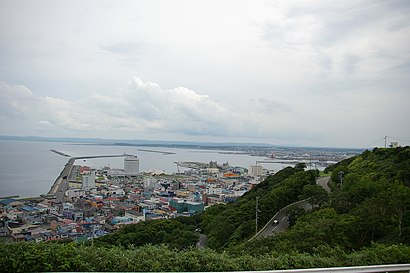
Directions to 稚内公園 (稚内市) with public transportation
The following transit lines have routes that pass near 稚内公園
How to get to 稚内公園 by bus?
Click on the bus route to see step by step directions with maps, line arrival times and updated time schedules.
Bus stations near 稚内公園 in 稚内市
- 神社前, 8 min walk,
- 稚内郵便局前, 11 min walk,
- 駅前ターミナル(稚内駅), 13 min walk,
- 稚内駅前ターミナル, 14 min walk,
Bus lines to 稚内公園 in 稚内市
- 坂の下線, 坂の下線,
- 声問線, 声問線,
- 天北宗谷岬線, 稚内方面,
- 富士見線, 富士見線,
- 富岡線[ノシャップ~潮見五], 富岡線[ノシャップ~潮見五],
- 富岡線[潮見五~病院~稚内T], 富岡線[潮見五~病院~稚内T],
- 富岡線[稚内T~大黒~潮見五], 富岡線[稚内T~大黒~潮見五],
- 市内線, 潮見五~ノシャップ,
- 緑町線[ターミナル~緑六丁目], 緑町線[ターミナル~緑六丁目],
- 富岡循環線, 潮見五丁目,
- 市内線, 駅前ターミナル(稚内駅),
- 天北宗谷岬線, 中頓別ターミナル,
- 富岡線循環, 駅前ターミナル(稚内駅),
- 札幌~稚内, 稚内フェリーターミナル,
What are the closest stations to 稚内公園?
The closest stations to 稚内公園 are:
- 神社前 is 557 meters away, 8 min walk.
- 稚内郵便局前 is 785 meters away, 11 min walk.
- 駅前ターミナル(稚内駅) is 975 meters away, 13 min walk.
- 稚内駅前ターミナル is 1020 meters away, 14 min walk.
Which bus lines stop near 稚内公園?
These bus lines stop near 稚内公園: 声問線, 天北宗谷岬線, 市内線, 札幌~稚内.
What’s the nearest bus stop to 稚内公園 in 稚内市?
The nearest bus stop to 稚内公園 in 稚内市 is 神社前. It’s a 8 min walk away.
What time is the first bus to 稚内公園 in 稚内市?
The 札幌~稚内 is the first bus that goes to 稚内公園 in 稚内市. It stops nearby at 6:30 AM.
What time is the last bus to 稚内公園 in 稚内市?
The 札幌~稚内 is the last bus that goes to 稚内公園 in 稚内市. It stops nearby at 10:50 PM.
How much is the bus fare to 稚内公園?
The bus fare to 稚内公園 costs about ¥160.00 - ¥220.00.
See 稚内公園, 稚内市, on the map
Public Transit to 稚内公園 in 稚内市
Wondering how to get to 稚内公園 in 稚内市, Japan? Moovit helps you find the best way to get to 稚内公園 with step-by-step directions from the nearest public transit station.
Moovit provides free maps and live directions to help you navigate through your city. View schedules, routes, timetables, and find out how long does it take to get to 稚内公園 in real time.
Looking for the nearest stop or station to 稚内公園? Check out this list of stops closest to your destination: 神社前; 稚内郵便局前; 駅前ターミナル(稚内駅); 稚内駅前ターミナル.
Bus: 声問線, 天北宗谷岬線, 市内線, 札幌~稚内, 坂の下線, 富士見線, 富岡線[ノシャップ~潮見五], 富岡循環線, 富岡線循環.
Want to see if there’s another route that gets you there at an earlier time? Moovit helps you find alternative routes or times. Get directions from and directions to 稚内公園 easily from the Moovit App or Website.
We make riding to 稚内公園 easy, which is why over 1.5 million users, including users in 稚内市, trust Moovit as the best app for public transit. You don’t need to download an individual bus app or train app, Moovit is your all-in-one transit app that helps you find the best bus time or train time available.
For information on prices of bus, costs and ride fares to 稚内公園, please check the Moovit app.
Use the app to navigate to popular places including to the airport, hospital, stadium, grocery store, mall, coffee shop, school, college, and university.
Location: 稚内市, Hokkaido
Attractions near 稚内公園
稚内公園,北門神社,洋服のよろずや,旅人の宿アドバルーン,BARBERSHOP HATAKEYAMA (バーバー ハタケヤマ),鍵屋のまっちゃん,スナック男と女,竹ちゃん,北の味心 竹ちゃん 寿司・蟹・郷土料理,中央2,Love Doll,稚内市営駐車場,稚内市北方記念館・開基百年記念塔,中央3,日本最北端の線路,北船泊漁港,宗谷本線稚内終点,Wakkanai Station,市立稚内病院,宝来五丁目How to get to popular attractions in 稚内市 with public transit
三角市場, 小樽市,バーガーキング, 札幌市,北海道札幌稲穂高等支援学校, 小樽市,活裂燒烏賊, 七飯町,張碓町, 小樽市,北海道大学水産学部, 北斗市,道の駅知床らうす, 羅臼町,中島本町三丁目, 室蘭市,発寒11条14, 札幌市,北海道室蘭東翔高等学校, 室蘭市,北海道四季劇場, 札幌市,八軒9条西9, 札幌市,石狩病院, 石狩市,北のカナリアパーク, 礼文町,東雁来13条2, 札幌市,歌才自然の家, 黒松内町,照道寺, 北広島市,星槎もみじ中学校, 札幌市,スーパースポーツゼビオ, 札幌市,ホテルルートイン札幌白石, 札幌市Get around Hokkaido by public transit!
Traveling around Hokkaido has never been so easy. See step by step directions as you travel to any attraction, street or major public transit station. View bus and train schedules, arrival times, service alerts and detailed routes on a map, so you know exactly how to get to anywhere in Hokkaido.
When traveling to any destination around Hokkaido use Moovit's Live Directions with Get Off Notifications to know exactly where and how far to walk, how long to wait for your line, and how many stops are left. Moovit will alert you when it's time to get off — no need to constantly re-check whether yours is the next stop.
Wondering how to use public transit in Hokkaido or how to pay for public transit in Hokkaido? Moovit public transit app can help you navigate your way with public transit easily, and at minimum cost. It includes public transit fees, ticket prices, and costs. Looking for a map of Hokkaido public transit lines? Moovit public transit app shows all public transit maps in Hokkaido with all Bus, Light Rail and Ferry routes and stops on an interactive map.
Hokkaido has 3 transit type(s), including: Bus, Light Rail and Ferry, operated by several transit agencies, including 北海道中央バス, ジェイ・アール北海道バス, 函館市電, 道北バス, 宗谷バス, じょうてつ, 空知交通, 旭川電気軌道, 士幌町コミュニティ, 白糠町コミュニティ, 恵庭市, 斜里町コミュニティ, 蘭越町コミュニティ, 浦臼町コミュニティ, 札幌ばんけい