Directions to 花城大道 (冼村街道) with public transportation
The following transit lines have routes that pass near 花城大道
How to get to 花城大道 by bus?
Click on the bus route to see step by step directions with maps, line arrival times and updated time schedules.
How to get to 花城大道 by metro?
Click on the metro route to see step by step directions with maps, line arrival times and updated time schedules.
Bus stops near 花城大道 in 冼村街道
- 马场路中, 2 min walk,
- 花城大道东, 3 min walk,
- 珠江公园北门, 8 min walk,
Metro station near 花城大道 in 冼村街道
- 潭村 Tancun, 4 min walk,
Tram stations near 花城大道 in 冼村街道
- 琶醍 Party Pier, 43 min walk,
Bus lines to 花城大道 in 冼村街道
- 138路, 东莞庄总站,
- 407路环线, 珠江新城总站,
- 499路, 珠江新城总站(冼村路),
- 545路, 同德围总站(泽德花苑),
- 901A路, 天河智慧城核心区总站(高唐),
- 40路, 广氮花园总站 - 东山总站(署前路),
- 777路, 珠江新城总站 - 天河城总站,
- 886A路, 黄园路总站(黄石花园) - 珠江新城总站,
- 886路, 集贤苑总站 - 珠江新城总站,
- 778路, 石牌东路北总站,
What are the closest stations to 花城大道?
The closest stations to 花城大道 are:
- 马场路中 is 135 meters away, 2 min walk.
- 花城大道东 is 211 meters away, 3 min walk.
- 潭村 Tancun is 233 meters away, 4 min walk.
- 珠江公园北门 is 573 meters away, 8 min walk.
- 琶醍 Party Pier is 3313 meters away, 43 min walk.
Which bus lines stop near 花城大道?
These bus lines stop near 花城大道: 138路, 40路, 545路, 886A路.
Which metro line stops near 花城大道?
5号线 LINE 5 (往文冲 To Wenchong)
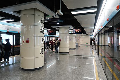
What’s the nearest metro station to 花城大道 in 冼村街道?
The nearest metro station to 花城大道 in 冼村街道 is 潭村 Tancun. It’s a 4 min walk away.
What’s the nearest bus station to 花城大道 in 冼村街道?
The nearest bus station to 花城大道 in 冼村街道 is 马场路中. It’s a 2 min walk away.
What time is the first tram to 花城大道 in 冼村街道?
The 海珠有轨电车 THZ1 is the first tram that goes to 花城大道 in 冼村街道. It stops nearby at 7:38 AM.
What time is the last tram to 花城大道 in 冼村街道?
The 海珠有轨电车 THZ1 is the last tram that goes to 花城大道 in 冼村街道. It stops nearby at 11:32 PM.
What time is the first metro to 花城大道 in 冼村街道?
The 5号线 LINE 5 is the first metro that goes to 花城大道 in 冼村街道. It stops nearby at 6:10 AM.
What time is the last metro to 花城大道 in 冼村街道?
The 5号线 LINE 5 is the last metro that goes to 花城大道 in 冼村街道. It stops nearby at 12:00 AM.
What time is the first bus to 花城大道 in 冼村街道?
The 545路 is the first bus that goes to 花城大道 in 冼村街道. It stops nearby at 6:00 AM.
What time is the last bus to 花城大道 in 冼村街道?
The 886路 is the last bus that goes to 花城大道 in 冼村街道. It stops nearby at 12:03 AM.
See 花城大道, 冼村街道, on the map
Public Transit to 花城大道 in 冼村街道
How to get to 花城大道 in 冼村街道, China?
It’s easy with Moovit. Type in your street address and Moovit’s route finder will locate the fastest way to get you there! Not sure where to get off on the street? Download the Moovit App to find live directions (including where to get off on 花城大道), see timetables and get the estimated arrival times for your favorite metro or bus lines.
Looking for the nearest stop or station to 花城大道? Check out this list of closest stops available to your destination: 马场路中; 花城大道东; 潭村 Tancun; 珠江公园北门; 琶醍 Party Pier.
Bus: 138路, 40路, 545路, 886A路, 407路环线, 499路, 901A路, 777路, 886路, 778路.Metro: 5号线 LINE 5.
Download the Moovit App to see the current schedule and routes available for 冼村街道. No need to install a special bus app to check the bus time or a train app to get train time. Moovit is the only all-in-one transit app that helps you get where you need to go.
We make riding on public transit to 花城大道 easy, which is why over 1.5 million users, including users in 冼村街道 trust Moovit as the best app for public transit.
Use the app to navigate to popular places including to the airport, hospital, stadium, grocery store, mall, coffee shop, school, college, and university.
Location: 冼村街道, Guangzhou
Get around 冼村街道 by public transit!
Traveling around 冼村街道 has never been so easy. See step by step directions as you travel to any attraction, street or major public transit station. View bus and train schedules, arrival times, service alerts and detailed routes on a map, so you know exactly how to get to anywhere in 冼村街道.
When traveling to any destination around 冼村街道 use Moovit's Live Directions with Get Off Notifications to know exactly where and how far to walk, how long to wait for your line, and how many stops are left. Moovit will alert you when it's time to get off — no need to constantly re-check whether yours is the next stop.
Wondering how to use public transit in 冼村街道 or how to pay for public transit in 冼村街道? Moovit public transit app can help you navigate your way with public transit easily, and at minimum cost. It includes public transit fees, ticket prices, and costs. Looking for a map of 冼村街道 public transit lines? Moovit public transit app shows all public transit maps in 冼村街道 with all Bus, Metro, Tram and Ferry routes and stops on an interactive map.
Guangzhou has 4 transit type(s), including: Bus, Metro, Tram and Ferry, operated by several transit agencies, including 广州地铁, BRT, 广州公交, 广州客轮公司, 广州有轨电车有限责任公司 and 佛山公交