花都广场东 stop - Sunday schedule
| Line | Direction | Time |
|---|---|---|
| 花30路 | 豪利花园 | 07:43 |
| 花30路 | 豪利花园 | 07:53 |
| 花30路 | 豪利花园 | 08:03 |
| 花30路 | 豪利花园 | 08:13 |
| 花30路 | 豪利花园 | 08:23 |
| 花30路 | 豪利花园 | 08:33 |
| 花30路 | 豪利花园 | 08:43 |
| 花30路 | 豪利花园 | 08:53 |
| 花30路 | 豪利花园 | 09:03 |
| 花30路 | 豪利花园 | 09:13 |
| 花30路 | 豪利花园 | 09:23 |
| 花30路 | 豪利花园 | 09:33 |
| 花30路 | 豪利花园 | 09:43 |
| 花30路 | 豪利花园 | 09:53 |
| 花30路 | 豪利花园 | 10:03 |
| 花30路 | 豪利花园 | 10:11 |
| 花30路 | 豪利花园 | 10:19 |
| 花30路 | 豪利花园 | 10:27 |
| 花30路 | 豪利花园 | 10:35 |
| 花30路 | 豪利花园 | 10:45 |
| 花30路 | 豪利花园 | 10:55 |
| 花30路 | 豪利花园 | 11:05 |
| 花30路 | 豪利花园 | 11:15 |
| 花30路 | 豪利花园 | 11:25 |
| 花30路 | 豪利花园 | 11:35 |
Directions to 花都广场东 (Guangzhou) with public transportation
The following transit lines have routes that pass near 花都广场东
How to get to 花都广场东 by bus?
Click on the bus route to see step by step directions with maps, line arrival times and updated time schedules.
How to get to 花都广场东 by metro?
Click on the metro route to see step by step directions with maps, line arrival times and updated time schedules.
Bus stations near 花都广场东 in Guangzhou
- 花都广场东, 3 min walk,
- 田美村(花都), 5 min walk,
- 钻石花园, 5 min walk,
- 交通局(花都), 8 min walk,
- 花都广场, 8 min walk,
- 中医院(花都), 11 min walk,
Metro stations near 花都广场东 in Guangzhou
- 花果山公园 Huaguoshan Park, 33 min walk,
Bus lines to 花都广场东 in Guangzhou
- 花6路, 石岗村,
- 花30路, 华工广州学院(汽车学院),
- 715路, 花都狮岭皮革城总站(五金龙头市场) - 人和商业中心总站,
- 花26路, 汽车城 - 马鞍山公园,
- 花70路, 花都万科天景花园总站 - 人和商业中心总站,
- 花85路, 站前路公交站 - 北兴天湖峰境,
- 花8B路, 平西村 - 东镜,
- 花8路, 三东 - 东镜,
- 715路大站快车, 花都狮岭皮革城总站(五金龙头市场),
- 花22路, 花都汽车城,
- 花4路, 汽车总站(花都),
- 花23路, 狮岭总站(利和路),
- 花7路, 汽车总站(花都),
- 花18路, 人民公园,
What are the closest stations to 花都广场东?
The closest stations to 花都广场东 are:
- 花都广场东 is 216 meters away, 3 min walk.
- 田美村(花都) is 315 meters away, 5 min walk.
- 钻石花园 is 356 meters away, 5 min walk.
- 交通局(花都) is 537 meters away, 8 min walk.
- 花都广场 is 562 meters away, 8 min walk.
- 中医院(花都) is 780 meters away, 11 min walk.
- 花果山公园 Huaguoshan Park is 2398 meters away, 33 min walk.
Which bus lines stop near 花都广场东?
These bus lines stop near 花都广场东: 715路大站快车, 花6路, 花85路, 花8路.
Which metro line stops near 花都广场东?
9号线 LINE 9
What’s the nearest bus stop to 花都广场东 in Guangzhou?
The nearest bus stop to 花都广场东 in Guangzhou is 花都广场东. It’s a 3 min walk away.
What time is the first metro to 花都广场东 in Guangzhou?
The 9号线 LINE 9 is the first metro that goes to 花都广场东 in Guangzhou. It stops nearby at 6:09 AM.
What time is the last metro to 花都广场东 in Guangzhou?
The 9号线 LINE 9 is the last metro that goes to 花都广场东 in Guangzhou. It stops nearby at 11:31 PM.
What time is the first bus to 花都广场东 in Guangzhou?
The 花85路 is the first bus that goes to 花都广场东 in Guangzhou. It stops nearby at 6:29 AM.
What time is the last bus to 花都广场东 in Guangzhou?
The 715路 is the last bus that goes to 花都广场东 in Guangzhou. It stops nearby at 11:25 PM.
See 花都广场东, Guangzhou, on the map
Public transit to 花都广场东 stop in Guangzhou
Looking for directions to 花都广场东 in Guangzhou, China?
Download the Moovit App to find the current schedule and step-by-step directions for Bus or Metro routes that pass through 花都广场东.
Looking for the nearest stops closest to 花都广场东 ? Check out this list of closest stops to your destination: 花都广场东; 田美村(花都); 钻石花园; 交通局(花都); 花都广场; 中医院(花都); 花果山公园 Huaguoshan Park.
Bus: 715路大站快车, 花6路, 花85路, 花8路, 花30路, 715路, 花26路, 花70路, 花8B路, 花22路, 花4路.Metro: 9号线 LINE 9.
We make riding on public transit to 花都广场东 easy, which is why over 1.5 million users, including users in Guangzhou trust Moovit as the best app for public transit.
Use the app to navigate to popular places including to the airport, hospital, stadium, grocery store, mall, coffee shop, school, college, and university.
The first line to this stop is 花30路, at 07:43, and the last line is 花30路 at 19:43.
This stop serves 广州公交’s lines
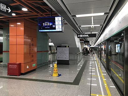
Huadu Square station (Chinese: 花都广场站), is a station of Line 9 of the Guangzhou Metro. It started operations on 28 December 2017.Wiki
Metro station near 花都广场东
花果山公园 Huaguoshan ParkGet around Guangzhou by public transit!
Traveling around Guangzhou has never been so easy. See step by step directions as you travel to any attraction, street or major public transit station. View bus and train schedules, arrival times, service alerts and detailed routes on a map, so you know exactly how to get to anywhere in Guangzhou.
When traveling to any destination around Guangzhou use Moovit's Live Directions with Get Off Notifications to know exactly where and how far to walk, how long to wait for your line, and how many stops are left. Moovit will alert you when it's time to get off — no need to constantly re-check whether yours is the next stop.
Wondering how to use public transit in Guangzhou or how to pay for public transit in Guangzhou? Moovit public transit app can help you navigate your way with public transit easily, and at minimum cost. It includes public transit fees, ticket prices, and costs. Looking for a map of Guangzhou public transit lines? Moovit public transit app shows all public transit maps in Guangzhou with all Bus, Metro, Tram and Ferry routes and stops on an interactive map.
Guangzhou has 4 transit type(s), including: Bus, Metro, Tram and Ferry, operated by several transit agencies, including 广州地铁, BRT, 广州公交, 广州客轮公司, 广州有轨电车有限责任公司, 佛山公交