Metro stations near 西大家駅 in Tokyo
- 武蔵高萩 Musashi-Takahagi,52 min walk,
- 高麗川 Komagawa,64 min walk,
What are the closest stations to 西大家駅?
The closest stations to 西大家駅 are:
- 武蔵高萩 Musashi-Takahagi is 4019 meters away, 52 min walk.
- 高麗川 Komagawa is 4991 meters away, 64 min walk.
What time is the first metro to 西大家駅 in Tokyo?
The 八高線 HACHIKO LINE is the first metro that goes to 西大家駅 in Tokyo. It stops nearby at 5:10 AM.
What time is the last metro to 西大家駅 in Tokyo?
The 川越線(川越-高麗川間) KAWAGOE LINE is the last metro that goes to 西大家駅 in Tokyo. It stops nearby at 12:30 AM.
See 西大家駅, Tokyo, on the map
Public Transit to 西大家駅 in Tokyo
Wondering how to get to 西大家駅 in Tokyo, Japan? Moovit helps you find the best way to get to 西大家駅 with step-by-step directions from the nearest public transit station.
Moovit provides free maps and live directions to help you navigate through your city. View schedules, routes, timetables, and find out how long does it take to get to 西大家駅 in real time.
Looking for the nearest stop or station to 西大家駅? Check out this list of stops closest to your destination: 武蔵高萩 Musashi-Takahagi; 高麗川 Komagawa.
Want to see if there’s another route that gets you there at an earlier time? Moovit helps you find alternative routes or times. Get directions from and directions to 西大家駅 easily from the Moovit App or Website.
We make riding to 西大家駅 easy, which is why over 1.5 million users, including users in Tokyo, trust Moovit as the best app for public transit. You don’t need to download an individual bus app or train app, Moovit is your all-in-one transit app that helps you find the best bus time or train time available.
Use the app to navigate to popular places including to the airport, hospital, stadium, grocery store, mall, coffee shop, school, college, and university.
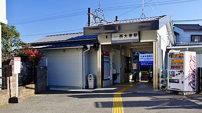
西大家駅 Address: 日高川島線 street in Tokyo
Nishi-Ōya Station (西大家駅, Nishi Ōya-eki) is a passenger railway station located in the city of Sakado, Saitama, Japan, operated by the private railway operator Tōbu Railway.Wiki
Attractions near 西大家駅
(有)ワカテ,國渭地祇神社,ダイトクデンキ,神明社,明神社,(有)近藤商店 砂利,有 近藤商店 砂利,越 第38号踏切道,西大家変電所,有 和考ストアー,神能,輪業,東京国際大学 総合グラウンド,四日市場,住ま居る,株式会社 住ま居る,明倫堂薬局西大家店,ローソン上新田店,越 第45号踏切道,埼玉県立 坂戸西高等学校,西入間警察署大家駐在所How to get to popular attractions in Tokyo with public transit
祓戸神社, 葛飾区,Shinagawa station Konan exit, 港区,Hotel Monterey Ginza Tokyo, 中央区,トミヤ精米工場, 横浜市,Hikarigaoka Station, 練馬区,Camp Zama,北口, 川崎市,千歳橋, 墨田区,Inzai, 印西市,救急救命東京研修所, 八王子市,Kawagoe Station, 川越市,幸むら, 成田市,Kanegafuchi Eki, 墨田区,Kamata Tokyo Japan, 大田区,Higashi Kurume Station, 東久留米市,Koishikawa Botanical Garden, 文京区,Shintomichō Station, 中央区,イワタニ水素ステーション横浜戸塚, 横浜市,叡知と慈愛の女神像, 新宿区,Hotel Allamanda Aoyama Tokyo, 渋谷区Get around Tokyo by public transit!
Traveling around Tokyo has never been so easy. See step by step directions as you travel to any attraction, street or major public transit station. View bus and train schedules, arrival times, service alerts and detailed routes on a map, so you know exactly how to get to anywhere in Tokyo.
When traveling to any destination around Tokyo use Moovit's Live Directions with Get Off Notifications to know exactly where and how far to walk, how long to wait for your line, and how many stops are left. Moovit will alert you when it's time to get off — no need to constantly re-check whether yours is the next stop.
Wondering how to use public transit in Tokyo or how to pay for public transit in Tokyo? Moovit public transit app can help you navigate your way with public transit easily, and at minimum cost. It includes public transit fees, ticket prices, and costs. Looking for a map of Tokyo public transit lines? Moovit public transit app shows all public transit maps in Tokyo with all routes and stops on an interactive map.
Tokyo has 0 transit type(s), including: , operated by several transit agencies, including JR East, Tokyo Metro, Toei, Tokyo Waterfront Area Rapid Transit, Transportation Bureau, City of Yokohama, Sagami Railway, 都営バス, Kokusai Kogyo Bus, Tokyu Bus, Keio Bus, Seibu Bus, Kanto Bus, Nishi Tokyo Bus, Sotetsu Bus and Transportation Bureau, City of Yokohama