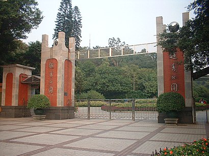
越秀公园 stop - Thursday schedule
| Line | Direction | Time |
|---|---|---|
| 夜26路 | 石井总站(庆丰纺织服装城) | 05:40 |
| 21路 | 平沙村总站(平沙公园) | 06:04 |
| 夜26路 | 石井总站(庆丰纺织服装城) | 06:05 |
| 528路 | 新科下新村总站 | 06:06 |
| 21路 | 平沙村总站(平沙公园) | 06:14 |
| 528路 | 新科下新村总站 | 06:16 |
| 110路 | 天平架总站 | 06:18 |
| 109路 | 天平架总站 | 06:19 |
| 103路 | 机场路总站 | 06:20 |
| 108路 | 黄石路总站 | 06:20 |
| 113路 | 棠安路总站(新市花园) | 06:21 |
| 21路 | 平沙村总站(平沙公园) | 06:24 |
| 101路 | 机场路总站 | 06:24 |
| 109路 | 天平架总站 | 06:25 |
| 528路 | 新科下新村总站 | 06:26 |
| 113路 | 棠安路总站(新市花园) | 06:27 |
| 110路 | 天平架总站 | 06:28 |
| 555路 | 白云文化广场总站 | 06:29 |
| 夜26路 | 石井总站(庆丰纺织服装城) | 06:30 |
| 103路 | 机场路总站 | 06:30 |
| 108路 | 黄石路总站 | 06:30 |
| 109路 | 天平架总站 | 06:31 |
| 105路 | 棠安路总站 | 06:32 |
| 113路 | 棠安路总站(新市花园) | 06:33 |
| 186路 | 广园新村总站 | 06:33 |
Directions to 越秀公园 stop (Guangzhou) with public transit
The following transit lines have routes that pass near 越秀公园
How to get to 越秀公园 stop by bus?
Click on the bus route to see step by step directions with maps, line arrival times and updated time schedules.
How to get to 越秀公园 stop by metro?
Click on the metro route to see step by step directions with maps, line arrival times and updated time schedules.
Bus stops near 越秀公园 stop in Guangzhou
- 越秀公园, 1 min walk,
- 解放北路口, 3 min walk,
- 盘福路, 8 min walk,
- 广州军区总医院, 8 min walk,
- 人民北路(站南路口), 11 min walk,
- 站南路, 13 min walk,
- 草暖公园, 14 min walk,
- 民航售票处(广州火车站), 15 min walk,
- 越秀公园北门, 20 min walk,
Metro stations near 越秀公园 station in Guangzhou
- 公园前 Gongyuanqian, 10 min walk,
- 小北 Xiaobei, 26 min walk,
Bus lines to 越秀公园 stop in Guangzhou
- 101路, 海印桥总站,
- 103路, 机场路总站,
- 105路, 棠安路总站,
- 108路, 东山总站(农林下路),
- 109路, 中山八路总站,
- 110路, 文化公园总站,
- 113路, 南田路总站,
- 124路, 滘口客运站总站,
- 186路, 珠江医院总站,
- 21路, 解放北路总站(应元路),
- 244A路, 汇侨新城总站,
- 244B路, 江南大道南总站,
- 244路, 江南大道南总站,
- 244路短线, 江南大道南总站,
- 273路, 柯子岭总站(河田路),
- 42路, 文德路总站,
- 519路, 白云路总站,
- 555路, 大坦沙总站(市1中),
- 556路, 石井总站(庆丰纺织服装城),
- 58A路, 解放北路总站(应元路口),
What are the closest stations to 越秀公园?
The closest stations to 越秀公园 are:
- 越秀公园 is 25 meters away, 1 min walk.
- 解放北路口 is 150 meters away, 3 min walk.
- 盘福路 is 553 meters away, 8 min walk.
- 广州军区总医院 is 580 meters away, 8 min walk.
- 公园前 Gongyuanqian is 708 meters away, 10 min walk.
- 人民北路(站南路口) is 848 meters away, 11 min walk.
- 站南路 is 976 meters away, 13 min walk.
- 草暖公园 is 1062 meters away, 14 min walk.
- 民航售票处(广州火车站) is 1095 meters away, 15 min walk.
- 越秀公园北门 is 1497 meters away, 20 min walk.
- 小北 Xiaobei is 1976 meters away, 26 min walk.
Which bus lines stop near 越秀公园?
These bus lines stop near 越秀公园: 101路, 109路, 110路, 124路, 高峰快线38路, 高峰快线40路.
Which metro line stops near 越秀公园?
2号线 LINE 2 (往嘉禾望岗 To Jiahe Wanggang)
What’s the nearest metro station to 越秀公园 in Guangzhou?
The nearest metro station to 越秀公园 in Guangzhou is 公园前 Gongyuanqian. It’s a 10 min walk away.
What’s the nearest bus station to 越秀公园 in Guangzhou?
The nearest bus station to 越秀公园 in Guangzhou is 越秀公园. It’s a 1 min walk away.
What time is the first metro to 越秀公园 in Guangzhou?
The 1号线 LINE 1 is the first metro that goes to 越秀公园 in Guangzhou. It stops nearby at 6:10 AM.
What time is the last metro to 越秀公园 in Guangzhou?
The 2号线 LINE 2 is the last metro that goes to 越秀公园 in Guangzhou. It stops nearby at 12:25 AM.
What time is the first bus to 越秀公园 in Guangzhou?
The 夜7路 is the first bus that goes to 越秀公园 in Guangzhou. It stops nearby at 4:02 AM.
What time is the last bus to 越秀公园 in Guangzhou?
The 机场快线1线 is the last bus that goes to 越秀公园 in Guangzhou. It stops nearby at 2:44 AM.
See 越秀公园 stop, Guangzhou, on the map
Public transit to 越秀公园 stop in Guangzhou
Looking for directions to 越秀公园 in Guangzhou, China?
Download the Moovit App to find the current schedule and step-by-step directions for Bus or Metro routes that pass through 越秀公园.
Looking for the nearest stops closest to 越秀公园 ? Check out this list of closest stops to your destination: 越秀公园; 解放北路口; 盘福路; 广州军区总医院; 公园前 Gongyuanqian; 人民北路(站南路口); 站南路; 草暖公园; 民航售票处(广州火车站); 越秀公园北门; 小北 Xiaobei.
Bus: 101路, 109路, 110路, 124路, 高峰快线38路, 高峰快线40路, 103路, 105路, 108路, 211路, 543路, 5路, 夜55路, 夜79路, 182路, 24路, 256路, 265路, 284路, 528路.Metro: 2号线 LINE 2, 1号线 LINE 1, 5号线 LINE 5.
We make riding on public transit to 越秀公园 easy, which is why over 1.5 million users, including users in Guangzhou trust Moovit as the best app for public transit.
Use the app to navigate to popular places including to the airport, hospital, stadium, grocery store, mall, coffee shop, school, college, and university.
The first line to this stop is 夜26路, at 05:40, and the last line is 夜26路 at 02:02.
This stop serves 广州公交’s lines
Get around Guangzhou by public transit!
Traveling around Guangzhou has never been so easy. See step by step directions as you travel to any attraction, street or major public transit station. View bus and train schedules, arrival times, service alerts and detailed routes on a map, so you know exactly how to get to anywhere in Guangzhou.
When traveling to any destination around Guangzhou use Moovit's Live Directions with Get Off Notifications to know exactly where and how far to walk, how long to wait for your line, and how many stops are left. Moovit will alert you when it's time to get off — no need to constantly re-check whether yours is the next stop.
Wondering how to use public transit in Guangzhou or how to pay for public transit in Guangzhou? Moovit public transit app can help you navigate your way with public transit easily, and at minimum cost. It includes public transit fees, ticket prices, and costs. Looking for a map of Guangzhou public transit lines? Moovit public transit app shows all public transit maps in Guangzhou with all Bus, Metro, Tram and Ferry routes and stops on an interactive map.
Guangzhou has 4 transit type(s), including: Bus, Metro, Tram and Ferry, operated by several transit agencies, including 广州地铁, BRT, 广州公交, 广州客轮公司, 广州有轨电车有限责任公司 and 佛山公交