Directions to 高尾山 (八王子市) with public transportation
The following transit lines have routes that pass near 高尾山
How to get to 高尾山 by bus?
Click on the bus route to see step by step directions with maps, line arrival times and updated time schedules.
Which bus lines stop near 高尾山?
These bus lines stop near 高尾山: 山01, 高01.
See 高尾山, 八王子市, on the map
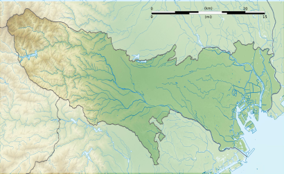
Création personnelle ;
- Topographie : NASA Shuttle Radar Topography Mission (SRTM3 v.2) (domaine public) ;
- Bathymétrie : ETOPO1 de la National Geophysisal Data Center ;
- Coast, lakes, boundaries / Côtes, lacs, frontières : données de la carte © les contributeurs d'OpenStreetMap, CC-BY-SA Openstreetmap via thinkgeo.com ;
- Other symbols / autres symboles provenant de File:Maps template-fr.svg
- Software / logiciels utilisés (méthode décrite dans ce didacticiel) :
- Visualization software 3DEM ;
- Quantum GIS ;
- Inkscape ;
- +Global Mapper pour le relief de la NASA.
Public Transit to 高尾山 in 八王子市
Wondering how to get to 高尾山 in 八王子市, Japan? Moovit helps you find the best way to get to 高尾山 with step-by-step directions from the nearest public transit station.
Moovit provides free maps and live directions to help you navigate through your city. View schedules, routes, timetables, and find out how long does it take to get to 高尾山 in real time.
Bus: 山01, 高01.
Want to see if there’s another route that gets you there at an earlier time? Moovit helps you find alternative routes or times. Get directions from and directions to 高尾山 easily from the Moovit App or Website.
We make riding to 高尾山 easy, which is why over 1.5 million users, including users in 八王子市, trust Moovit as the best app for public transit. You don’t need to download an individual bus app or train app, Moovit is your all-in-one transit app that helps you find the best bus time or train time available.
For information on prices of bus and metro, costs and ride fares to 高尾山, please check the Moovit app.
Use the app to navigate to popular places including to the airport, hospital, stadium, grocery store, mall, coffee shop, school, college, and university.
高尾山 Address: 高尾町 street in 八王子市
Création personnelle ;
- Topographie : NASA Shuttle Radar Topography Mission (SRTM3 v.2) (domaine public) ;
- Bathymétrie : ETOPO1 de la National Geophysisal Data Center ;
- Coast, lakes, boundaries / Côtes, lacs, frontières : données de la carte © les contributeurs d'OpenStreetMap, CC-BY-SA Openstreetmap via thinkgeo.com ;
- Other symbols / autres symboles provenant de File:Maps template-fr.svg
- Software / logiciels utilisés (méthode décrite dans ce didacticiel) :
- Visualization software 3DEM ;
- Quantum GIS ;
- Inkscape ;
- +Global Mapper pour le relief de la NASA.
Attractions near 高尾山
高尾山,もみじや,奉納杉苗十万本,登山五十回記念,持国天,四天王門,奉納金弐千円也,福寿円満八大龍王,めざめ石「是より びわのたきみち」,高尾山薬王院,天狗の腰掛け杉,福徳稲荷,天狗社,飯縄大権現,東京都指定天然記念物「高尾山 杉並木」,森のあばれん坊 ~イノシシ~,Takaosan Fudou-do (高尾山不動堂),権現茶屋,落ちている花はどこから?,Otoko-zaka (男坂)How to get to popular attractions in 八王子市 with public transit
アメダス江戸川臨海地域気象観測所, 江戸川区,中央大学附属高校, 小平市,陸上自衛隊 十条駐屯地, 北区,横浜モアーズ, 横浜市,富士通新川崎テクノロジースクエア, 川崎市,Starbucks Reserve Roastery, 目黒区,ワールドメイト みんなひょうきん東京エリア本部, 杉並区,ピアシティ芝浦ビル, 港区,合羽橋, 台東区,竹の塚警察署, 足立区,モンベル新山下, 横浜市,池田山公園, 品川区,日本年金機構 品川年金事務所, 品川区,埼玉県済生会川口総合病院, 川口市,山崎製パン 松戸工場, 松戸市,Ariake Garden (有明ガーデン), 江東区,東京貨物ターミナル駅, 品川区,私立 実践女子学園中学校 高等学校, 渋谷区,王子警察署, 北区,浜離宮恩賜庭園, 港区Get around Tokyo by public transit!
Traveling around Tokyo has never been so easy. See step by step directions as you travel to any attraction, street or major public transit station. View bus and train schedules, arrival times, service alerts and detailed routes on a map, so you know exactly how to get to anywhere in Tokyo.
When traveling to any destination around Tokyo use Moovit's Live Directions with Get Off Notifications to know exactly where and how far to walk, how long to wait for your line, and how many stops are left. Moovit will alert you when it's time to get off — no need to constantly re-check whether yours is the next stop.
Wondering how to use public transit in Tokyo or how to pay for public transit in Tokyo? Moovit public transit app can help you navigate your way with public transit easily, and at minimum cost. It includes public transit fees, ticket prices, and costs. Looking for a map of Tokyo public transit lines? Moovit public transit app shows all public transit maps in Tokyo with all Bus and Metro routes and stops on an interactive map.
Tokyo has 2 transit type(s), including: Bus and Metro, operated by several transit agencies, including JR East, Tokyo Metro, Toei, Tokyo Waterfront Area Rapid Transit, Transportation Bureau, City of Yokohama, Sagami Railway, 都営バス, Kokusai Kogyo Bus, Tokyu Bus, Keio Bus, Kanto Bus, Nishi Tokyo Bus, Sotetsu Bus