See 동아리방, 안성시, 경기도, on the map
Directions to 동아리방 (안성시, 경기도) with public transportation
The following transit lines have routes that pass near 동아리방
 Bus:
Bus:
How to get to 동아리방 by bus?
Click on the bus route to see step by step directions with maps, line arrival times and updated time schedules.
Bus stations near 동아리방 in 안성시, 경기도
- 동아방송예술대학,6 min walk,
- 동아방송대,15 min walk,
Bus lines to 동아리방 in 안성시, 경기도
- 35,백암,
- 380,서인사거리.맥도널드앞,
- 8146,서울남부터미널,
- 8153,동서울터미널,
- 8433,고양.화정터미널,
- 8435,성남터미널,
- 8449,수원공용버스터미널,
- 8455,고양.화정터미널,
- 8456,동두천터미널,
- 8458,부천터미널소풍(시외.고속),
- 8459,안산터미널,
- 8830,인천터미널,
What are the closest stations to 동아리방?
The closest stations to 동아리방 are:
- 동아방송예술대학 is 384 meters away, 6 min walk.
- 동아방송대 is 1112 meters away, 15 min walk.
Which bus lines stop near 동아리방?
These bus lines stop near 동아리방: 35, 380.
What’s the nearest bus stop to 동아리방 in 안성시, 경기도?
The nearest bus stop to 동아리방 in 안성시, 경기도 is 동아방송예술대학. It’s a 6 min walk away.
What time is the first bus to 동아리방 in 안성시, 경기도?
The 8435 is the first bus that goes to 동아리방 in 안성시, 경기도. It stops nearby at 5:30 AM.
What time is the last bus to 동아리방 in 안성시, 경기도?
The 8146 is the last bus that goes to 동아리방 in 안성시, 경기도. It stops nearby at 10:20 PM.
See 동아리방, 안성시, 경기도, on the map
Public Transit to 동아리방 in 안성시, 경기도
Wondering how to get to 동아리방 in 안성시, 경기도, South Korea? Moovit helps you find the best way to get to 동아리방 with step-by-step directions from the nearest public transit station.
Moovit provides free maps and live directions to help you navigate through your city. View schedules, routes, timetables, and find out how long does it take to get to 동아리방 in real time.
Looking for the nearest stop or station to 동아리방? Check out this list of stops closest to your destination: 동아방송예술대학; 동아방송대.
Bus:
Want to see if there’s another route that gets you there at an earlier time? Moovit helps you find alternative routes or times. Get directions from and directions to 동아리방 easily from the Moovit App or Website.
We make riding to 동아리방 easy, which is why over 1.5 million users, including users in 안성시, 경기도, trust Moovit as the best app for public transit. You don’t need to download an individual bus app or train app, Moovit is your all-in-one transit app that helps you find the best bus time or train time available.
For information on prices of bus, light rail and subway, costs and ride fares to 동아리방, please check the Moovit app.
Use the app to navigate to popular places including to the airport, hospital, stadium, grocery store, mall, coffee shop, school, college, and university.
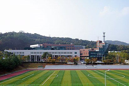
동아리방 Address: 18고개 street in 안성시, 경기도
Attractions near 동아리방
학교헬스장,바른손,이디야 동아방송대점,학생회관,동아방송예술대학교,Dong ah Institute of Media and Arts,동아방송예술대학 지성관,동아방송예술대학교,운동장,덕성관,동아방송예술대학 체육관,10주년 상징 구조물,동아방송예술대학교 버스터미널,동아방송예술대 버스터미널,원룸 C촌,P&D원룸,장보고,엄마손,블루바,오븐쿡-치킨How to get to popular attractions in 안성시, 경기도 with public transit
화정버스터미널, 고양시, 경기도,개화산역, 강서구, 서울시,군포역, 군포시, 경기도,산본중심상가, 군포시, 경기도,LG디스플레이 파주공장 A동, 파주시, 경기도,당정역, 군포시, 경기도,일산벧엘교회, 고양시, 경기도,LOUIS VUITTON,고양종합운동장, 고양시, 경기도,홈플러스, 의정부시, 경기도,헤이리예술마을, 파주시, 경기도,경기영어마을 파주캠프, 파주시, 경기도,지구촌교회, 성남시, 경기도,롯데마트, 부평구, 인천시,영종도,고양농수산물종합센터 하나로마트, 고양시, 경기도,킴스클럽, 은평구, 서울시,정왕역, 시흥시, 경기도,목동제일교회, 양천구, 서울시,산본중앙공원, 군포시, 경기도Get around 안성시, 경기도 by public transit!
Traveling around 안성시, 경기도 has never been so easy. See step by step directions as you travel to any attraction, street or major public transit station. View bus and train schedules, arrival times, service alerts and detailed routes on a map, so you know exactly how to get to anywhere in 안성시, 경기도.
When traveling to any destination around 안성시, 경기도 use Moovit's Live Directions with Get Off Notifications to know exactly where and how far to walk, how long to wait for your line, and how many stops are left. Moovit will alert you when it's time to get off — no need to constantly re-check whether yours is the next stop.
Wondering how to use public transit in 안성시, 경기도 or how to pay for public transit in 안성시, 경기도? Moovit public transit app can help you navigate your way with public transit easily, and at minimum cost. It includes public transit fees, ticket prices, and costs. Looking for a map of 안성시, 경기도 public transit lines? Moovit public transit app shows all public transit maps in 안성시, 경기도 with all bus, light rail or subway routes and stops on an interactive map.
안성시, 경기도 has 3 transit type(s), including: bus, light rail or subway, operated by several transit agencies, including 서울교통공사, 인천교통공사, 네오트랜스, 한국철도공사, 네오트랜스, 경기, 공항, 간선, 지선, 순환, 광역, 인천, 김포 도시철도, 경기고속 and 대원고속