Directions to 21244 (Tel Aviv-Yafo) with public transportation
The following transit lines have routes that pass near 21244
 Bus: 1, 160, 171, 190, 270.
- Light Rail: R1.
- Israel Railways: Be'er Sheva Center - Herzliya, Herzliya - Ashkelon, Herzliya - Be'er Sheva Center, Nahariya - Modi'in Center, Ofakim - Herzliya.
How to get to 21244 by bus?
Click on the bus route to see step by step directions with maps, line arrival times and updated time schedules.
From Em HaMoshavot, Petah Tikva
37 minFrom Separate Beach, Herzliya
47 minFrom Chen Palaces Halls, Bnei Brak
35 minFrom 0ff, Bnei Brak
22 minFrom Raoul Wallenberg, Tel Aviv-Yafo
25 minFrom Yes Planet, Rishon LeZion
40 minFrom Superland, Rishon LeZion
38 minFrom Brodetzky 43, Tel Aviv-Yafo
20 minFrom Rothschild, Petah Tikva
39 minFrom Petah Tikva Market, Petah Tikva
33 min
How to get to 21244 by Israel Railways?
Click on the Israel Railways route to see step by step directions with maps, line arrival times and updated time schedules.
Bus stops near 21244 in Tel Aviv-Yafo
- Begin Road/HaRakevet, 1 min walk,VIEW
- HaRakevet/Solomon, 2 min walk,VIEW
- Railway/Menachem Begin Road, 3 min walk,VIEW
- Allenby Light Rail Station/Menachem Begin Road, 3 min walk,VIEW
- Solomon/HaRakevet, 4 min walk,VIEW
- Israel Tal/Menachem Begin Road, 4 min walk,VIEW
- Electric Company/Menachem Begin Road, 5 min walk,VIEW
- HaRakevet/Bnei Brak, 6 min walk,VIEW
- Rothschild Boulevard/Mazeh, 8 min walk,VIEW
Israel Railways station near 21244 in Tel Aviv-Yafo
- Tel Aviv HaHagana Railway Station, 11 min walk,VIEW
Light Rail stations near 21244 in Tel Aviv-Yafo
- Carlebach Light Rail Station, 25 min walk,VIEW
Bus lines to 21244 in Tel Aviv-Yafo
- 1, Bat Yam,VIEW
- 2, Tel Aviv-Yafo,VIEW
- 40, Bat Yam,VIEW
- 42, Bat Yam,VIEW
- 44, Tel Aviv-Yafo,VIEW
- 74, Rishon LeZion,VIEW
- 101, Modi'in-Maccabim-Re'ut,VIEW
- 103, Modi'in-Maccabim-Re'ut,VIEW
- 105, Modi'in-Maccabim-Re'ut,VIEW
- 107, Modi'in-Maccabim-Re'ut,VIEW
- 111, Modi'in-Maccabim-Re'ut,VIEW
- 126, Bat Yam,VIEW
- 168, Kiryat Ono,VIEW
- 174, Rehovot,VIEW
- 189, Holon,VIEW
- 289, Holon,VIEW
- 450, Ramla,VIEW
- 454, Ramla,VIEW
- 460, Lod,VIEW
- 462, Lod,VIEW
What are the closest stations to 21244?
The closest stations to 21244 are:
- Begin Road/HaRakevet is 12 meters away, 1 min walk.
- HaRakevet/Solomon is 117 meters away, 2 min walk.
- Railway/Menachem Begin Road is 169 meters away, 3 min walk.
- Allenby Light Rail Station/Menachem Begin Road is 201 meters away, 3 min walk.
- Solomon/HaRakevet is 249 meters away, 4 min walk.
- Israel Tal/Menachem Begin Road is 276 meters away, 4 min walk.
- Electric Company/Menachem Begin Road is 315 meters away, 5 min walk.
- HaRakevet/Bnei Brak is 420 meters away, 6 min walk.
- Rothschild Boulevard/Mazeh is 583 meters away, 8 min walk.
- Tel Aviv HaHagana Railway Station is 852 meters away, 11 min walk.
- Carlebach Light Rail Station is 1890 meters away, 25 min walk.
Which bus lines stop near 21244?
These bus lines stop near 21244: 1, 160, 171, 190, 270, 42, 44, 51.
Which light rail line stops near 21244?
R1 (Petah Tikva Central Station Light Rail Station→Komemiyut Light Rail Station)
Which Israel Railways lines stop near 21244?
These Israel Railways lines stop near 21244: Be'er Sheva Center - Herzliya, Herzliya - Ashkelon, Herzliya - Be'er Sheva Center, Nahariya - Modi'in Center.
What’s the nearest light rail station to 21244 in Tel Aviv-Yafo?
The nearest light rail station to 21244 in Tel Aviv-Yafo is Carlebach Light Rail Station. It’s a 25 min walk away.
What’s the nearest Israel Railways station to 21244 in Tel Aviv-Yafo?
The nearest Israel Railways station to 21244 in Tel Aviv-Yafo is Tel Aviv HaHagana Railway Station. It’s a 11 min walk away.
What’s the nearest bus station to 21244 in Tel Aviv-Yafo?
The nearest bus station to 21244 in Tel Aviv-Yafo is Begin Road/HaRakevet. It’s a 1 min walk away.
What time is the first light rail to 21244 in Tel Aviv-Yafo?
The R3 is the first light rail that goes to 21244 in Tel Aviv-Yafo. It stops nearby at 5:32 AM.
What time is the last light rail to 21244 in Tel Aviv-Yafo?
The R2 is the last light rail that goes to 21244 in Tel Aviv-Yafo. It stops nearby at 12:52 AM.
What time is the first Israel Railways to 21244 in Tel Aviv-Yafo?
The Tel Aviv Center - Rehovot is the first Israel Railways that goes to 21244 in Tel Aviv-Yafo. It stops nearby at 5:22 AM.
What time is the last Israel Railways to 21244 in Tel Aviv-Yafo?
The Beer Sheva Center - Tel Aviv Center is the last Israel Railways that goes to 21244 in Tel Aviv-Yafo. It stops nearby at 1:00 AM.
What time is the first bus to 21244 in Tel Aviv-Yafo?
The 469 is the first bus that goes to 21244 in Tel Aviv-Yafo. It stops nearby at 3:27 AM.
What time is the last bus to 21244 in Tel Aviv-Yafo?
The 469 is the last bus that goes to 21244 in Tel Aviv-Yafo. It stops nearby at 4:55 AM.
What time is the first shuttle to 21244 in Tel Aviv-Yafo?
The 803 - HaMaslul HaMahir Rothschild TLV is the first shuttle that goes to 21244 in Tel Aviv-Yafo. It stops nearby at 6:11 AM.
What time is the last shuttle to 21244 in Tel Aviv-Yafo?
The 803 - HaMaslul HaMahir Rothschild TLV is the last shuttle that goes to 21244 in Tel Aviv-Yafo. It stops nearby at 11:18 PM.
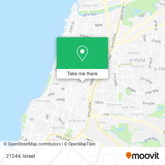
See 21244, Tel Aviv-Yafo, on the map
Public Transit to 21244 in Tel Aviv-Yafo
Wondering how to get to 21244 in Tel Aviv-Yafo? Moovit helps you find the best way to get to 21244 with step-by-step directions from the nearest public transit station.
Moovit provides free maps and live directions to help you navigate through your city. View schedules, routes, timetables, and find out how long does it take to get to 21244 in real time.
Looking for the nearest stop or station to 21244? Check out this list of stops closest to your destination: Begin Road/HaRakevet; HaRakevet/Solomon; Railway/Menachem Begin Road; Allenby Light Rail Station/Menachem Begin Road; Solomon/HaRakevet; Israel Tal/Menachem Begin Road; Electric Company/Menachem Begin Road; HaRakevet/Bnei Brak; Rothschild Boulevard/Mazeh; Tel Aviv HaHagana Railway Station; Carlebach Light Rail Station.
Bus: 1, 160, 171, 190, 270, 42, 44, 51, 2, 40, 16, 31, 31, 31, 163, Red Savvus, 803 - HaMaslul HaMahir Rothschild TLV, 5, 26, 47, 71, 83, 96.Light Rail: R1.Israel Railways: Be'er Sheva Center - Herzliya, Herzliya - Ashkelon, Herzliya - Be'er Sheva Center, Nahariya - Modi'in Center, Ofakim - Herzliya, Ashdod Ad Halom - Herzliya, Ashkelon - Binyamina, Ashkelon - Herzliya, Ashkelon - Tel Aviv Center.
Want to see if there’s another route that gets you there at an earlier time? Moovit helps you find alternative routes or times. Get directions from and directions to 21244 easily from the Moovit App or Website.
We make riding to 21244 easy, which is why over 1.5 million users, including users in Tel Aviv-Yafo, trust Moovit as the best app for public transit. You don’t need to download an individual bus app or train app, Moovit is your all-in-one transit app that helps you find the best bus time or train time available.
For information on prices of bus, light rail and Israel Railways, costs and ride fares to 21244, please check the Moovit app.
Use the app to navigate to popular places including to the airport, hospital, stadium, grocery store, mall, coffee shop, school, college, and university.
21244 Address: מנחם בגין (הרכבת) street in Tel Aviv-Yafo
- Berkowitz 4,
- Begin Road/HaRakevet,
- NYX Tel Aviv,
- Menachem Begin Road 48,
- Taizo,
- Similarweb Office,
- Pahan, Kaneh & Co,
- Aquarius Capital Assets,
- Clal Insurance Company,
- Rafael Ilan,
- Menachem Begin Road,
- Beit Clal,
- Menachem Begin 48,
- Ethiopian Embassy,
- Beit Amot,
- Magazzino,
- Shelter Tel Aviv-Yafo, Begin Menachem 23,
- Levinstein Tower,
- BDO,
- Bon Appetit
Places Near 21244 (Tel Aviv-Yafo)
- Carmel Market, Tel Aviv-Yafo,
- Dizengoff Center, Tel Aviv-Yafo,
- Menora Mivtachim Arena, Tel Aviv-Yafo,
- HaKotel, Jerusalem,
- Glilot Complex, Hof HaSharon Regional Council,
- Moovit Office, Nes Ziona,
- Tel Hashomer Base, Ramat Gan,
- Azrieli, Tel Aviv-Yafo,
- Tel HaShomer North Gate, Ramat Gan,
- Ramat Gan Stadium, Ramat Gan,
- Southern Medical Center, Ramat Negev Regional Council,
- Beilinson Hospital, Petah Tikva,
- Bloomfield Stadium, Tel Aviv-Yafo,
- Bislach 17, Ramat Negev Regional Council,
- Yarkon Park, Tel Aviv-Yafo,
- Ichilov Hospital, Tel Aviv-Yafo,
- Kashcafe, Kiryat Ata,
- Assuta Hospital - Ramat HaHayal, Tel Aviv-Yafo,
- Expo Tel Aviv, Tel Aviv-Yafo,
- Gideon Camp - Military Base 7, Emek Lod Regional Council
How to get to popular places in Israel with public transit
Get around Tel Aviv-Yafo by public transit!
Traveling around Tel Aviv-Yafo has never been so easy. See step by step directions as you travel to any attraction, street or major public transit station. View bus and train schedules, arrival times, service alerts and detailed routes on a map, so you know exactly how to get to anywhere in Tel Aviv-Yafo.
When traveling to any destination around Tel Aviv-Yafo use Moovit's Live Directions with Get Off Notifications to know exactly where and how far to walk, how long to wait for your line, and how many stops are left. Moovit will alert you when it's time to get off — no need to constantly re-check whether yours is the next stop.
Wondering how to use public transit in Tel Aviv-Yafo or how to pay for public transit in Tel Aviv-Yafo? Moovit public transit app can help you navigate your way with public transit easily, and at minimum cost. It includes public transit fees, ticket prices, and costs. Looking for a map of Tel Aviv-Yafo public transit lines? Moovit public transit app shows all public transit maps in Tel Aviv-Yafo with all Bus, Israel Railways, Light Rail, Carmelit / Rachbalit and Shuttle routes and stops on an interactive map.
Israel has 5 transit type(s), including: Bus, Israel Railways, Light Rail, Carmelit / Rachbalit and Shuttle, operated by several transit agencies, including Dan, Tel Aviv Light Rail - Tevel - Red Line, Israel Railways, Egged, Metropoline, Kavim, Electra Afikim, Nateev Express, Extra, Extra Jerusalem, Jerusalem Light Rail - Kfir, Egged Jerusalem Envelope Route, Dan Badarom, Dan Beer-Sheva and Electra Afikim Transport

