Directions to 26 Webster St (Boston) with public transportation
The following transit lines have routes that pass near 26 Webster St
 Bus: 34E.
- Train: FRANKLIN/FOXBORO, PROVIDENCE/STOUGHTON, ACELA, NORTHEAST REGIONAL, FOXBORO EVENT SERVICE.
How to get to 26 Webster St by bus?
Click on the bus route to see step by step directions with maps, line arrival times and updated time schedules.
From Walpole, MA, Walpole
37 minFrom Arnold Arboretum, Boston
45 minFrom Showa Boston Institute, Boston
62 minFrom Arnold Arboretum, Boston
41 minFrom Milton Academy, Milton
81 minFrom Milton, MA, Milton
82 minFrom VFW Parkway, Boston
51 minFrom 1153 Centre Street, Boston
53 minFrom Sheraton-Needham Hotel (Sheraton Boston Needham Hotel), Needham
122 min
How to get to 26 Webster St by train?
Click on the train route to see step by step directions with maps, line arrival times and updated time schedules.
Bus stop near 26 Webster St in Boston
- Washington St @ Hooper St, 4 min walk,VIEW
Train stations near 26 Webster St in Boston
Bus lines to 26 Webster St in Boston
- 34E, East Walpole,VIEW
What are the closest stations to 26 Webster St?
The closest stations to 26 Webster St are:
- Washington St @ Hooper St is 280 yards away, 4 min walk.
- Norwood Depot is 480 yards away, 6 min walk.
- Route 128 - Westwood is 5001 yards away, 59 min walk.
- Dedham Corporate Center is 5451 yards away, 64 min walk.
Which bus line stops near 26 Webster St?
34E (Forest Hills)
Which train line stops near 26 Webster St?
FRANKLIN/FOXBORO (#724 | South Station)
What’s the nearest train station to 26 Webster St in Boston?
The nearest train station to 26 Webster St in Boston is Norwood Depot. It’s a 6 min walk away.
What’s the nearest bus station to 26 Webster St in Boston?
The nearest bus station to 26 Webster St in Boston is Washington St @ Hooper St. It’s a 4 min walk away.
What time is the first train to 26 Webster St in Boston?
The PROVIDENCE/STOUGHTON is the first train that goes to 26 Webster St in Boston. It stops nearby at 4:39 AM.
What time is the last train to 26 Webster St in Boston?
The NORTHEAST REGIONAL is the last train that goes to 26 Webster St in Boston. It stops nearby at 9:42 AM.
What time is the first bus to 26 Webster St in Boston?
The 34E is the first bus that goes to 26 Webster St in Boston. It stops nearby at 5:04 AM.
What time is the last bus to 26 Webster St in Boston?
The 34E is the last bus that goes to 26 Webster St in Boston. It stops nearby at 1:16 AM.
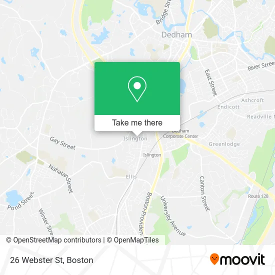
See 26 Webster St, Boston, on the map
Public Transit to 26 Webster St in Boston
Wondering how to get to 26 Webster St in Boston? Moovit helps you find the best way to get to 26 Webster St with step-by-step directions from the nearest public transit station.
Moovit provides free maps and live directions to help you navigate through your city. View schedules, routes, timetables, and find out how long does it take to get to 26 Webster St in real time.
Looking for the nearest stop or station to 26 Webster St? Check out this list of stops closest to your destination: Washington St @ Hooper St; Norwood Depot; Route 128 - Westwood; Dedham Corporate Center.
Bus: 34E.Train: FRANKLIN/FOXBORO, PROVIDENCE/STOUGHTON, ACELA, NORTHEAST REGIONAL, FOXBORO EVENT SERVICE.
Want to see if there’s another route that gets you there at an earlier time? Moovit helps you find alternative routes or times. Get directions from and directions to 26 Webster St easily from the Moovit App or Website.
We make riding to 26 Webster St easy, which is why over 1.5 million users, including users in Boston, trust Moovit as the best app for public transit. You don’t need to download an individual bus app or train app, Moovit is your all-in-one transit app that helps you find the best bus time or train time available.
For information on prices of bus and train, costs and ride fares to 26 Webster St, please check the Moovit app.
Use the app to navigate to popular places including to the airport, hospital, stadium, grocery store, mall, coffee shop, school, college, and university.
26 Webster St Address: Westwood, MA 02090 street in Boston
- Jen Barsamian - Donahue Real Estate,
- Locks Re-Keyed Locksmith,
- Ideal Image Attleboro,
- Town of Westwood School Dept,
- Paul Hanlon,
- Meier's General Store,
- Islington/Guindon Agency,
- Davidson Robt J Rev,
- Creative Dental,
- RCCG, Westwood Parish,
- The Russian Center for Languages and Arts,
- Kilraine & Son Roofing,
- Pilot Investments, LLC,
- Boston Carriage Limousines,
- Neroli Mercato,
- Factory Certified Appliance Repair,
- DUNKIN',
- 48 Carroll Ave Parking,
- Hogan Tire & Auto,
- Starkweather & Shepley
Places Near 26 Webster St (Boston)
- Boston Children's Hospital, Boston,
- Prudential Center, Boston,
- Cheers, Boston,
- Quincy Market, Boston,
- Boston Convention & Exhibition Center, Boston,
- Boston Medical Center, Boston,
- Seaport District, Boston,
- North End, Boston,
- Wang Theater, Boston,
- Faneuil Hall, Boston,
- Massachusetts General Hospital, Boston,
- Castle Island, Boston,
- Wilbur Theatre, Boston,
- Museum Of Science, Boston,
- Mgm Music Hall, Boston,
- Boston Common, Boston,
- Isabella Stewart Gardner Museum, Boston,
- Td Garden, Boston,
- House Of Blues, Boston,
- Leader Bank Pavilion (Leader Bank Pavillion), Boston
How to get to popular places in Boston with public transit
Get around Boston by public transit!
Traveling around Boston has never been so easy. See step by step directions as you travel to any attraction, street or major public transit station. View bus and train schedules, arrival times, service alerts and detailed routes on a map, so you know exactly how to get to anywhere in Boston.
When traveling to any destination around Boston use Moovit's Live Directions with Get Off Notifications to know exactly where and how far to walk, how long to wait for your line, and how many stops are left. Moovit will alert you when it's time to get off — no need to constantly re-check whether yours is the next stop.
Wondering how to use public transit in Boston or how to pay for public transit in Boston? Moovit public transit app can help you navigate your way with public transit easily, and at minimum cost. It includes public transit fees, ticket prices, and costs. Looking for a map of Boston public transit lines? Moovit public transit app shows all public transit maps in Boston with all Bus, Train, Subway and Ferry routes and stops on an interactive map.
Boston has 4 transit type(s), including: Bus, Train, Subway and Ferry, operated by several transit agencies, including MBTA, Southeastern Regional Transit Authority, MetroWest Regional Transit Authority, Rhode Island Public Transit Authority, WRTA, Lowell Regional Transit Authority, Merrimack Valley Transit, Montachusett Regional Transit Authority, Cape Cod Regional Transit Authority, Brockton Area Transit Authority, Martha's Vineyard Transit Authority, the WAVE - Nantucket Regional Transit Authority, GATRA, Cape Ann Transportation Authority and Massport