See Boston Children's Hospital on the map
Directions to Boston Children's Hospital with public transportation
The following transit lines have routes that pass near Boston Children's Hospital
 Bus:
Bus: - Train:
- Subway:
How to get to Boston Children's Hospital by bus?
Click on the bus route to see step by step directions with maps, line arrival times and updated time schedules.
How to get to Boston Children's Hospital by train?
Click on the train route to see step by step directions with maps, line arrival times and updated time schedules.
How to get to Boston Children's Hospital by subway?
Click on the subway route to see step by step directions with maps, line arrival times and updated time schedules.
Bus stations near Boston Children's Hospital
- Longwood Ave @ Blackfan St,2 min walk,
- Longwood Ave @ Binney St,3 min walk,
- Brookline Ave @ Longwood Ave,5 min walk,
- 677 Huntington Ave,9 min walk,
- Huntington Ave @ Fenwood Rd,11 min walk,
Subway stations near Boston Children's Hospital
- Longwood Medical Area,7 min walk,
- Longwood,11 min walk,
Bus lines to Boston Children's Hospital
- CT2,Sullivan (Limited Stops),
- 8,Harbor Point Via South Bay Center,
- 19,Kenmore,
- 47,Broadway,
- CT3,Avenue Louis Pasteur (Limited Stops),
- GREEN LINE D SHUTTLE,Reservoir - Fenway,
- GREEN LINE D SHUTTLE,Riverside - Fenway,
- GREEN LINE D SHUTTLE,Newton Highlands - Kenmore,
- GREEN LINE D SHUTTLE,Newton Highlands - Fenway,
- GREEN LINE D SHUTTLE,Reservoir - Kenmore,
- GREEN LINE D SHUTTLE,Brookline Hills - Kenmore,
- GREEN LINE D SHUTTLE,Newton Highlands - Kenmore via Saint Mary's Street,
- GREEN LINE D SHUTTLE,Riverside - Kenmore,
- GREEN LINE D SHUTTLE,Riverside - Kenmore via Saint Mary's Street,
- 60,Kenmore - Chestnut Hill Mall,
- 65,Kenmore - Brighton Center,
- GREEN LINE E SHUTTLE,Park Street (Shuttle),
- GREEN LINE E SHUTTLE,Heath Street (Shuttle),
- 39,Haymarket Via Forest Hills,
- 66,Harvard Via Allston,
What are the closest stations to Boston Children's Hospital?
The closest stations to Boston Children's Hospital are:
- Longwood Ave @ Blackfan St is 105 yards away, 2 min walk.
- Longwood Ave @ Binney St is 132 yards away, 3 min walk.
- Brookline Ave @ Longwood Ave is 300 yards away, 5 min walk.
- Longwood Medical Area is 539 yards away, 7 min walk.
- 677 Huntington Ave is 657 yards away, 9 min walk.
- Longwood is 829 yards away, 11 min walk.
- Huntington Ave @ Fenwood Rd is 831 yards away, 11 min walk.
Which bus lines stop near Boston Children's Hospital?
These bus lines stop near Boston Children's Hospital: 19, 39, CT2, CT3.
Which train lines stop near Boston Children's Hospital?
These train lines stop near Boston Children's Hospital: FRAMINGHAM/WORCESTER, FRANKLIN/FOXBORO, PROVIDENCE/STOUGHTON.
Which subway lines stop near Boston Children's Hospital?
These subway lines stop near Boston Children's Hospital: GREEN LINE D, GREEN LINE E.
What’s the nearest subway station to Boston Children's Hospital?
The nearest subway station to Boston Children's Hospital is Longwood Medical Area. It’s a 7 min walk away.
What’s the nearest bus stop to Boston Children's Hospital?
The nearest bus stop to Boston Children's Hospital is Longwood Ave @ Blackfan St. It’s a 2 min walk away.
What time is the first subway to Boston Children's Hospital?
The GREEN LINE D is the first subway that goes to Boston Children's Hospital. It stops nearby at 4:55 AM.
What time is the last subway to Boston Children's Hospital?
The GREEN LINE D is the last subway that goes to Boston Children's Hospital. It stops nearby at 1:28 AM.
What time is the first bus to Boston Children's Hospital?
The 39 is the first bus that goes to Boston Children's Hospital. It stops nearby at 4:48 AM.
What time is the last bus to Boston Children's Hospital?
The 39 is the last bus that goes to Boston Children's Hospital. It stops nearby at 1:20 AM.
How much is the subway fare to Boston Children's Hospital?
The subway fare to Boston Children's Hospital costs about $2.40.
How much is the train fare to Boston Children's Hospital?
The train fare to Boston Children's Hospital costs about $2.40 - $12.25.
See Boston Children's Hospital on the map
Public Transportation to Boston Children's Hospital
Wondering how to get to Boston Children's Hospital, United States? Moovit helps you find the best way to get to Boston Children's Hospital with step-by-step directions from the nearest public transit station.
Moovit provides free maps and live directions to help you navigate through your city. View schedules, routes, timetables, and find out how long does it take to get to Boston Children's Hospital in real time.
Looking for the nearest stop or station to Boston Children's Hospital? Check out this list of stops closest to your destination: Longwood Ave @ Blackfan St; Longwood Ave @ Binney St; Brookline Ave @ Longwood Ave; Longwood Medical Area; 677 Huntington Ave; Longwood; Huntington Ave @ Fenwood Rd.
Bus:Train:Subway:
Want to see if there’s another route that gets you there at an earlier time? Moovit helps you find alternative routes or times. Get directions from and directions to Boston Children's Hospital easily from the Moovit App or Website.
We make riding to Boston Children's Hospital easy, which is why over 1.5 million users, including users in Boston, trust Moovit as the best app for public transit. You don’t need to download an individual bus app or train app, Moovit is your all-in-one transit app that helps you find the best bus time or train time available.
For information on prices of bus, subway and train, costs and ride fares to Boston Children's Hospital, please check the Moovit app.
Use the app to navigate to popular places including to the airport, hospital, stadium, grocery store, mall, coffee shop, school, college, and university.
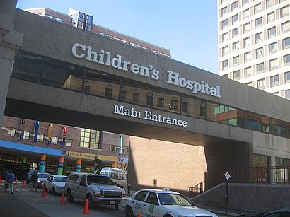
Boston Children's Hospital Address: Blackfan Street street in Boston
Popular routes to Boston Children's Hospital
Attractions near Boston Children's Hospital
Baruch S. Krauss, MD, Edm,Spine Division,Stella Kourembanas MD,Susan Saleeb MD,Fatma Dedeoglu, MD,Eitan Rubinstein MD,Joan Daya-Daly, MD,Pierre Dhemecourt,Christine Salinas, Psyd,Nikki Check, Pa-C,Martin Broff, MD,Prathima Nandivada, MD,Amy O'Connell MD PHD,Anne Marie Valente MD,Sarah Cavallaro, MD,Muscular Dystrophy Association,BJ's Playground,Kathy Jenkins MD MPH,Arnold Sansevere MD,Joyce Li, MDHow to get to popular attractions in Boston with public transit
Bell In Hand Tavern, Boston,Star Market, Newton,Apple Providence Place,Dillon's, Boston,MBTA Cleveland Circle Station, Boston,Milford, MA, Milford,MET Back Bay, Boston,Samuel Adams Brewery, Boston,Five Horses Tavern, Somerville,BonChon Chicken, Boston,Golds Gym,Cafeteria Boston, Boston,Quincy Center, Quincy,Flour Bakery & Cafe, Boston,White Horse Tavern, Boston,Ruggles Station, Boston,Union Station (WOR), Worcester,Dave & Buster's,Raising Cane's Chicken Fingers, Boston,Portsmouth, RIGet around Boston by public transit!
Traveling around Boston has never been so easy. See step by step directions as you travel to any attraction, street or major public transit station. View bus and train schedules, arrival times, service alerts and detailed routes on a map, so you know exactly how to get to anywhere in Boston.
When traveling to any destination around Boston use Moovit's Live Directions with Get Off Notifications to know exactly where and how far to walk, how long to wait for your line, and how many stops are left. Moovit will alert you when it's time to get off — no need to constantly re-check whether yours is the next stop.
Wondering how to use public transit in Boston or how to pay for public transit in Boston? Moovit public transit app can help you navigate your way with public transit easily, and at minimum cost. It includes public transit fees, ticket prices, and costs. Looking for a map of Boston public transit lines? Moovit public transit app shows all public transit maps in Boston with all bus, subway or train routes and stops on an interactive map.
Boston has 3 transit type(s), including: bus, subway or train, operated by several transit agencies, including MBTA, MBTA, MBTA, Southeastern Regional Transit Authority, MetroWest Regional Transit Authority, Rhode Island Public Transit Authority, WRTA, Lowell Regional Transit Authority, Merrimack Valley Transit, Montachusett Regional Transit Authority, Cape Cod Regional Transit Authority, Brockton Area Transit Authority, Cape Cod Regional Transit Authority, Martha's Vineyard Transit Authority and the WAVE - Nantucket Regional Transit Authority