See 36th St, Brooklyn, on the map
Directions to 36th St (Brooklyn) with public transportation
The following transit lines have routes that pass near 36th St
 Bus:
Bus: - Subway:
How to get to 36th St by bus?
Click on the bus route to see step by step directions with maps, line arrival times and updated time schedules.
How to get to 36th St by subway?
Click on the subway route to see step by step directions with maps, line arrival times and updated time schedules.
Bus stations near 36th St in Brooklyn
- 36 St/4 Av,3 min walk,
- 5 Av/39 St,5 min walk,
- 39 St/5 Av,5 min walk,
- 3 Av/34 St,7 min walk,
Subway stations near 36th St in Brooklyn
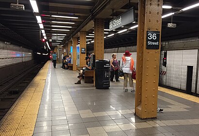
- 36 St [D,N,R],4 min walk,
Bus lines to 36th St in Brooklyn
- B70,Dyker Heights Va Hospital,
- B63,Bay Ridge Shore Rd Via 5 Av,
- B35,Limited Sunset Park 1 Av Via Church Av,
- B37,Atlantic Av Barclays Center Via 3 Av,
What are the closest stations to 36th St?
The closest stations to 36th St are:
- 36 St/4 Av is 177 yards away, 3 min walk.
- 36 St [D,N,R] is 252 yards away, 4 min walk.
- 5 Av/39 St is 341 yards away, 5 min walk.
- 39 St/5 Av is 408 yards away, 5 min walk.
- 3 Av/34 St is 522 yards away, 7 min walk.
Which bus lines stop near 36th St?
These bus lines stop near 36th St: B35, B37, B63.
Which subway lines stop near 36th St?
These subway lines stop near 36th St: D, N, R.
What’s the nearest subway station to 36th St in Brooklyn?
The nearest subway station to 36th St in Brooklyn is 36 St [D,N,R]. It’s a 4 min walk away.
What’s the nearest bus stop to 36th St in Brooklyn?
The nearest bus stop to 36th St in Brooklyn is 36 St/4 Av. It’s a 3 min walk away.
See 36th St, Brooklyn, on the map
Public Transit to 36th St in Brooklyn
Wondering how to get to 36th St in Brooklyn, United States? Moovit helps you find the best way to get to 36th St with step-by-step directions from the nearest public transit station.
Moovit provides free maps and live directions to help you navigate through your city. View schedules, routes, timetables, and find out how long does it take to get to 36th St in real time.
Looking for the nearest stop or station to 36th St? Check out this list of stops closest to your destination: 36 St/4 Av; 36 St [D,N,R]; 5 Av/39 St; 39 St/5 Av; 3 Av/34 St.
Bus:Subway:
Want to see if there’s another route that gets you there at an earlier time? Moovit helps you find alternative routes or times. Get directions from and directions to 36th St easily from the Moovit App or Website.
We make riding to 36th St easy, which is why over 1.5 million users, including users in Brooklyn, trust Moovit as the best app for public transit. You don’t need to download an individual bus app or train app, Moovit is your all-in-one transit app that helps you find the best bus time or train time available.
For information on prices of subway and bus, costs and ride fares to 36th St, please check the Moovit app.
Use the app to navigate to popular places including to the airport, hospital, stadium, grocery store, mall, coffee shop, school, college, and university.
36th St Address: Brooklyn, NY 11232 street in Brooklyn
Attractions near 36th St
Bookery,Pantomima - Theatrical Experiences for Kids,Public Health Solutions,Acts Christian Church,Melody Lanes,Gio's Express,461 37th St,NYCT DOB - Jackie Gleason Depot Brooklyn Divison,Alicia's Employment Agency,Lioni Hero Sunset,Iglesia Alcance Victoria,La Fe Restaurant,Hernandez & Paulonis, P.C.,Old Brooklyn Real Estate,Prosperity Noodle,MTA Subway - 36th St (D/N/R),5th Ave 36th,5th Ave Ave 36th St,36th St (36th st and 4th ave),36th St (36th street 4th avenue)How to get to popular attractions in Brooklyn with public transit
Boat Basin Cafe, Manhattan,Newark Liberty International Airport (EWR), Newark, Nj,I-80 (Interstate 80), Paterson, Nj,Clinton St. Baking Co. & Restaurant, Manhattan,Great Lawn, Manhattan,Ace Hotel Lobby Bar, Manhattan,Woorijip, Manhattan,Mission Dolores,Sheep Meadow, Manhattan,The Biergarten at The Standard, Manhattan,Beauty & Essex, Manhattan,Upper West Side, Manhattan,Jing Fong Restaurant 金豐大酒樓, Manhattan,Shake Shack, Manhattan,Jersey Shore University Medical Center, Neptune, Nj,MTA Subway - 30th Ave (N/W), Queens,The Stumble Inn, Manhattan,SoHo, Manhattan,Nassau Community College, East Garden City, Ny,Secaucus, NJ, Secaucus, NjGet around Brooklyn by public transit!
Traveling around Brooklyn has never been so easy. See step by step directions as you travel to any attraction, street or major public transit station. View bus and train schedules, arrival times, service alerts and detailed routes on a map, so you know exactly how to get to anywhere in Brooklyn.
When traveling to any destination around Brooklyn use Moovit's Live Directions with Get Off Notifications to know exactly where and how far to walk, how long to wait for your line, and how many stops are left. Moovit will alert you when it's time to get off — no need to constantly re-check whether yours is the next stop.
Wondering how to use public transit in Brooklyn or how to pay for public transit in Brooklyn? Moovit public transit app can help you navigate your way with public transit easily, and at minimum cost. It includes public transit fees, ticket prices, and costs. Looking for a map of Brooklyn public transit lines? Moovit public transit app shows all public transit maps in Brooklyn with all subway or bus routes and stops on an interactive map.
Brooklyn has 2 transit type(s), including: subway or bus, operated by several transit agencies, including MTA Subway, Metro-North Railroad, LIRR, PATH, Shore Line East, MTA Bus Company, MTA New York City Transit - Express routes, MTA Bus, NJ Transit, NYC Ferry, NICE bus, Bee-Line Bus, NJ Transit Rail, NJ Transit Rail and Norwalk Transit District