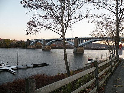
See 40th Street Bridge, Pittsburgh, on the map
Directions to 40th Street Bridge (Pittsburgh) with public transportation
The following transit lines have routes that pass near 40th Street Bridge
 Bus:
Bus: - Train:
How to get to 40th Street Bridge by bus?
Click on the bus route to see step by step directions with maps, line arrival times and updated time schedules.
Light Rail stations near 40th Street Bridge in Pittsburgh
- Wood Street,6 min walk,
Bus stations near 40th Street Bridge in Pittsburgh
- 40th St + Butler,8 min walk,
- Butler St + 40th St Ns,9 min walk,
- East Ohio St + Grant,12 min walk,
Train stations near 40th Street Bridge in Pittsburgh
- Pittsburgh Amtrak Station,57 min walk,
Bus lines to 40th Street Bridge in Pittsburgh
- 93,Outbound-Lawrenceville Shopping Center,
- 64,Inbound-Lawrenceville Via Sq Hill-Shadyside-Bloomfield,
- 91,Outbound-Old Freeport Rd,
- 1,Inbound-Downtown,
- 2,Inbound-Downtown Via Millvale,
What are the closest stations to 40th Street Bridge?
The closest stations to 40th Street Bridge are:
- Wood Street is 425 yards away, 6 min walk.
- 40th St + Butler is 676 yards away, 8 min walk.
- Butler St + 40th St Ns is 697 yards away, 9 min walk.
- East Ohio St + Grant is 983 yards away, 12 min walk.
- Pittsburgh Amtrak Station is 4766 yards away, 57 min walk.
Which bus lines stop near 40th Street Bridge?
These bus lines stop near 40th Street Bridge: 86, 91.
What’s the nearest light rail station to 40th Street Bridge in Pittsburgh?
The nearest light rail station to 40th Street Bridge in Pittsburgh is Wood Street. It’s a 6 min walk away.
What’s the nearest bus stop to 40th Street Bridge in Pittsburgh?
The nearest bus stop to 40th Street Bridge in Pittsburgh is 40th St + Butler. It’s a 8 min walk away.
What time is the first light rail to 40th Street Bridge in Pittsburgh?
The RED is the first light rail that goes to 40th Street Bridge in Pittsburgh. It stops nearby at 4:46 AM.
What time is the last light rail to 40th Street Bridge in Pittsburgh?
The RED is the last light rail that goes to 40th Street Bridge in Pittsburgh. It stops nearby at 1:39 AM.
What time is the first train to 40th Street Bridge in Pittsburgh?
The CAPITOL LIMITED is the first train that goes to 40th Street Bridge in Pittsburgh. It stops nearby at 5:20 AM.
What time is the last train to 40th Street Bridge in Pittsburgh?
The CAPITOL LIMITED is the last train that goes to 40th Street Bridge in Pittsburgh. It stops nearby at 5:20 AM.
What time is the first bus to 40th Street Bridge in Pittsburgh?
The 91 is the first bus that goes to 40th Street Bridge in Pittsburgh. It stops nearby at 4:37 AM.
What time is the last bus to 40th Street Bridge in Pittsburgh?
The 64 is the last bus that goes to 40th Street Bridge in Pittsburgh. It stops nearby at 1:45 AM.
How much is the bus fare to 40th Street Bridge?
The bus fare to 40th Street Bridge costs about $2.75.
See 40th Street Bridge, Pittsburgh, on the map
Public Transit to 40th Street Bridge in Pittsburgh
Wondering how to get to 40th Street Bridge in Pittsburgh, United States? Moovit helps you find the best way to get to 40th Street Bridge with step-by-step directions from the nearest public transit station.
Moovit provides free maps and live directions to help you navigate through your city. View schedules, routes, timetables, and find out how long does it take to get to 40th Street Bridge in real time.
Looking for the nearest stop or station to 40th Street Bridge? Check out this list of stops closest to your destination: Wood Street; 40th St + Butler; Butler St + 40th St Ns; East Ohio St + Grant; Pittsburgh Amtrak Station.
Bus:Train:
Want to see if there’s another route that gets you there at an earlier time? Moovit helps you find alternative routes or times. Get directions from and directions to 40th Street Bridge easily from the Moovit App or Website.
We make riding to 40th Street Bridge easy, which is why over 1.5 million users, including users in Pittsburgh, trust Moovit as the best app for public transit. You don’t need to download an individual bus app or train app, Moovit is your all-in-one transit app that helps you find the best bus time or train time available.
For information on prices of bus and light rail, costs and ride fares to 40th Street Bridge, please check the Moovit app.
Use the app to navigate to popular places including to the airport, hospital, stadium, grocery store, mall, coffee shop, school, college, and university.
40th Street Bridge Address: 40th Street Bridge street in Pittsburgh
Attractions near 40th Street Bridge
Lawrenceville Launch,Carnegie Mellon Robotics Academy,40t 40th St,Bay 41,Millvale Riverfront Park Launch,The Foundry at 41st,Children's Hospital of Pittsburgh Foundation,ChargePoint,39t 39th St,Comira Solutions,Green Mountain Energy,Wells Fargo Advisors,Icehouse Recording,Whiteys Mobile Wash 2,Edward Marc Brands,Edward Marc Chocolatier,Global Green Energy,Kayak Pittsburgh,42n 42nd St,Pittsburgh KitchenramaHow to get to popular attractions in Pittsburgh with public transit
Turtle Creek, Turtle Creek,Banksville Road and Potomac Avenue Bus Stop, Pittsburgh,Bus Stop At Stanwix & 4th Ave, Pittsburgh,Clever Park,Braddock, Braddock,Coraopolis-Neville Island Bridge!, Coraopolis,29-Robinson, Crafton,Wharton Square, Pittsburgh,Heinz Hall, Pittsburgh,Dollar Bank, Pittsburgh,Green Tree, Green Tree,Giant Eagle,Pittsburgh Bottle Shop Cafe,Lincoln-Lemington, Pittsburgh,Bridgeville, Bridgeville,Carrick, Pittsburgh,Omni William Penn Hotel, Pittsburgh,David L. Lawrence Convention Center, Pittsburgh,Interstate 79 at Exit 66, Glenfield,Wilkinsburg, WilkinsburgGet around Pittsburgh by public transit!
Traveling around Pittsburgh has never been so easy. See step by step directions as you travel to any attraction, street or major public transit station. View bus and train schedules, arrival times, service alerts and detailed routes on a map, so you know exactly how to get to anywhere in Pittsburgh.
When traveling to any destination around Pittsburgh use Moovit's Live Directions with Get Off Notifications to know exactly where and how far to walk, how long to wait for your line, and how many stops are left. Moovit will alert you when it's time to get off — no need to constantly re-check whether yours is the next stop.
Wondering how to use public transit in Pittsburgh or how to pay for public transit in Pittsburgh? Moovit public transit app can help you navigate your way with public transit easily, and at minimum cost. It includes public transit fees, ticket prices, and costs. Looking for a map of Pittsburgh public transit lines? Moovit public transit app shows all public transit maps in Pittsburgh with all bus or light rail routes and stops on an interactive map.
Pittsburgh has 2 transit type(s), including: bus or light rail, operated by several transit agencies, including Pittsburgh Regional Transit, Pittsburgh Regional Transit, CamTran, Amtran, Mid Mon Valley Transit, BCTA, Butler Transit Authority, IndiGo, Area Transportation Authority, Freedom Transit, Pittsburgh Regional Transit, Mountain Line Transit Authority, Megabus, Greyhound-us and Fullington Trailways