See A38 Hajó, Budapest, on the map
Directions to A38 Hajó (Budapest) with public transportation
The following transit lines have routes that pass near A38 Hajó
 Bus:
Bus: - Train:
- Metro:
- Light Rail:
How to get to A38 Hajó by bus?
Click on the bus route to see step by step directions with maps, line arrival times and updated time schedules.
How to get to A38 Hajó by train?
Click on the train route to see step by step directions with maps, line arrival times and updated time schedules.
How to get to A38 Hajó by metro?
Click on the metro route to see step by step directions with maps, line arrival times and updated time schedules.
Bus stations near A38 Hajó in Budapest
- Petőfi Híd, Budai Hídfő,6 min walk,
- Haller Utca / Soroksári Út,9 min walk,
- Boráros Tér H,14 min walk,
Light Rail stations near A38 Hajó in Budapest
- Petőfi Híd, Budai Hídfő,6 min walk,
- Boráros Tér H,12 min walk,
Train stations near A38 Hajó in Budapest
- Boráros Tér,16 min walk,
Bus lines to A38 Hajó in Budapest
- 107,Infopark ► Budapart,
- 6,Móricz Zsigmond körtér M / Széll Kálmán tér M,
- 153,Infopark (Pázmány Péter sétány) / Gazdagréti tér,
- 154,Gazdagréti tér / Petőfi híd budai hídfő,
- 212,Boráros tér H / Normafa látogatóközpont,
- 212A,Boráros tér H / Svábhegy,
- 212B,Boráros tér H / Csillebérc KFKI,
- 918,Kelenföld vasútállomás M / Óbudai autóbuszgarázs,
- 54,Pestszentimre, Ültetvény Utca,
- 55,Vecsési Út ► Boráros Tér H,
- 223E,Pesterzsébeti Lakótelep,
- 224,Szentlőrinci Úti Lakótelep,
- 224E,Boráros Tér H,
- 255E,Alacskai Úti Lakótelep,
- 923,Dél-Pesti Autóbuszgarázs,
- 934,Békásmegyer H,
- 979,Csepel, Szent Imre Tér,
- 979A,Csepel, Csillagtelep,
- 15,Boráros Tér H,
What are the closest stations to A38 Hajó?
The closest stations to A38 Hajó are:
- Petőfi Híd, Budai Hídfő is 423 meters away, 6 min walk.
- Haller Utca / Soroksári Út is 619 meters away, 9 min walk.
- Boráros Tér H is 875 meters away, 12 min walk.
- Boráros Tér is 1169 meters away, 16 min walk.
Which bus lines stop near A38 Hajó?
These bus lines stop near A38 Hajó: 107, 154.
Which train line stops near A38 Hajó?
H5
Which metro line stops near A38 Hajó?
M4
Which light rail line stops near A38 Hajó?
4-6
What’s the nearest light rail station to A38 Hajó in Budapest?
The nearest light rail station to A38 Hajó in Budapest is Petőfi Híd, Budai Hídfő. It’s a 6 min walk away.
What’s the nearest train station to A38 Hajó in Budapest?
The nearest train station to A38 Hajó in Budapest is Boráros Tér. It’s a 16 min walk away.
What’s the nearest bus stop to A38 Hajó in Budapest?
The nearest bus stop to A38 Hajó in Budapest is Petőfi Híd, Budai Hídfő. It’s a 6 min walk away.
What time is the first light rail to A38 Hajó in Budapest?
The 4-6 is the first light rail that goes to A38 Hajó in Budapest. It stops nearby at 3:00 AM.
What time is the last light rail to A38 Hajó in Budapest?
The 6 is the last light rail that goes to A38 Hajó in Budapest. It stops nearby at 3:10 AM.
What time is the first bus to A38 Hajó in Budapest?
The 979A is the first bus that goes to A38 Hajó in Budapest. It stops nearby at 3:03 AM.
What time is the last bus to A38 Hajó in Budapest?
The 923 is the last bus that goes to A38 Hajó in Budapest. It stops nearby at 3:35 AM.
See A38 Hajó, Budapest, on the map
Public Transit to A38 Hajó in Budapest
Wondering how to get to A38 Hajó in Budapest, Hungary? Moovit helps you find the best way to get to A38 Hajó with step-by-step directions from the nearest public transit station.
Moovit provides free maps and live directions to help you navigate through your city. View schedules, routes, timetables, and find out how long does it take to get to A38 Hajó in real time.
Looking for the nearest stop or station to A38 Hajó? Check out this list of stops closest to your destination: Petőfi Híd; Haller Utca / Soroksári Út; Boráros Tér H; Boráros Tér.
Bus:Train:Metro:Light Rail:
Want to see if there’s another route that gets you there at an earlier time? Moovit helps you find alternative routes or times. Get directions from and directions to A38 Hajó easily from the Moovit App or Website.
We make riding to A38 Hajó easy, which is why over 1.5 million users, including users in Budapest, trust Moovit as the best app for public transit. You don’t need to download an individual bus app or train app, Moovit is your all-in-one transit app that helps you find the best bus time or train time available.
For information on prices of bus, light rail, metro and train, costs and ride fares to A38 Hajó, please check the Moovit app.
Use the app to navigate to popular places including to the airport, hospital, stadium, grocery store, mall, coffee shop, school, college, and university.
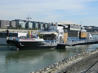
A38 Hajó Address: Petőfi bridge, Buda side street in Budapest
Attractions near A38 Hajó
Egyetemváros - A38,A38,A38 H2,Egyetemváros - A38 hajóállomás,ELTE Lágymányos Hajóorr,Petőfi híd,D11 D12 D13,ELTE TTK Kémia Épület,ELTE Északi Tömb Harmónia terem,Rio D.I.Y. Spot,D11 D12 D13,Petőfi Híd, Budai Hídfő,Petőfi Híd,ELTE Északi Tömb Gömb Aula,Elte Társadalomtudományi Kar,Campus Faloda,ELTE Északi Tömb 0.83 (Eötvös Loránd terem),Petőfi híd, budai hídfő (4, 6),Petőfi Híd - Buda,ELTE IK HÖKHow to get to popular attractions in Budapest with public transit
TESCO Hipermarket, Ráckeve,Budapest, Népliget Autóbusz-Pályaudvar, Budapest,Fellini Római Kultúrbisztró, Budapest,Siemens Zrt. Csepel, Budapest,Arena Mall Üzletközpont, Budapest,SPAR, Gödöllo,Csepel - Kertváros, Budapest,Don Pepe, Budapest,Horizont ház, Budapest,Etele Út / Fehérvári Út, Budapest,Sziget Fesztivál, Budapest,Budafoki Business Center, Budapest,Pizza Paradicsom, Budapest,ELMŰ Dél-budai Régióközpont, Budapest,Flórián Bevásárlóközpont, Budapest,Apáthy-szikla, Budapest,Bambuszliget Japán Étterem & Sushi Bár, Budapest,Káposztásmegyer II, Budapest,Kelenföld, városközpont, Budapest,Budapest-Keleti, BudapestGet around Budapest by public transit!
Traveling around Budapest has never been so easy. See step by step directions as you travel to any attraction, street or major public transit station. View bus and train schedules, arrival times, service alerts and detailed routes on a map, so you know exactly how to get to anywhere in Budapest.
When traveling to any destination around Budapest use Moovit's Live Directions with Get Off Notifications to know exactly where and how far to walk, how long to wait for your line, and how many stops are left. Moovit will alert you when it's time to get off — no need to constantly re-check whether yours is the next stop.
Wondering how to use public transit in Budapest or how to pay for public transit in Budapest? Moovit public transit app can help you navigate your way with public transit easily, and at minimum cost. It includes public transit fees, ticket prices, and costs. Looking for a map of Budapest public transit lines? Moovit public transit app shows all public transit maps in Budapest with all bus, light rail, metro or train routes and stops on an interactive map.
Budapest has 4 transit type(s), including: bus, light rail, metro or train, operated by several transit agencies, including BKK, BKK, BKK, BKK and MÁV-HÉV