Directions to ATM (Waltham) with public transportation
The following transit lines have routes that pass near ATM
 Bus: 556, 70, 61.
- Train: FRAMINGHAM/WORCESTER, FITCHBURG.
How to get to ATM by bus?
Click on the bus route to see step by step directions with maps, line arrival times and updated time schedules.
From Charles W. Eliot Bridge, Boston
60 minFrom Christian A Herter Park, Boston
58 minFrom Regina Pizzeria, Boston
54 minFrom Allston, Boston
55 minFrom Citizens Bank Opera House, Boston
50 minFrom Harvard Stadium, Boston
60 minFrom MBTA / Alewife #6, Cambridge
89 minFrom AWACS (Bldg 1612), Hanscom Afb
161 minFrom Roadrunner, Boston
67 minFrom Brighton Music Hall, Boston
50 min
Bus stops near ATM in Waltham
What are the closest stations to ATM?
The closest stations to ATM are:
- Tomlin St @ Summit St is 15 yards away, 1 min walk.
- Bacon St @ Plympton St is 609 yards away, 8 min walk.
- West Newton is 1313 yards away, 16 min walk.
- Waltham is 2916 yards away, 35 min walk.
Which bus lines stop near ATM?
These bus lines stop near ATM: 556, 70.
What’s the nearest train station to ATM in Waltham?
The nearest train station to ATM in Waltham is West Newton. It’s a 16 min walk away.
What’s the nearest bus station to ATM in Waltham?
The nearest bus station to ATM in Waltham is Tomlin St @ Summit St. It’s a 1 min walk away.
What time is the first train to ATM in Waltham?
The FRAMINGHAM/WORCESTER is the first train that goes to ATM in Waltham. It stops nearby at 5:19 AM.
What time is the last train to ATM in Waltham?
The FITCHBURG is the last train that goes to ATM in Waltham. It stops nearby at 12:19 AM.
What time is the first bus to ATM in Waltham?
The 61 is the first bus that goes to ATM in Waltham. It stops nearby at 5:58 AM.
What time is the last bus to ATM in Waltham?
The 61 is the last bus that goes to ATM in Waltham. It stops nearby at 8:30 PM.
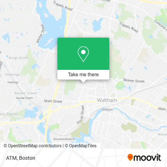
See ATM, Waltham, on the map
Public Transit to ATM in Waltham
Wondering how to get to ATM in Waltham? Moovit helps you find the best way to get to ATM with step-by-step directions from the nearest public transit station.
Moovit provides free maps and live directions to help you navigate through your city. View schedules, routes, timetables, and find out how long does it take to get to ATM in real time.
Looking for the nearest stop or station to ATM? Check out this list of stops closest to your destination: Tomlin St @ Summit St; Bacon St @ Plympton St; West Newton; Waltham.
Bus: 556, 70, 61.Train: FRAMINGHAM/WORCESTER, FITCHBURG.
Want to see if there’s another route that gets you there at an earlier time? Moovit helps you find alternative routes or times. Get directions from and directions to ATM easily from the Moovit App or Website.
We make riding to ATM easy, which is why over 1.5 million users, including users in Waltham, trust Moovit as the best app for public transit. You don’t need to download an individual bus app or train app, Moovit is your all-in-one transit app that helps you find the best bus time or train time available.
For information on prices of bus, subway and train, costs and ride fares to ATM, please check the Moovit app.
Use the app to navigate to popular places including to the airport, hospital, stadium, grocery store, mall, coffee shop, school, college, and university.
ATM Address: 61 Tomlin St Waltham, MA 02451 street in Waltham
- Available Locksmith,
- MBTA Bus Route 556,
- Lord's Castle,
- Ultrafast Pest Control,
- Prospect Hill Park,
- Waltham Church of God,
- JDL Remodeling,
- Pine Street Inn LTH,
- CubeSmart,
- Star Locks,
- Tan Yang Lu,
- Justice Resource Institute,
- Reynolds Justin W & Associates,
- Benjamin Moore,
- Hogan Tire & Auto,
- Dominican Grill Chicken Pizza,
- Mls Property Information Network,
- Div Waltham Main Street,
- Metro PCS,
- E.M. Snow, Inc
Places Near ATM (Waltham)
- Boston Convention & Exhibition Center, Boston,
- Quincy Market, Boston,
- Massachusetts General Hospital, Boston,
- Isabella Stewart Gardner Museum, Boston,
- Museum Of Science, Boston,
- Wang Theater, Boston,
- Prudential Center, Boston,
- Boston Children's Hospital, Boston,
- Seaport District, Boston,
- Cheers, Boston,
- Leader Bank Pavilion (Leader Bank Pavillion), Boston,
- House Of Blues, Boston,
- Boston Common, Boston,
- Td Garden, Boston,
- Wilbur Theatre, Boston,
- Castle Island, Boston,
- Mgm Music Hall, Boston,
- Faneuil Hall, Boston,
- North End, Boston,
- Boston Medical Center, Boston
How to get to popular places in Boston with public transit
Get around Waltham by public transit!
Traveling around Waltham has never been so easy. See step by step directions as you travel to any attraction, street or major public transit station. View bus and train schedules, arrival times, service alerts and detailed routes on a map, so you know exactly how to get to anywhere in Waltham.
When traveling to any destination around Waltham use Moovit's Live Directions with Get Off Notifications to know exactly where and how far to walk, how long to wait for your line, and how many stops are left. Moovit will alert you when it's time to get off — no need to constantly re-check whether yours is the next stop.
Wondering how to use public transit in Waltham or how to pay for public transit in Waltham? Moovit public transit app can help you navigate your way with public transit easily, and at minimum cost. It includes public transit fees, ticket prices, and costs. Looking for a map of Waltham public transit lines? Moovit public transit app shows all public transit maps in Waltham with all Bus, Train, Subway and Ferry routes and stops on an interactive map.
Boston has 4 transit type(s), including: Bus, Train, Subway and Ferry, operated by several transit agencies, including MBTA, Southeastern Regional Transit Authority, MetroWest Regional Transit Authority, Rhode Island Public Transit Authority, WRTA, Lowell Regional Transit Authority, Merrimack Valley Transit, Montachusett Regional Transit Authority, Cape Cod Regional Transit Authority, Brockton Area Transit Authority, Martha's Vineyard Transit Authority, the WAVE - Nantucket Regional Transit Authority, GATRA, Cape Ann Transportation Authority and Massport