See Adele H. Stamp Student Union, College Park, on the map
Directions to Adele H. Stamp Student Union (College Park) with public transportation
The following transit lines have routes that pass near Adele H. Stamp Student Union
 Bus:
Bus: - Train:
- Metro:
How to get to Adele H. Stamp Student Union by bus?
Click on the bus route to see step by step directions with maps, line arrival times and updated time schedules.
How to get to Adele H. Stamp Student Union by train?
Click on the train route to see step by step directions with maps, line arrival times and updated time schedules.
How to get to Adele H. Stamp Student Union by metro?
Click on the metro route to see step by step directions with maps, line arrival times and updated time schedules.
Which bus lines stop near Adele H. Stamp Student Union?
These bus lines stop near Adele H. Stamp Student Union: 104, 111, C8, F6.
Which train line stops near Adele H. Stamp Student Union?
MARC
Which metro line stops near Adele H. Stamp Student Union?
METRORAIL GREEN LINE
See Adele H. Stamp Student Union, College Park, on the map
Public Transit to Adele H. Stamp Student Union in College Park
Wondering how to get to Adele H. Stamp Student Union in College Park, United States? Moovit helps you find the best way to get to Adele H. Stamp Student Union with step-by-step directions from the nearest public transit station.
Moovit provides free maps and live directions to help you navigate through your city. View schedules, routes, timetables, and find out how long does it take to get to Adele H. Stamp Student Union in real time.
Bus:Train:Metro:
Want to see if there’s another route that gets you there at an earlier time? Moovit helps you find alternative routes or times. Get directions from and directions to Adele H. Stamp Student Union easily from the Moovit App or Website.
We make riding to Adele H. Stamp Student Union easy, which is why over 1.5 million users, including users in College Park, trust Moovit as the best app for public transit. You don’t need to download an individual bus app or train app, Moovit is your all-in-one transit app that helps you find the best bus time or train time available.
For information on prices of bus, metro and train, costs and ride fares to Adele H. Stamp Student Union, please check the Moovit app.
Use the app to navigate to popular places including to the airport, hospital, stadium, grocery store, mall, coffee shop, school, college, and university.
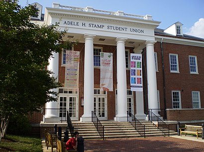
Adele H. Stamp Student Union Address: Fieldhouse Drive street in College Park
Attractions near Adele H. Stamp Student Union
4122 Fieldhouse Drive,Adele H.Stamp Student Union Building,Umd Bookstore,Testudo (Adele H. Stamp Student Union),1220 Stamp Student Un,Pyon Su,Jim Henson And Kermit Statue,Umd Orientation,3120 Health Ctr,University of Maryland College Park Book Store,Capital One ATM,Bob Turtle Smith Stadium,University of Maryland Health Center,Maryland Food Co-OP,Bob Turtle Smith Baseball Stadium,Health Center,Landscape Architecture,140 Campus Drive,Nyumburu Cultural Center,McKeldin LibraryHow to get to popular attractions in College Park with public transit
Uncle Julio's Rio Grande Cafe, Montgomery County,BWI Rental Car Facility, Anne Arundel County,P.J. Clarke's, Washington,Honey Pig Gooldaegee Korean Grill, Fairfax County,Ebenezers Coffeehouse, Washington,Biergarten Haus, Washington,Herndon, Virginia, Fairfax County,Intercounty Connector (ICC) / MD 200, Montgomery County,Buffalo Wild Wings, Anne Arundel County,New Psalmist Baptist Church, Baltimore County,Green Lantern, Washington,Under Armour, Baltimore,Owings Mills, Maryland, Baltimore County,Earth Treks Climbing Center, Montgomery County,The Hippodrome Theatre at the France-Merrick Performing Arts Center, Baltimore,Gordon Biersch Brewery Restaurant, Fairfax County,Peking Gourmet Inn, Fairfax County,Hyatt Regency Baltimore Inner Harbor, Baltimore,Perry Hall, Maryland, Baltimore County,Walmart Supercenter, Baltimore CountyGet around College Park by public transit!
Traveling around College Park has never been so easy. See step by step directions as you travel to any attraction, street or major public transit station. View bus and train schedules, arrival times, service alerts and detailed routes on a map, so you know exactly how to get to anywhere in College Park.
When traveling to any destination around College Park use Moovit's Live Directions with Get Off Notifications to know exactly where and how far to walk, how long to wait for your line, and how many stops are left. Moovit will alert you when it's time to get off — no need to constantly re-check whether yours is the next stop.
Wondering how to use public transit in College Park or how to pay for public transit in College Park? Moovit public transit app can help you navigate your way with public transit easily, and at minimum cost. It includes public transit fees, ticket prices, and costs. Looking for a map of College Park public transit lines? Moovit public transit app shows all public transit maps in College Park with all bus, metro or train routes and stops on an interactive map.
College Park has 3 transit type(s), including: bus, metro or train, operated by several transit agencies, including WMATA, WMATA, Montgomery County Ride On, Fairfax Connector, TheBus, DC Circulator, MDOT MTA, Marc, MDOT MTA, MDOT MTA, Virginia Railway Express (VRE), PRTC, DASH - Alexandria, Arlington Transit (ART) and DC Streetcar