How to get to Adledge by bus?
Click on the bus route to see step by step directions with maps, line arrival times and updated time schedules.
From ZAC des Hunaudières, Le Mans
104 minFrom Jardiland, Ruaudin
108 minFrom Ntn Transmissions Europe Sa, Allonnes
80 minFrom Carrefour Le Mans, Le Mans
92 minFrom Département de la Sarthe, Le Mans
82 minFrom MMArena, Le Mans
101 minFrom La Pincenardière, Mulsanne
99 minFrom K-rejser Beausejour camp, Le Mans
107 minFrom Family Village, Ruaudin
108 minFrom Sécurité Sociale, Le Mans
58 min
Bus stops near Adledge in Le Mans
Bus lines to Adledge in Le Mans
- 160, Collège Épine,VIEW
- 161, Foresterie,VIEW
- 11, Closerie,VIEW
- 28, La Chapelle-St-Aubin,VIEW
- 33, Universite,VIEW
- T1, Ant-Circuit 24h,VIEW
- 4, St-Georges / St-Joseph – Bellevue-Hauts de C.,VIEW
- 7, Éperon par Auchan,VIEW
- 14, Parc Manceau - St-Martin,VIEW
- 16, Lafayette - Californie,VIEW
- 17, Gallière - Eperon,VIEW
- 20, Éperon - Aigné,VIEW
What are the closest stations to Adledge?
The closest stations to Adledge are:
- Martial Vivet is 232 meters away, 3 min walk.
- Le Cadran is 570 meters away, 8 min walk.
- Université is 636 meters away, 9 min walk.
- Lafayette is 3974 meters away, 51 min walk.
Which bus lines stop near Adledge?
These bus lines stop near Adledge: 11, 12, 28.
Which light rail line stops near Adledge?
T1 (Universite)
What’s the nearest bus station to Adledge in Le Mans?
The nearest bus station to Adledge in Le Mans is Martial Vivet. It’s a 3 min walk away.
What time is the first light rail to Adledge in Le Mans?
The T1 is the first light rail that goes to Adledge in Le Mans. It stops nearby at 5:24 AM.
What time is the last light rail to Adledge in Le Mans?
The T1 is the last light rail that goes to Adledge in Le Mans. It stops nearby at 1:03 AM.
What time is the first bus to Adledge in Le Mans?
The 16 is the first bus that goes to Adledge in Le Mans. It stops nearby at 6:30 AM.
What time is the last bus to Adledge in Le Mans?
The 11 is the last bus that goes to Adledge in Le Mans. It stops nearby at 8:30 PM.
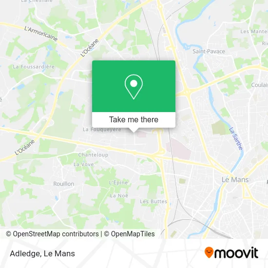
See Adledge, Le Mans, on the map
Public Transit to Adledge in Le Mans
Wondering how to get to Adledge in Le Mans? Moovit helps you find the best way to get to Adledge with step-by-step directions from the nearest public transit station.
Moovit provides free maps and live directions to help you navigate through your city. View schedules, routes, timetables, and find out how long does it take to get to Adledge in real time.
Looking for the nearest stop or station to Adledge? Check out this list of stops closest to your destination: Martial Vivet; Le Cadran; Université; Lafayette.
Bus: 11, 12, 28, 160, 161, 33, T1, 4, 7, 14, 16, 17.Light Rail: T1.
Want to see if there’s another route that gets you there at an earlier time? Moovit helps you find alternative routes or times. Get directions from and directions to Adledge easily from the Moovit App or Website.
We make riding to Adledge easy, which is why over 1.5 million users, including users in Le Mans, trust Moovit as the best app for public transit. You don’t need to download an individual bus app or train app, Moovit is your all-in-one transit app that helps you find the best bus time or train time available.
For information on prices of bus and light rail, costs and ride fares to Adledge, please check the Moovit app.
Use the app to navigate to popular places including to the airport, hospital, stadium, grocery store, mall, coffee shop, school, college, and university.
Adledge Address: 8 Avenue René Laënnec 72000 Le Mans street in Le Mans
- Inalta,
- Institut Sensations,
- Aéro Solutions,
- Id,
- Jdc,
- Ic2 — Institut Informatique Claude Chappe,
- Docteur Jérémie Lamy Chirurgie Plastique et Esthétique le Mans,
- Lukasiewicz Martin,
- Chousterman Michel,
- Cenovia Sortie,
- Sel Dr Milet,
- Clinique Chirurgicale Pré Pasteu,
- Bour Christian,
- Prodétis,
- Bartholdi,
- Arret Tram Clinique Du Pré,
- Pouliquen,
- Immobilier Friedrich Celine,
- CAISSE D'ÉPARGNE,
- Haute Venelle - Clinique Du Pré
Places Near Adledge (Le Mans)
- Camp du 2e RIMa, Champagné,
- Hôpital, Le Mans,
- Centre Hospitalier Du Mans, Le Mans,
- Gare SNCF du Mans, Le Mans,
- Changé, Changé,
- Circuit des 24 Heures du Mans, Le Mans,
- Clinique Pôle Santé Sud, Le Mans,
- Pôle Santé Sud-Elsan, Le Mans,
- Saint-Saturnin, Saint-Saturnin,
- Avenue Bollée, Le Mans,
- Auchan le Mans, La Chapelle-Saint-Aubin,
- Université, Le Mans,
- Family Village, Ruaudin,
- Clinique Du Pré, Le Mans,
- Place des Jacobins (le Mans), Le Mans,
- Parc Des Expositions, Le Mans,
- Maison D'Arrêt Le Mans - Les Croisettes, Coulaines,
- La Chapelle-Saint-Aubin, La Chapelle-Saint-Aubin,
- Coulaines, Coulaines,
- E.Leclerc, Le Mans
How to get to popular places in Le Mans with public transit
Get around Le Mans by public transit!
Traveling around Le Mans has never been so easy. See step by step directions as you travel to any attraction, street or major public transit station. View bus and train schedules, arrival times, service alerts and detailed routes on a map, so you know exactly how to get to anywhere in Le Mans.
When traveling to any destination around Le Mans use Moovit's Live Directions with Get Off Notifications to know exactly where and how far to walk, how long to wait for your line, and how many stops are left. Moovit will alert you when it's time to get off — no need to constantly re-check whether yours is the next stop.
Wondering how to use public transit in Le Mans or how to pay for public transit in Le Mans? Moovit public transit app can help you navigate your way with public transit easily, and at minimum cost. It includes public transit fees, ticket prices, and costs. Looking for a map of Le Mans public transit lines? Moovit public transit app shows all public transit maps in Le Mans with all Bus and Light Rail routes and stops on an interactive map.
Le Mans has 2 transit type(s), including: Bus and Light Rail, operated by several transit agencies, including SETRAM