Directions to La Chapelle-Saint-Aubin with public transportation
The following transit lines have routes that pass near La Chapelle-Saint-Aubin
 Bus: 11, 28, 7, 14, 101.
- Light Rail: T1.
How to get to La Chapelle-Saint-Aubin by bus?
Click on the bus route to see step by step directions with maps, line arrival times and updated time schedules.
Light Rail stations near La Chapelle-Saint-Aubin
- Haute Venelle, 12 min walk,
- Lafayette, 26 min walk,
Bus stops near La Chapelle-Saint-Aubin
- Citroën, 13 min walk,
- St-Christophe, 18 min walk,
- Église La Chapelle-St-Aubin, 18 min walk,
Bus lines to La Chapelle-Saint-Aubin
- 14, Parc Manceau,
- 28, Rouillon,
- 101, Collège Les Mûriers,
- 11, Closerie,
What are the closest stations to La Chapelle-Saint-Aubin?
The closest stations to La Chapelle-Saint-Aubin are:
- Haute Venelle is 881 meters away, 12 min walk.
- Citroën is 973 meters away, 13 min walk.
- St-Christophe is 1258 meters away, 18 min walk.
- Église La Chapelle-St-Aubin is 1374 meters away, 18 min walk.
- Lafayette is 1970 meters away, 26 min walk.
Which bus lines stop near La Chapelle-Saint-Aubin?
These bus lines stop near La Chapelle-Saint-Aubin: 11, 28, 7.
Which light rail line stops near La Chapelle-Saint-Aubin?
T1 (Universite)
What’s the nearest light rail station to La Chapelle-Saint-Aubin?
The nearest light rail station to La Chapelle-Saint-Aubin is Haute Venelle. It’s a 12 min walk away.
What’s the nearest bus station to La Chapelle-Saint-Aubin?
The nearest bus station to La Chapelle-Saint-Aubin is Citroën. It’s a 13 min walk away.
What time is the first light rail to La Chapelle-Saint-Aubin?
The T1 is the first light rail that goes to La Chapelle-Saint-Aubin. It stops nearby at 6:47 AM.
What time is the last light rail to La Chapelle-Saint-Aubin?
The T1 is the last light rail that goes to La Chapelle-Saint-Aubin. It stops nearby at 12:57 AM.
What time is the first bus to La Chapelle-Saint-Aubin?
The 16 is the first bus that goes to La Chapelle-Saint-Aubin. It stops nearby at 7:50 AM.
What time is the last bus to La Chapelle-Saint-Aubin?
The 16 is the last bus that goes to La Chapelle-Saint-Aubin. It stops nearby at 7:45 PM.
See La Chapelle-Saint-Aubin on the map
Public Transportation to La Chapelle-Saint-Aubin
Wondering how to get to La Chapelle-Saint-Aubin? Moovit helps you find the best way to get to La Chapelle-Saint-Aubin with step-by-step directions from the nearest public transit station.
Moovit provides free maps and live directions to help you navigate through your city. View schedules, routes, timetables, and find out how long does it take to get to La Chapelle-Saint-Aubin in real time.
Looking for the nearest stop or station to La Chapelle-Saint-Aubin? Check out this list of stops closest to your destination: Haute Venelle; Citroën; St-Christophe; Église La Chapelle-St-Aubin; Lafayette.
Bus: 11, 28, 7, 14, 101.Light Rail: T1.
Want to see if there’s another route that gets you there at an earlier time? Moovit helps you find alternative routes or times. Get directions from and directions to La Chapelle-Saint-Aubin easily from the Moovit App or Website.
We make riding to La Chapelle-Saint-Aubin easy, which is why over 1.5 million users, including users in La Chapelle-Saint-Aubin, trust Moovit as the best app for public transit. You don’t need to download an individual bus app or train app, Moovit is your all-in-one transit app that helps you find the best bus time or train time available.
For information on prices of bus and light rail, costs and ride fares to La Chapelle-Saint-Aubin, please check the Moovit app.
Use the app to navigate to popular places including to the airport, hospital, stadium, grocery store, mall, coffee shop, school, college, and university.
La Chapelle-Saint-Aubin Address: Rue de la République street in La Chapelle-Saint-Aubin
La Chapelle-Saint-Aubin (French pronunciation: [la ʃapɛl sɛ̃.t‿obɛ̃]) is a commune in the Sarthe department in the Pays de la Loire region in north-western France.Wiki
- La Brioche Dorée le Fournil de Pierre,
- Le Capella Drugstore,
- Magico Truck,
- Maître Artisan,
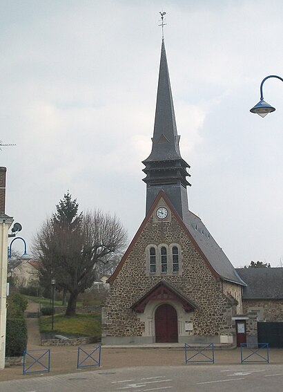
- Église de La Chapelle-Saint-Aubin,
- Keria Luminaires,
- Panorama,
- Rue de la Paille 48,
- La Bd'o la Boutique d'Optique,
- Complexe Sportif Raoul Rousselière,
- Le Monde des Abeilles,
- La Croustille,
- Sonepar Connect le Mans Nord,
- Trampoline Park le Mans,
- Heppner Le Mans,
- Let's Jump Trampoline Park Le Mans,
- Boulanger,
- Stokomani,
- Bedane,
- Go Sport
Places Near La Chapelle-Saint-Aubin
- Family Village, Ruaudin,
- Centre Hospitalier Du Mans, Le Mans,
- Saint-Saturnin, Saint-Saturnin,
- Coulaines, Coulaines,
- La Chapelle-Saint-Aubin, La Chapelle-Saint-Aubin,
- Changé, Changé,
- Gare SNCF du Mans, Le Mans,
- Circuit des 24 Heures du Mans, Le Mans,
- Clinique Du Pré, Le Mans,
- E.Leclerc, Le Mans,
- Hôpital, Le Mans,
- Maison D'Arrêt Le Mans - Les Croisettes, Coulaines,
- Clinique Pôle Santé Sud, Le Mans,
- Parc Des Expositions, Le Mans,
- Pôle Santé Sud-Elsan, Le Mans,
- Avenue Bollée, Le Mans,
- Camp du 2e RIMa, Champagné,
- Place des Jacobins (le Mans), Le Mans,
- Auchan le Mans, La Chapelle-Saint-Aubin,
- Circuit Bugatti, Le Mans
How to get to popular places in Le Mans with public transit
Get around La Chapelle-Saint-Aubin by public transit!
Traveling around La Chapelle-Saint-Aubin has never been so easy. See step by step directions as you travel to any attraction, street or major public transit station. View bus and train schedules, arrival times, service alerts and detailed routes on a map, so you know exactly how to get to anywhere in La Chapelle-Saint-Aubin.
When traveling to any destination around La Chapelle-Saint-Aubin use Moovit's Live Directions with Get Off Notifications to know exactly where and how far to walk, how long to wait for your line, and how many stops are left. Moovit will alert you when it's time to get off — no need to constantly re-check whether yours is the next stop.
Wondering how to use public transit in La Chapelle-Saint-Aubin or how to pay for public transit in La Chapelle-Saint-Aubin? Moovit public transit app can help you navigate your way with public transit easily, and at minimum cost. It includes public transit fees, ticket prices, and costs. Looking for a map of La Chapelle-Saint-Aubin public transit lines? Moovit public transit app shows all public transit maps in La Chapelle-Saint-Aubin with all Bus and Light Rail routes and stops on an interactive map.
Le Mans has 2 transit type(s), including: Bus and Light Rail, operated by several transit agencies, including SETRAM